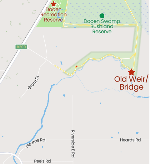
WHAT Riverside Bridge to old Dooen Weir, along the Wimmera River.
WHERE – Riverside Road, Horsham
HOW – Follow the Indigenous Riverside Walk and then continue along the track beside the river until you get to the weir ruins. Total distance 8km return.
10 WORDS – Peaceful, vintage river, accessible, history, Indigenous information, great trees, shrubs.


There is nothing like limited travel options to help you appreciate your own back yard.
The track from Riverside heading upstream towards Dooen is a perfect example. It has history, cultural heritage, nature, magnificent riverscape and all on the edge of town.
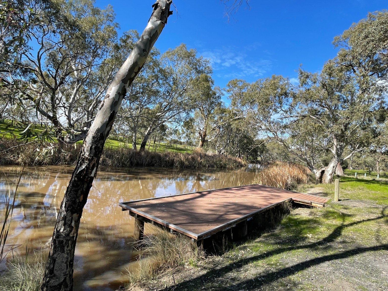
This area has been upgraded over the years with quite a few waterside platforms, signs and a really good track.
A bit of googling when I get home tells me it even has an official name – Riverside Indigenous Walk, (see https://walkingmaps.com.au/walk/402 )

Being upstream from the town and the Horsham weir, this is vintage Wimmera River with grand old red gums perched at the edge – even if their toes get cold sometimes with some roots poking out of the bank.
The track is a road but there is also a narrow walking track behind the barriers meandering along the riverbank.
During the first kilometre there seem to have been a lot of natives planted – possibly as part of the Indigenous Walk development – and the wattles are just a sea of yellow.
There are also quite a few other flowering shrubs and I think it will only get better once spring is in full swing.


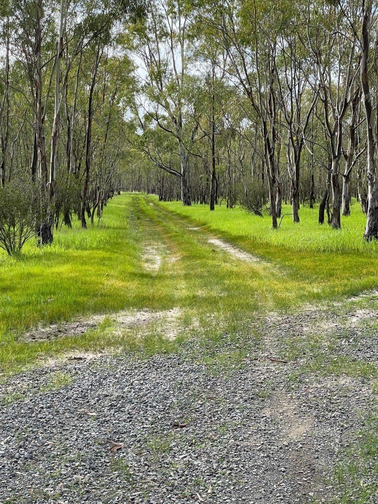
The road, which has been shut off for winter, basically backs on to quite a few houses on acreage at River Heights and then you reach some open paddocks and a lovely little forest of spindly red gums that probably popped up after floods in the 90s.

We walk through a ford which crosses a channel or creek that may have helped drain the Dooen swamp – or been part of an irrigation project at some point in the past. A bit further on from here a track veers away from the river and will take you through more trees which lead to the Dooen Swamp Reserve area.


We keep following the river and come to what I am assuming is the Old Dooen Weir site.
It does not look like a very significant structure, but a bit of research suggests it may have been a very big and important piece of kit back in its day.
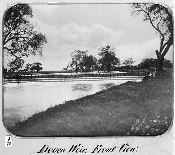

These are 1880s images of the weir which was according to this link
( ///C:/Users/Simon/Downloads/2037-3857-1-PB%20(2).pdf )
“200 feet in length between the abutments, divided by wooden standards into forty bays. The purpose served by this weir is the diversion of water into a gravitation channel 2 miles in length, from which it is raised by a steam-pumping plant through a rising main, 1.25 miles in length, into a summit reservoir of a commanding elevation. From this reservoir are supplied 155 miles of channel reticulation for the ser vice of the country lying to the north.”


The images of 130 years ago seem a world away from this place I am now standing.
You can see the aged timber remnants of the structure but the lack of trees and vast open vista in the old photos make it hard to imagine they are the same place.
I also find a reference from 1953 where the weir’s future seems bleak.
According to a Horsham Times news story the Minister had written a letter outlining the high cost of replacing the weir and noting that it was both damaged in a flood some years ago and is also servicing less irrigators than in the past. There is also reference to the new opportunities to come once Rocklands Reservoir is built.
Fast forward to 2021 and all the irrigation has ceased in the Wimmera; we have a pipeline that moves out water around and much of this comes from lakes in the Grampians.

It is almost like this place has come full circle and the river is moving back to the pace and purpose that it had for 1000s of years before white settlement. It certainly is a peaceful, beautiful place today.
The track ends here and we turn around and head back.
On the way I explore some little turn offs where grassy spaces would provide ideal picnic spots, possibly fishing or camp sites.

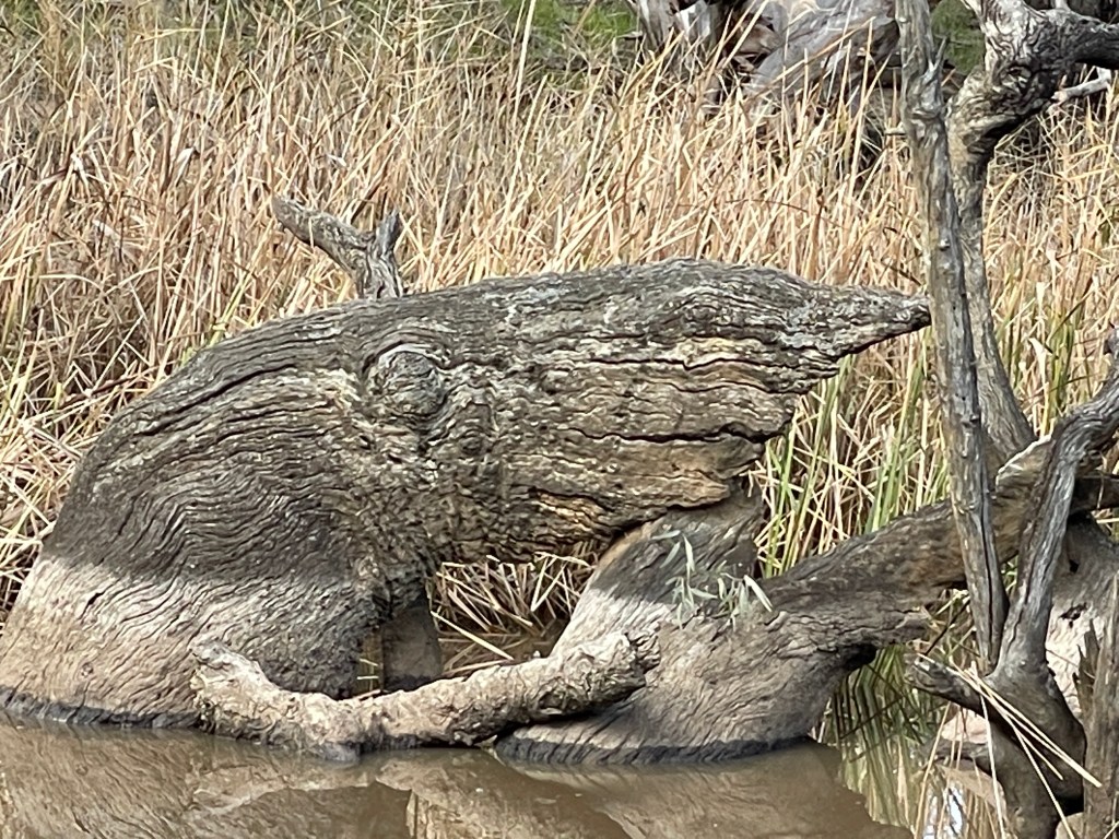
One stump in the river looks a bit like a monster but mostly it is just peaceful, grand old trees and quite a few birds enjoying the sunshine.
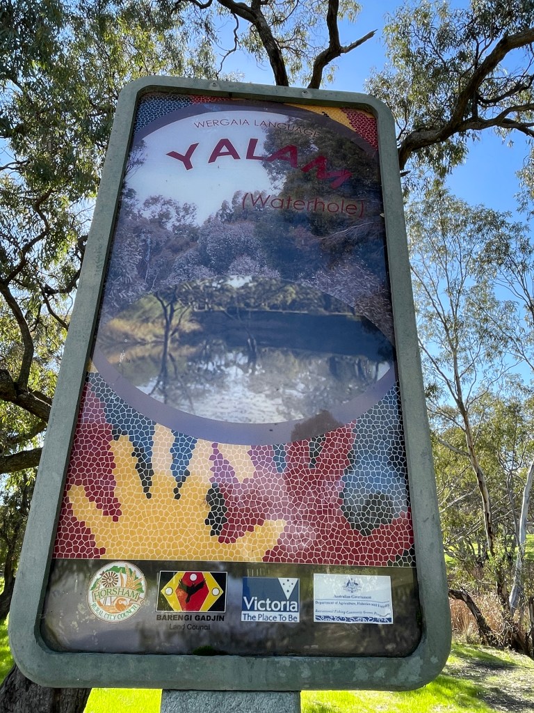
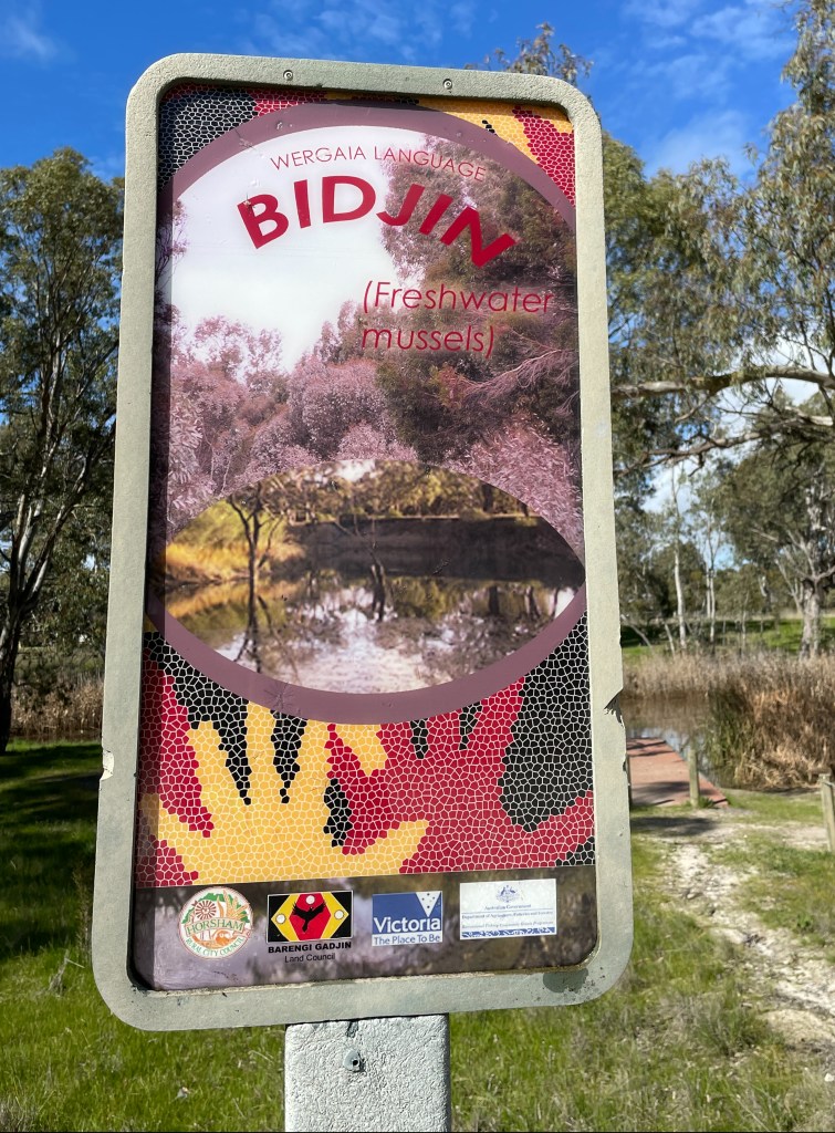
I also spend a bit more time taking a closer look at the Indigenous Walk’s jetties closer to the Riverside Bridge with signs explaining some Aboriginal words: Bidjin (meaning freshwater mussel); Wirringgal (meaning Golden Perch) and Yalam (meaning Waterhole).

It is a great spot and excellent way to have a peaceful 8km walk, along natural the river very close to town.