What – Beehive Falls and Golton Gorge
Where – Northern Grampians (Gariwerd)
How far – Beehive Falls – 3km; Golton Gorge – 1km
10 words – Oldies but goodies, good paths, great views, short and sweet.
I feel like an ultimate tourist today doing the Northern Grampians (Gariewerd) easy dynamic duo – Golton Gorge and Beehive falls.
They are a great addition to Hollow Mountain (Wudjub-Guyan), Mt Zero and or Mt Stapleton (Gunigalg) as the gorge is just a bit further along the Halls Gap- Flat Rock Road towards Halls Gap from these places.
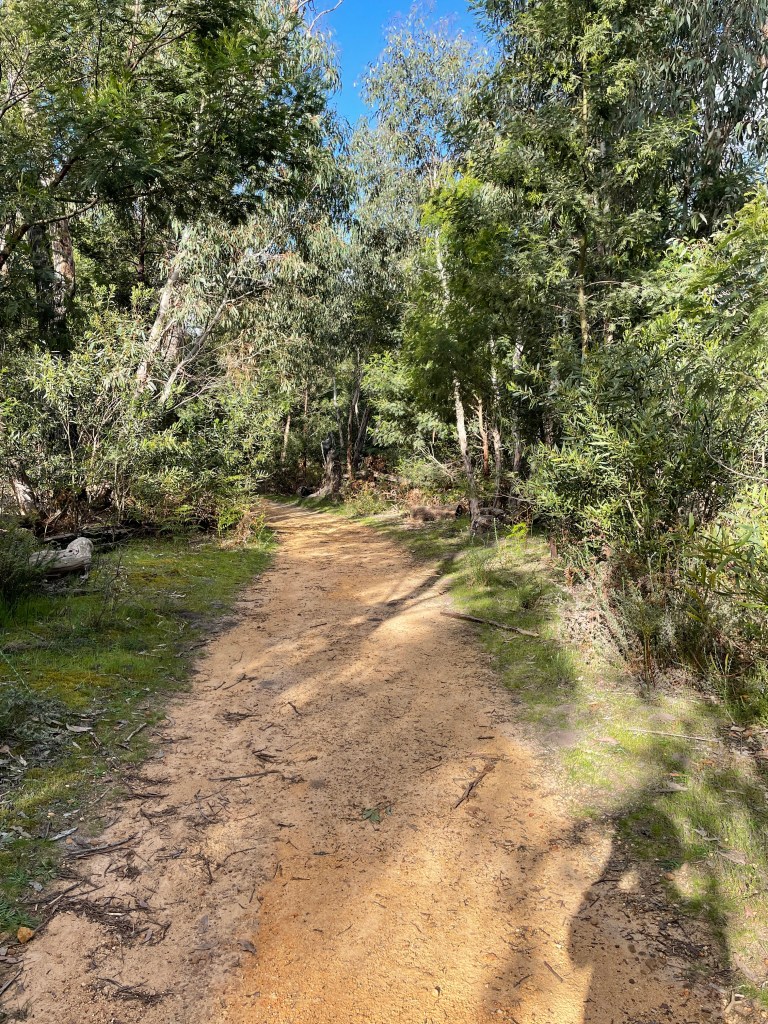
Golton Gorge is easy and short – I walked it one night after work with the benefit of daylight savings.
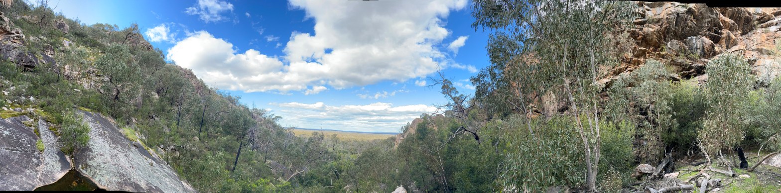
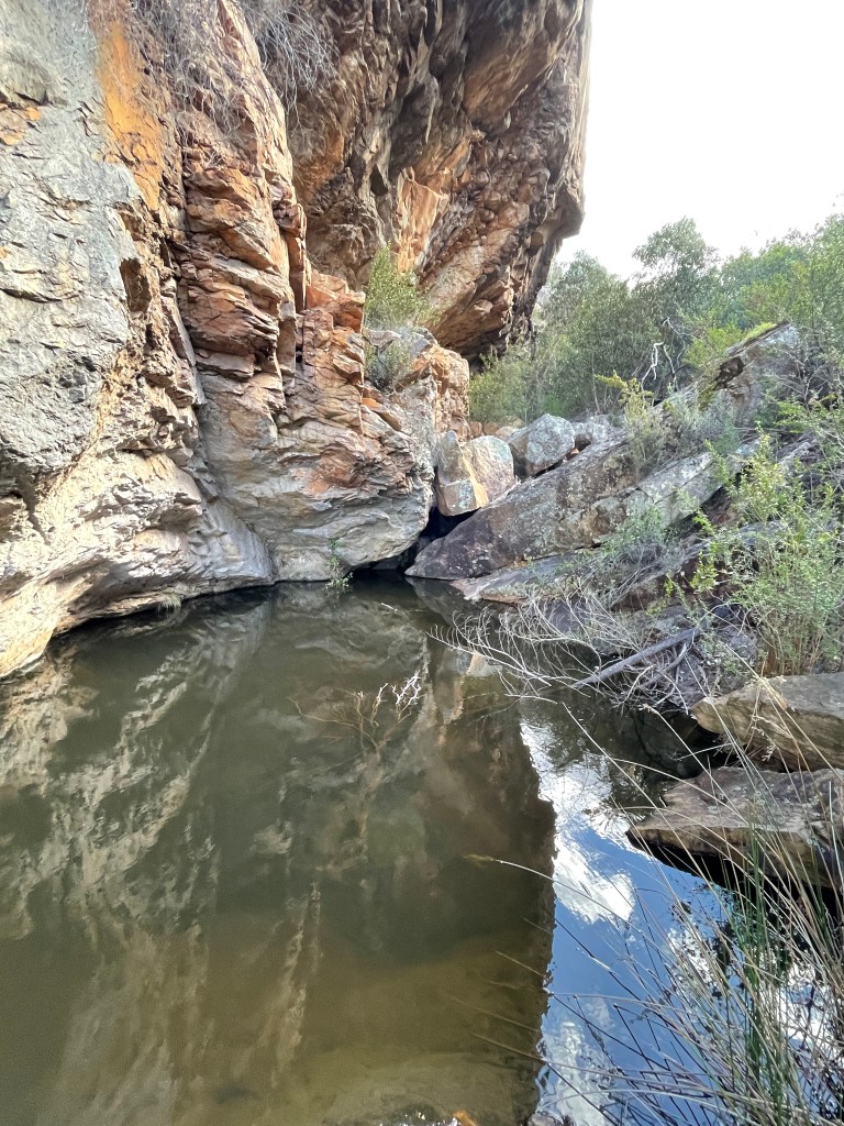
You follow Golton Creek, which joins Mt William Creek and then ends up in the Wimmera River.

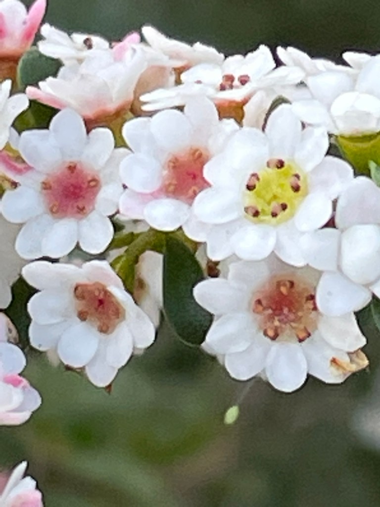
There is not much water today as we are well into spring, and it has not rained this week. Once again there are flowers to see on the way up this good track.
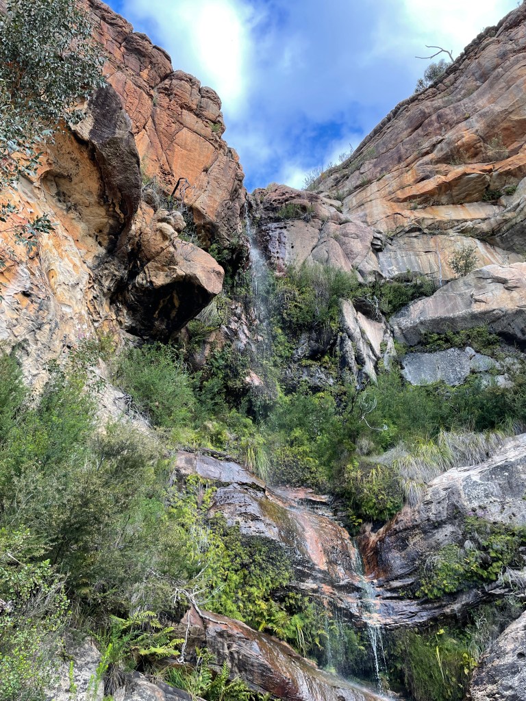
The official track is only about 300m up but today because it is dry, I do a bit more scrambling to see what is at the top of the rocky rise. It is worth the scramble as the view from the top is one of the best in the Grampians.
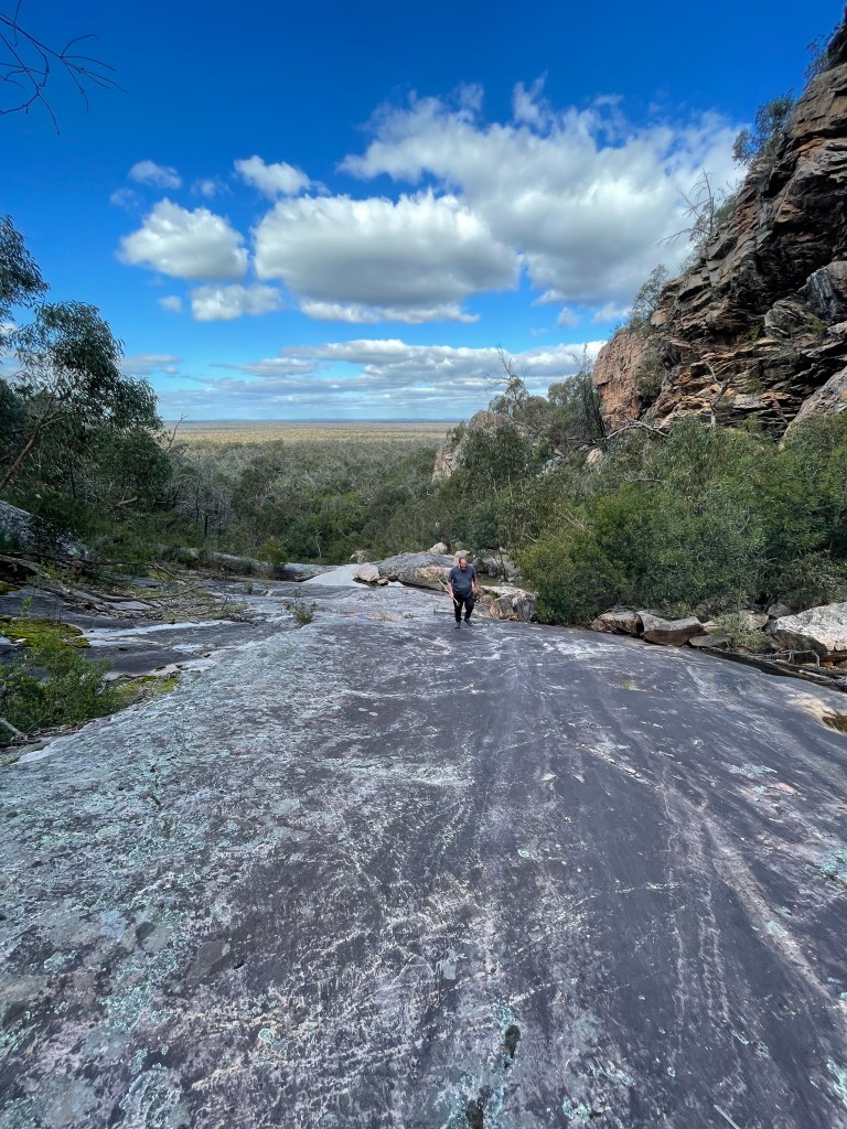
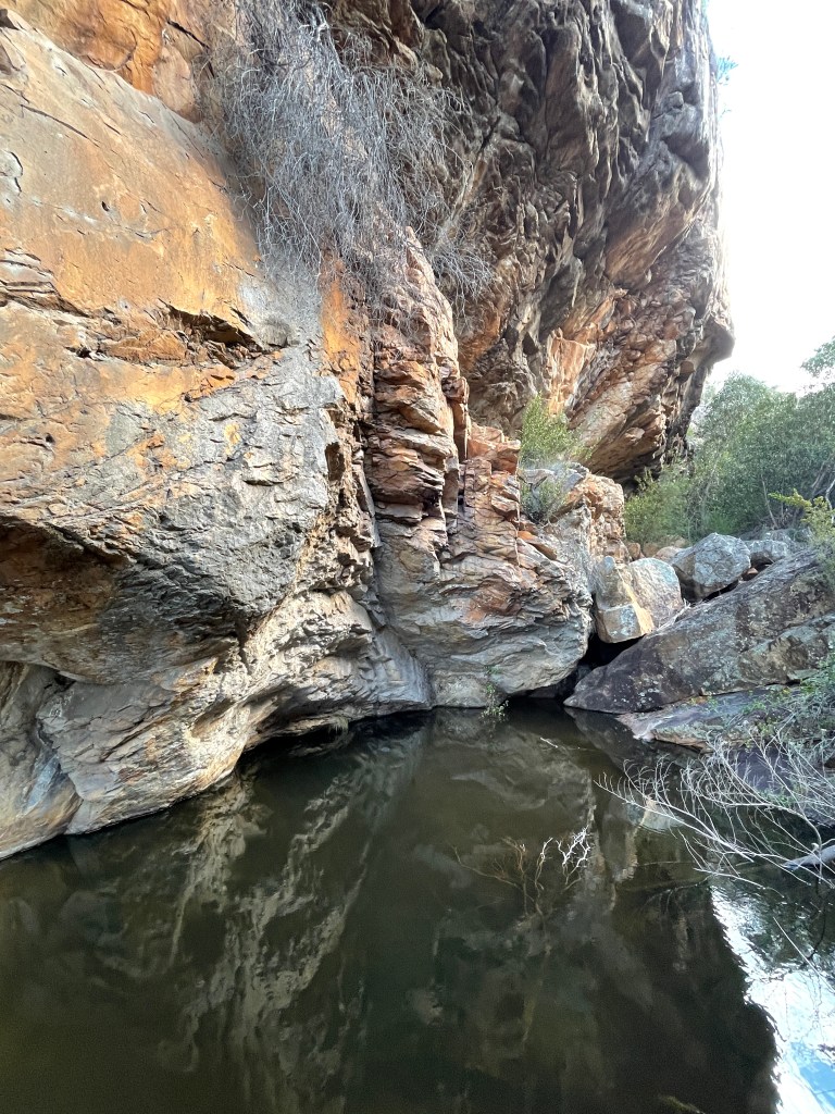
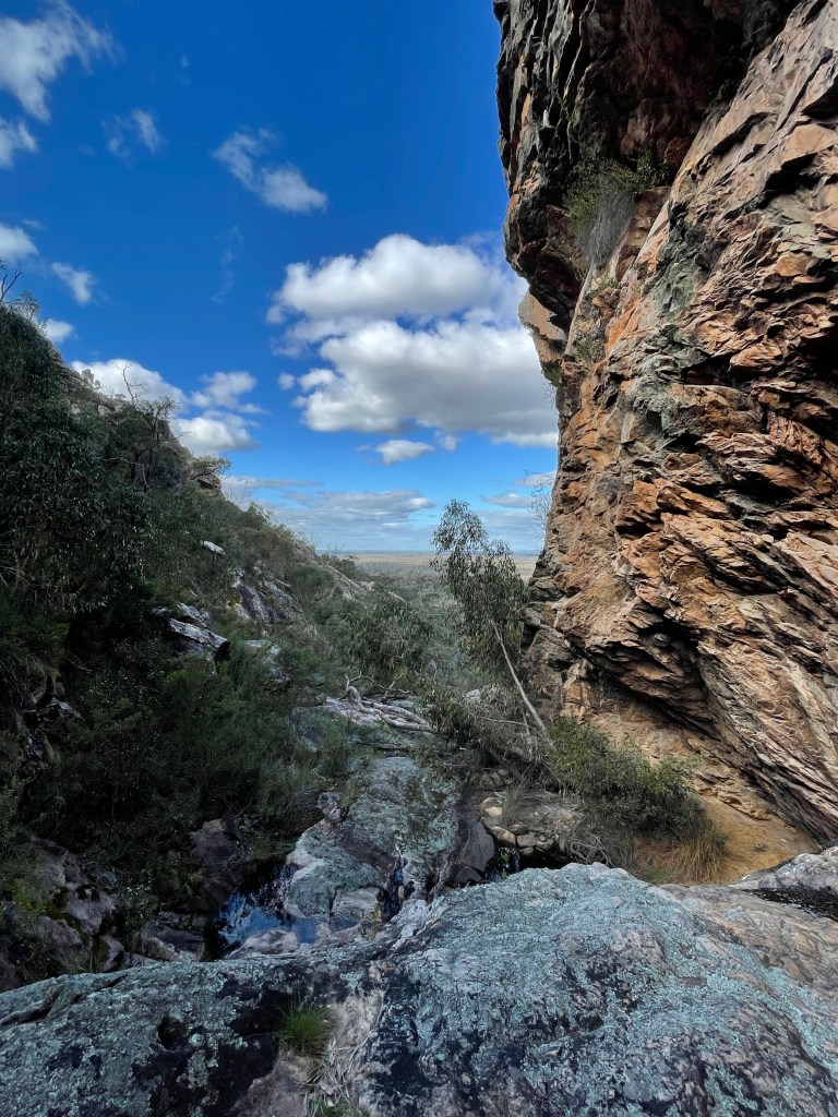
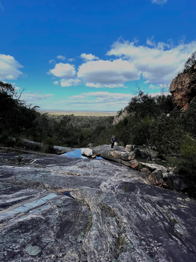
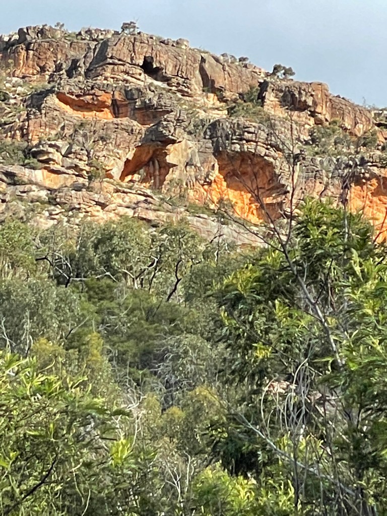
Before me is 50 metres of sloping grey rocks flattened and streaked by centuries of water flow, with a tangle of bush beyond and a backdrop of bold blue sky and greying clouds.
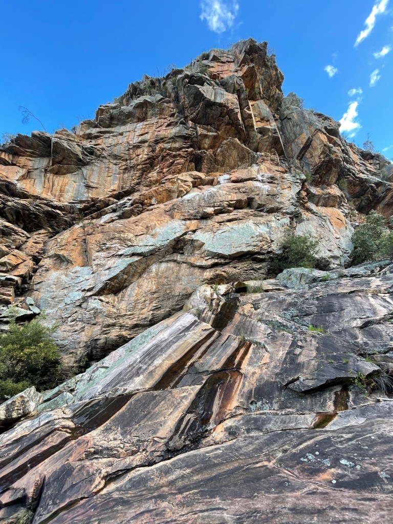
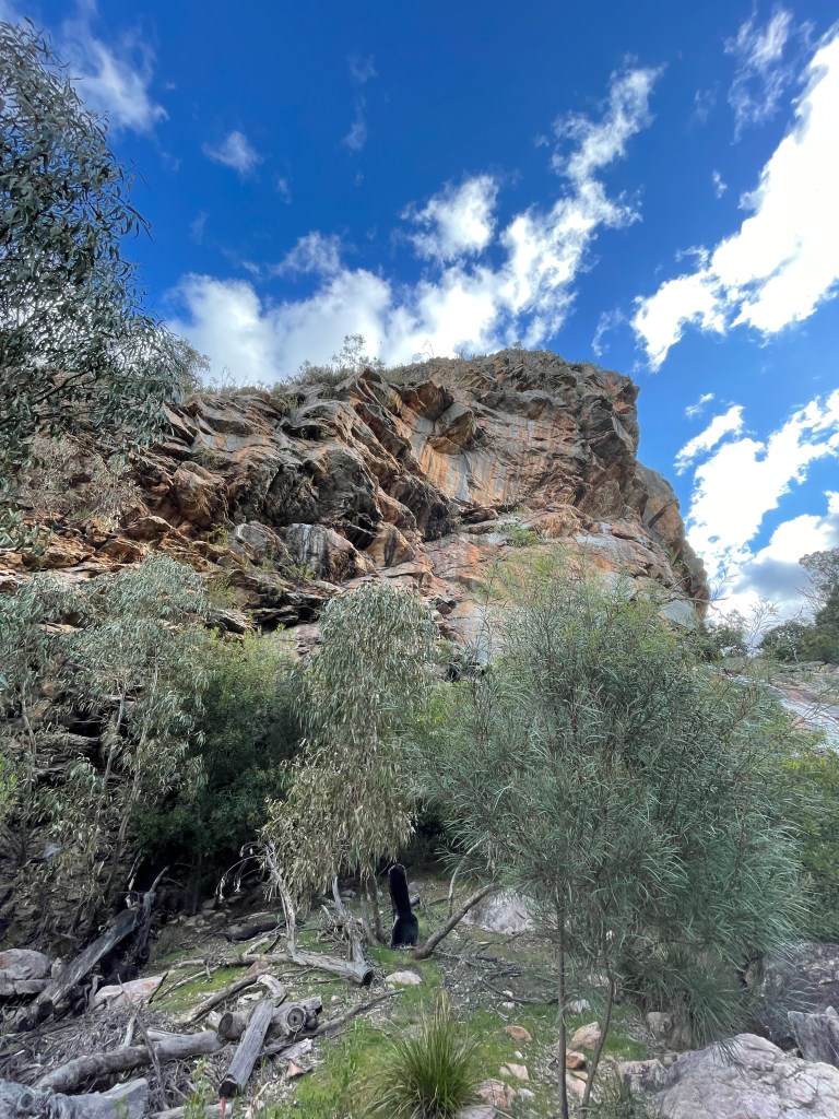
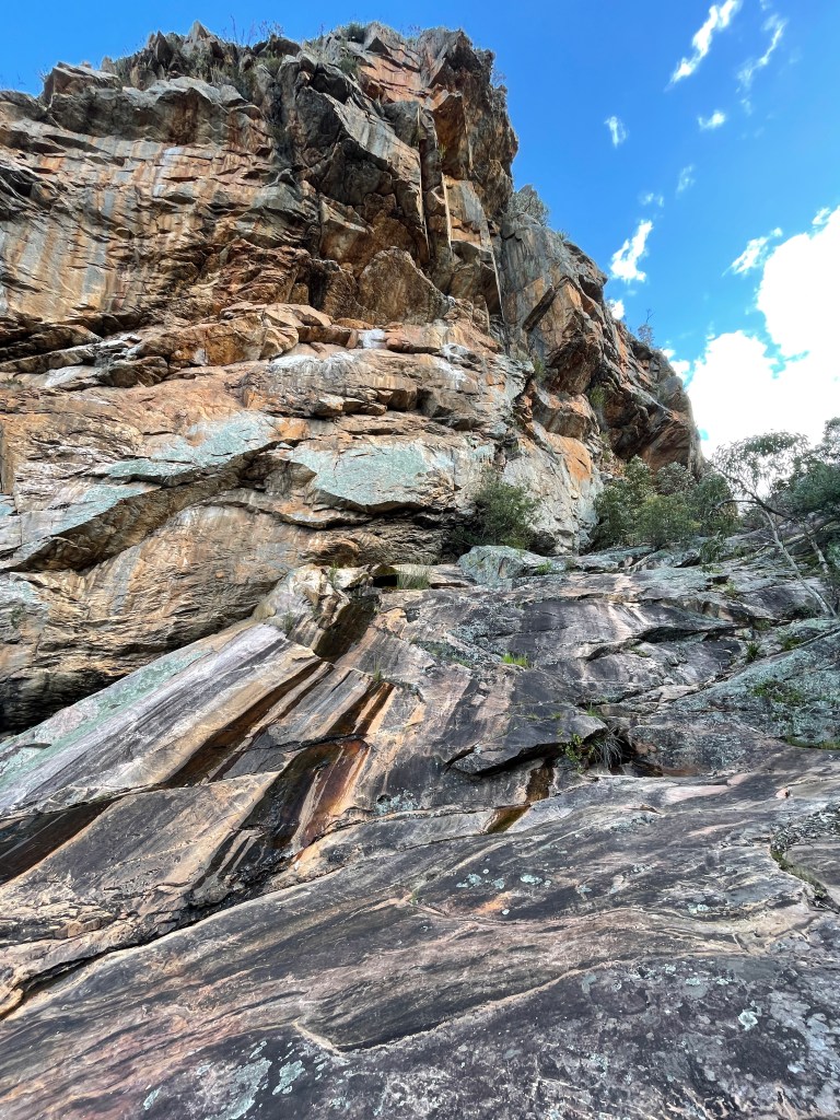
Peer upwards to the gorge wall and the view is just as dramatic. Orange, white, and black stones set in a chaotic mess of geometric shapes. It is as if Mother Nature took to it with a giant angle grinder after a few too many drinks.
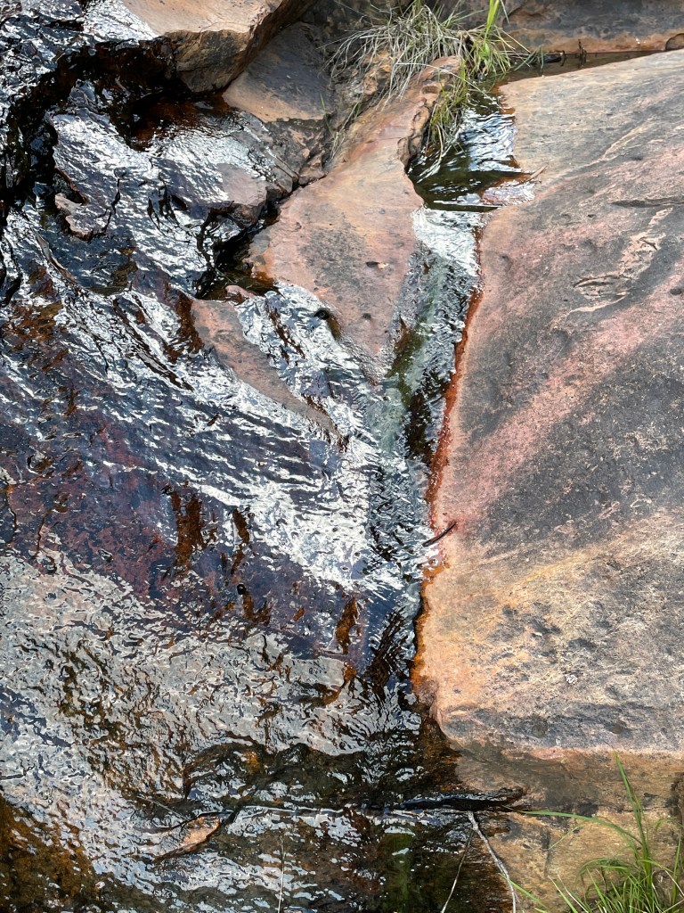
At times, these rocks are almost striped and so smooth after years of wind and water through this gorge.
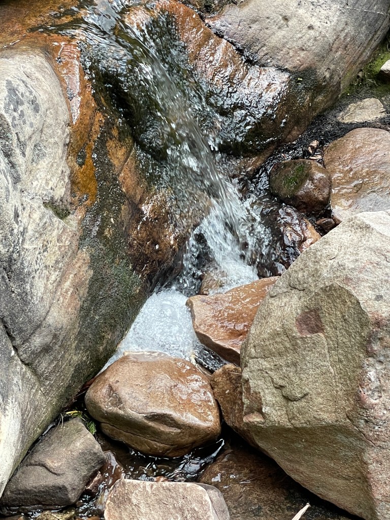
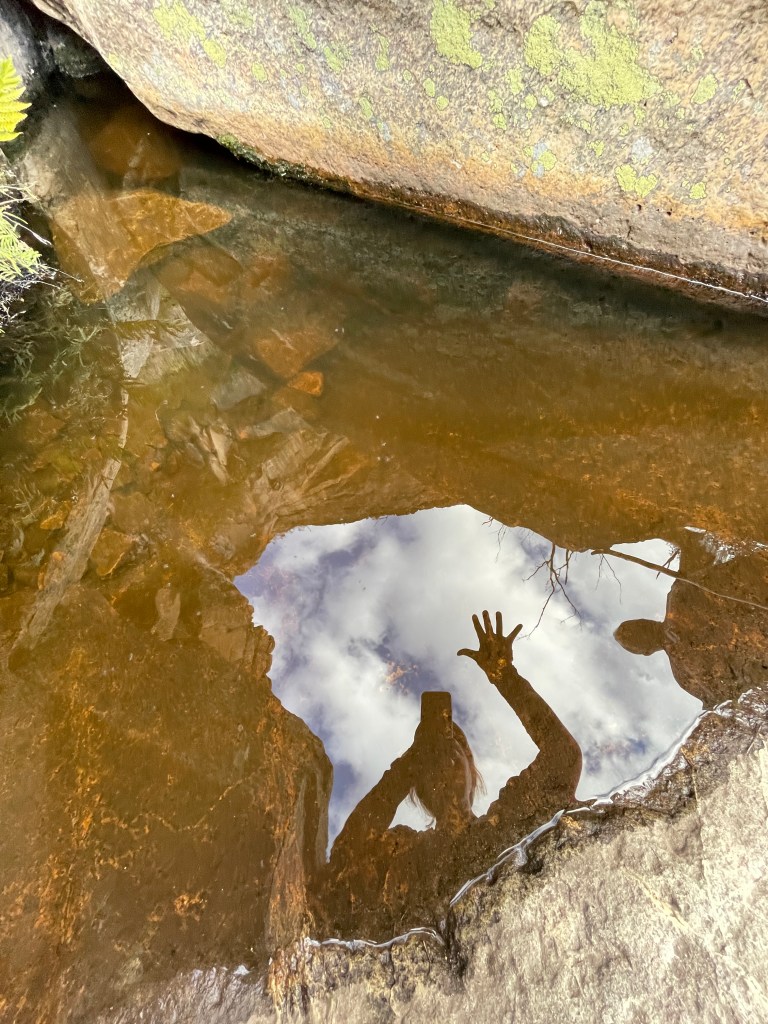
There are also little pools of water making this an ideal spot to simply stop, contemplate, and just enjoy a different place and view in this mighty range.
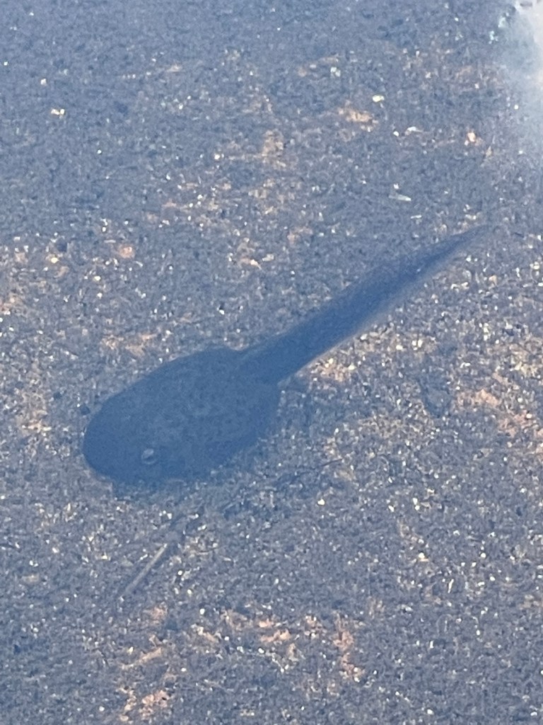
Tiny trickles of running water roll down in the rock pool where a fat tadpole watches me as he lies perfectly still.
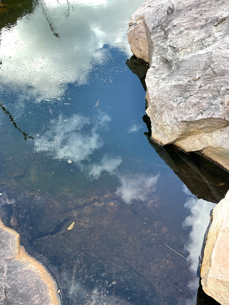
There is no wind and still water beautifully mirrors the big evening sky.
Directly over the peak of this gorge is Copper Mine track and this area has shafts where copper mining took place sometime in the past.
We head down and continue east before turning onto Roses Gap Road to visit Beehive Falls.
This is another Gariwerd classic and about 2.4km in total.
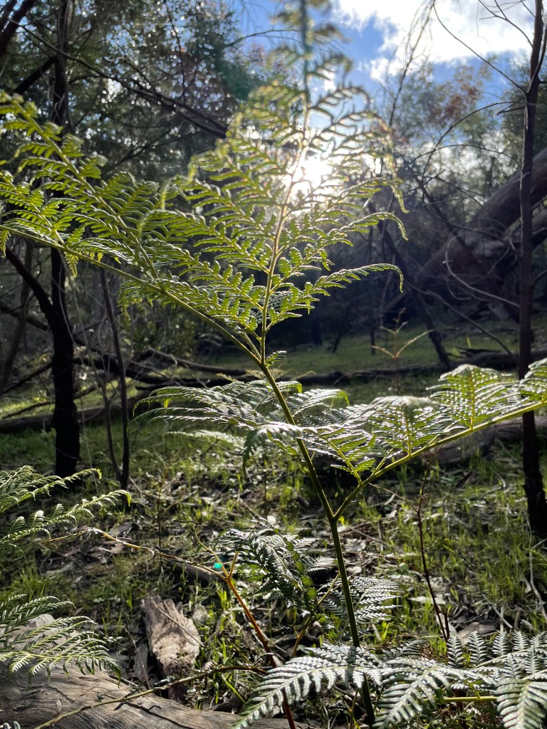
The evening sun make Bracken fern look quite beautiful as we take to the well-made path.
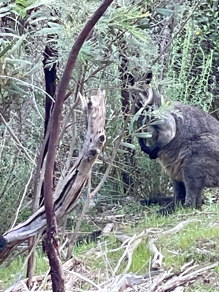
I see a wallaby watching me from the site and as I concentrate on his statue like demeanor. I completely miss the kangaroo that bursts out of the bush just ahead. Did not see that one coming!
The mountains ahead are quite orange in color but there are not the dramatic shapes of Golton, more rounded than geometric.
The path, which follows Mud Hut Creek, has a bit of climbing and twists and turns and there are many flowers to see along the way.
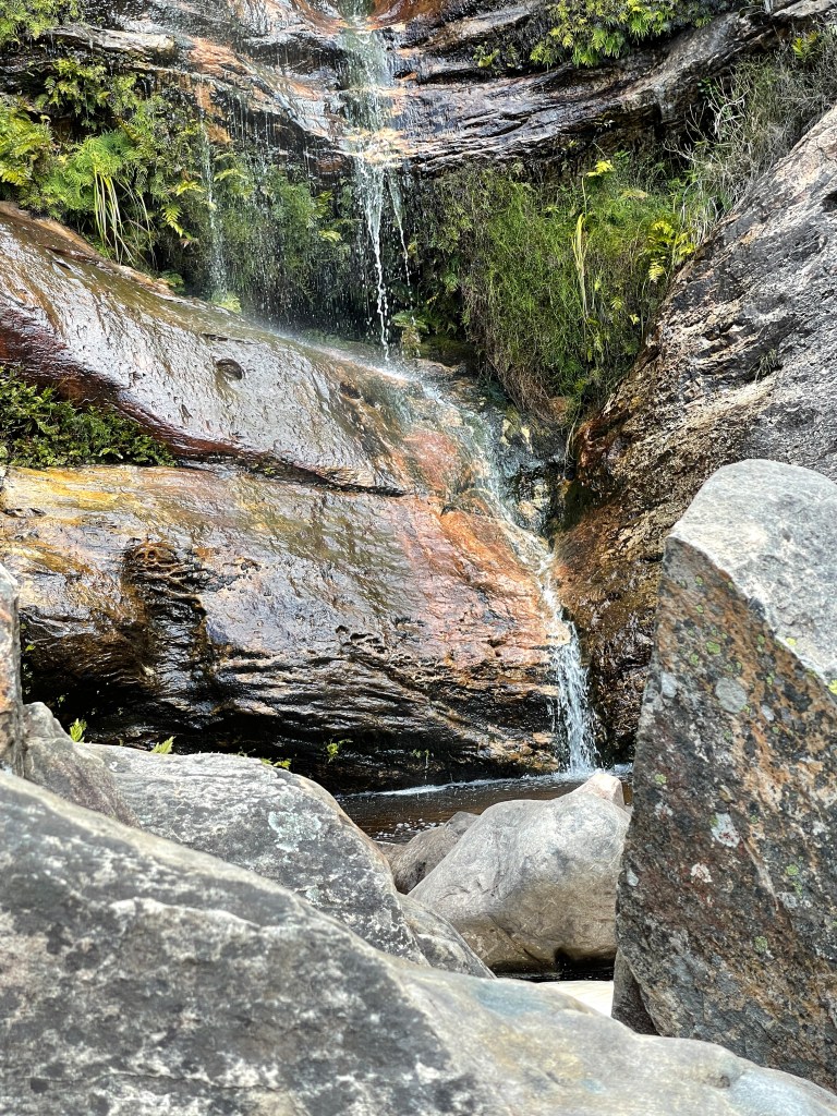
The delicate falls tumble gently over several big rocks that seem to be stacked vertically and home to many plants including ferns.
Wispy water trails roll down providing shimmering colorful features where they hit the rock.
Apparently, there are beehives here, which makes sense as bees like water.
There was a big apiary industry here in the early days which is no wonder when you see the capacity for the area to produce flowers all year round.
Indeed in 1917 The Melbourne Argus dubbed the Wimmera was as Victoria’s chief honey producing region with about half the state’s output coming from hives based in and around the Grampians.
It is a great path; the access is easy and the trip back about all downhill – a quick and effortless walk but a sweet result no less – at Beehive Falls.
