week 1 – A trek of two rivers
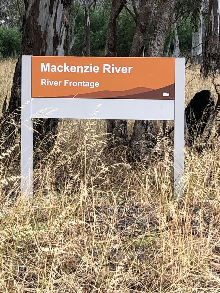
Where – Mackenzie River (Bun-nah) Wimmera River ( Barringgi Gadyin or Barengi Djul) junction walk. From Mackenzie Creek Bridge, Three Bridges Road, to Weir Park.
Distance walking 8.2km
Time – a very leisurely 2 hours but you can do it a bit faster.
In less than 10 words – Peaceful, diverse, surprising, reflective and worthwhile two hour wander.
What better way to start our yearlong adventure but with a short trek close to home.
On January 3 Bean and I wandered along two of the Wimmera’s most high-profile rivers, the Mackenzie or Bun-nah and the Wimmera or Barringgi Gadyin or Barengi DjulI.
Barengi DjulI or the Wimmera is the big daddy of the rivers and boasts plenty of grand old red gums and while Bun-nah might seem a bit of a poor cousin, but this thirsty little tributary is flowing with life, charm and spirit.
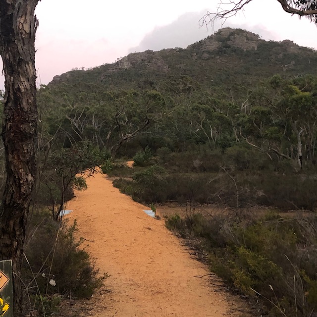
So let’ get walking. We start at the bridge parking on gravel on the left side of the road and cross over the right to start the track, heading north.

The gate to keep vehicles out is off its hinges and squashed on the track and the dirt road has it fair share of pot holes from past traffic in the wet.
The track follows Mackenzie River or Bun-nah, Referred locally as a Creek this river winds its way 57km from the northern end of the Grampians Gariewerd before joining the wimmera.
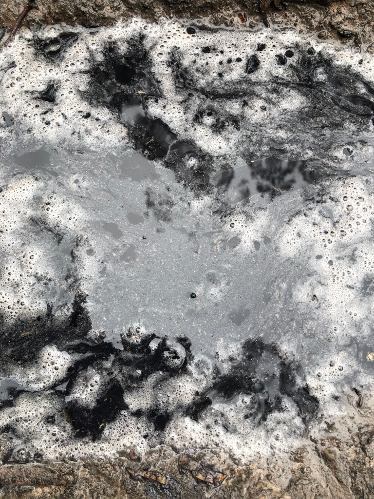
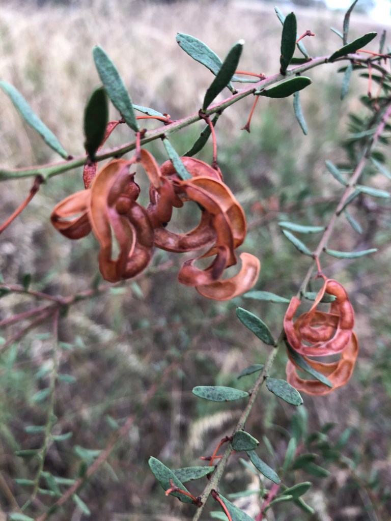
First week of January and it is pretty dry, although some summer rains have gifted us some black and foaming puddles and surprisingly healthy looking undergrowth. We pass quite a few flowers, which are more common in spring than summer.
The birds are also in fine form and the ornithological symphony is music to my ears. Not sure where 20-20 hearing, eternally-nervous Bean Dog sits on this issue especially as we have recently added early morning corellas choruses to his lists of hates/fears.
Kookaburra reckons its pretty funny even if the dog doesn’t.
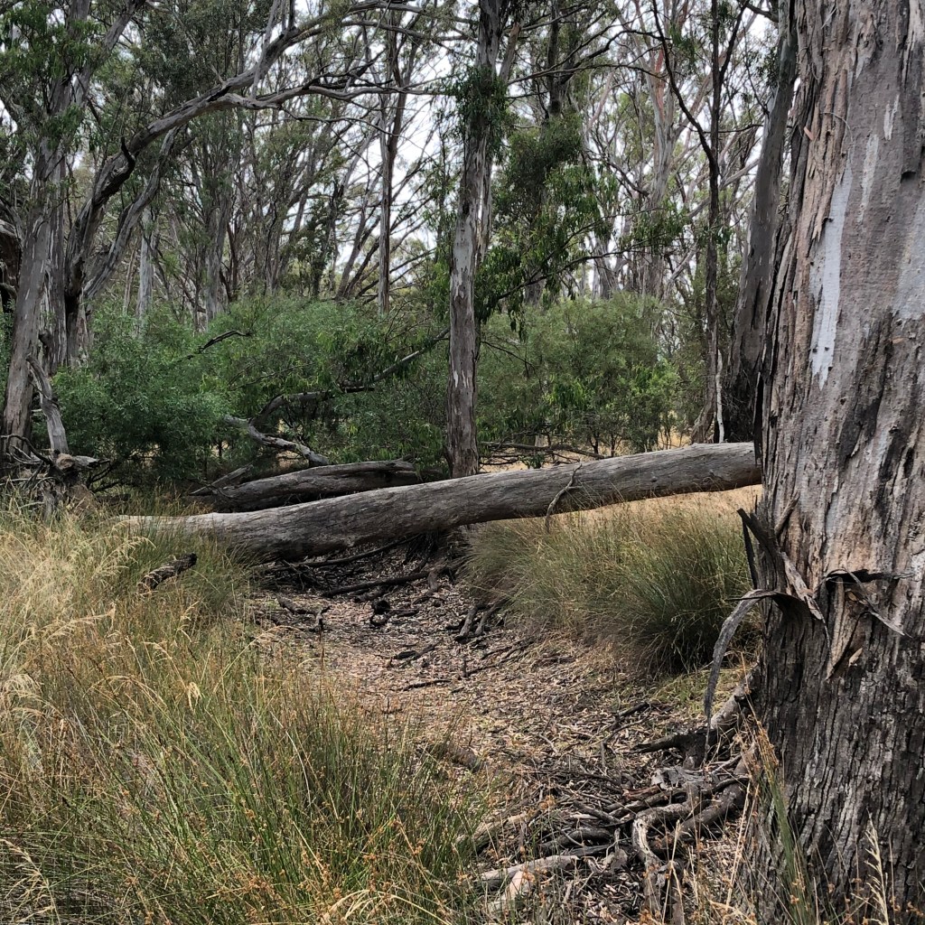
A wall of trees and shrubs hides the Mackenzie for much of the walk, until we reach a grassy patch dotted with large, old trees, many of which are sporting long oblong scars. I can’t find any written evidence that these were made by local Aboriginal people but I’d like to think I might be right.


Makes you wonder what it was like here more than 200 years ago. Who else walked this path and what happened under these trees? I want to step lightly as I pass
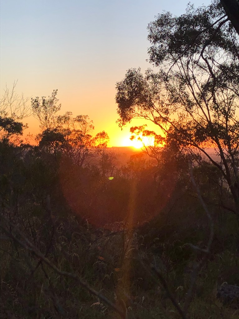
Just a few minutes further and we are at the Wimmera junction. With no water flow from Mackenzie and quite a few reeds you have to search to find the spot they connect.
Here I find another scar – made in recent years by modern day campers choosing to leave a different pointless mark.

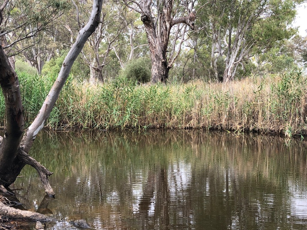
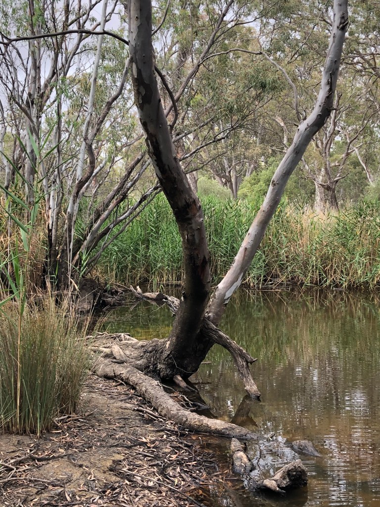
I now follow the Wimmera River back towards Horsham. The trees are bigger and the river is wider and wetter. A few more of them appear to have scars, others expose their giant roots at the rivers edge or have been beaten by water, wind and time and lie awkwardly in the water. They too, would have plenty of stories to tell from the last few 100 years.
It’s a great walk right near town and while COVID has increased the number of feet that use this path, it never loses its beauty. IN the mornings there can be misty fog sitting over the water and at night a wimmera sunset jumps into the water and creates.
Week 2 – Mitre Rock, near Natimuk
Mitre just seen the best sun rise this year!
Where – Mitre Rock
Distance – elevation 230 metres but the climb was only about 50m
Time – less than an hour
In 10 words – Little gem, amazing rocks and awesome dawn views across landscape.
So we have made it to week 2. January 9 at 5.55am.
Was going to be Mt Zero but when my walking partner slept in, and then after I turned around to come back and pick her up, she managed to bring two left shoes – that were not even hers! – We settle for more accessible Mitre Rock.
It is going to be a scorcher and we want to get the walking done before the heat sets in.
Heading west out of Horsham and the car temp reads a chilly 9 degrees.
It’s called an inversion layer and it hovers eerily above the ground.
Just past the bridge at Quantong a thin layer of cloud rises just above the stubble and crops on our right and left.
We stop for a quick pic but we are on a mission to get to the rock – which is the poor cousin to Arapiles and looks like a priest’s mitre – before the sun comes up.
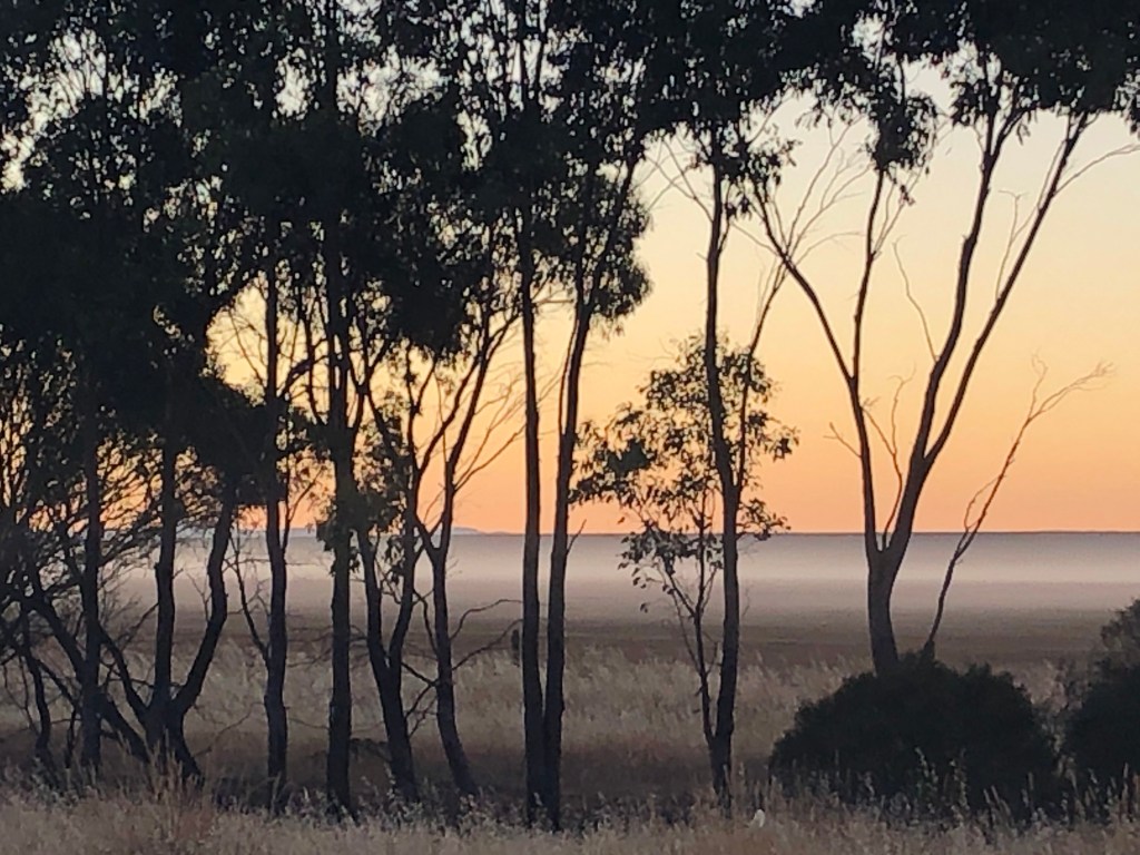
It’s a race and as we head up the rise at the turn off to the rock, I see the sun in the rear view mirror.
And just as I find a gap in the trees, the orange sunlight spikes its way over the horizon. It’s a big show of colour and might and she’s letting us know we are in for a scorcher.
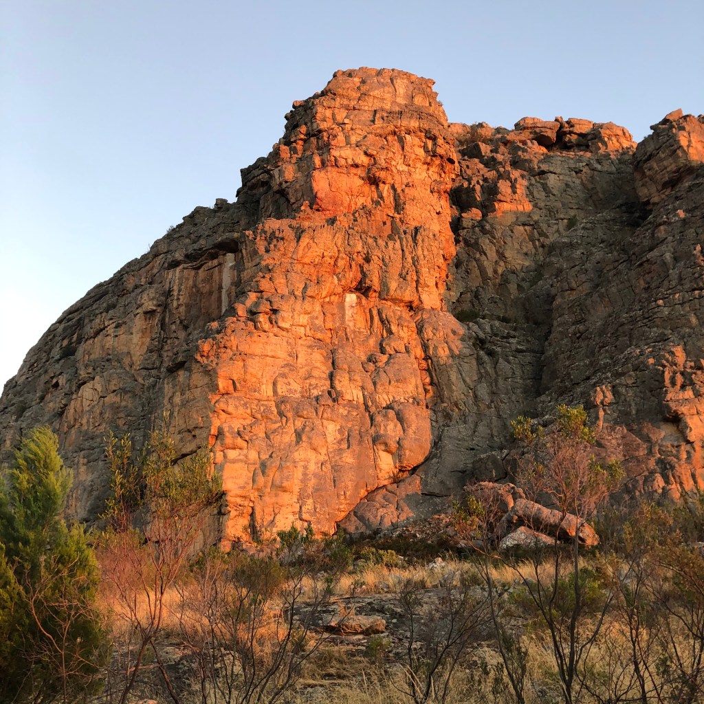
The rock behind me also gets painted with a filter of burnt orange which is very impressive and worth the 5am wake up call.
The moment captured we drive around the corner to start our climb. It’s dark on this western side and cool but all around you can see the sun finding other places to brighten, lighten and wake up the landscape.
It is pretty easy going. More effort looking out for snakes in the dry grass either side of the sketchy track than it is scrambling over the rocks.
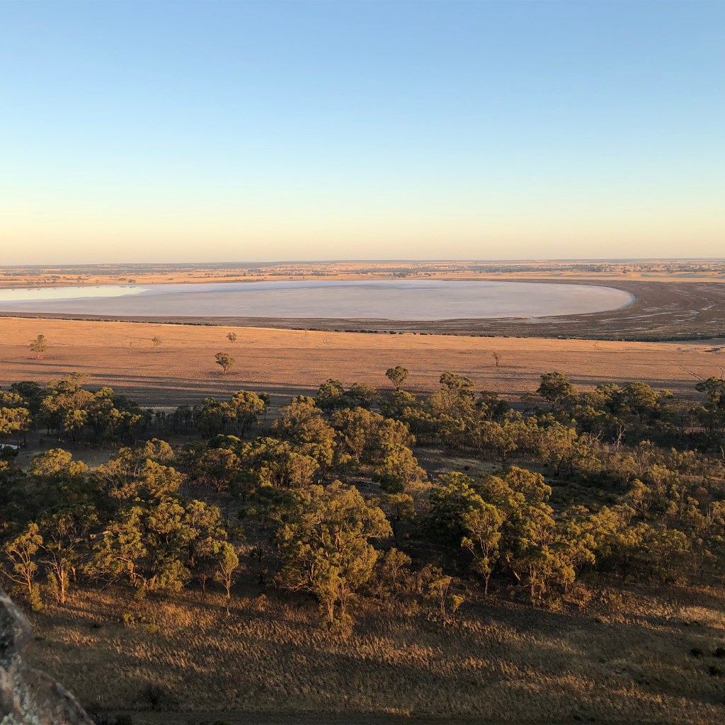
We head up towards the left and are impressed by the 720ha salty puddle of Mitre Lake that spreads out across the flats to the north. At mid summer the lake is more salt than water but there are still a few patches of trees and sky reflected on at one end so she is not completely dry.
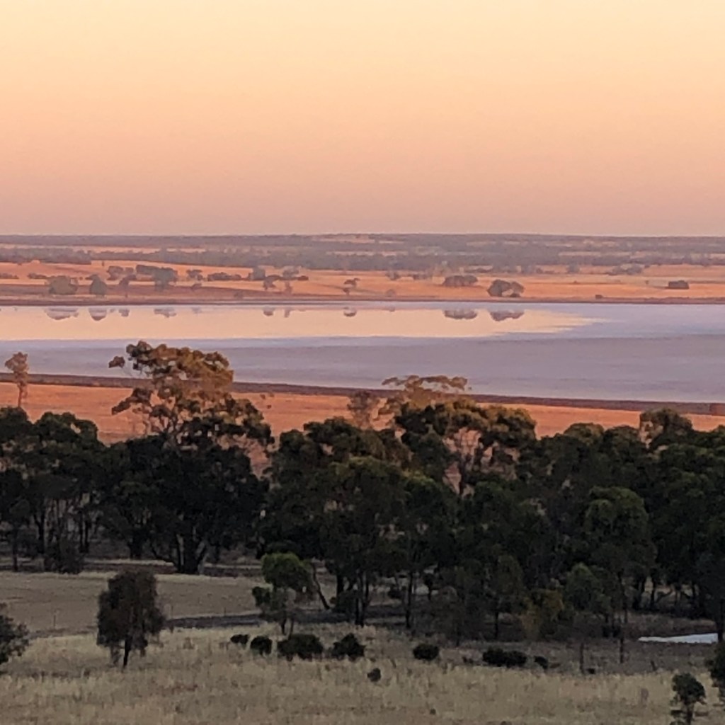

From the north western side of the rock you get some great views. The early morning sun picks up every shade and texture in the landscape. The receding waters of the lake, the trees and the teethmarks left by hungry harvesters as they chewed their way through this year’s crops.
It’s a moment of contrasts – dark where we stand on these shaded rocks but out in the open the shadows a big and distant metal silos simply shimmer.
It’s time to head to the eastern side and get the full burst of morning.
So a bit more scrambling and snake-avoidance and we are nearly there.
This rock is full of life. There are many tiny correas bursting from a stony base and producing beautiful lime flowers. The birds also in full song – which is a bit surprising considering you are on a rock.
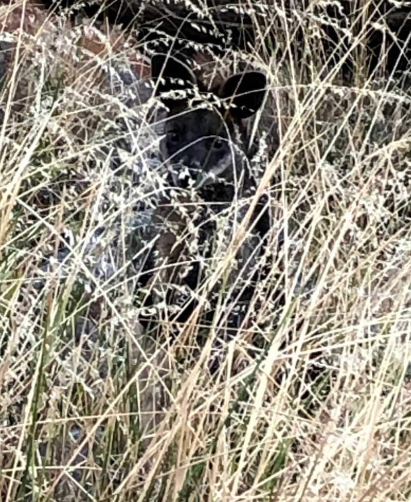
Suddenly I hear something gin the bushes and stop dead. Nothing slithering my way but there are two eyes upon me from a wallaby propping in the scrub. They are good animals to live on a rock as they kind of behave like one. We embark on what can best be described as a game of bobs and statues. I sometimes wonder if Wallabies are secretly closing their eyes like a three year old and hoping that if I can see them, they won’t see me.
I respect his space and his grace and quietly and gently pass thanking him for sharing his space.

I am nearly at the top and I see the light approaching. And what a light it is.
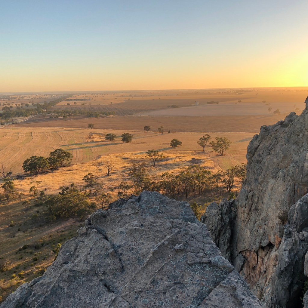
Rocks on ledges contrast with the floodlit paddocks below.
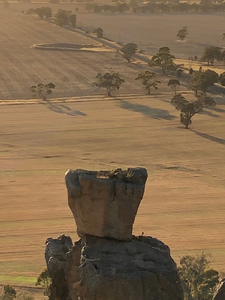
One amazing rock sits absurdly like a flower pot carefully placed for photo opportunities.
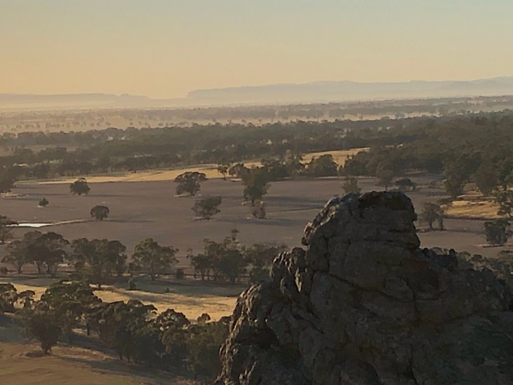
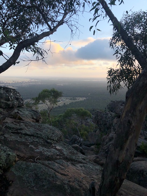
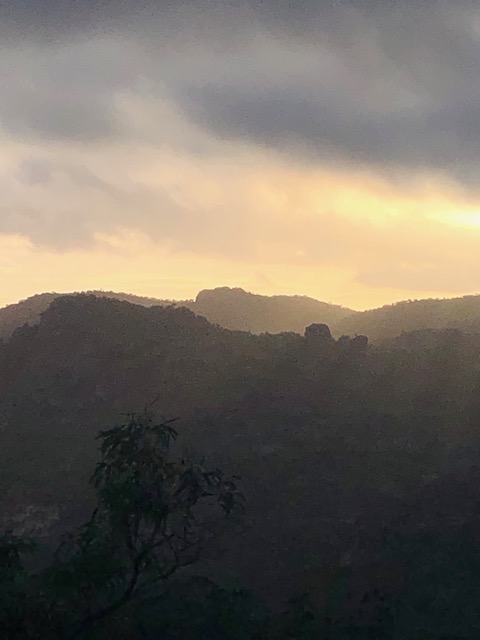
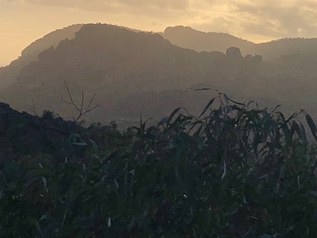
Beyond Mitre itself is just a burst of beautiful soft light amidst a misty vista of the Gariwerd Grampians and Black Range State Park in the background with a sea trees littered across the cream paddocks. Just awesome.
And as we turn to head back down the rocks itself turns orange with the full throttle morning burst.
So in summary not a difficult climb but a bloody amazing one all the same. I mitre had a really good time.
Pumped by the adventure I take a detour on the way home to Vinegar Hill – A little-know lunette located down Vinegar Hill Lane off Arapiles Grass Flat Road. This hill overlooks Mitre Lake and it is a perfect location for sunsets.

Today I discover it is pretty amazing at dawn too. We get out best view of Arapiles for the day, with well shaded crop circles of recently ploughed paddocks in the foreground and our rock bathed in sunlight to the rear.
This whole expedition has rocked.
Week Three – Mount Zero – Mura Mura
From Zero to hero – a mighty mini mount
Where – Pohlners Road to Mt Zero summit
Distance 2.3 km – Mura Mura is 394 m elevation but only 110 meters climbed
Time taken 46minutes and 19 seconds
In 10 words – Great start to day, awesome views, nice climb, no ghost
What a difference a week makes.
It’s freezing and cloudy and the radio talks of rain and hail storms overnight in other parts of the state as I head out towards Mt Zero or Mura Mura on the northern tip of the Grampians Gariwerd. There has even been an earthquake a bit further east along the highway.
I have left home at 5.50am and am wondering if I will get to see much at all. I almost have to imagine what the mountains will look like beyond the low cloud that’s hovering in the gloom.
I don’t see any kangaroos as I pass Mt Zero olives which have grown for decades on the northern slopes of Mt Zero. Usually it is a careful drive to ensure that you and them get to the end of the road unscathed.
When I get out and head to the walking track I am struck but how quiet everything is. No birds like there were last week. Too cold to sing today.
At least the snakes should be asleep.
I park near the junction of Pohlners Road and walk up to the start of Mt Zero track. It’s a good, wide track with steps at the start and plenty of arrows to show you the way.
Once again I am impressed with the number of flowers about for mid summer. Banksias look amazing, and there are a few other things flowering along the way.
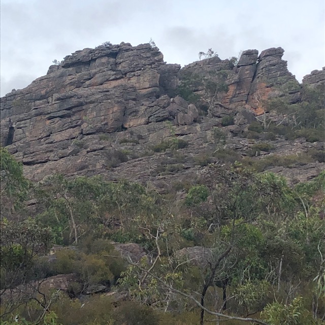
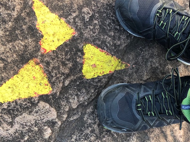
The sky mirrors the mountains today. Grey and treacherous. After a while the sandy track disappears and you start climbing rocks. It is just a case of watching for yellow arrows and following them.
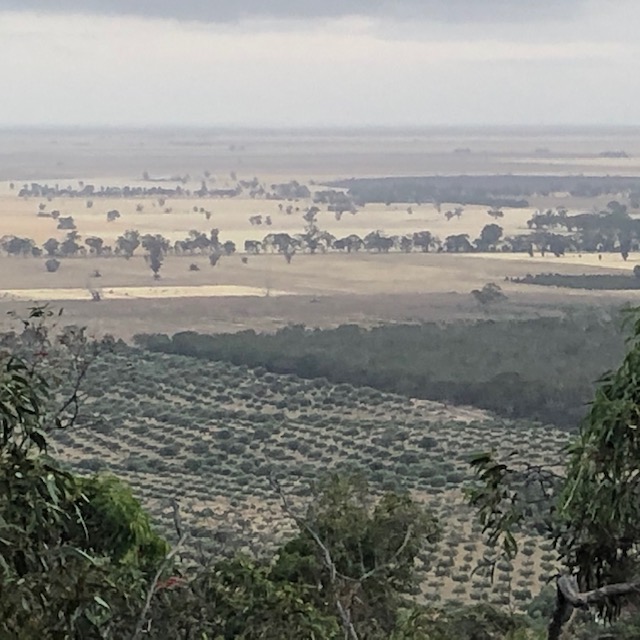
To the north we start to see olives created some ordered lines across the paddocks and to the east the sun is inching ever closer to the top of Mt Stapleton.
Nothing like the floodlight of Mitre Rock last week, but still exciting none the less.
A bit more climbing and I reach the peak which is noisy with wind. I hang on tight and don’t get too close the edge. It seems to whistle up from the south and I am glad that I have a bit of shelter from its full force. There are some awesome panoramas with the contrast of rock, trees, olives and crops stretched across the landscape.

And as I start to head down the roading wind is replaced by singing birds.
They have finally found their voice as the sunrise hits its brilliant, almost fruity straps on the way down.
For a time the defiant sun turns the grey sky peachy and then it produces a short burst of lemon brilliance before being unceremoniously gobbled up by those bossy grey clouds.
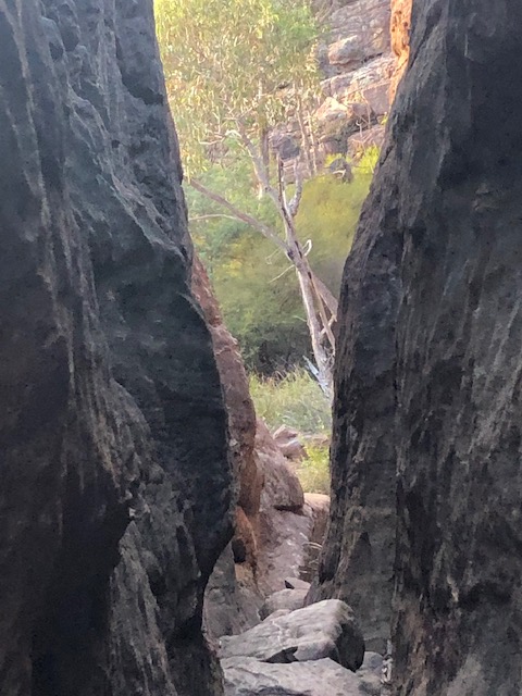
I also discover that my obsession with the sky has taken me down a completely different path on the descent. I am glad because it is the path I took last time I was here when one of my images made it look like the place was haunted.
I now have a chance to find that ghost.
Turns out it is a dead tree trunk at the top of a narrow gap that the path follows between two rocks. Oh well it will still be forever known to me as ghost alley.
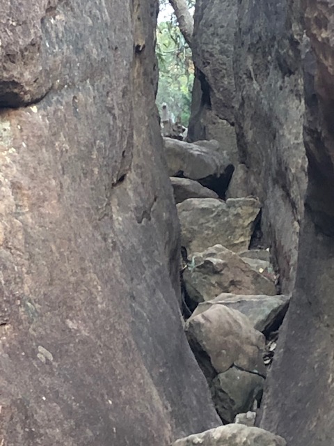
A little after ghost alley. The discoveries continue. I find the point where the arrows give you two choices of route.
Downwards is an easy stroll and before I know it I am at the bottom and pretty happy with the Mura Mura journey.
Get new content delivered directly to your inbox.
