Where – park at the Mackenzie River Bridge on Three Bridges Road and walk along the tracks.
How long – If you walk all the way back to Weir Park it is about 9km.
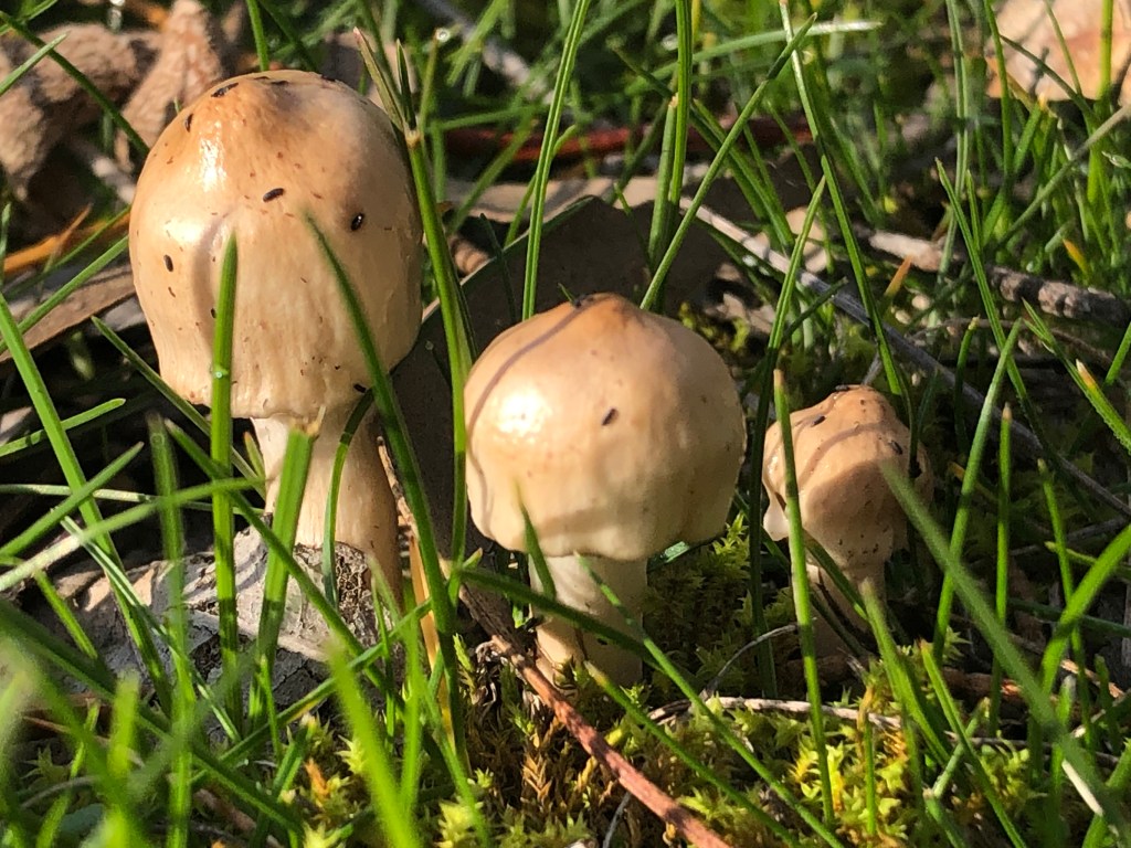
10 words – peaceful, lush, mushrooms, moss, happy singing birds, just add water.
Lockdown is playing hell with all our lives but is also a good time to let necessity be the mother of all sorts of invention.- making the most of what we have in our own back yard.
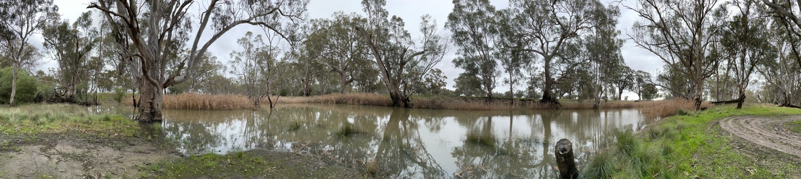
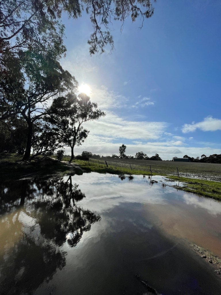
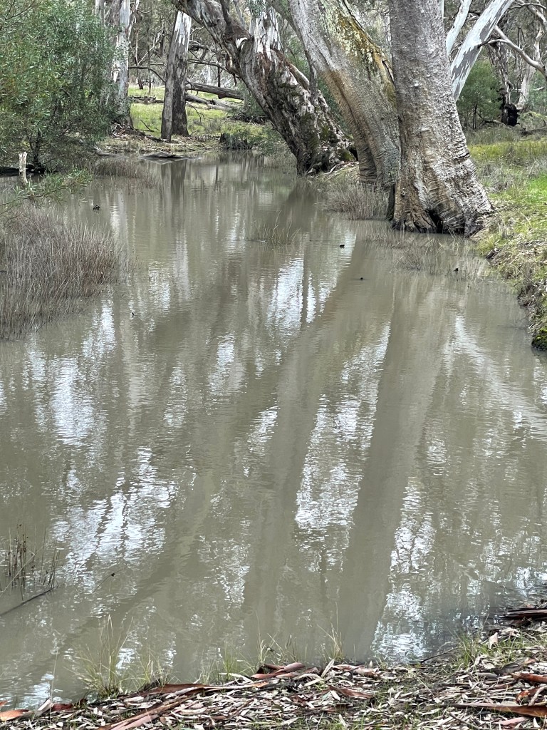
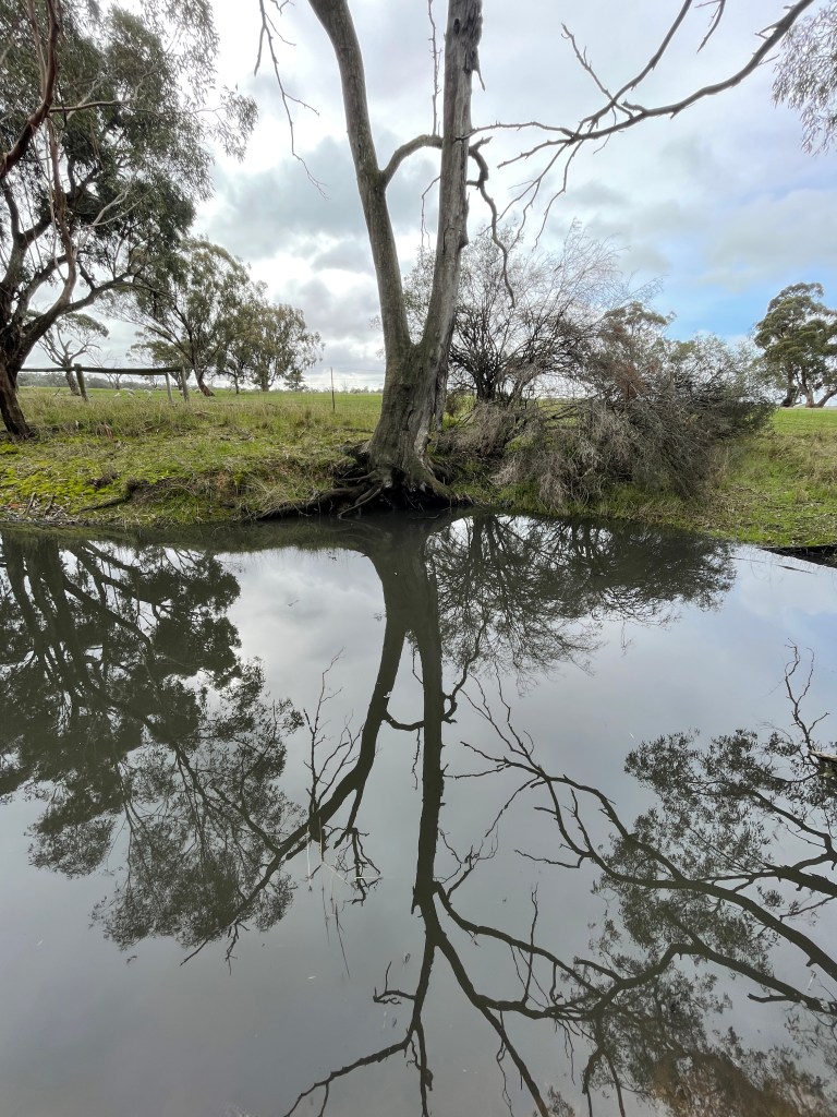
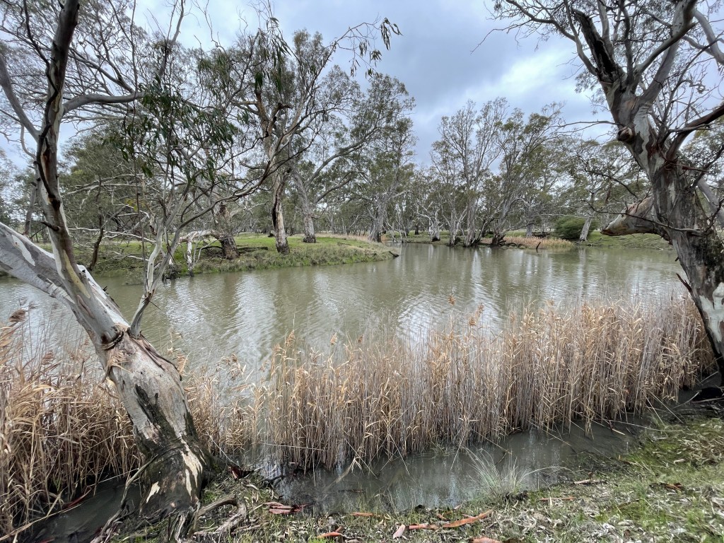
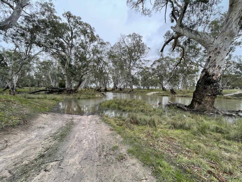
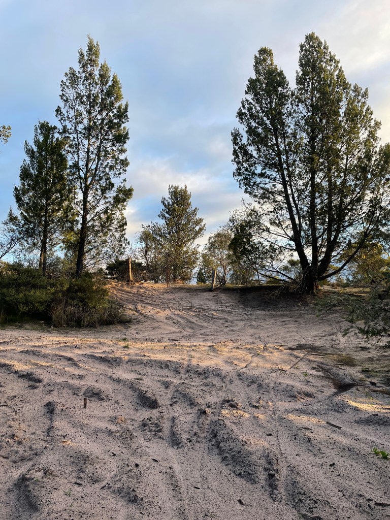
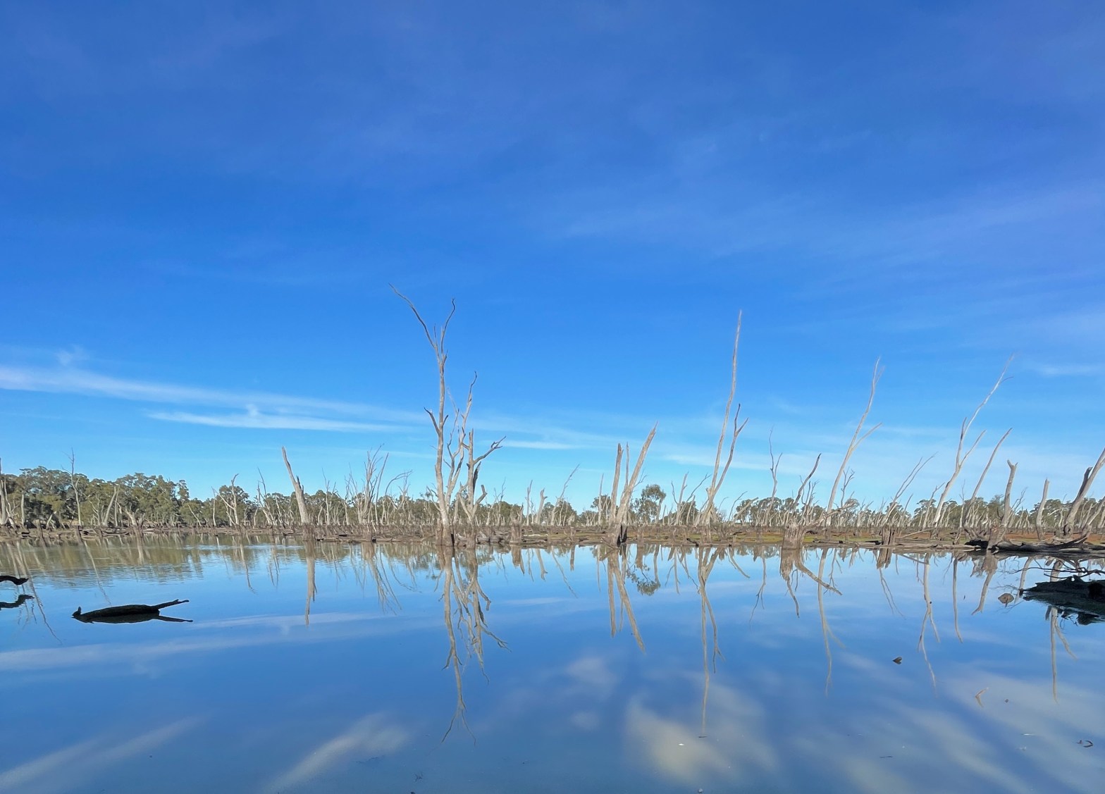
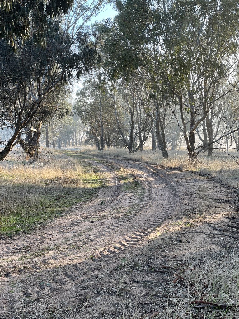
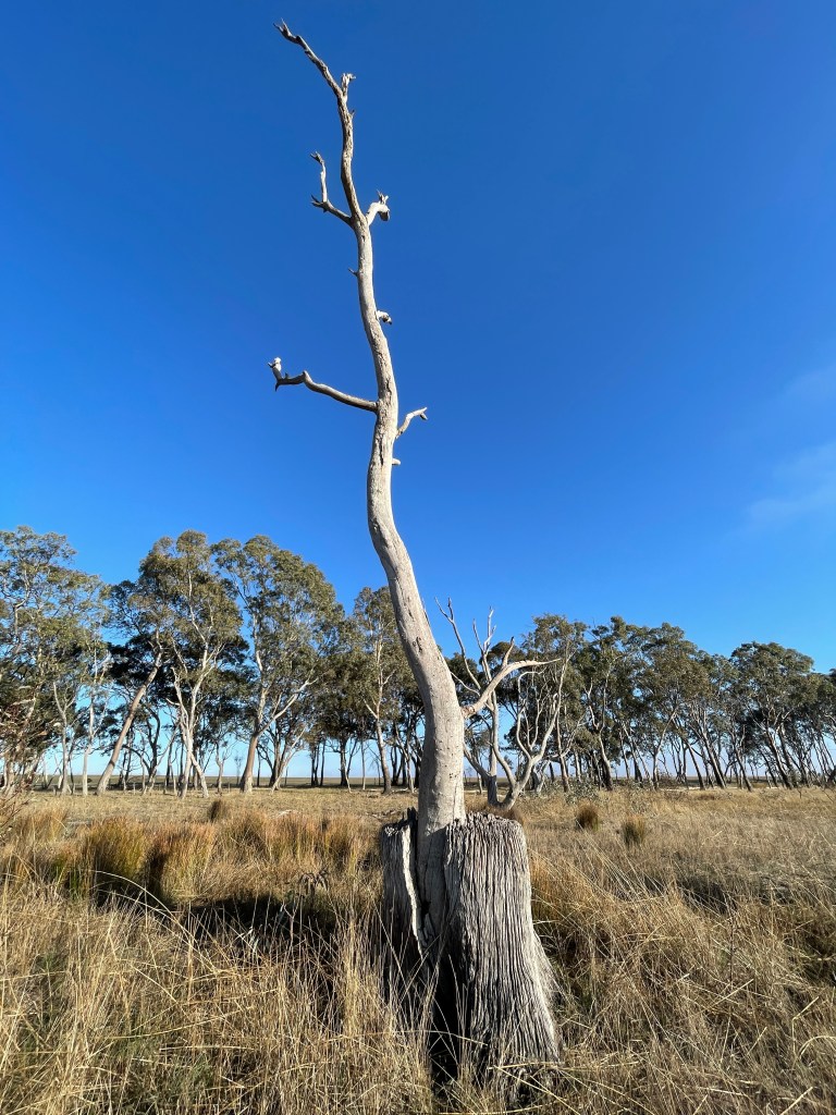
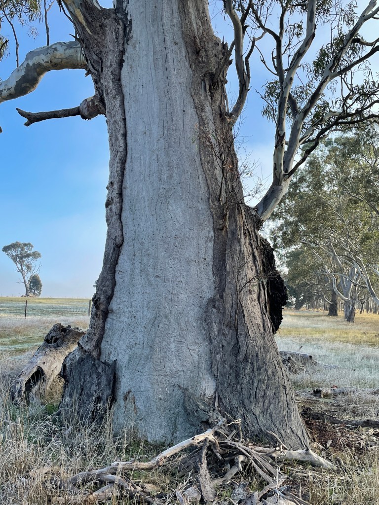
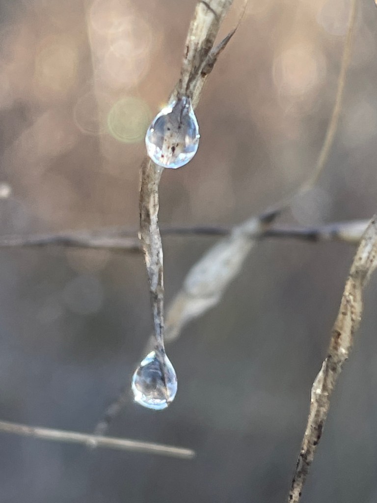
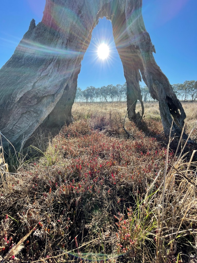
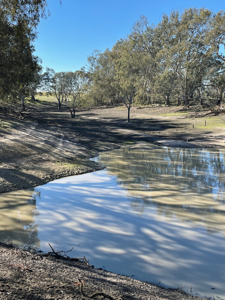
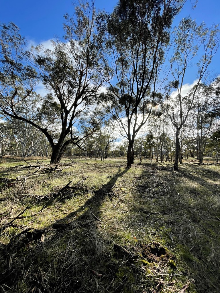
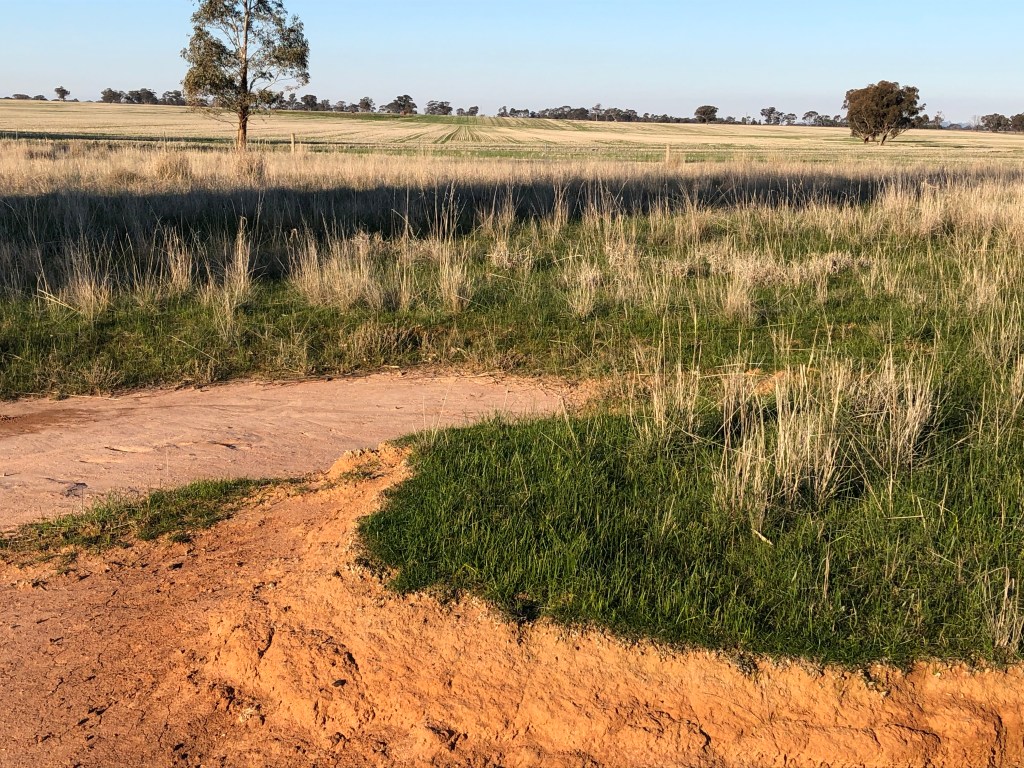
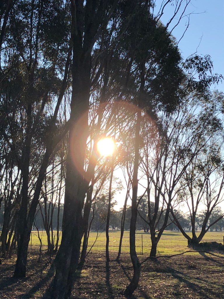
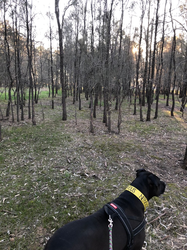
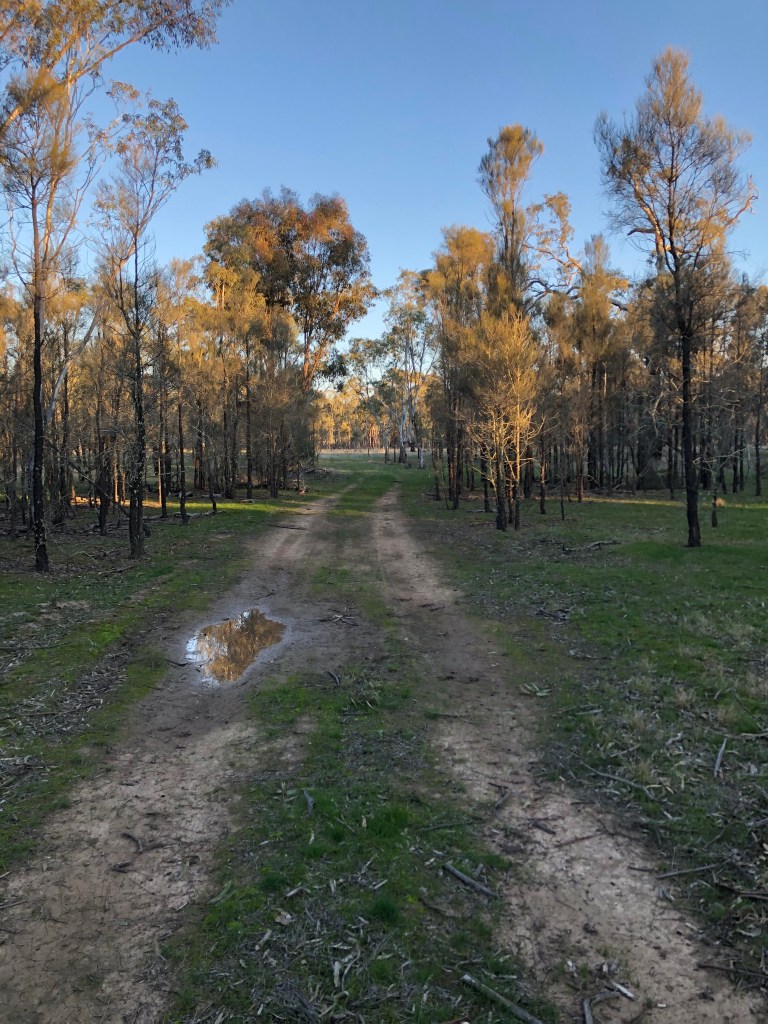
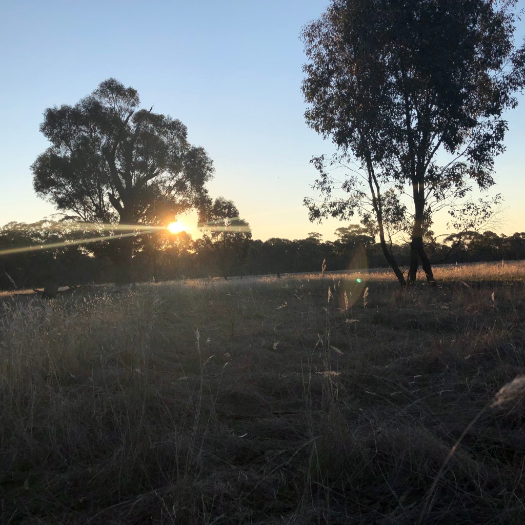
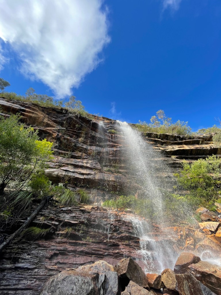
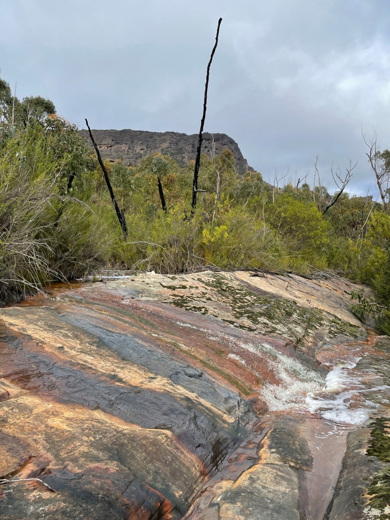
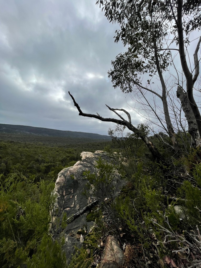
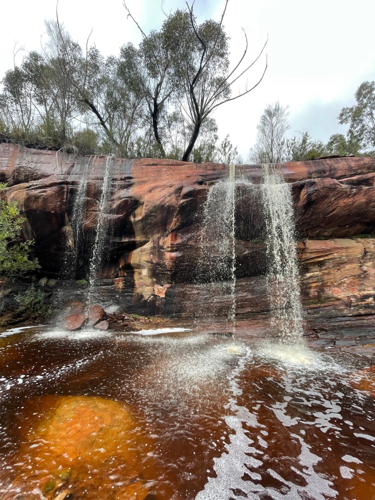
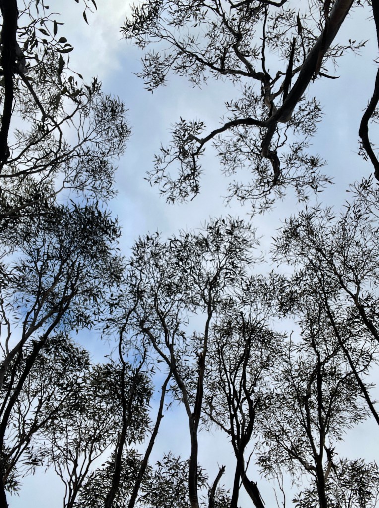
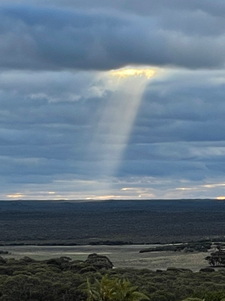
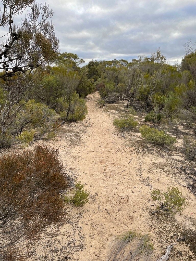
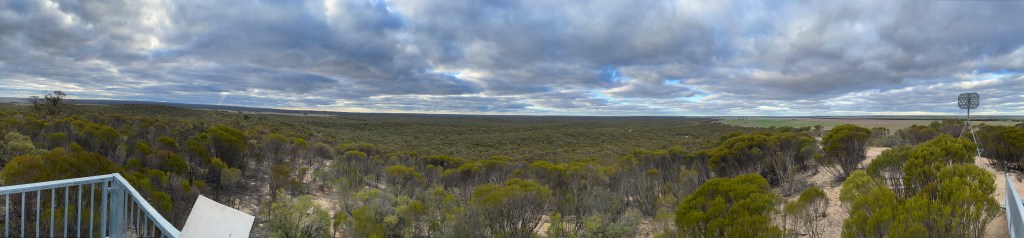
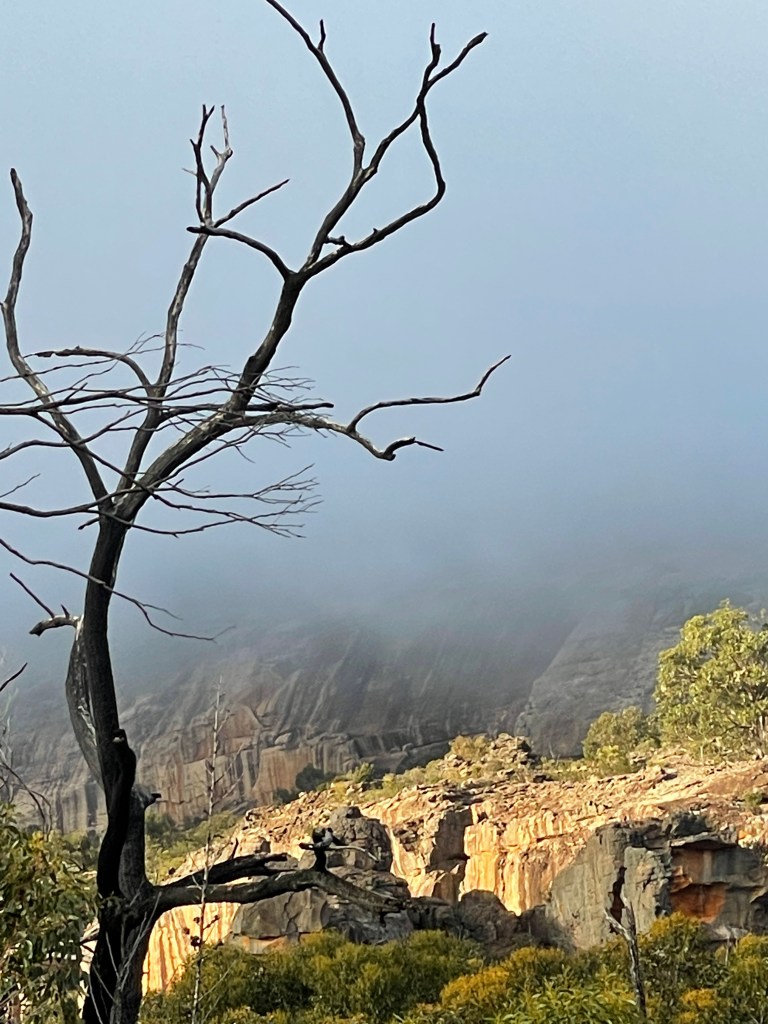
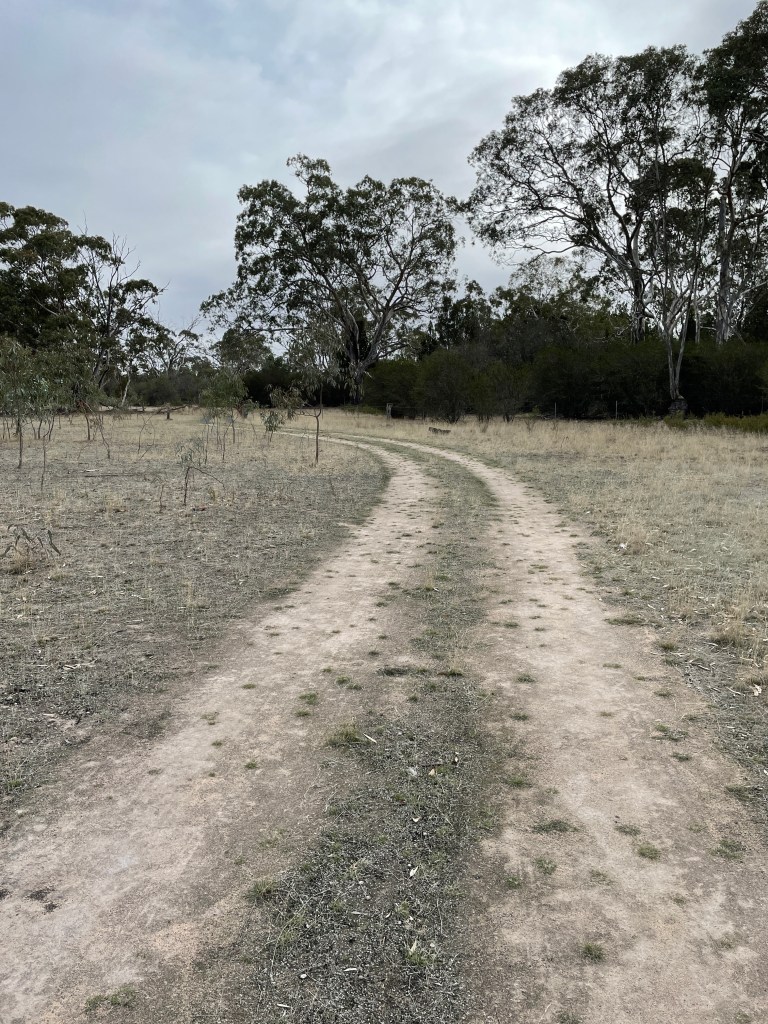
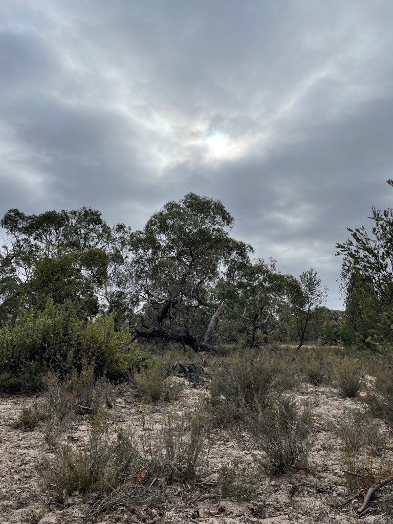
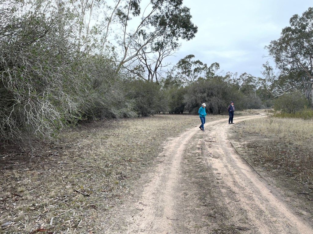
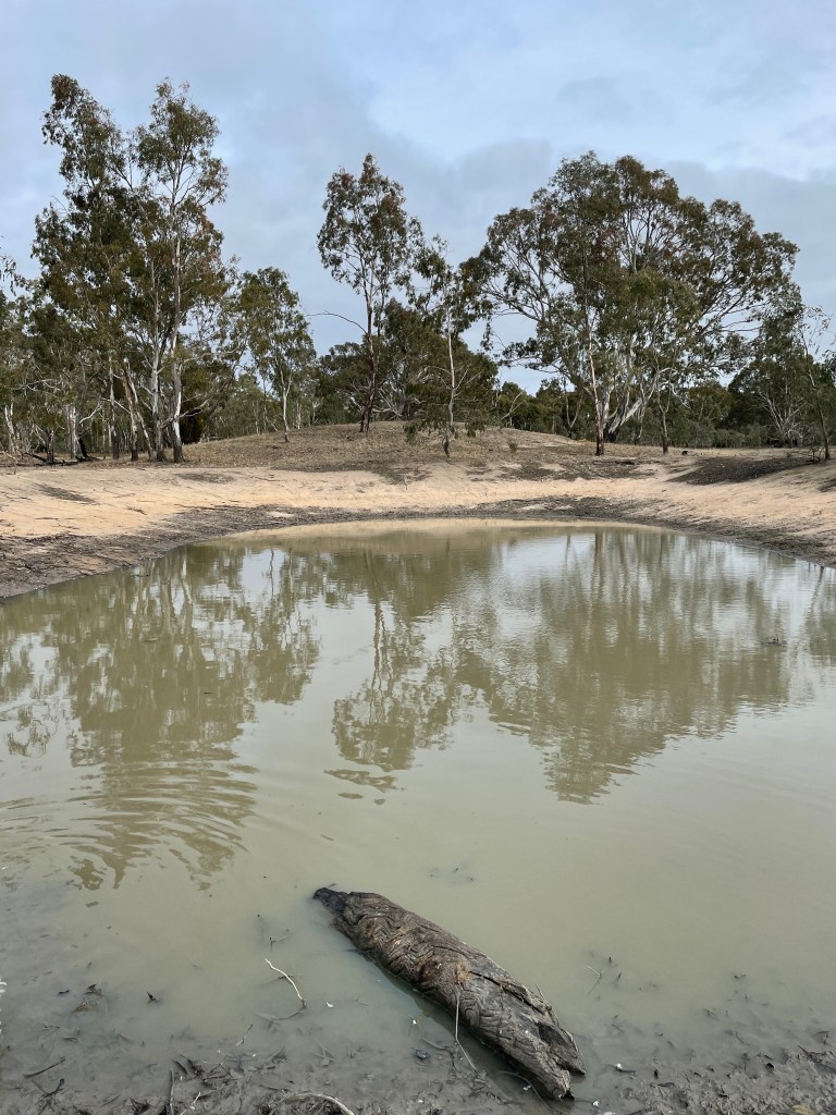
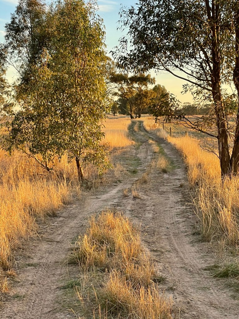
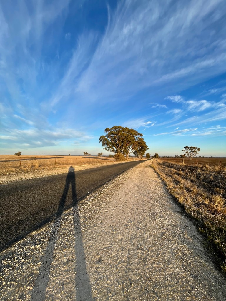
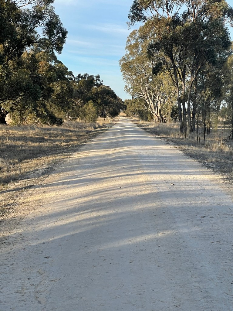
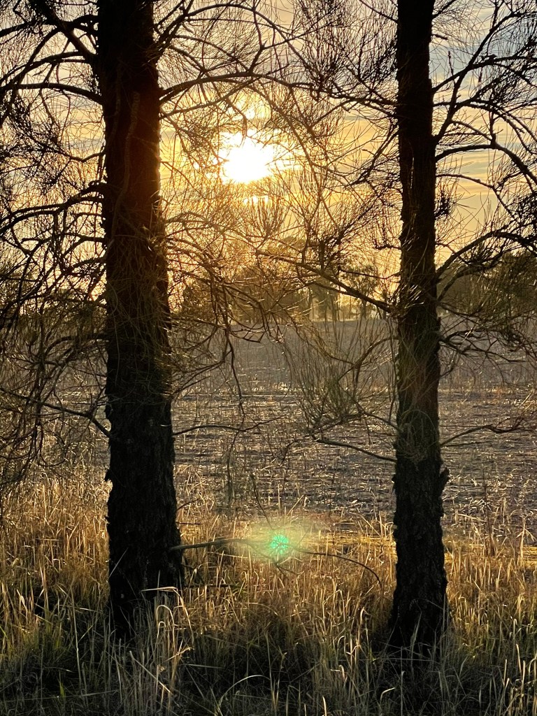
After some lovely winter rains, it seemed fitting to revisit the first walk we did this year in the heat of summer – this time in the dead of winter – the lower reaches of the Mackenzie River. We start at the bridge over this river on Three Bridges Road.
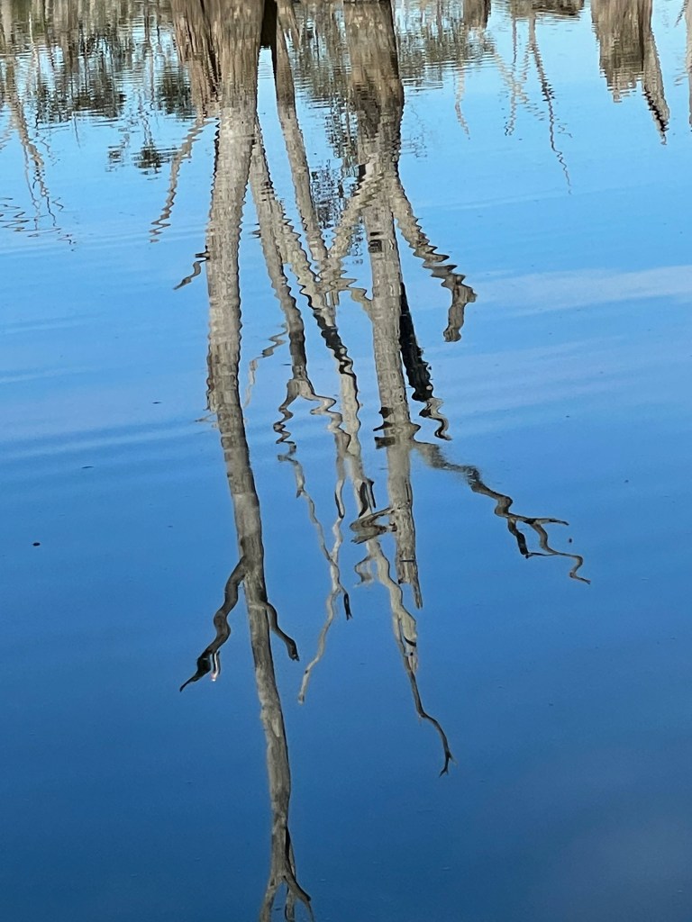
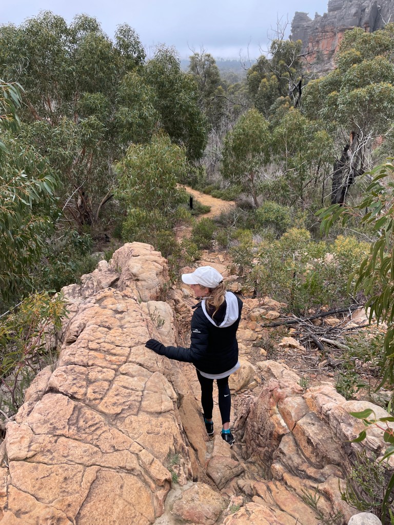
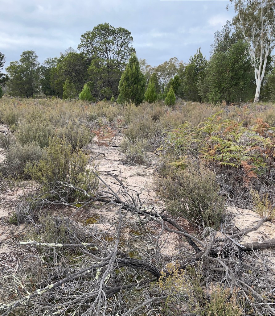
The track near Three Bridges Road, heading towards the Wimmera River.
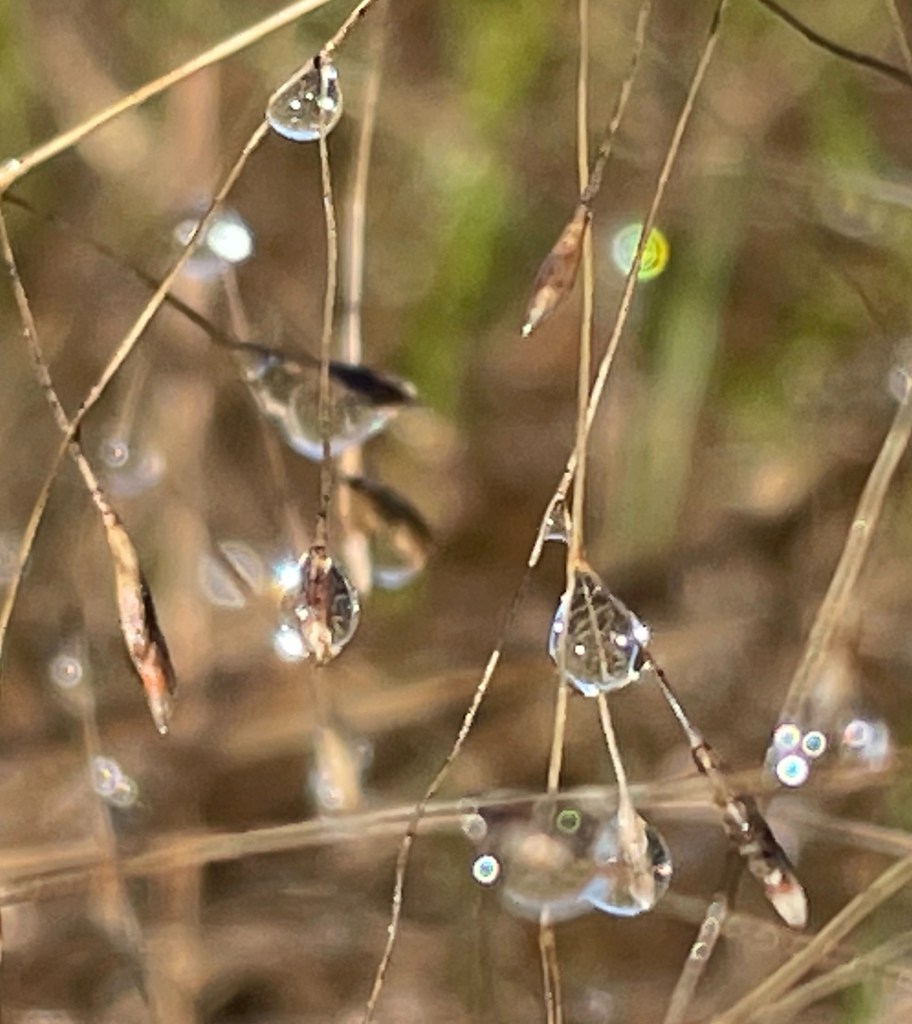
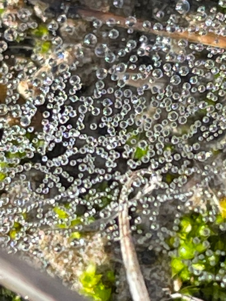
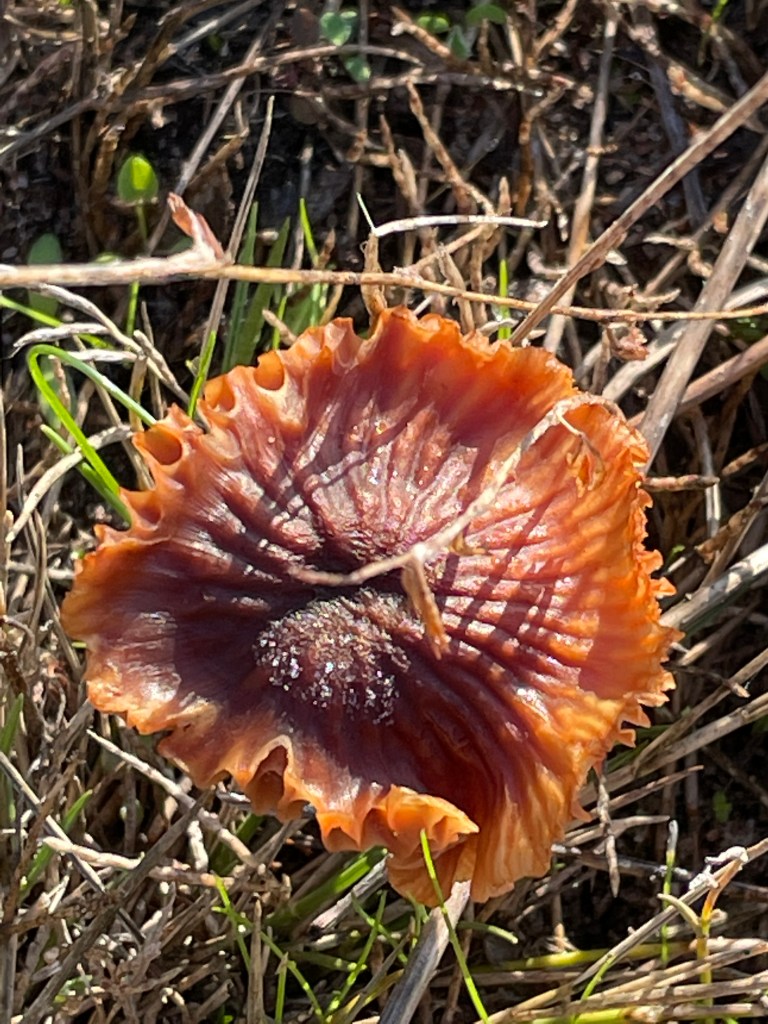
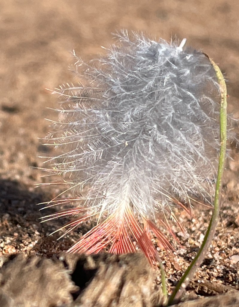
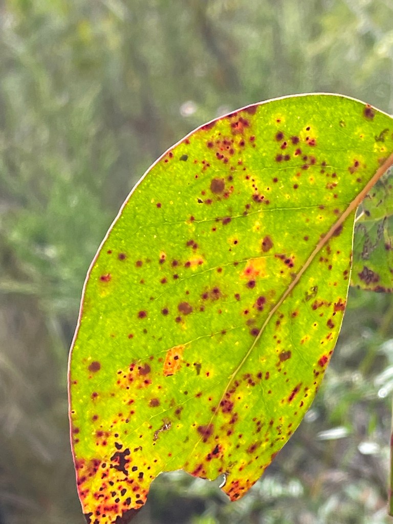
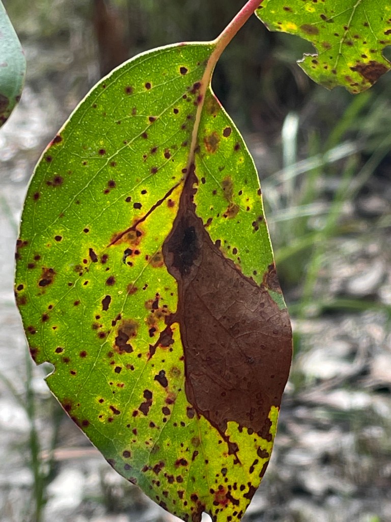
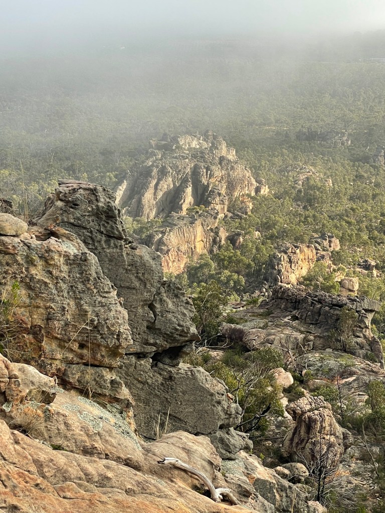
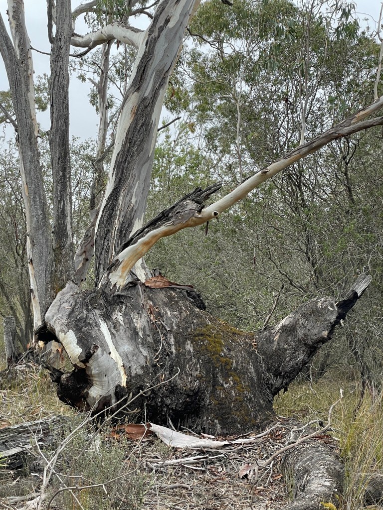
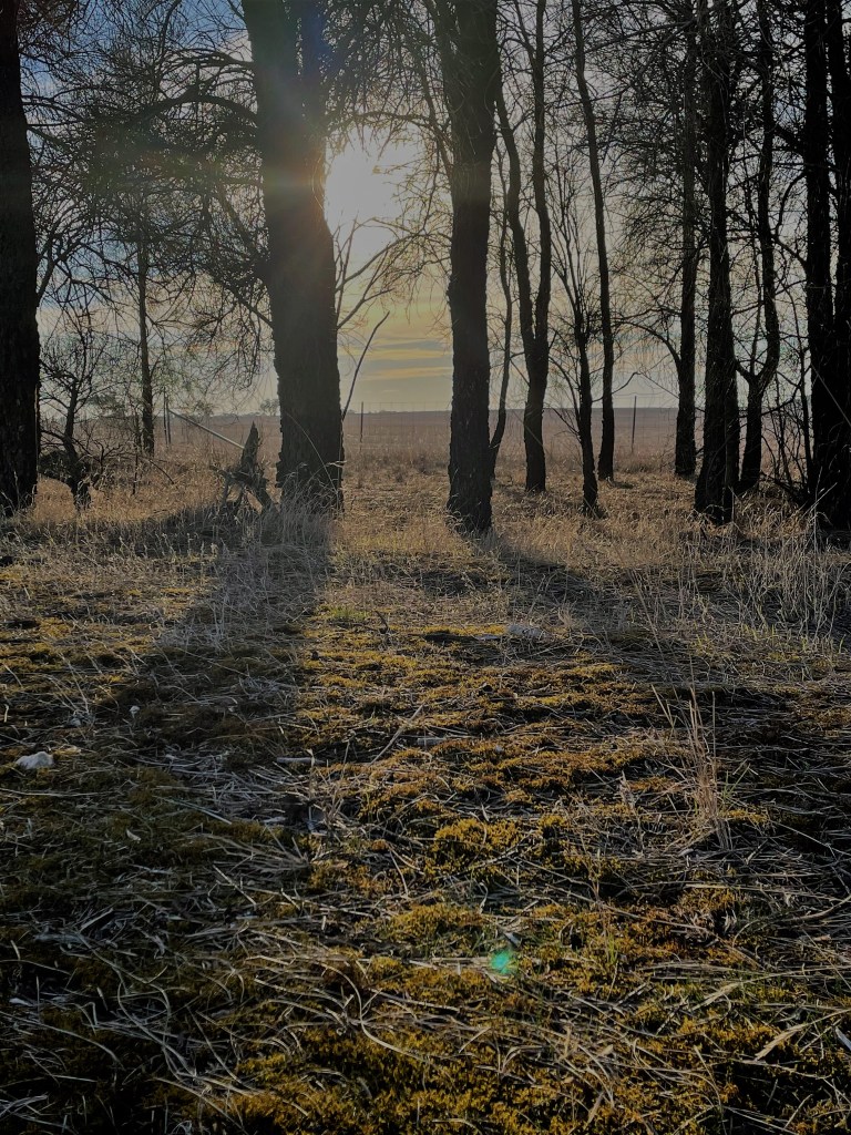
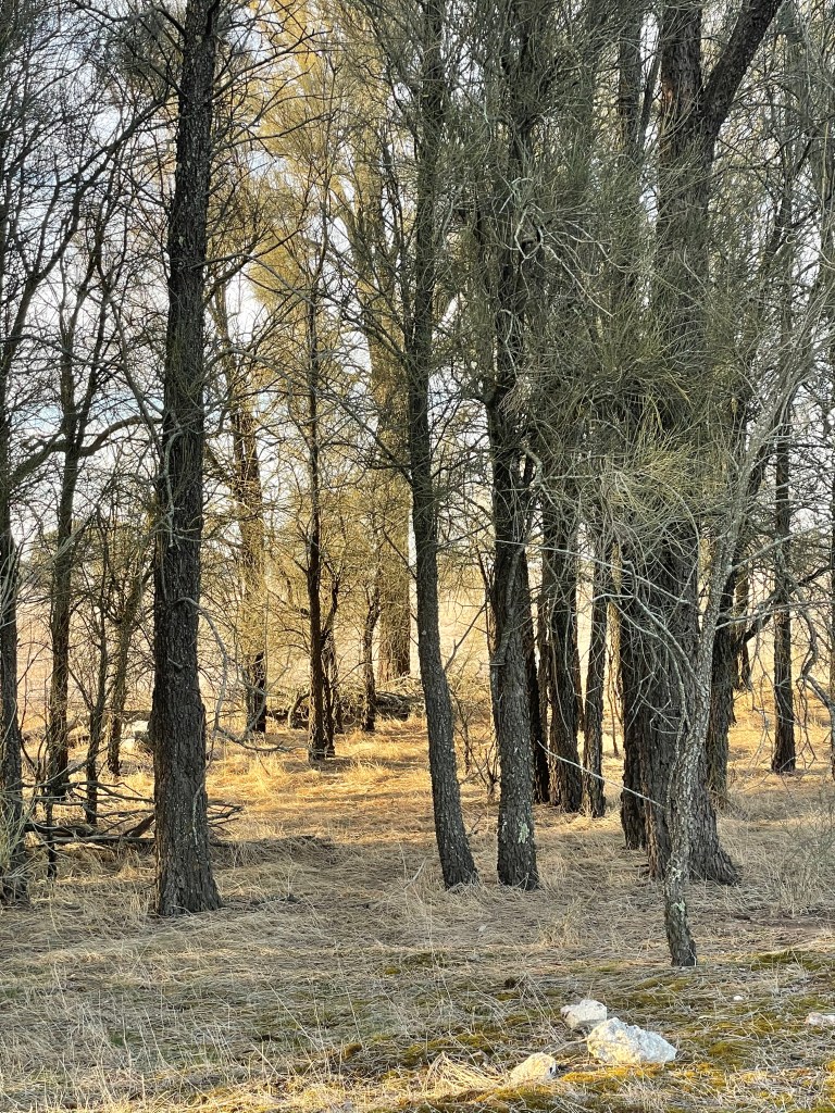
I am not going to say too much – I will let the Pictures tell the story.
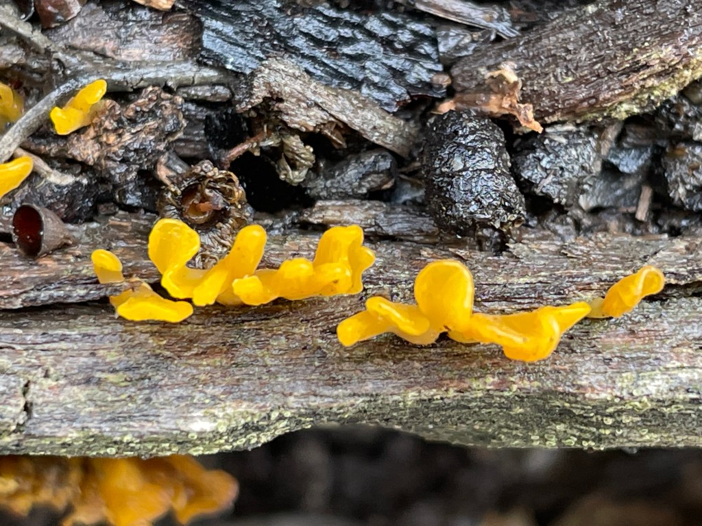
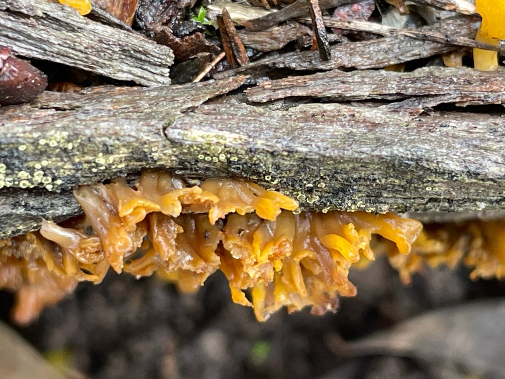
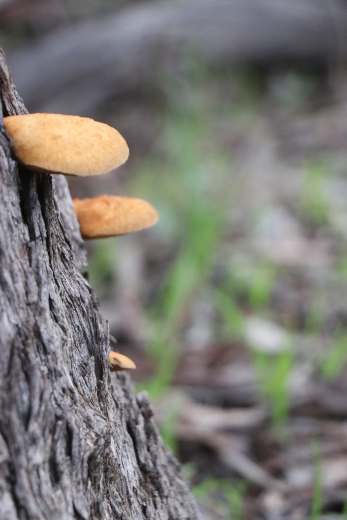
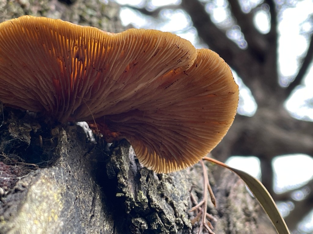
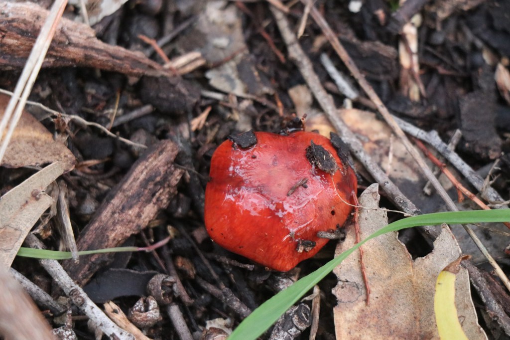
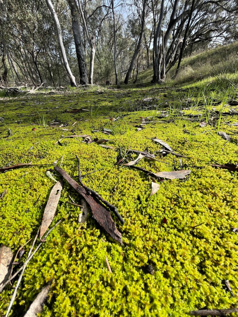
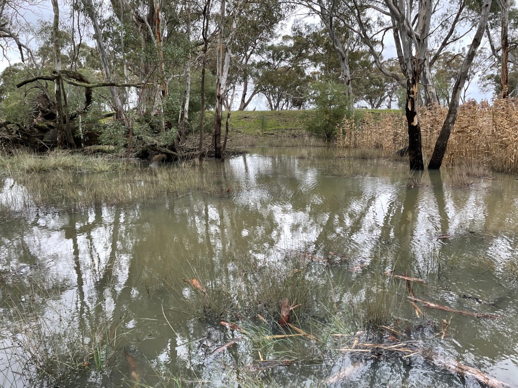
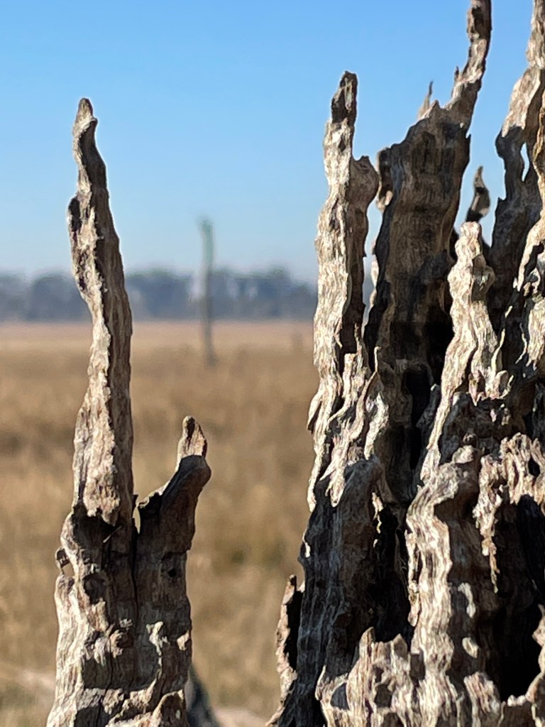
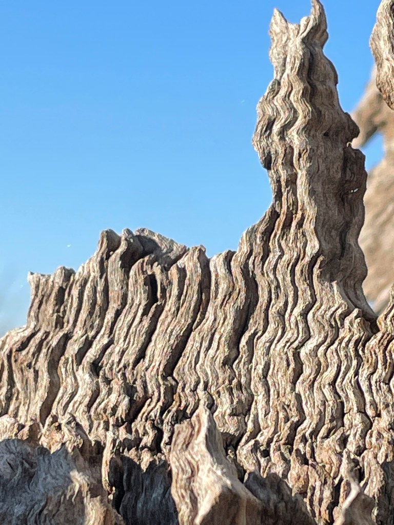
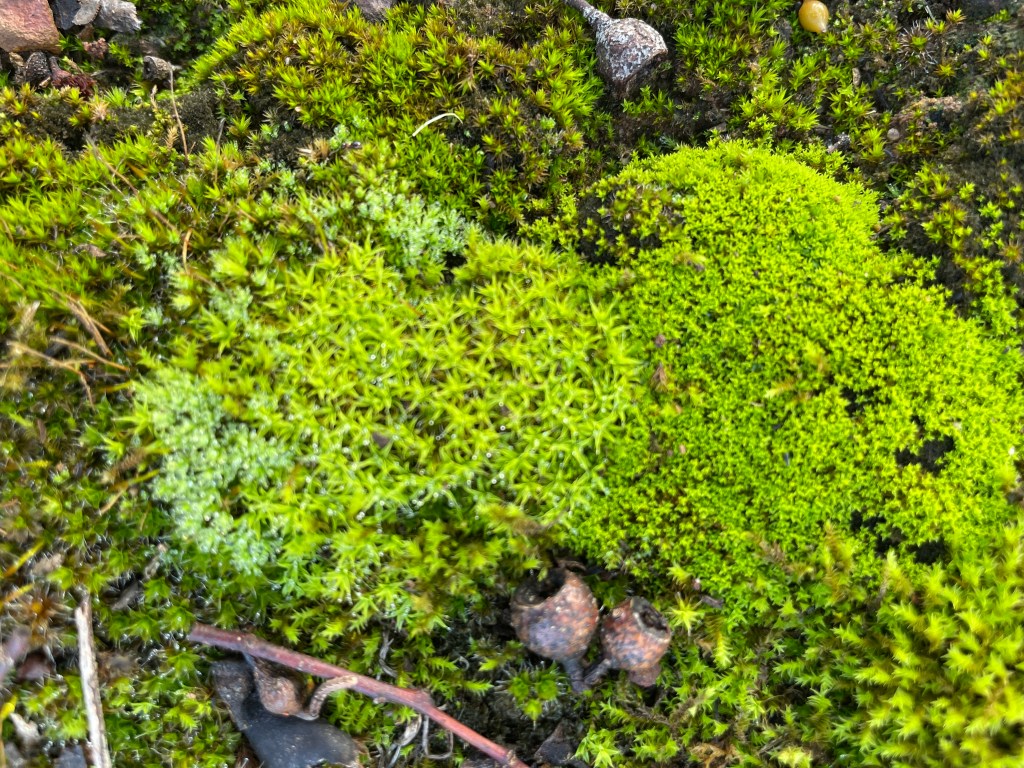
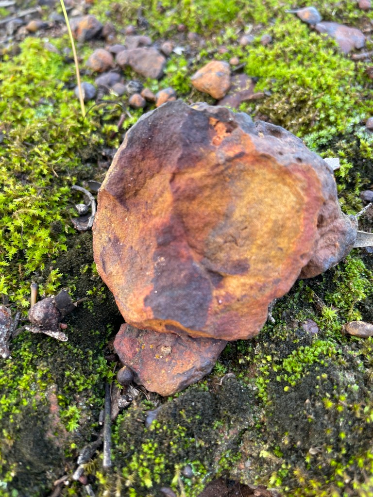
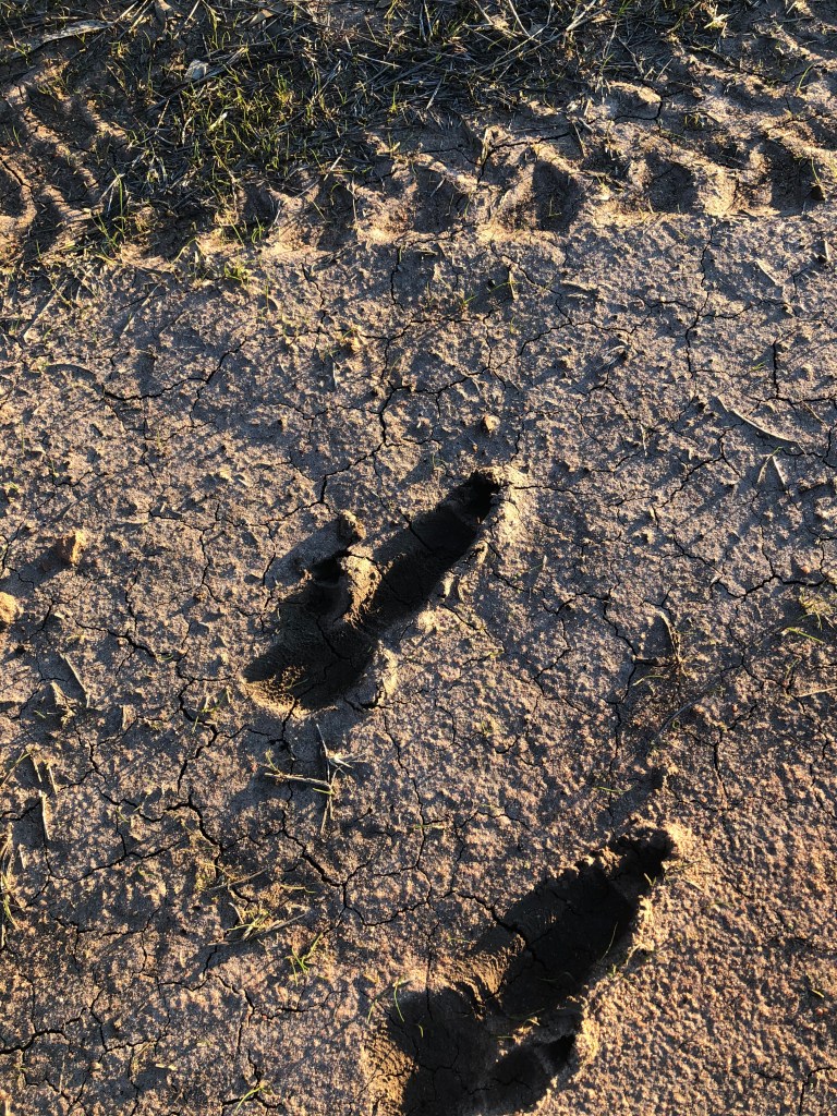
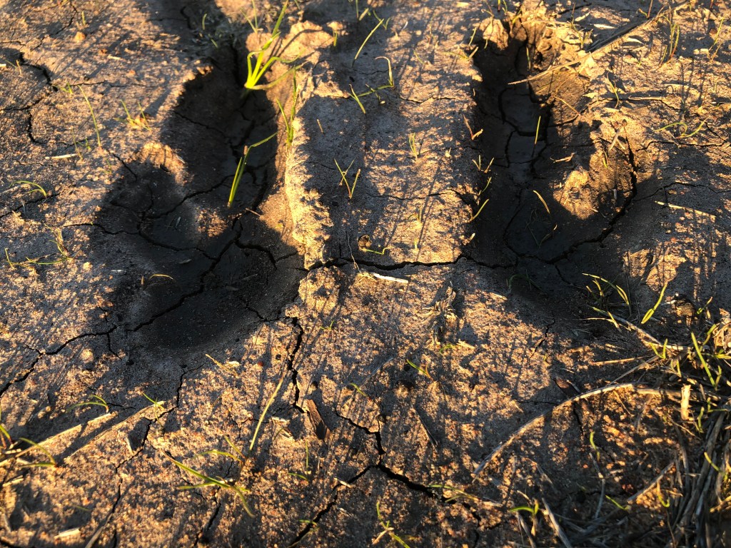
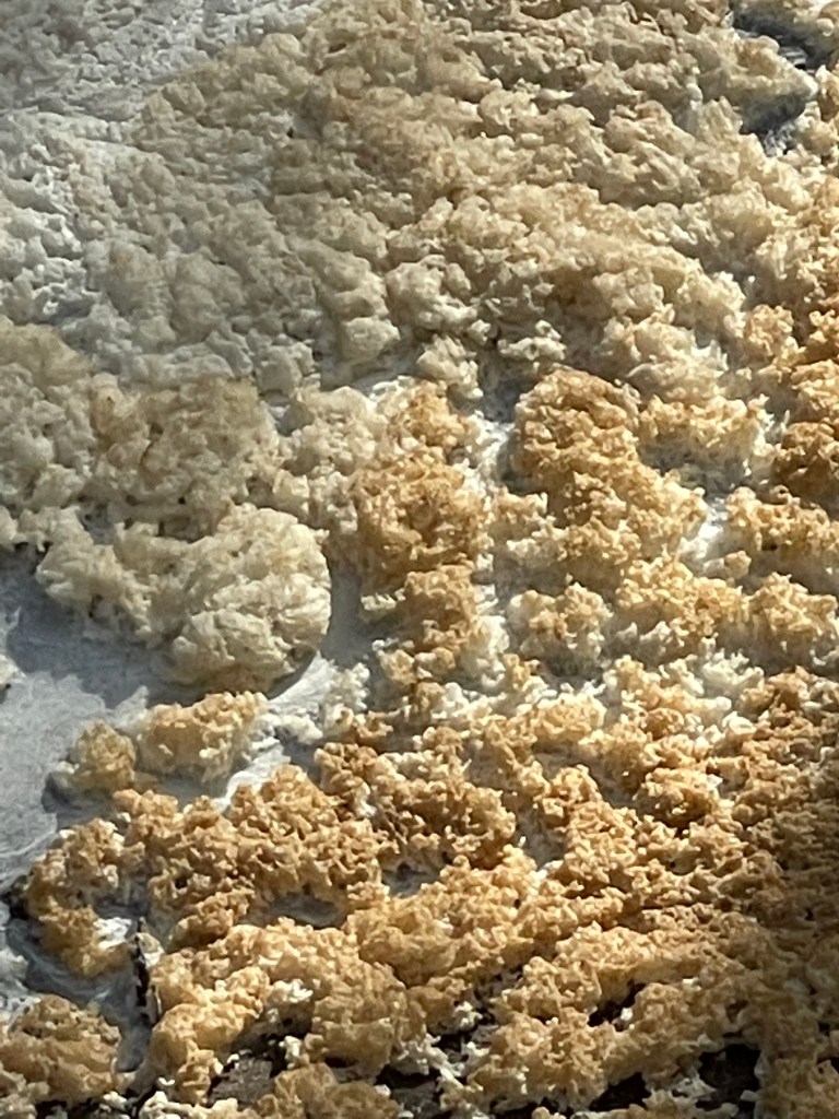
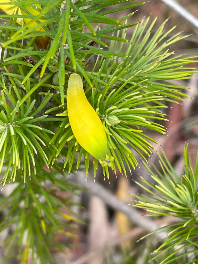
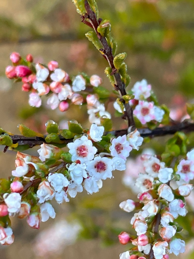
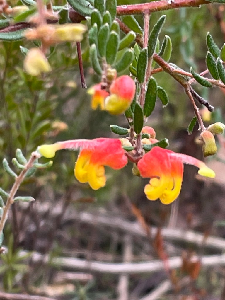
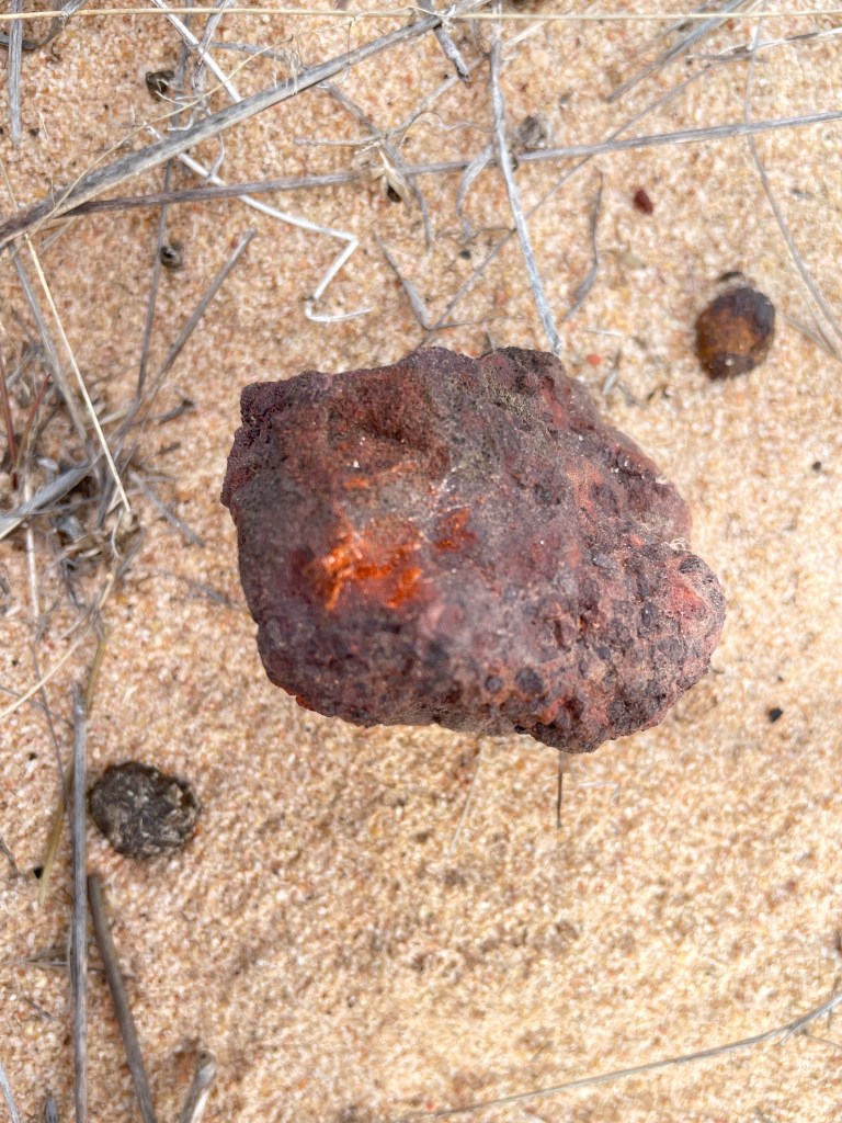
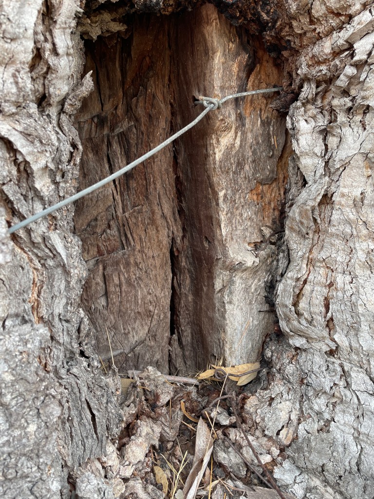
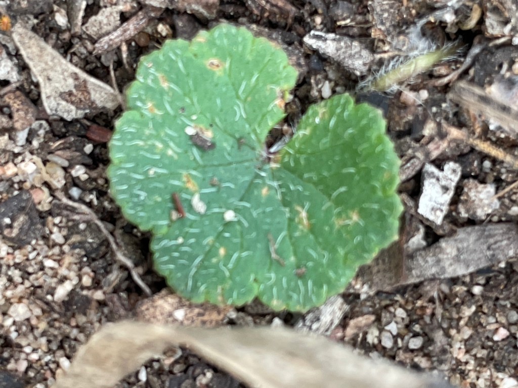
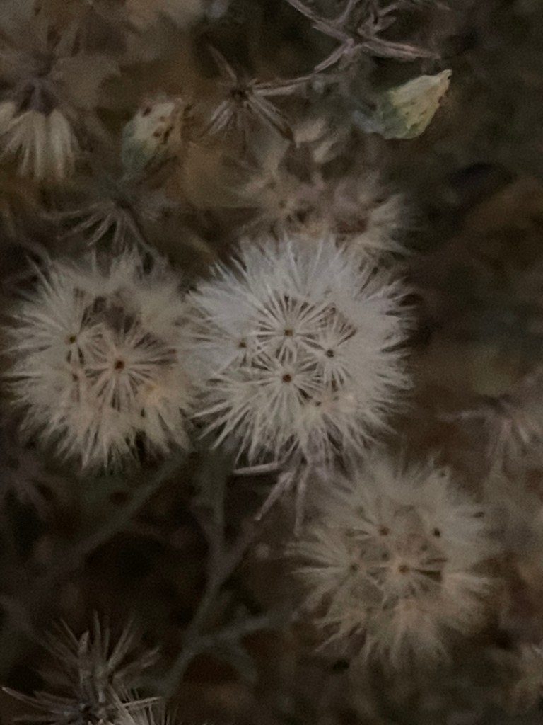
In short – there were plenty of mushrooms and fungi…
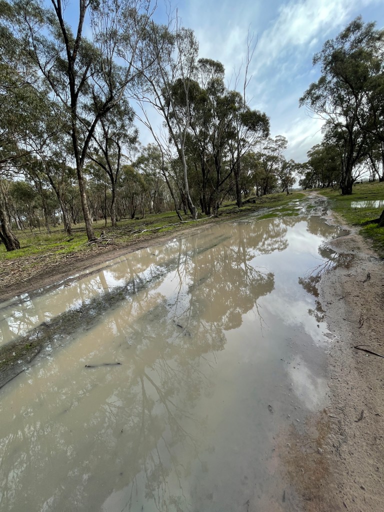
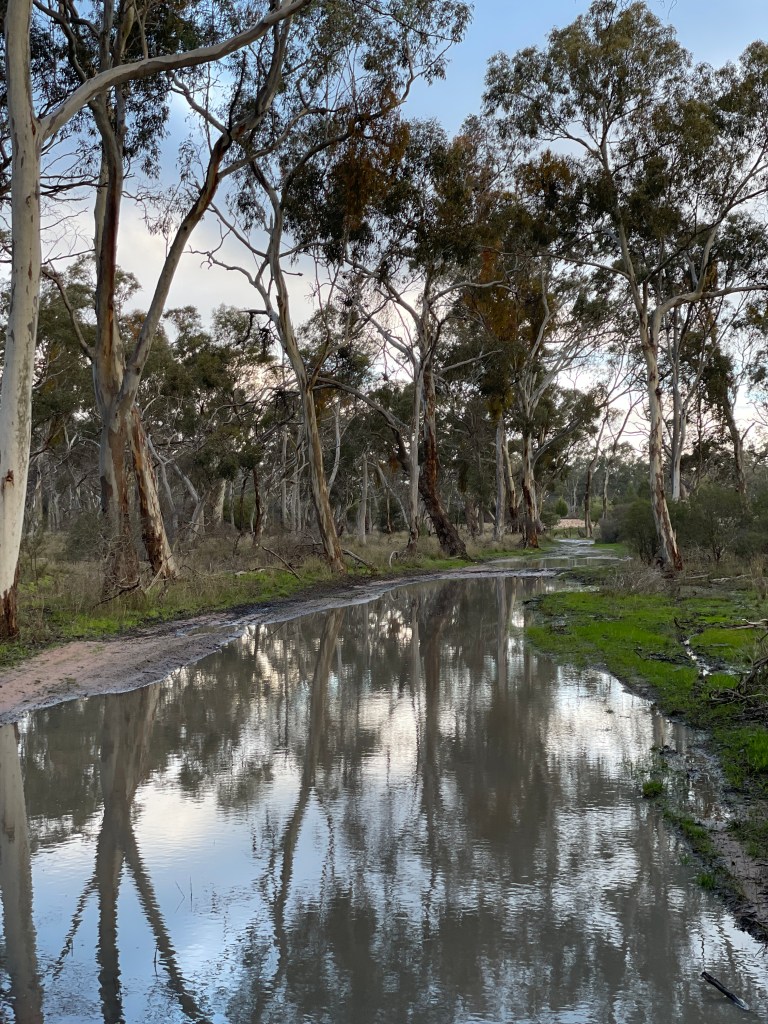
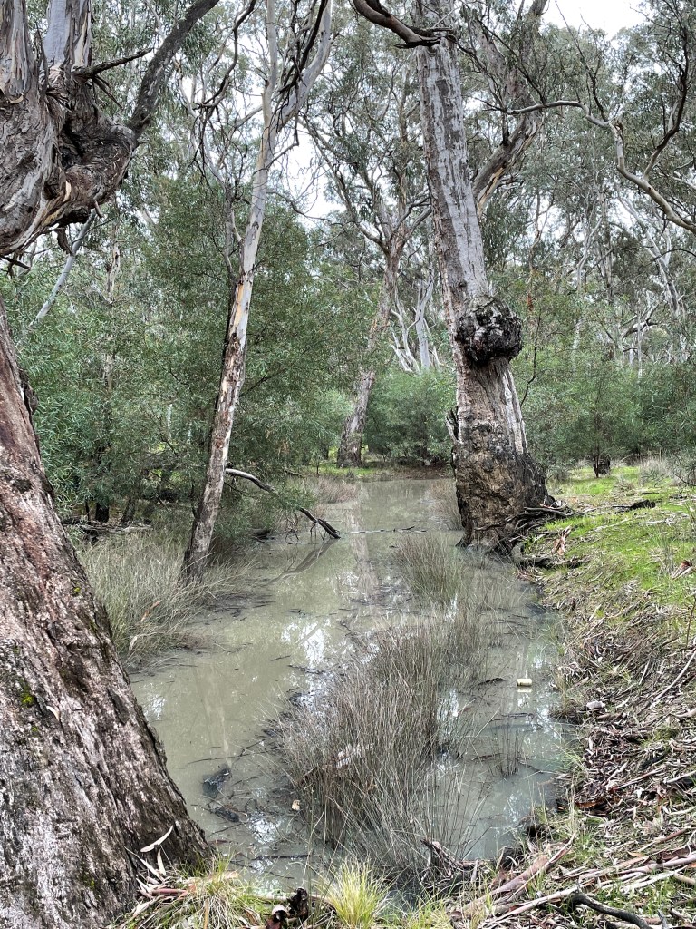
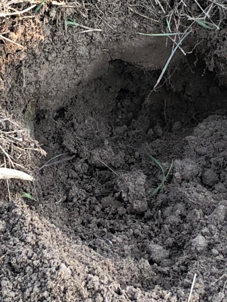
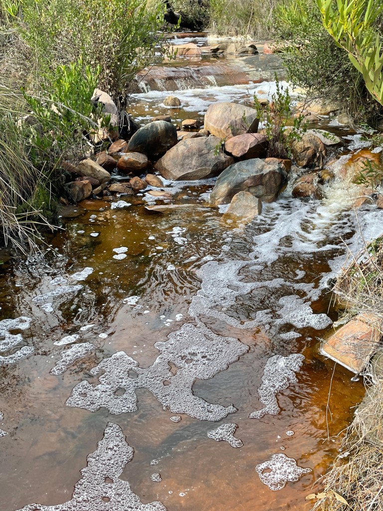
Lots of puddles, flowing water, and patches of icky sticky Wimmera grey clay mud…….
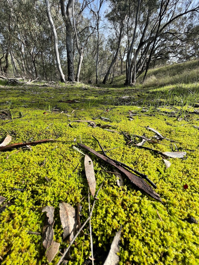
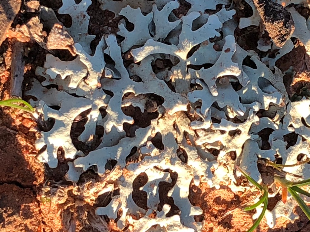
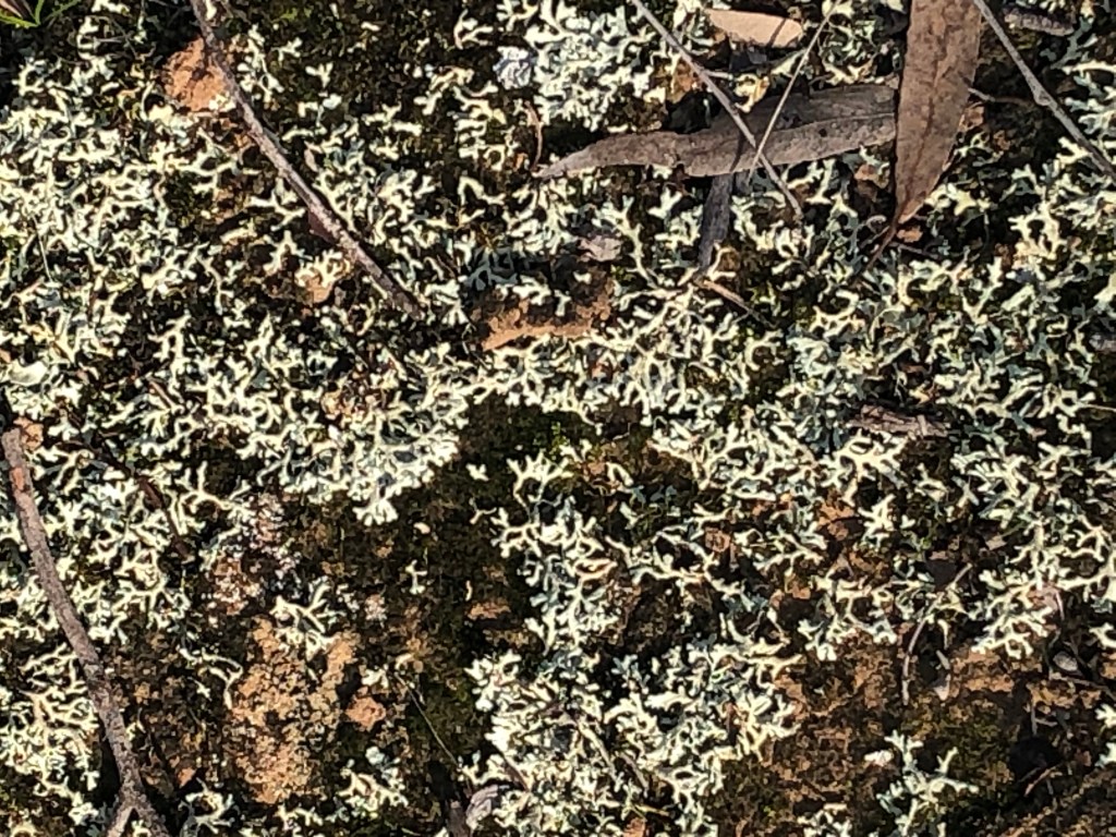
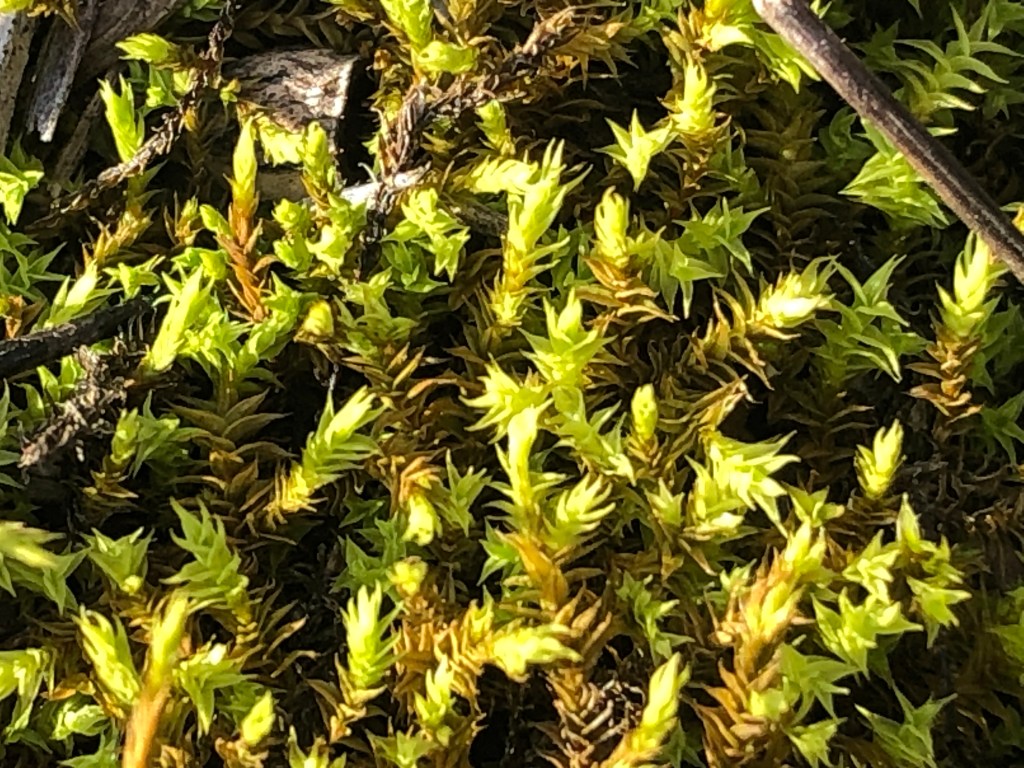
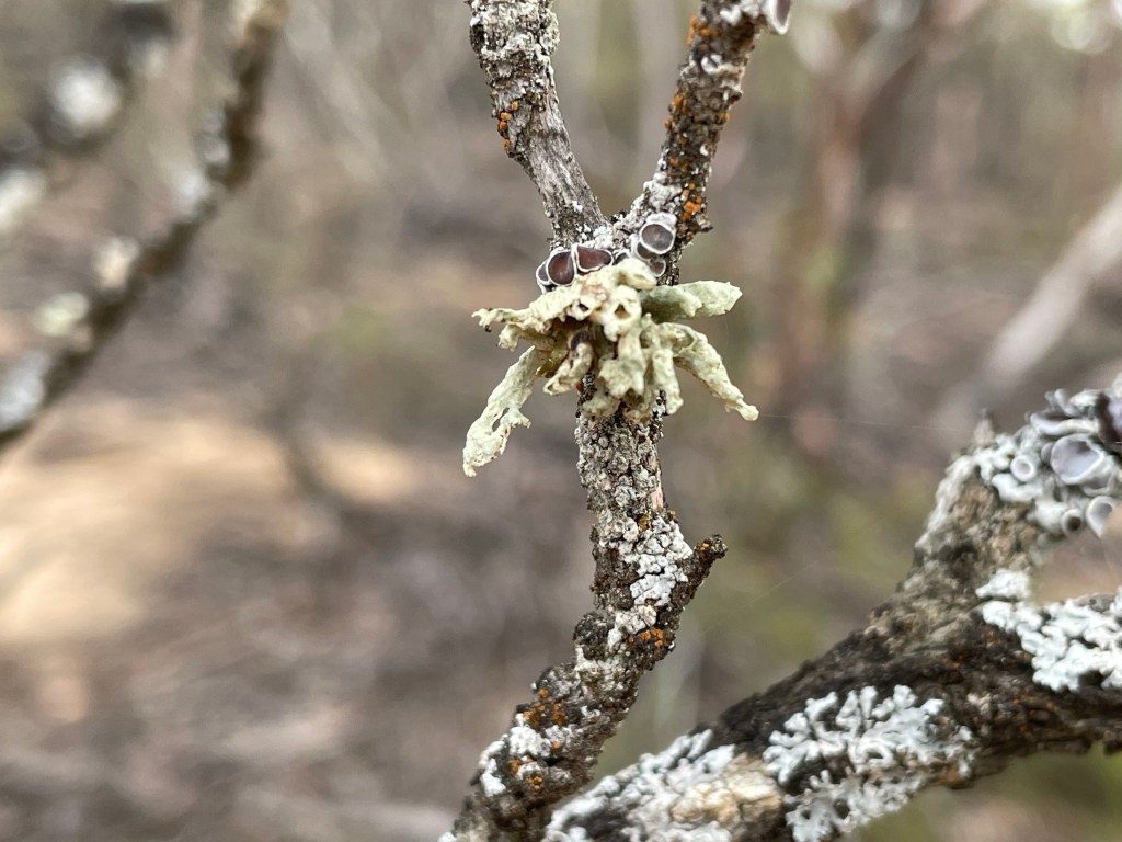
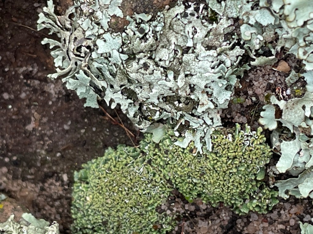
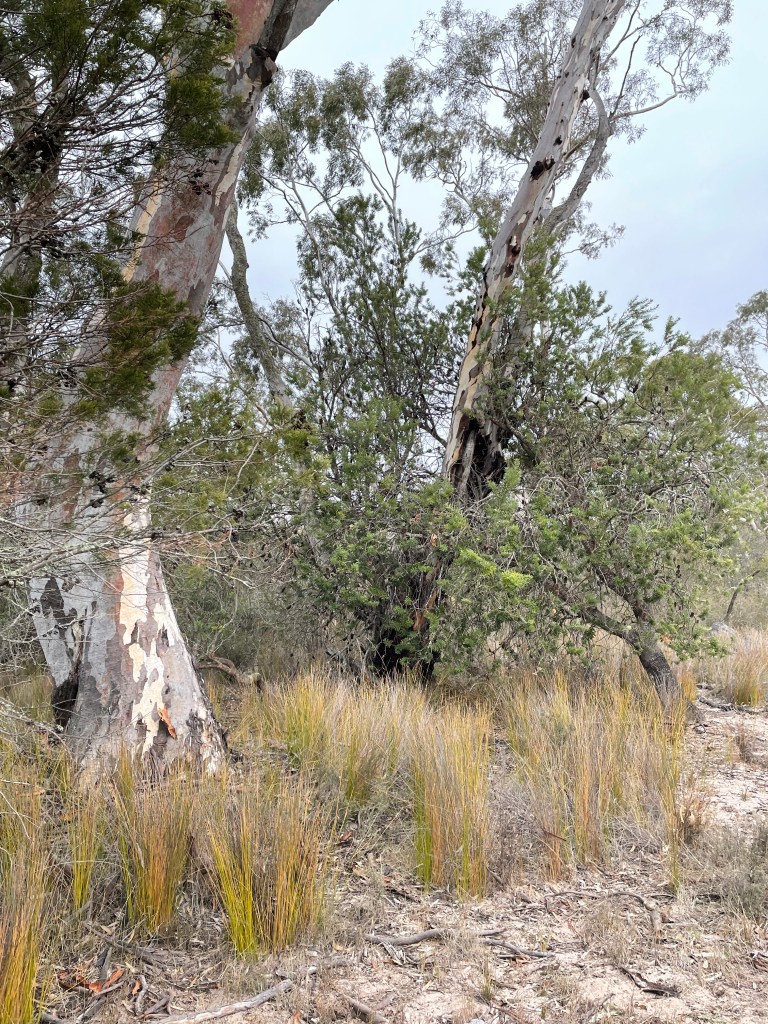
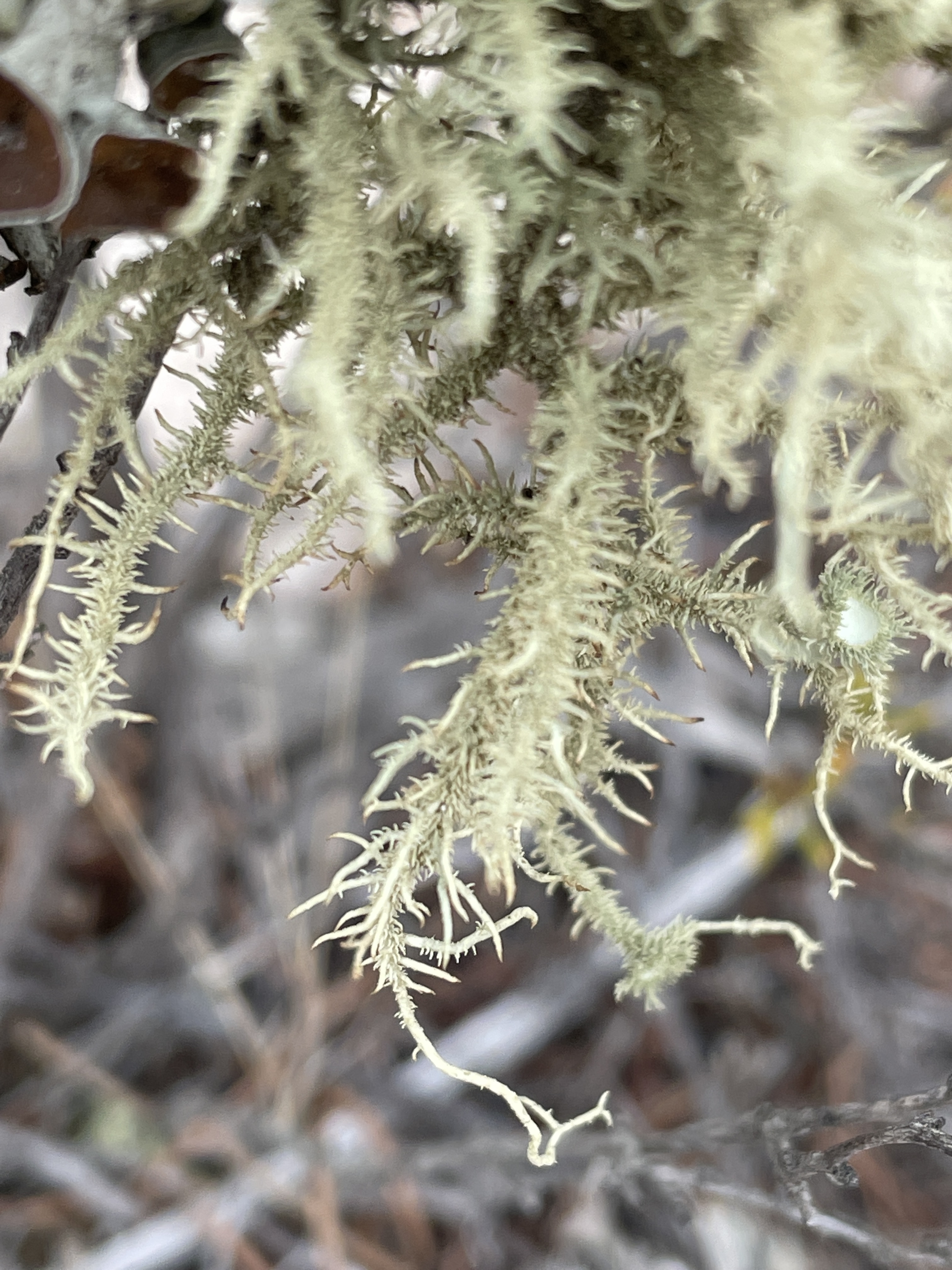
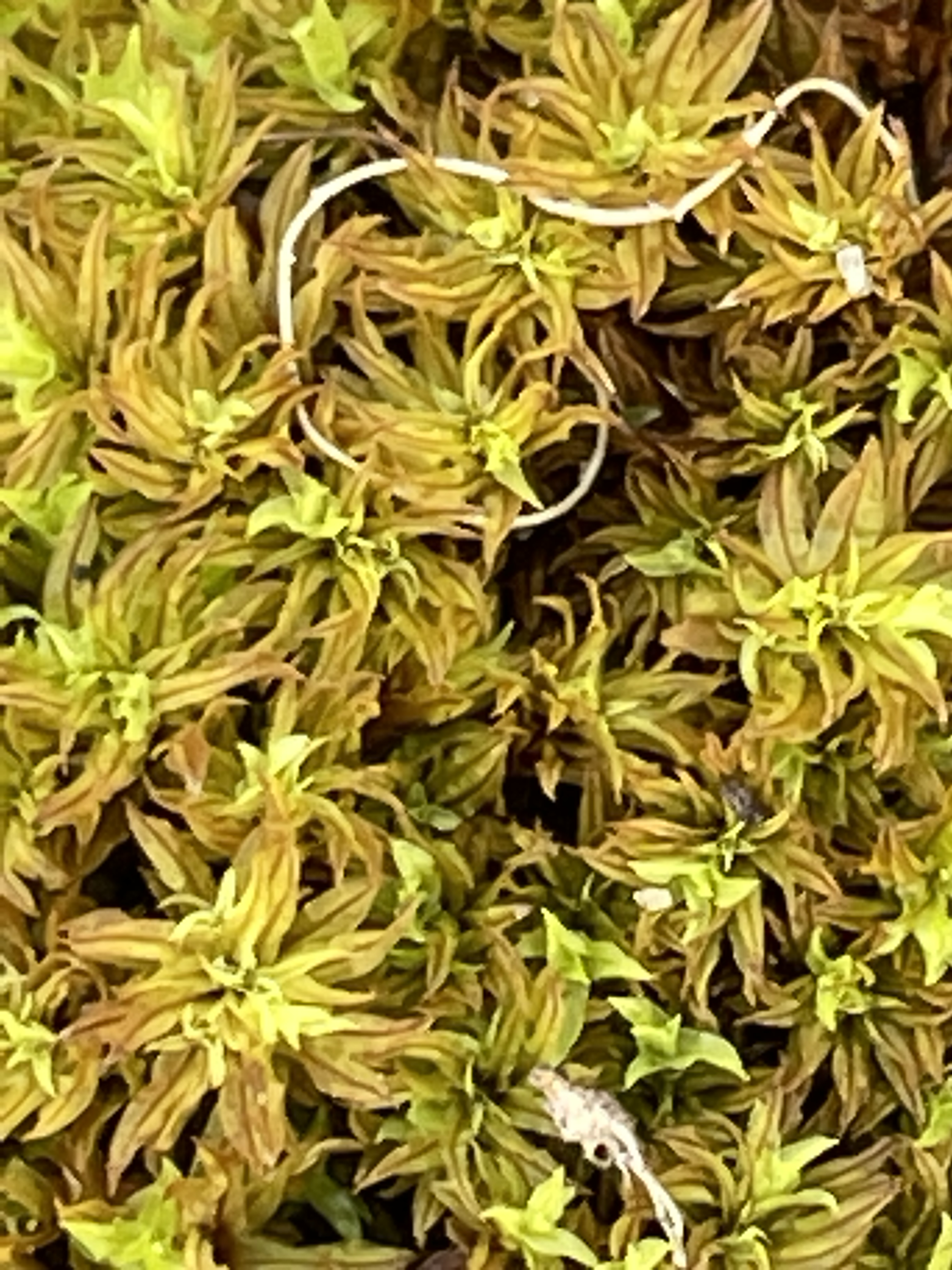
and healthy beds of bright green moss and lichen.
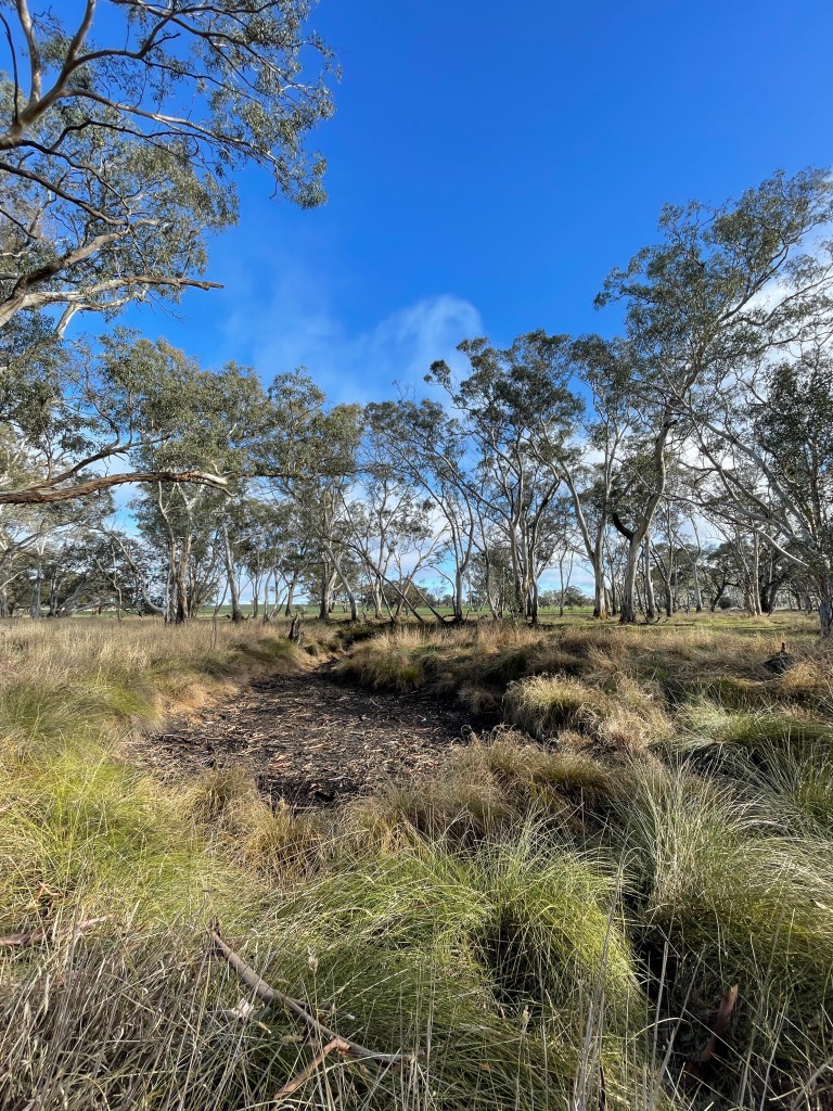
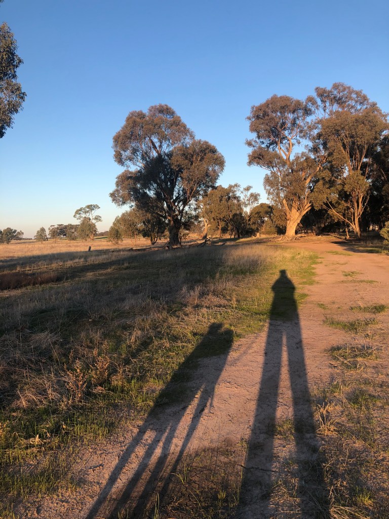
It was just as silent and peaceful along this magical walk – apart from a few mountain bike riders who also decided to get out and exercise close to home.
And of course the birds – heaps of them all singing their hearts out in perfect, natural harmony. Obviously happy to see the water back too.
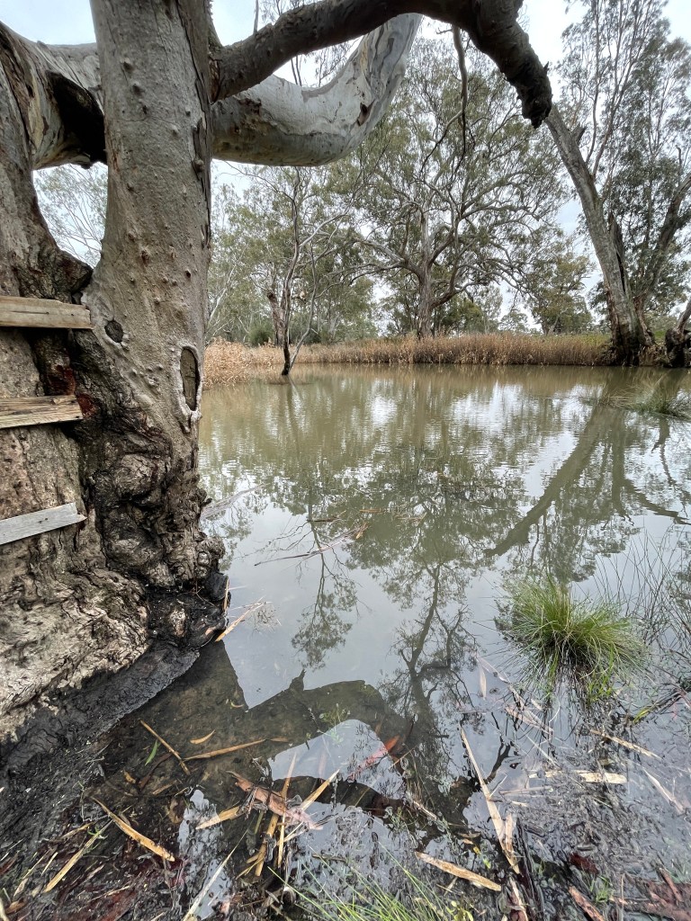
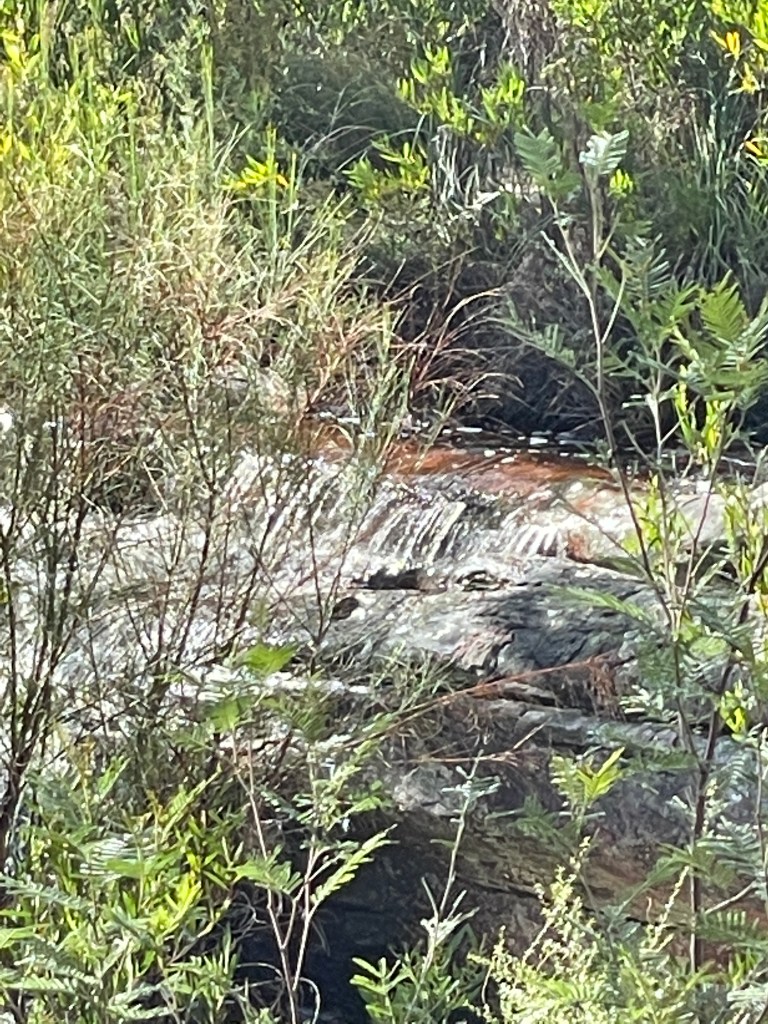
I had to make some delicate detours around huge puddles on the track but it was just so great to see some water in this often empty stream.
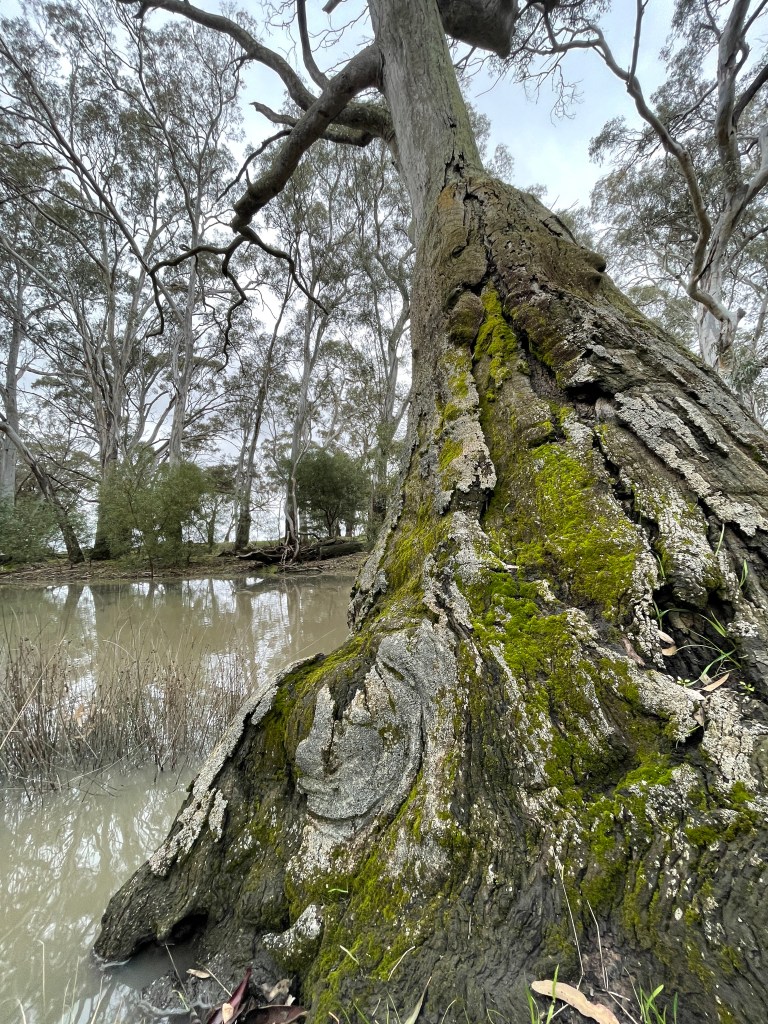
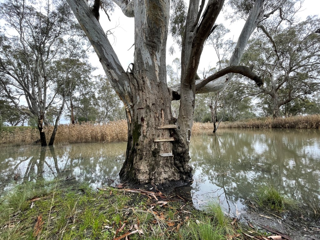
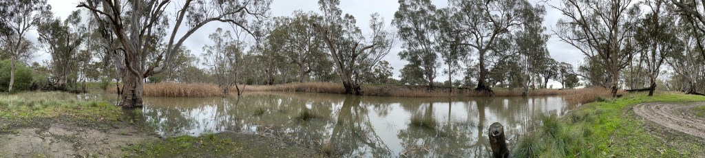
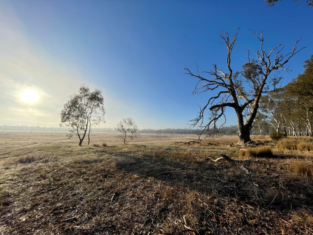
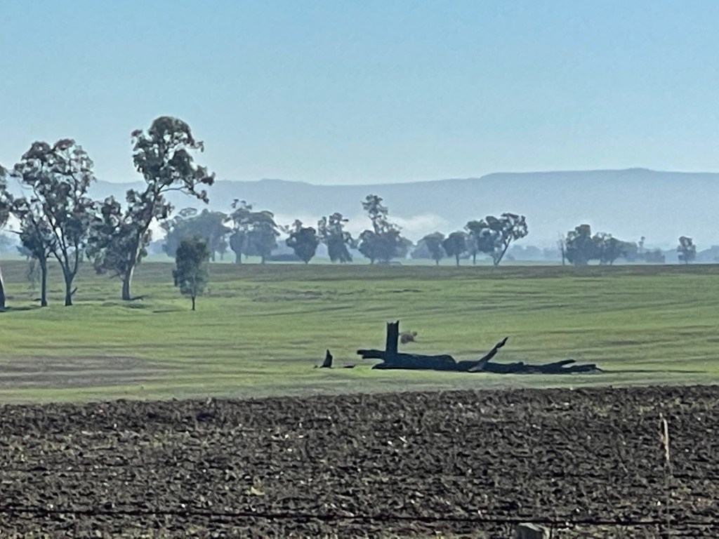
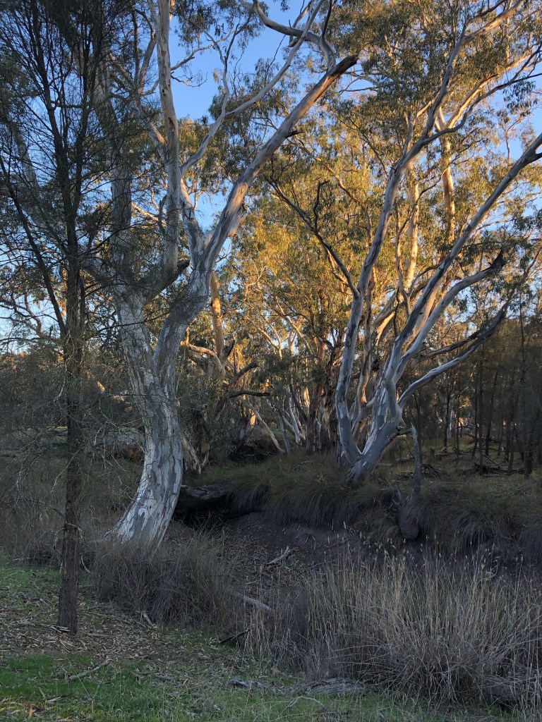
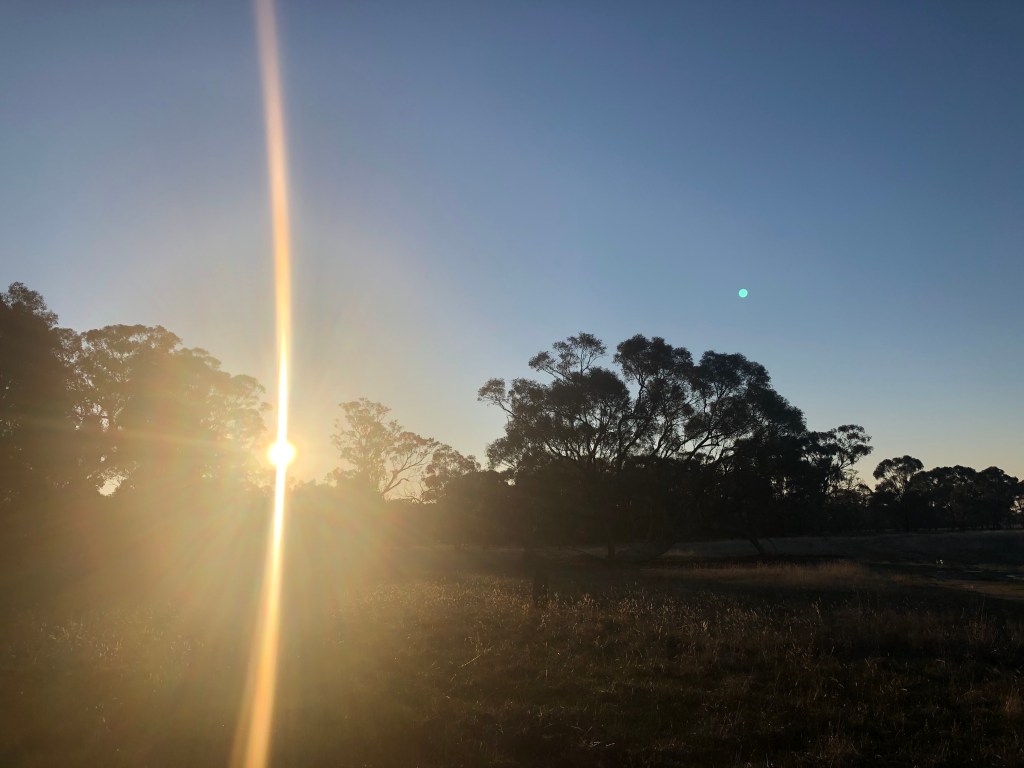
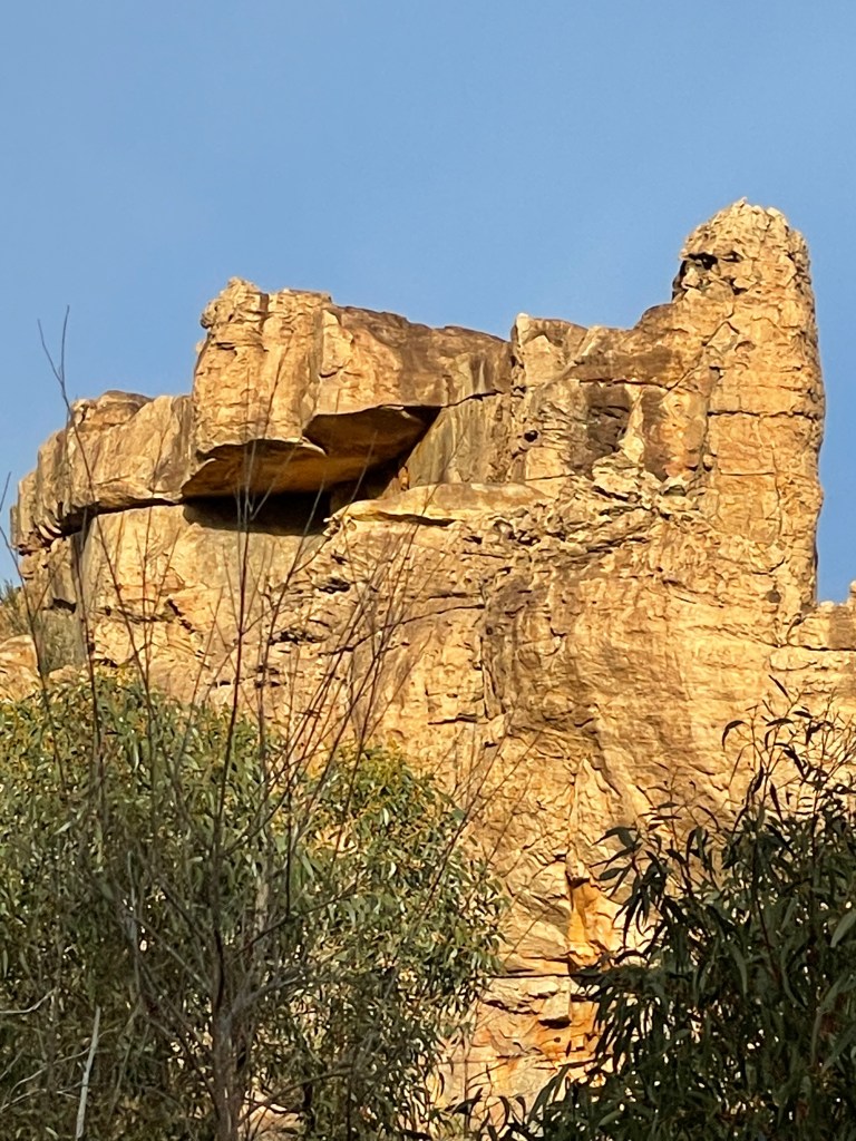
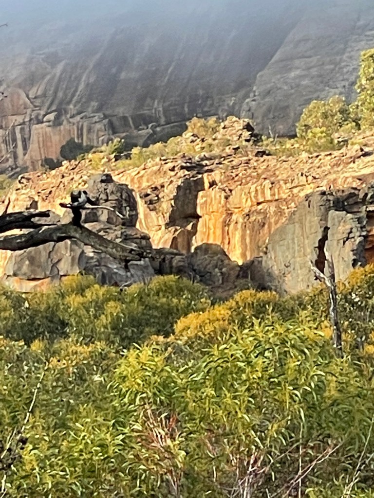
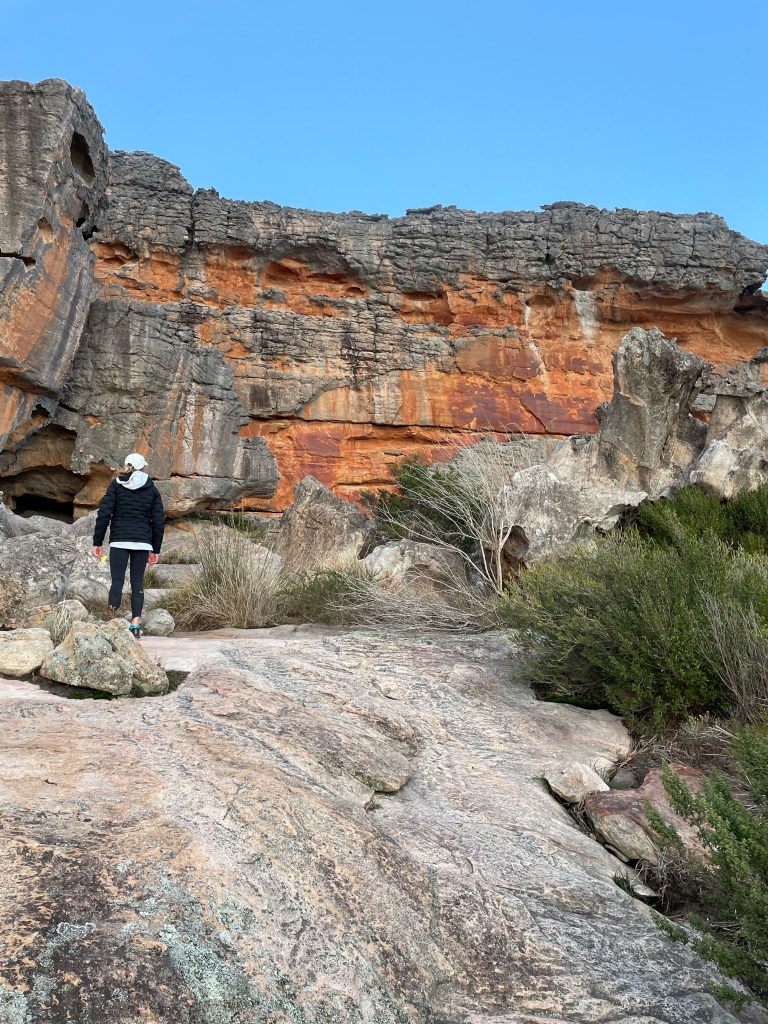
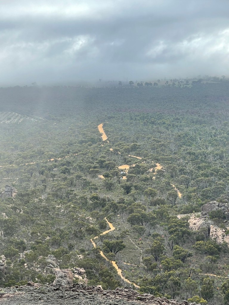
The confluence of Mackenzie and Wimmera rivers was also way more impressive than the empty drain of summer.
Flows from the fast-flowing Wimmera had backed up the Mackenzie and it was a different place to that of the summer visit.
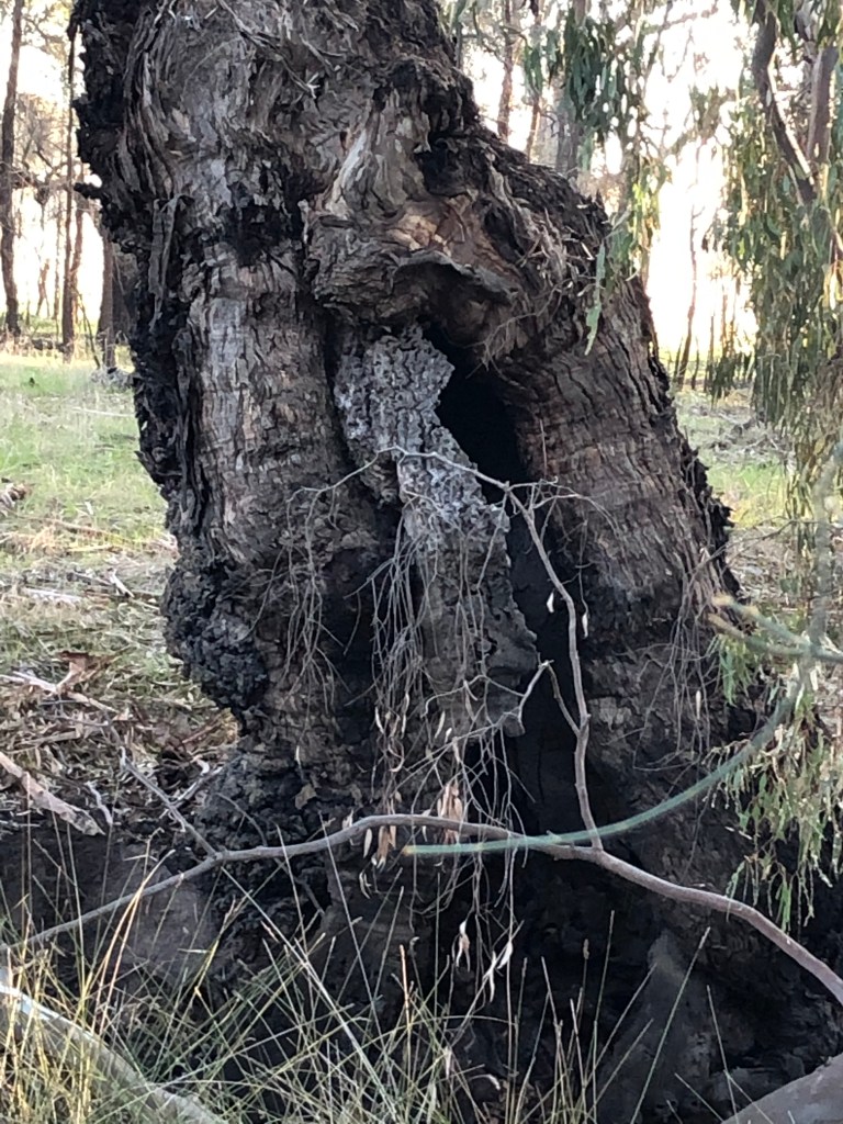
The tree which had likely been a metre from the bank was now standing in the water.
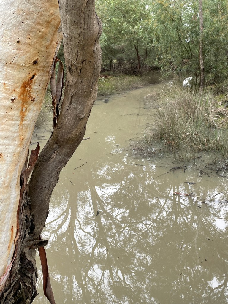
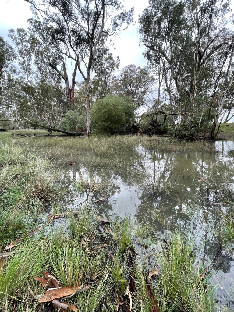
The ford near the gun club was not even worth thinking of crossing, nor the one about 1.5km past it but I could use the boardwalk at the end on Curran Road. You can see how much the river has risen by the reeds sitting in water well away from the bank.
So, when you are walking along the Wimmera River near the Weir do consider following the track a bit further west and visiting the magical spot where it meets Mackenzie.
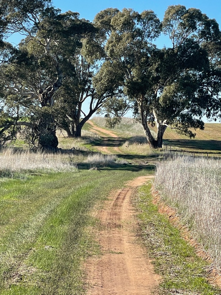
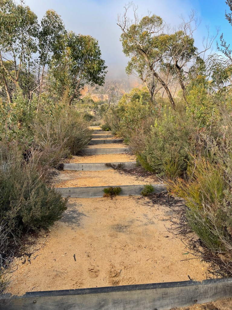
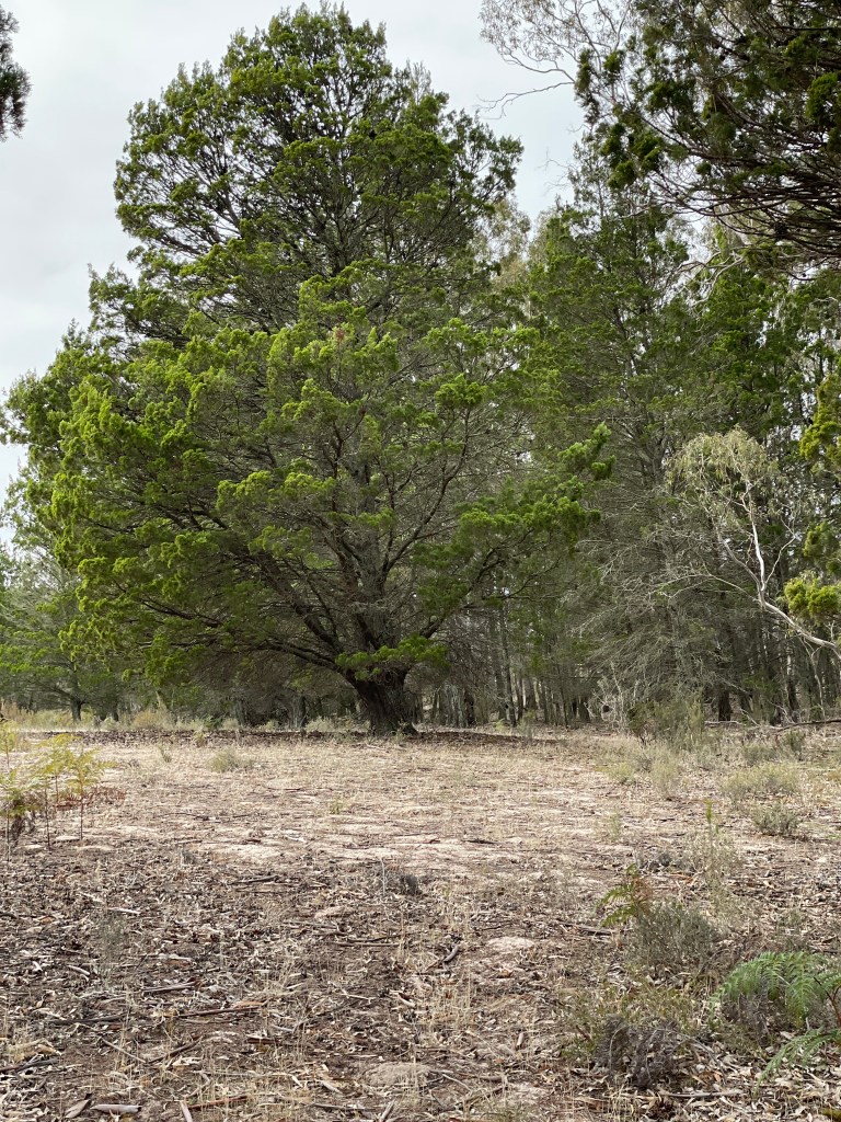
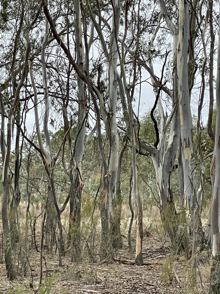
The other exploring to be done this close to town, is to head upstream at the Mackenzie River bridge on Three Bridges Road.
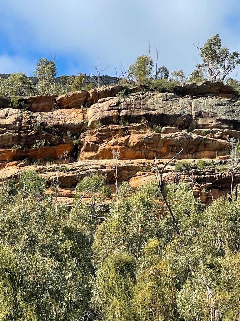
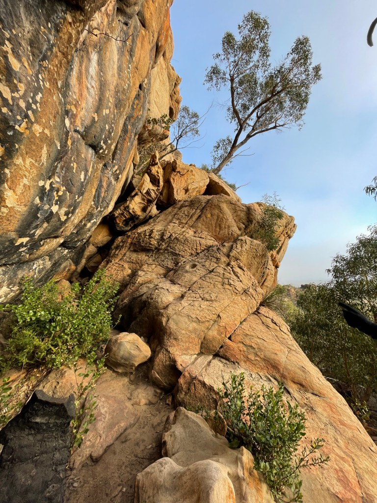
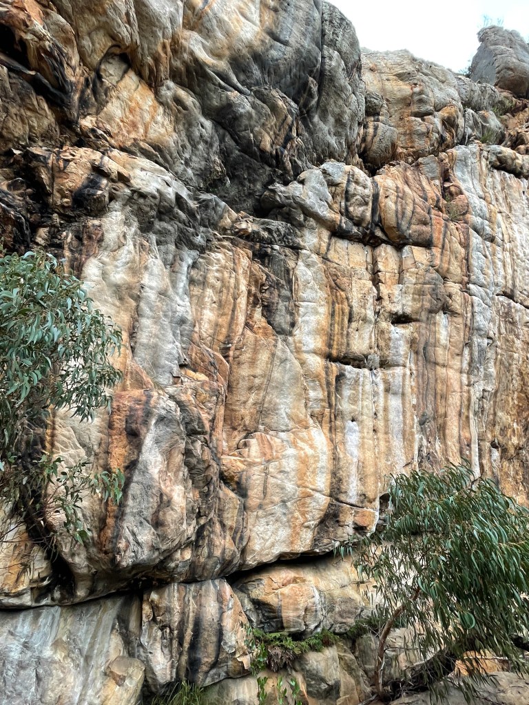
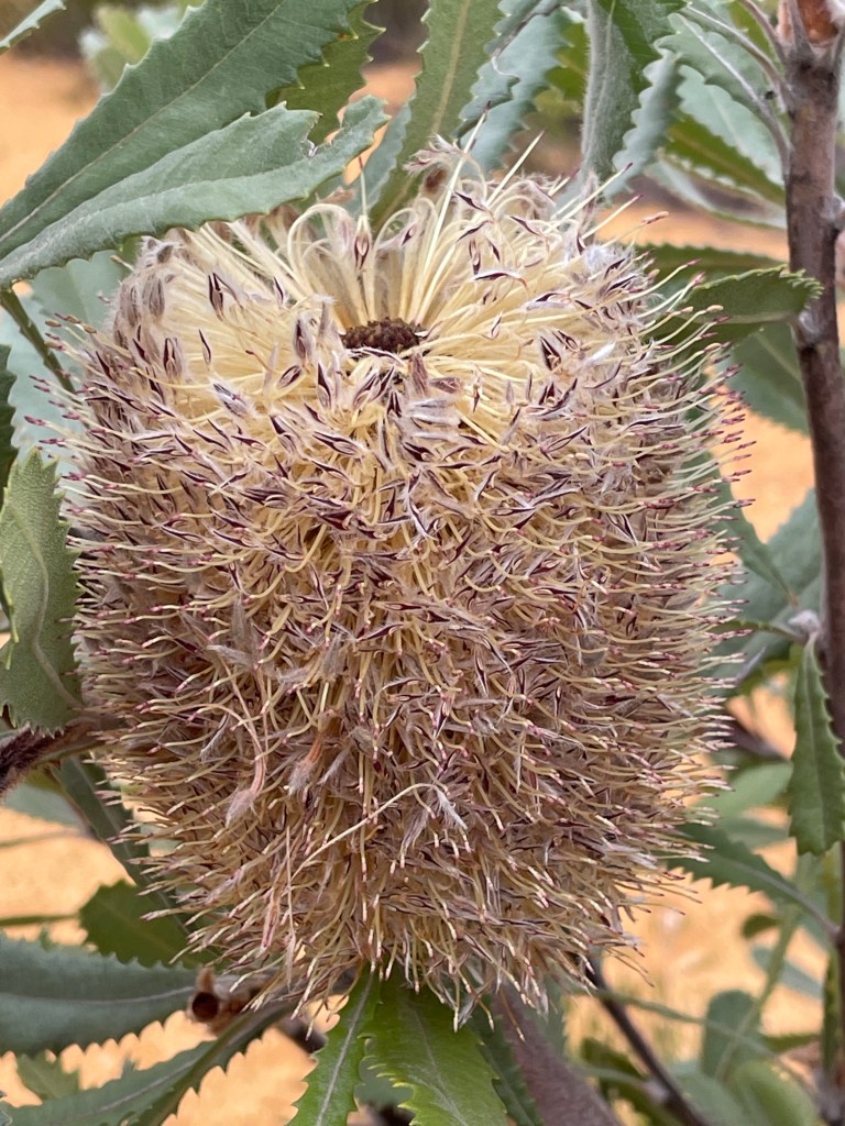
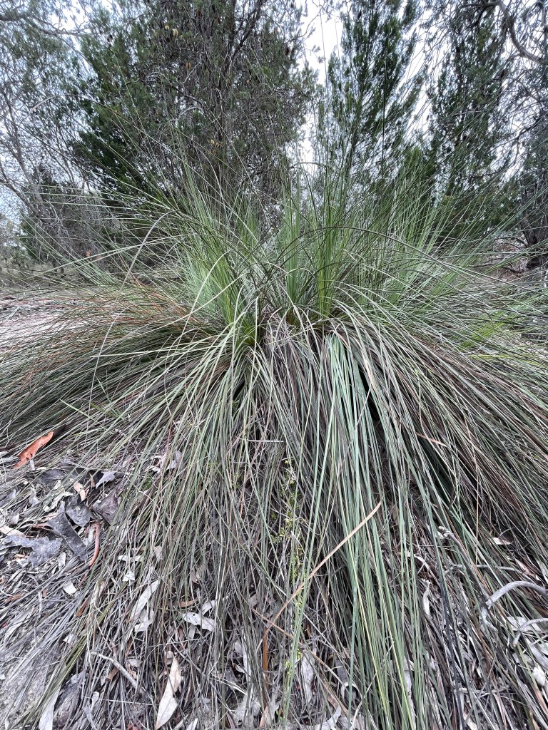
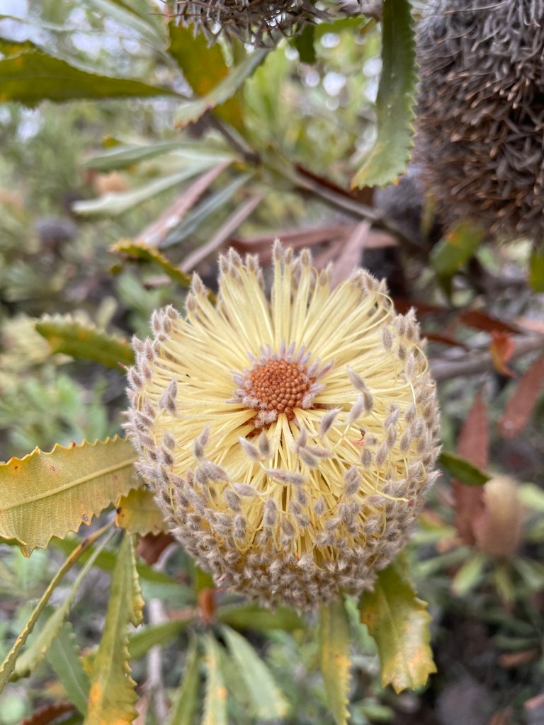
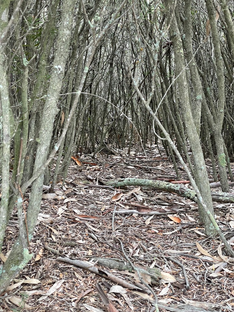
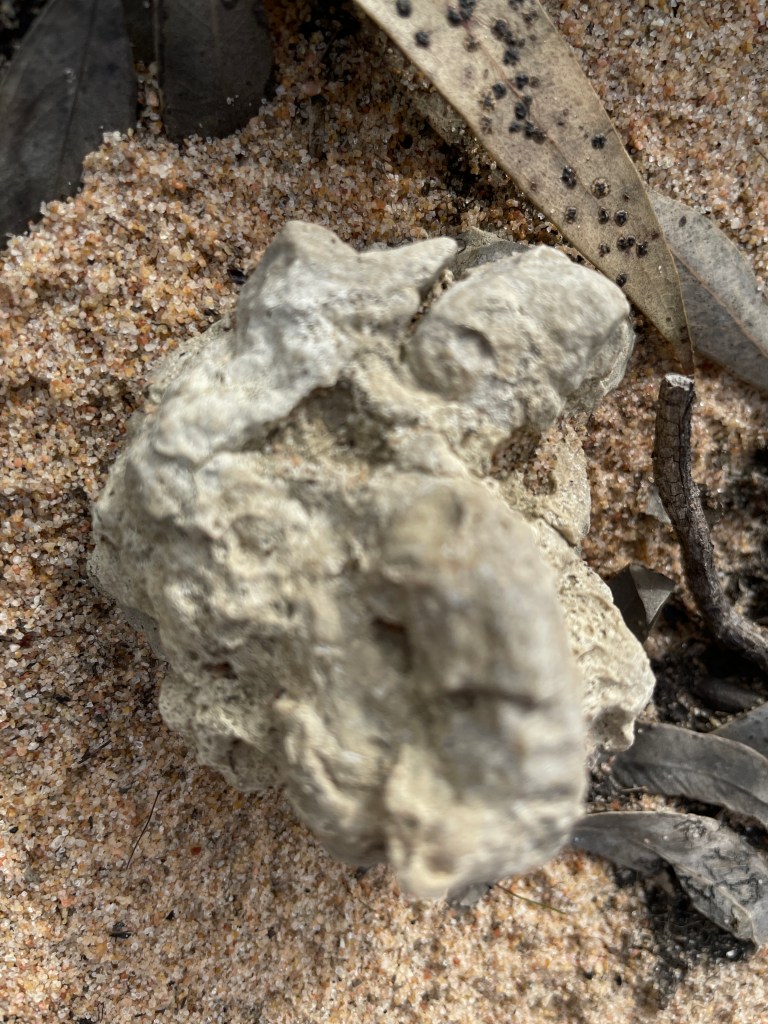
There is a track on the south side of the river travelling east that did have its fair share of puddles but takes you past an old channel and through a lunette filled with banksias.
It is quite different to the other end of the river and well worth an explore, with the track that I am pretty sure will take you all the way to the Henty Highway and not that far from where Bungalally Creek meets the Mackenzie.
I won’t bore you any longer – today you can just look at the pictures and hopefully be inspired to head out for your own adventure.
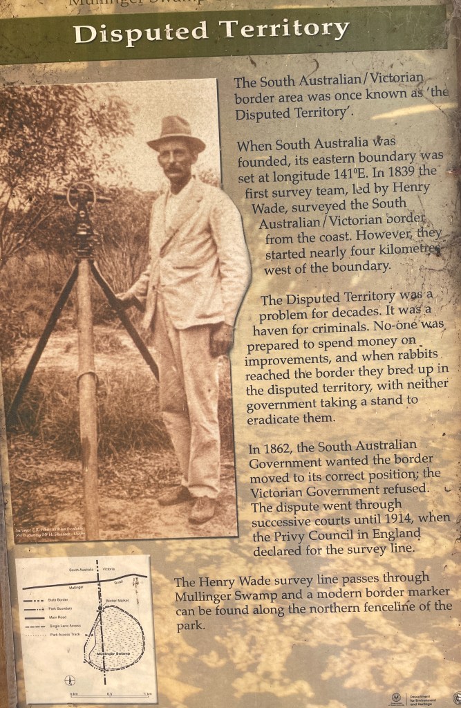
Where – Victoria-SA border about 90 minutes west of Horsham
What – Swamp and Reserve with trees, water and fascinating history
10 words – giant gum, invisible drain, dead trees, two states, worth visiting
Please note this trip was done BEFORE restrictions and lockdowns.
This is a story of giant trees, a disappearing swamp and disputed territory, with a few rabbits, crooks and mis-directed explorers thrown in.
Bordering on the ridiculous? Well, yes. It’s that too – literally.
We are at Mullinger Swamp – a small stretch of trees and water straddling the Victoria- South Australia border about 90 minutes west of Horsham on what I think may be land of the Jardwadjali peoples.
You can tell exactly where the border cuts through the reserve. There is one sign with two sets of yabbying rules – one for each state.
Things were not so clear for the first 70 years after Europeans arrived and began transforming the land.
With a border set at the 141st meridian – a team of surveyors led by Henry Wade mapped the line in 1847. After nine months of drought, swamps (including Mullinger), sand dunes and broken equipment they gave up 250km south of the Murray River.
Two years later Wade’s assistant, White, finished the last 250km but only after killing and bleeding his horse to survive and stagger the last few miles to the Murray.
As equipment got better later in the 1800s, doubts began to emerge about the accuracy of Wade and White’s handiwork.
Apparently Wade and White had begun their surveys in the wrong spot – due the arrow made by rocks in the sand near Nelson being 3.3km west of the 141st.
During this time the so-called .33km wide ‘disputed territory’ became a haven for criminals and rabbits who neither government wanted to control.
In 1914 the argument was finally settled in England by the Privy Council which ruled in favour of Victoria.
Today the lines are still drawn – to a degree.
The Victorian side is called Mullinger Swamp Wildlife Reserve and the SA bit is Mullinger Swamp Conservation Park. And yes, there are two signs.
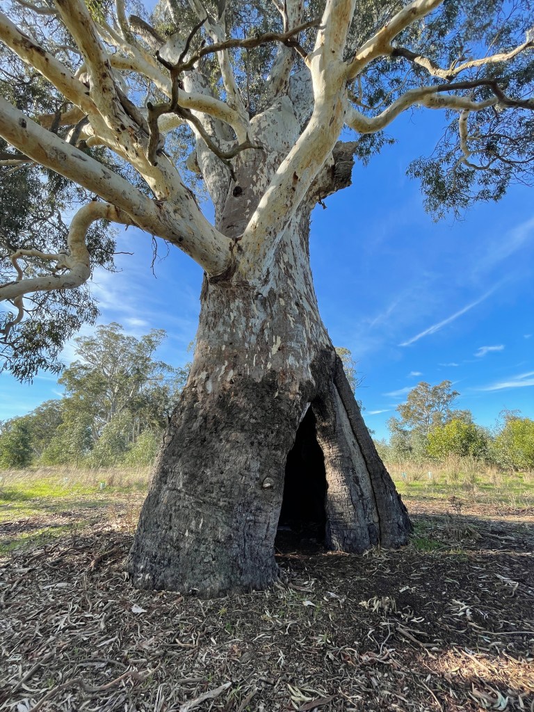
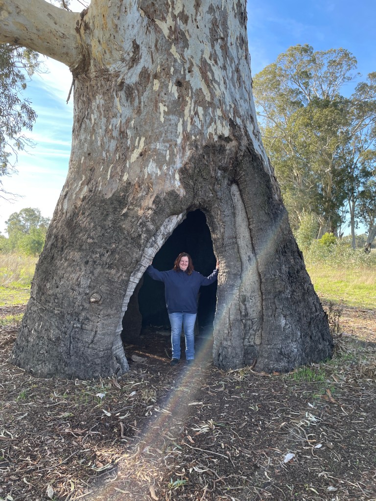
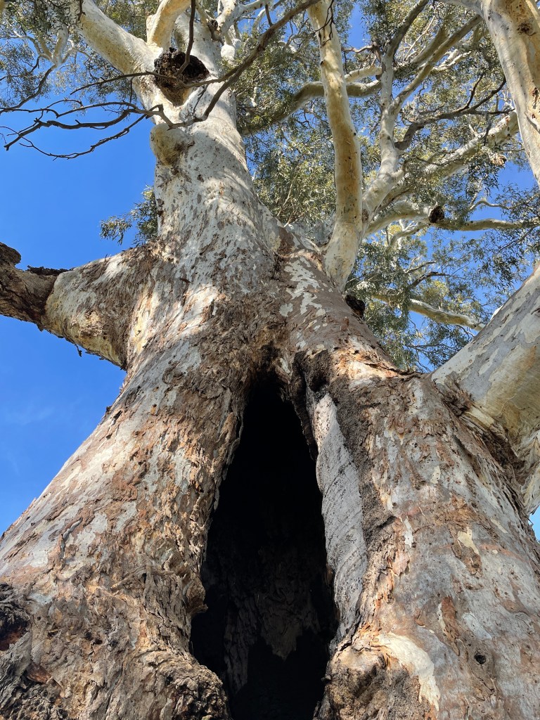
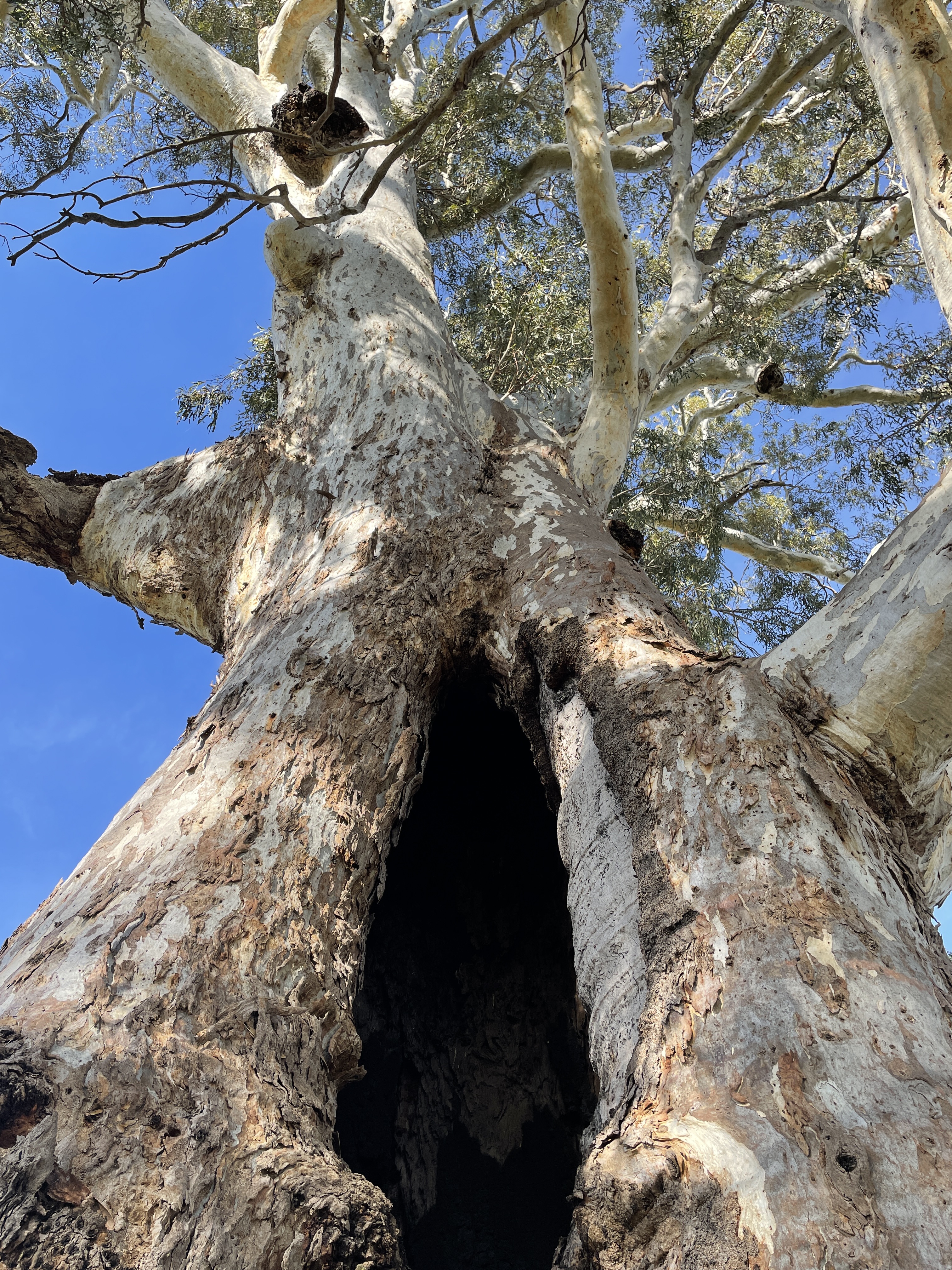
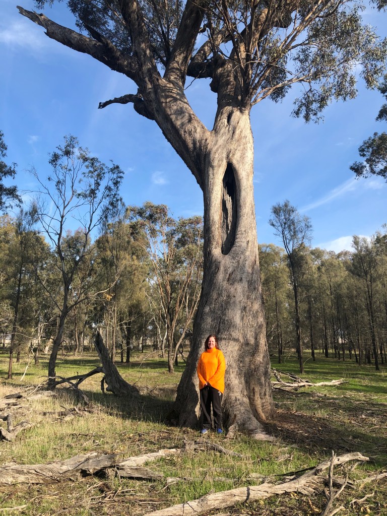
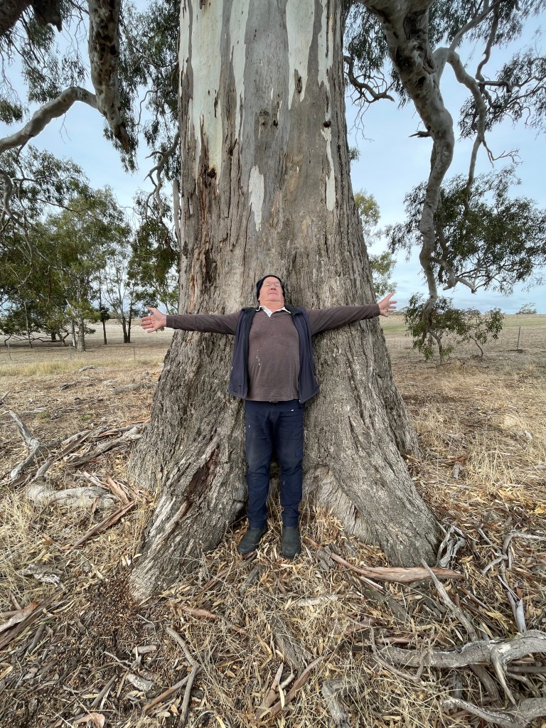
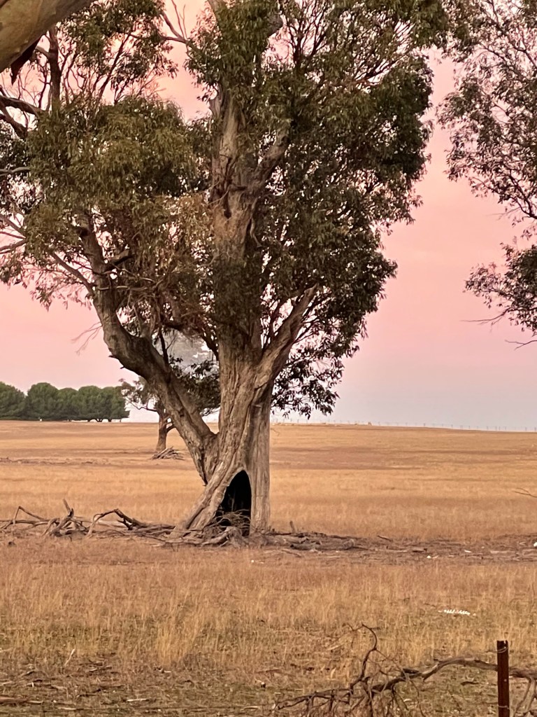
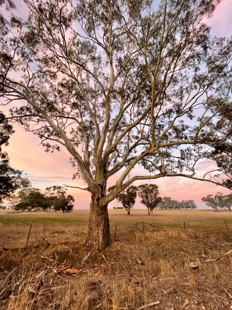
What can’t be argued is the humbling site of swamp’s giant gum trees.
Big Red – the largest – stands 39 metres high and is 11.6m around the girth. He is estimated to be 800 -1000 years old and has a hollow base burnt out before white settlement.
Red is almost like a room with a couple of windows and apparently doubles as a change area for swimmers.
You wonder what great shelter he would made for so many different people over the centuries.
SA proudly claims Big Red is the “largest living Red Gum in the South East of SA”.
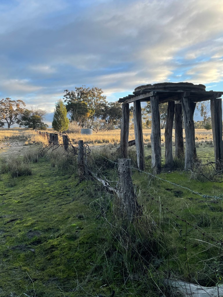
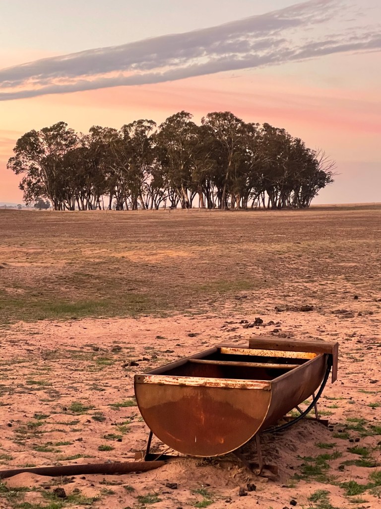
The other thing about Mullinger is the water – perfect for swimming, yabbying, scout camps and picnics.
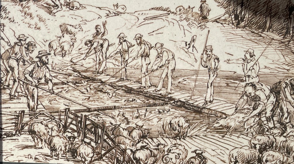
Back in the day it was also used by the Kybybolite Station to clean sheep fleeces of dirt and grease before shearing. The unsuspecting sheep were unceremoniously thrown in a deep end of the swamp and made to swim between parallel planks.
Today the blue sky is mirrored beautifully on the patch of water near the reserve entrance but look further around the swamp and it does seem that the sheep might struggle to be get very wet in the shallow water.
The might be good reason for this. Mullinger is home to a runaway hole – which sees water drain from the surface to the aquifer below.
These holes are renowned for being spectacular when they “let go” and at Mullinger the escape hatch sits at the park’s northwest end.
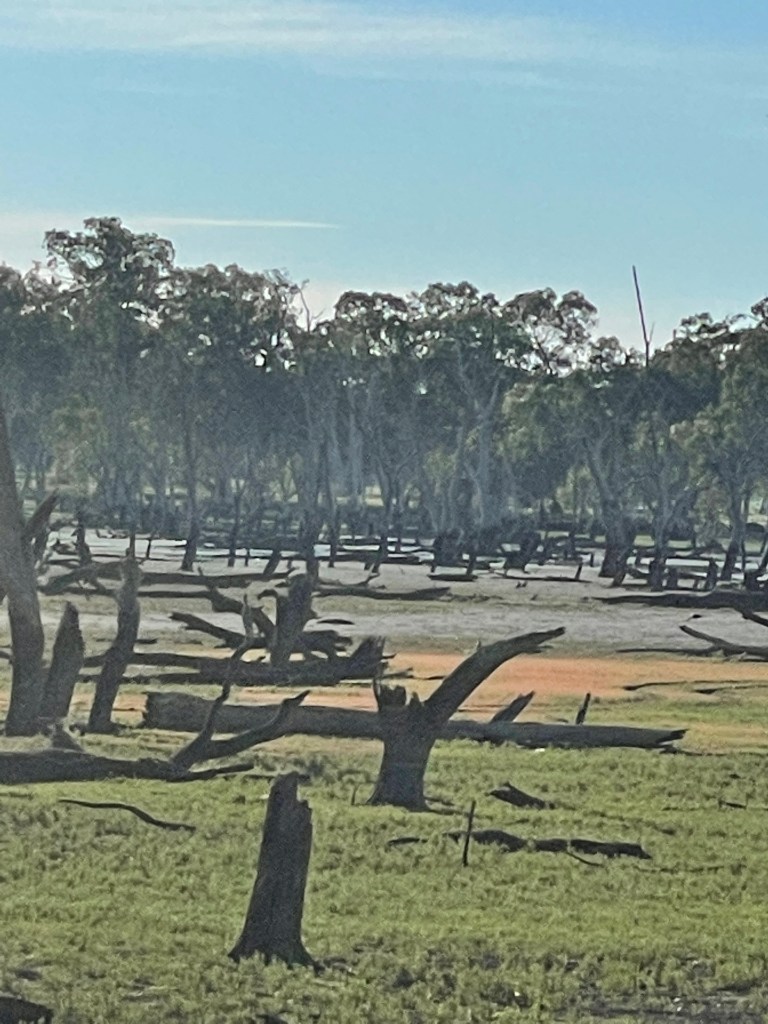
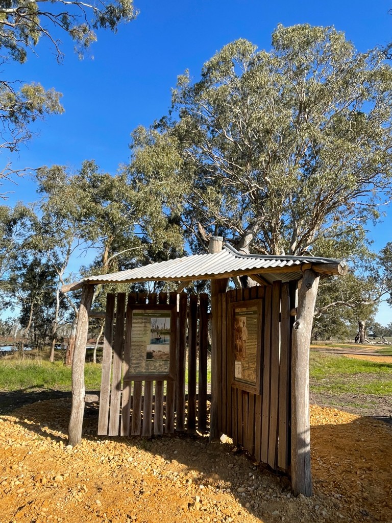
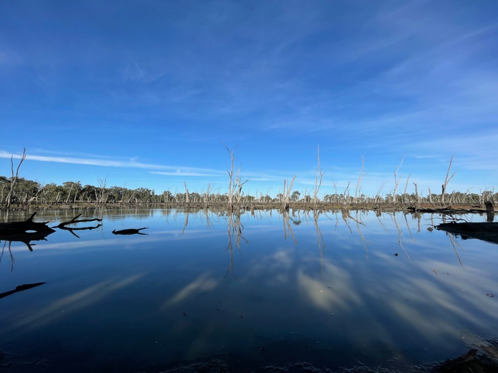
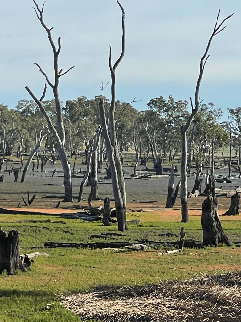
The reserve information sign tells us that some time before European settlement, this runaway hole blocked, and the trapped water drowned the trees.
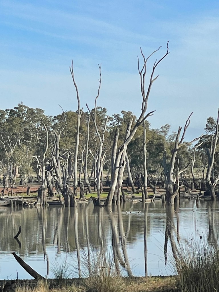
And that is the other things that you notice– there are a lot of dead trees.
Walking the track around its edge and the many black marks at the trunk bases suggest water has been much deeper in the past. It reminds me of the Wimmera Mallee reservoirs whose water levels also change – with weirs, droughts and new pipelines – rather than run-aways.
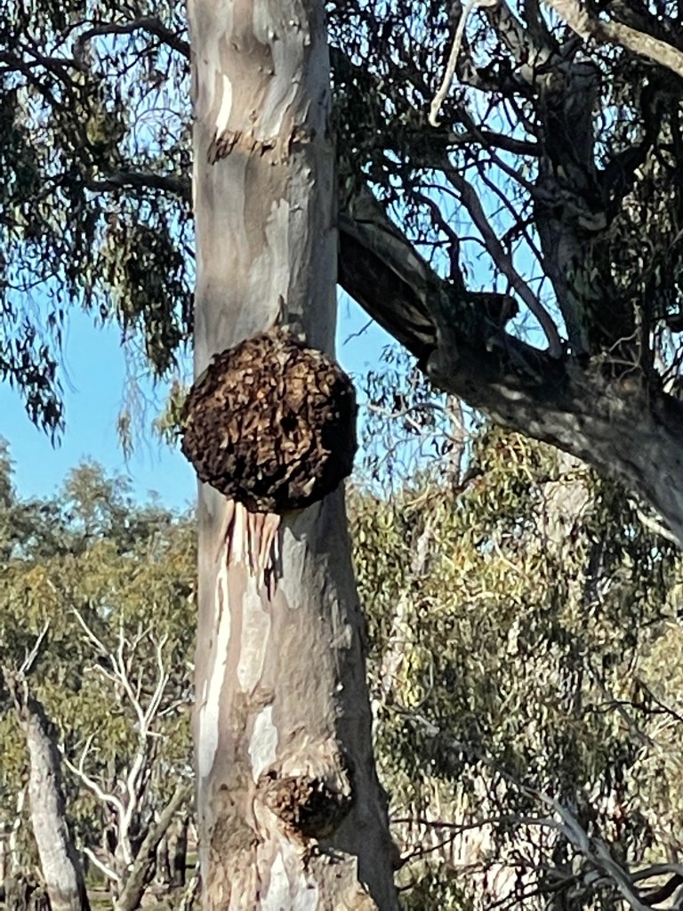
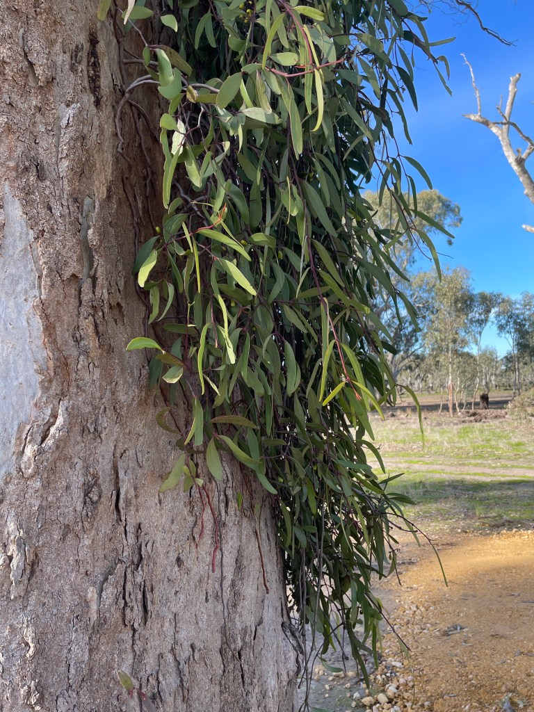
Away from the swamp, I notice one tree which seems to have been ringbarked many years ago and others that look healthy and strong. One has a giant burl and another appears to have mistletoe growing like unruly hair out of one side.
There is also a covering an iridescent lime green lichen on one trunk which from a distance looks like paint.
It is nice to see a series of skinny red gum saplings – maybe from a recent flood – which contrast positively with death and destruction in the centre.
It is not all gloom, with green and red swamp groundcover providing a carpet of colour among the skeletons .
Where there is life, there is hope and I hope one day to water bring this place back to life again.
In summary, Mullinger is tranquil – No wind, bright sunshine and almost silent but for the call of the local birds.
Ir is a place of wonder. Such a privilege to stand inside a living plant that watched up to 1000 years of this wetland’s ebbs and flows.
But there is also something unsettling.
Maybe it is the dead trees.
Or the disturbing reality that this whole swamp could be sucked down a drain at any given moment.
Or the wounds left by colonisation, inundation, disputes over an invisible line and rabbits running riot.
But maybe that’s the point. Life is about taking the good with the bad.
Mullinger is an expert in being swamped by both and continues to not only survive – but like Big Red – stand tall.
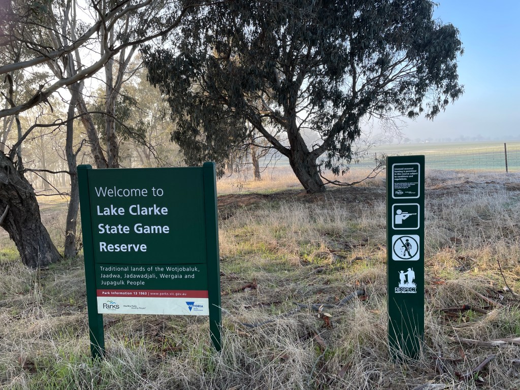
Where – About 40km from Horsham on Sherwoods Dam Road.
How long – 5km around the edge, with a couple of detours.
10 words – Mix of plants, kangas, birds. Good views, don’t drive past
I am not sure who Clarke was but the lake named in their honour is well worth a visit.
There is a Clarke Lane in the Noradjuha district and I found evidence of a Mr Clarke singing very well at a nearby Lowan School fundraiser in the 1930s for a family which had been burnt out in fires. But that’s about all I can tell you.
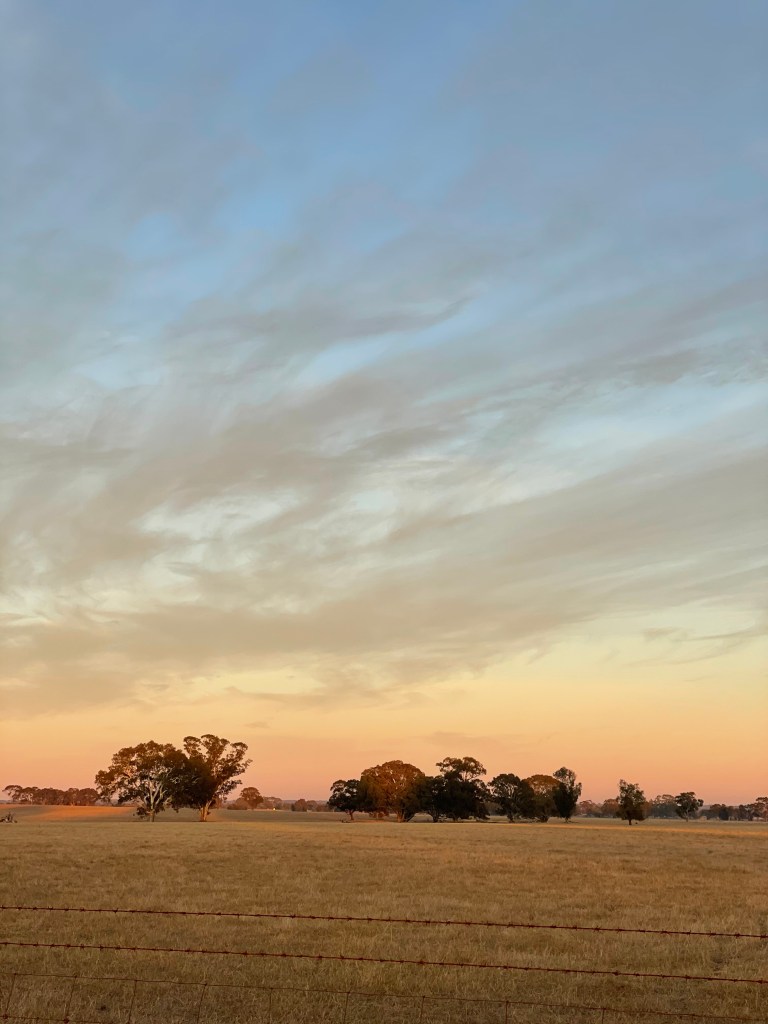
Clarke Lake sits beside Sherwoods Dam Road, between Mt Arapiles – Dyurrite and Clear Lake and, with a few hills beyond its shores, I reckon it has capacity to fill quite well with rain.
Covering 75ha it is part of the Douglas Depression – a 70km skinny line of lakes that stretch from north east of Natimuk south to Douglas near Harrow.
These saline or brackish lakes are considered regionally significant because they host birds and plants and are pretty awesome to look at, too.
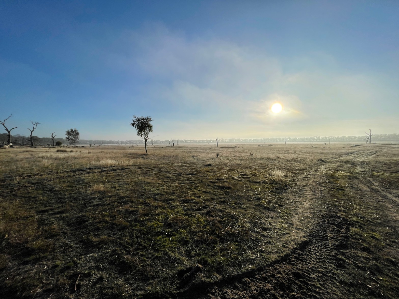
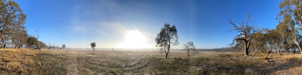
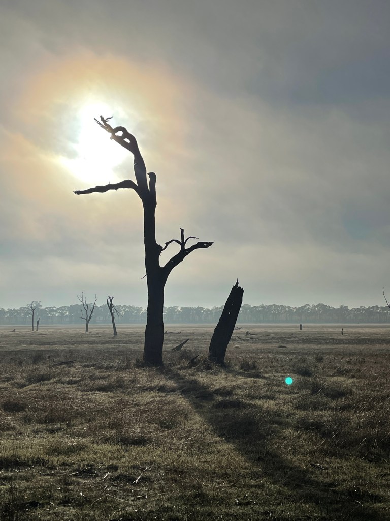
Today there is no water but the ice then sunshine and trees and wildlife make it a wonder to behold.
It’s literally freezing when we arrive about 8.45am. I am walking with Mandi and Deb who got up early on a Saturday morning to minus 2 – which felt like minus 4.
Someone had to have chosen the rise where we park as a house site. We see an old stove in the paddock and several peppercorns long the fenceline. Maybe this was where our singing Clarke lived.
The sandy track takes us downhill where a sign erected within the last decade announces Lake Clarke State Game Reserve. This place is flash on two levels – a new sign and its status as a lake not a swamp.
There are quite a few trees on the sandy incline leading down to the shore.
Twitchers have reported 61 different birds here but right now the only sign of any action are two mountain ducks loudly departing after we disturbed their breakfast graze. The remind me of a familiar couple who are getting deaf and yell at the top of their voices, no matter who else is around.
Once they duck off things are still and quiet again. Fog blurs trees on the other side of the lake and bed is a sea of frosty white,’
And then, as if the curtains have been drawn, the sun bursts onto Clarke’s stage.
We feel instantly warmer, the sky is blue and the day has arrived.
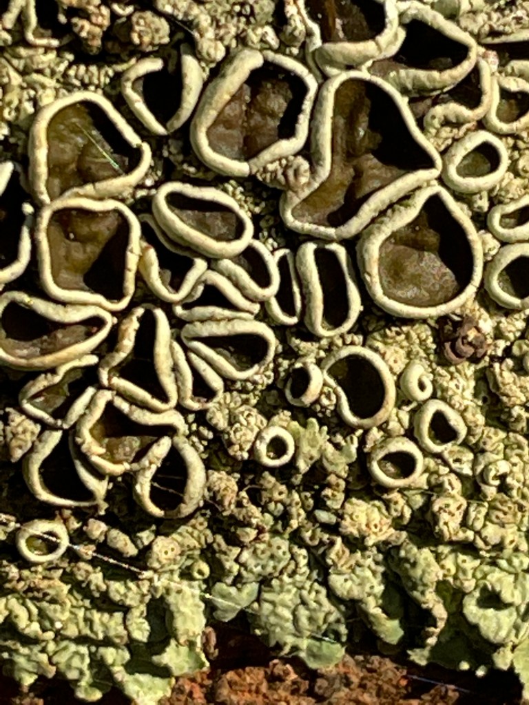
Lichens and even peppercorns take on a new glow.
About a quarter of the way around we come across an interesting patch of plants. Wine red and beady they are possibly glasswort which I’ve previously found at salt lakes. Nearby is a stand of paper barks – also sign of salt.
This patch of the Douglas Depression appears to living up to the brackish reputation, at least at this spot.
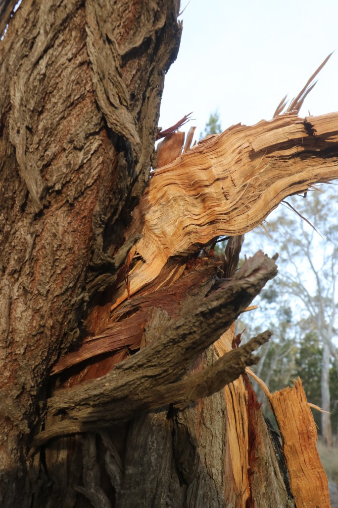
We find a scar on one tree and another thin trunk that has grown out of a previously cut down trunk.
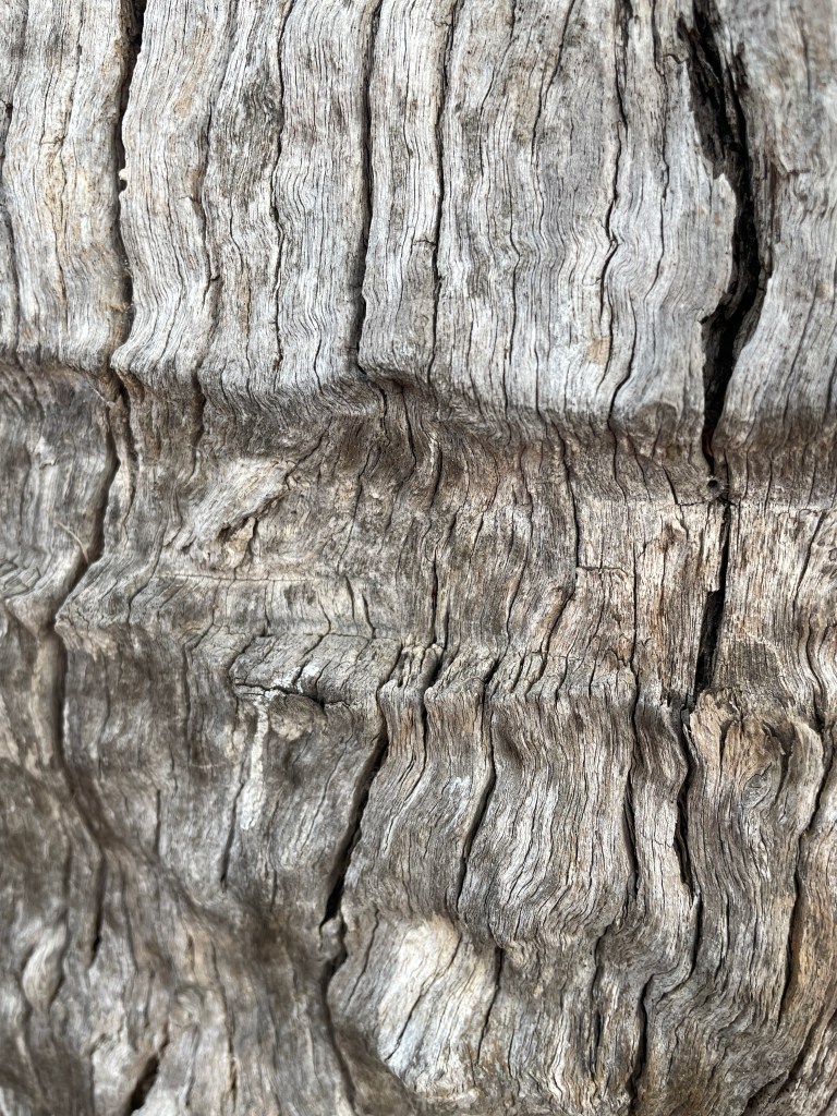
The wrinkly dead, grey timber is tough and beautiful on many of the trees.
The other interesting thing we find are a heap of rocks – something I have not see in other swamps.
The sun is beaming now but is still bloody freezing, especially when we stand in a patch of shade.
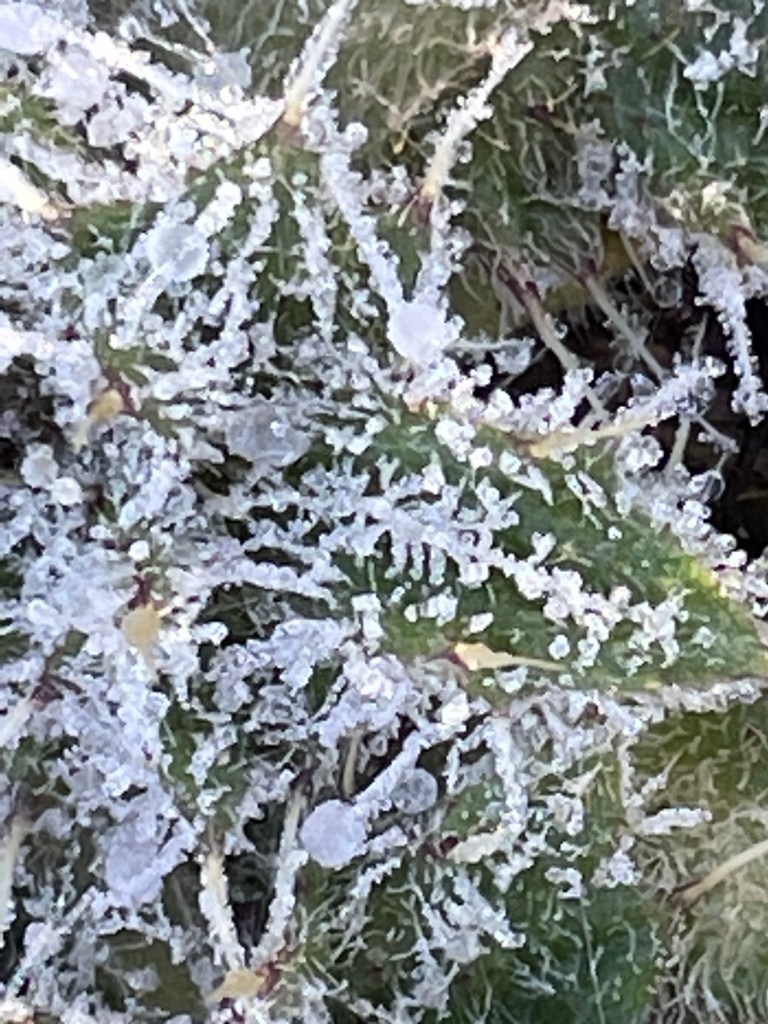
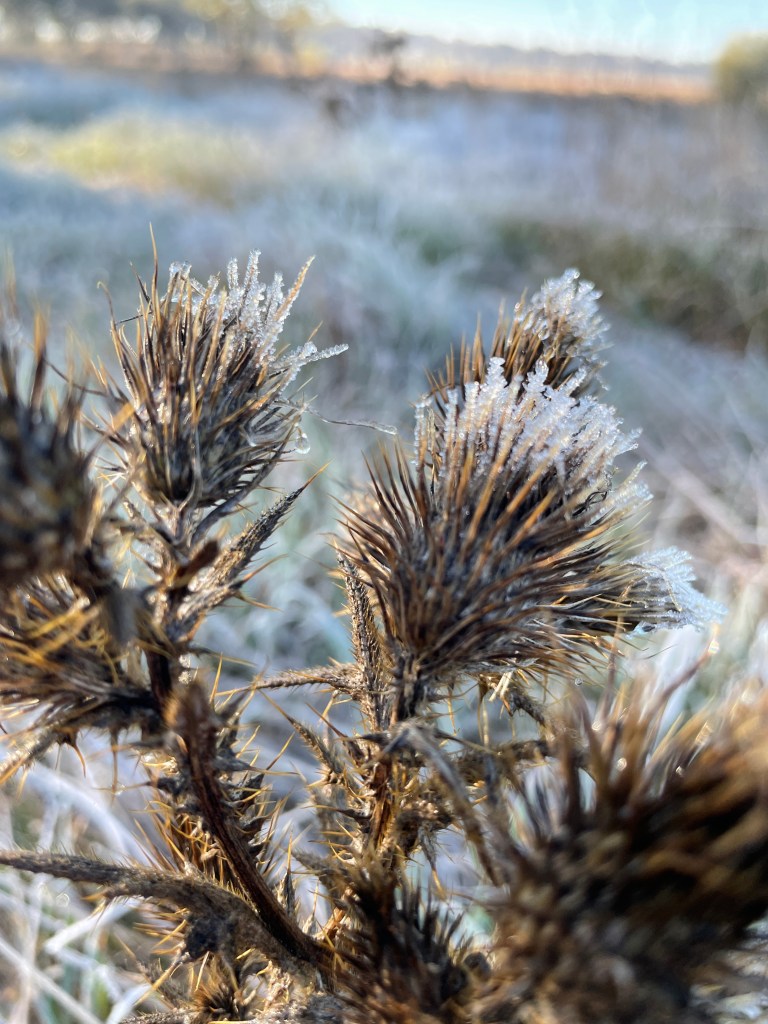
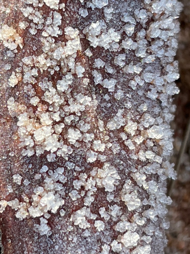
One tree has steam coming off it and close inspections in the shadows reveals ice on thistles, branches, grasses, leaves and weeds.
Up close it is such a beautiful, complex combination of tiny crystals.
There is also some awesome drip action on stems, plants and spider webs that make for some wonderful images.
Deb and Mandi spend way too much time waiting for me as I bend over mesmerised by a tiny speck of ice or water.
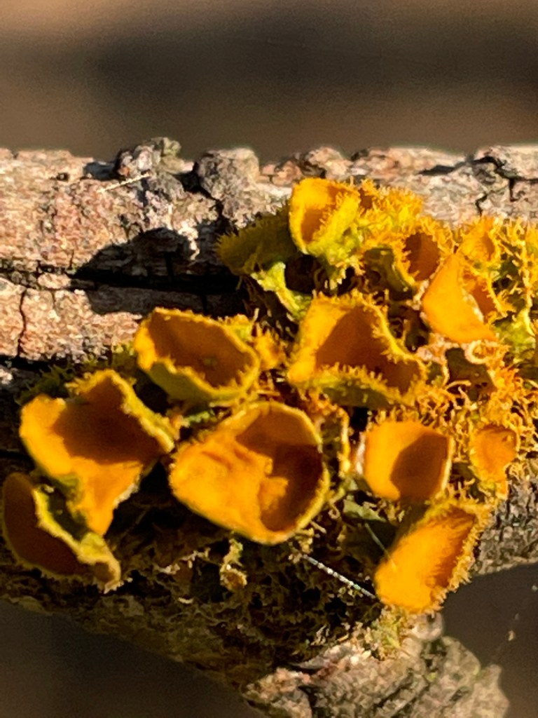
About half way round, we come across some more glasswort – very scrawny and red which is apparently a sign of stress. It has been a long time between drinks for Clarke I imagine.
There are also some brilliant orange fungi.
We also notice a ute crawling around the swamp’s boundary track. A local suspicious of our presence? Nah turns out ‘Bill’ is giving the dogs a run and happy to stop for a yarn.
He comes here often and tells us there are more birds here than nearby Boundary Swamp and kangaroo numbers have been growing recently.
All along the walk we’ve been watching the kangas move from spot to spot but remain on the reserve. We see a bird of prey scanning its brunch prospects from a dead tree but can’t get close enough to identify it.
Clarkes Lake Road rises from the lake’s eastern edge and provides a great view of the lake. It is worth a detour up this track, as you also get a lovely outlook to Arapiles – Dyurrite which is eerie today, partly shrouded in fog.
From here it is back west towards the car although we do take a quick look at another water way – St Mary’s dam – a man-made thin reservoir created on an inlet into Clarke.
There is an old diving board at the edge of what is a very deep hole. How wonderful this must have been for cooling on a hot Wimmera day paddling, swimming and even water skiing.
Must have been a lot of water to spare when this was regularly filled.
About 10 minutes later and we complete the full Clarke circle. What better way to warm up on a sub zero morning than brisk, 5km walk around this really impressive reserve. Thanks Mandi, Deb and our new friend ‘Clarke’, for a great walk.
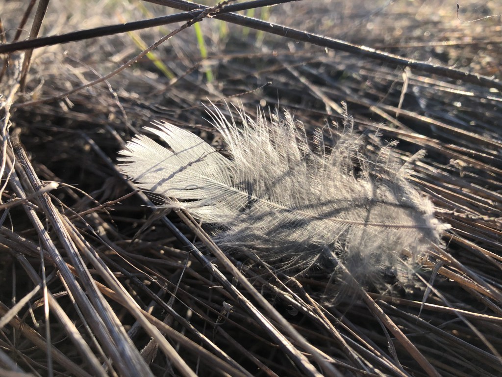
Where – Around Wonwondah, off Henty Highway, south of Horsham.
In 10 words – Gentle walk, nice creek, roos, moss, red dirt, unusual scar.
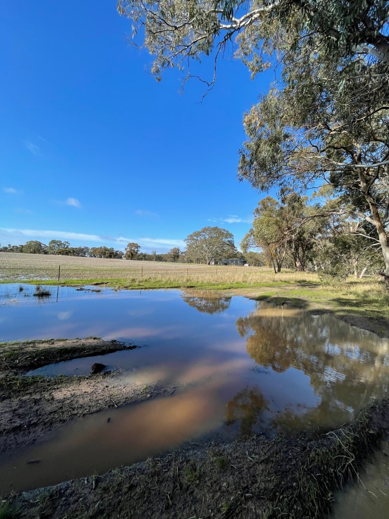
Week 29 and it has rained. Things are wet so we must carefully pick our roads.
Signs saying ‘dry weather road only’ don’t lie.
I settle on a couple of parts of Norton Creek around Wonwondah, just off the Henty Highway.
About 50km long, Norton is not the most famous Wimmera waterway.
MacKenzie river boasts waterfalls and platypus; Yarriambiack shares its name with a shire and is a distributary – flowing out of – instead of in-to the Wimmera River; and well know Burnt Creek joins the Wimmera in Horsham township.
Fame is often over rated and unassuming Norton turns out to be an impressive quiet achiever.
It begins its watery wanders 250m above sea level near the northern tip of the Black Range and drops about 120m on a journey north through Mockinya, Wonwondah and Lower Norton ending at the Wimmera River between Horsham and Quantong.
Today we will visit the creek at two sites around Wonwondah, about 20km south of Horsham.
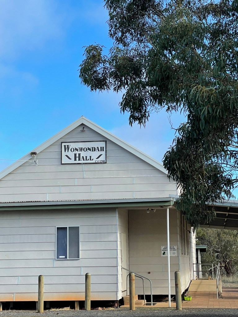
Wonwondah – which is possibly an Aboriginal word for a small bush or swamp, was the name used initially by white settlers for a large station and then for the settlement that followed in 1884. Places have been referred to East, North and South Wonwondah over the years and hosted several schools and a football and cricket club.
Today Wonwondah Recreation Reserve, which has the hall and the tennis court, is around the corner from the CFA shed and former Wonwondah North Primary site.
The local hall committee boasts well-tended gardens and is renowned for its catering with one visiting Premier particularly impressed by their homemade lamb shank soup.
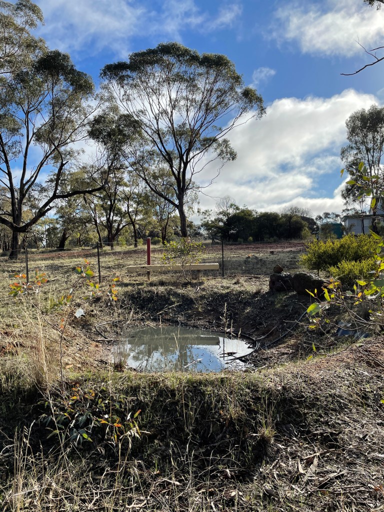
Our short walk takes us through a gateway near the Hall and into the bush along the creek.
There looks to be a pond, possibly created to help sustained the frog population when the Wimmera Mallee pipeline replaced the open channel water supply. I don’t hear any frogs but see a series of roo torsos bobbing up and down between the trees as they make a run (or should that be a bound) for it.
It is a nice bit of bush which I assume is a Crown land reserve. Norton Creek skirts along the edge and while virtually dry, its big holes suggest Norton would spring to life with good rains.
This obviously happened in 1935 when the swollen creek put the Wonwondah football final on hold until visiting players could cross the water to get to the ground.
The soil here is an interesting buckshot and there is quite a bit of vibrant green moss about. It is a short but nice walk.
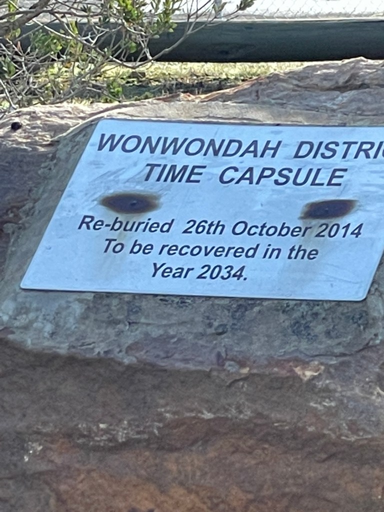
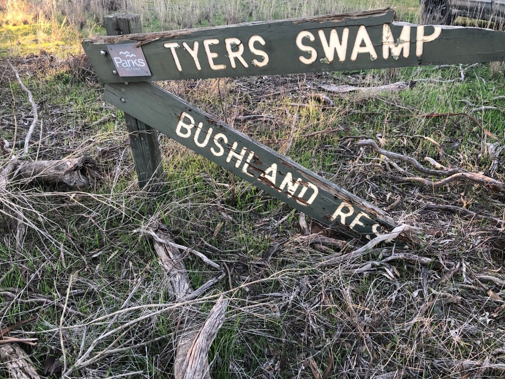
A few days later and km north I find another reserve at Tyer Swamp. Me and my walking partner Bean enter via an open gate on the junction of McGennisken’s and Tyer Road.
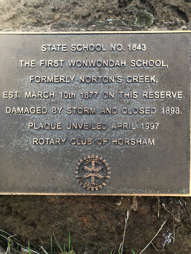
A plaque tells how this was the site of Wonwondah’s first school named Norton Creek way back in 1877. Classes ended when it was destroyed by a wind storm in 1897. Apparently two other district schools got hit in the same storm.
In December 1882 the school picnic was held here along the creek and the local paper reported that:
“About 120 or 130 were present during the day, about the half of whom were children. A still greater number would have been present but for the fact that that a number of the farmers are busy stripping (their crops).”
They ran, ate, sang and were in ‘rapt attention’ during a long lecture on astronomy.
It is hard to imagine that many people at this quiet, anonymous patch of bush nearly 140 years later.
And it seems a bit of a miracle that is has survived relatively unscathed all those years when you see how it is surrounded by emerging green cops from cleared paddocks.
Tyer swamp covers much of the reserve, Norton Creek runs along the western boundary and there is quite a hill at the northern end that probably only served to add more water.
Soil on the higher ground away from the swamp is quite red/orange and host to lace-like pale green lichen growing on the ground – rather than on trees.
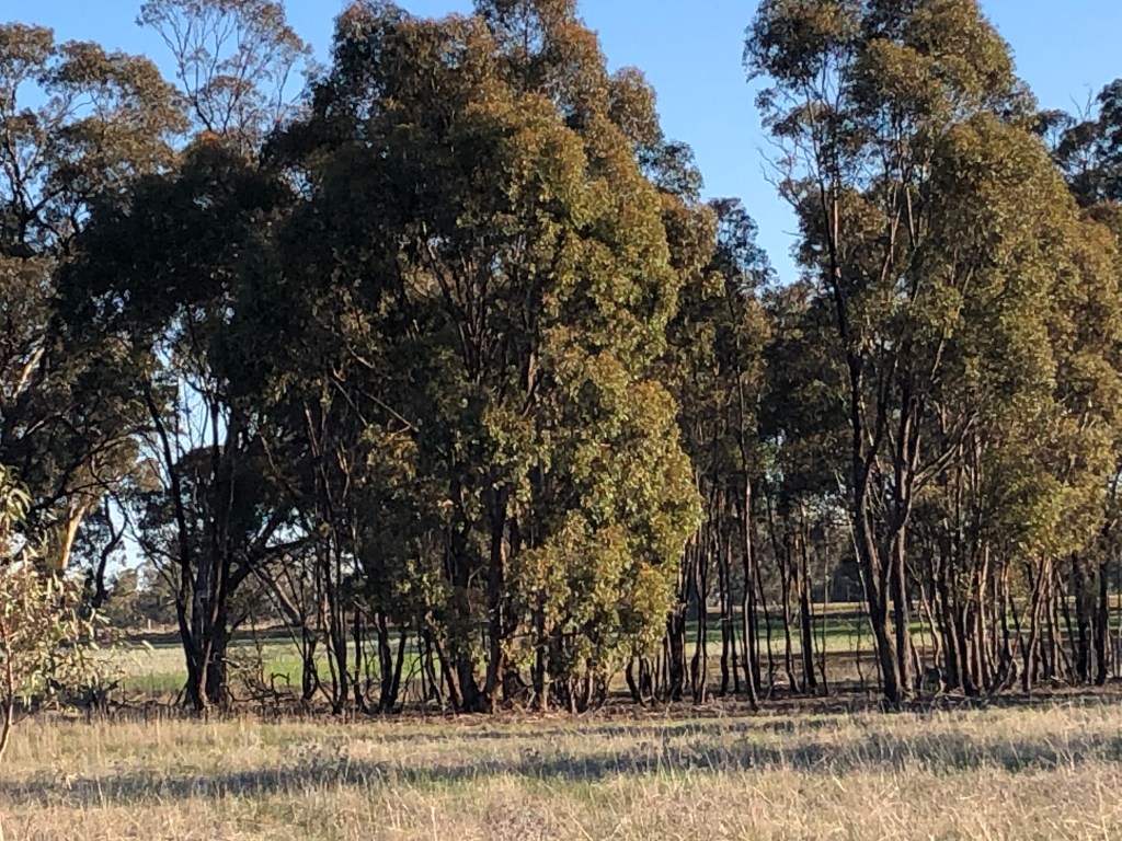
There are some nice eucalypts around the swamp edge and I see a good sized mob or roos heading through the trees on the hill.
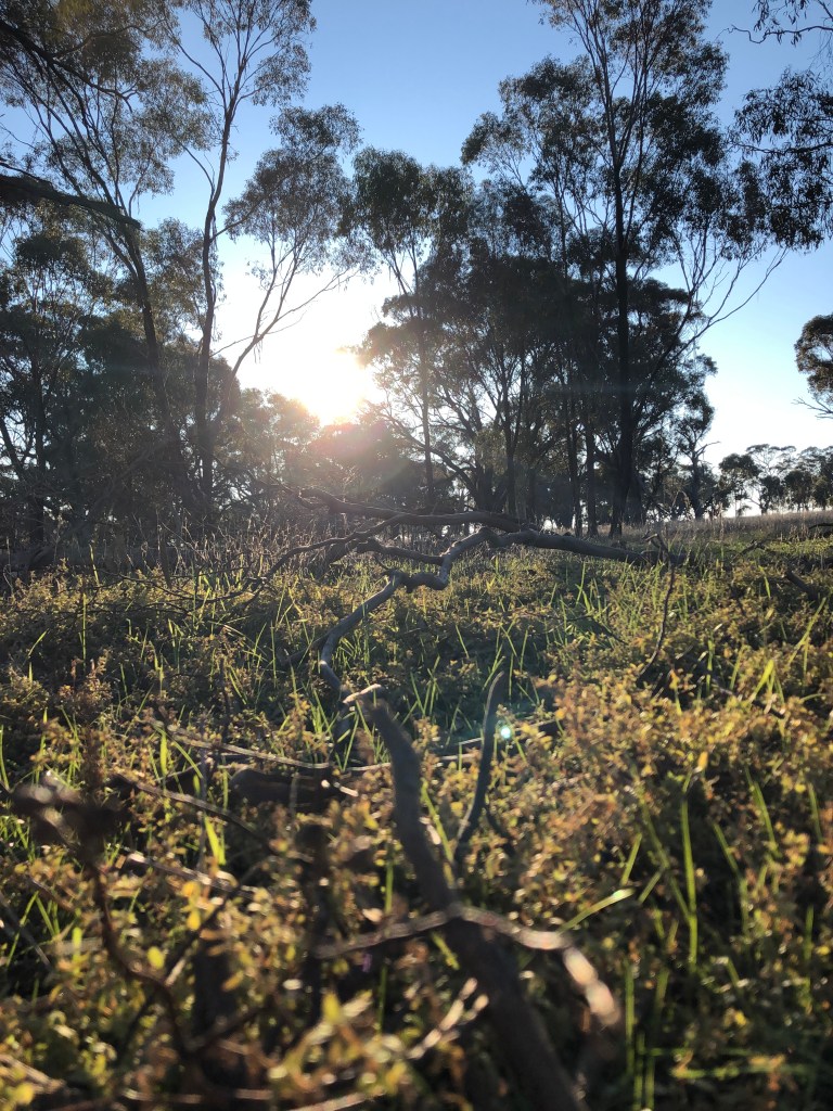
The late afternoon sun is just beaming – even if it was about minus 3 earlier in the day.
Things get sandy as I move up the rise. At one point I see some scratching, complete with a pointy hole that suggests some echidna handywork.
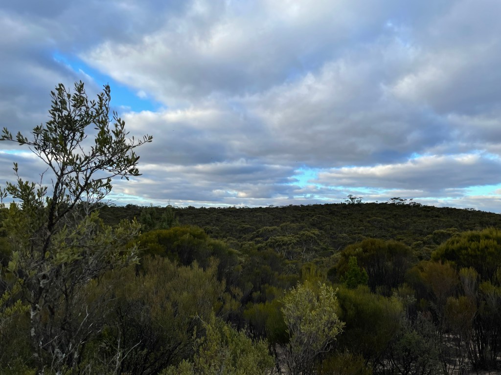
This hill provides great views of the swamp and the Grampians Gariwerd and I wonder if anyone ever built a house up there.
Towards Norton Creek there’s mini forest of skinny bulokes – uncharacteristically quiet because of the still evening.
The sound of an engine breaks the silence and I watch a farm ute crawl across the swamp to the back fence. My car at the gate might have got the locals wondering.
In the far corner is an unusual scar tree – its long slender wound starting about 3-4 metres from the ground.
I follow the empty creek south enjoying the trees, other plants including Dianella and some emerging fungi. The 1882 picnic report told how “ample shade was given by the’ large red-gum trees’ and they don’t disappoint today.
The evening sun helps with the ample shade, especially on the huge carpet of spongey mosses and lichen on the ground – what a great place this would have been for those students from the 1880s to play or lie and watch the clouds roll by.
Today the sky is endless blue as we pass through more bulokes on the track back to the gate.
The ute slowly passes me near the walk’s end. I get an obligatory wave but I suspect they don’t get a lot of visitors here.
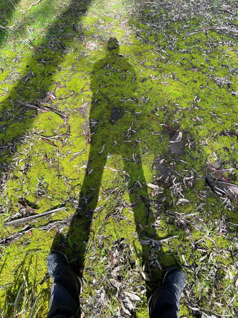
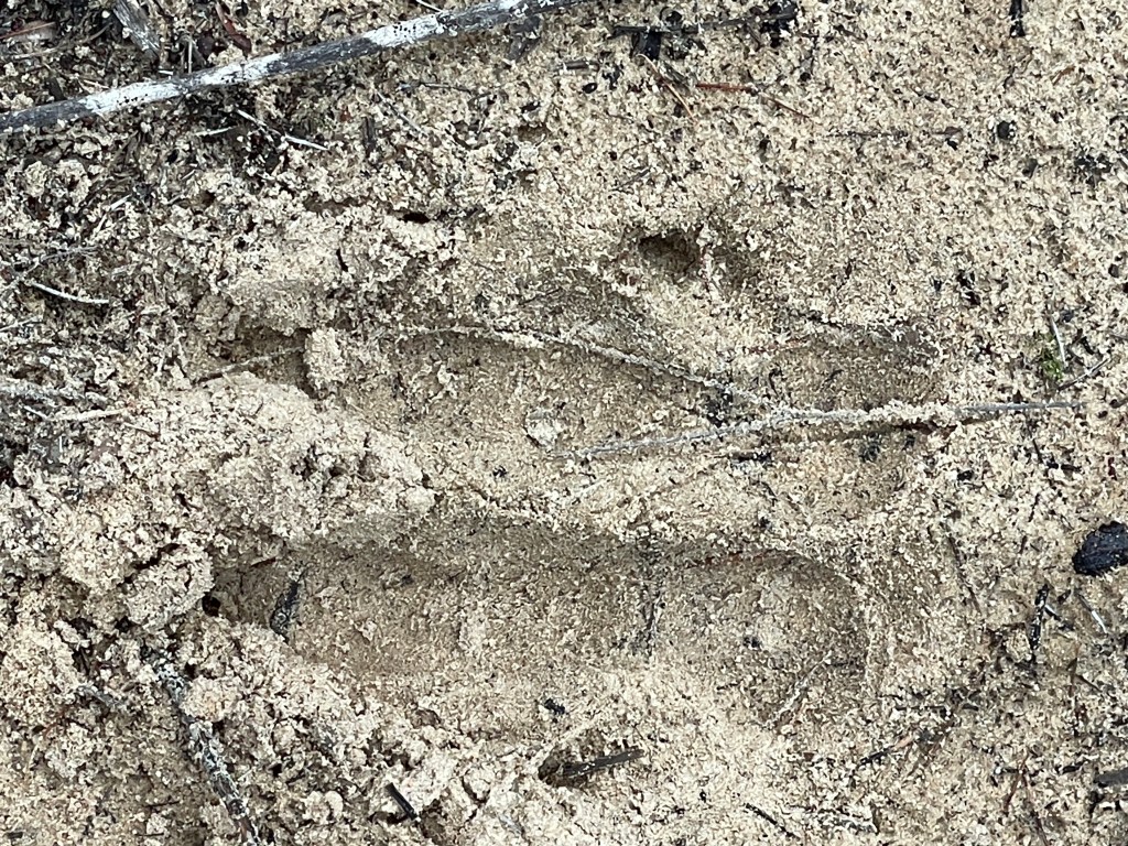
I see a few more trees that might be scarred and Bean, myself, wheel tracks and roo prints all cast dramatic shadows on the sandy track.
There are also a couple of lone trees out of the swamp – making the most of the last bit of sun before it disappears for the day.
It has been a short 3km walk but well worth the explore. And I can’t wait to return when the next big rains fill those holes in Norton Creek.
NOTE – I did go back a few days later to find the scar tree and discovered the gate at the front had been shut – it was open when I got there for the first walk. So, if you visit Tyer it would be a good idea to make sure you shut the gate as directed by the sign (which I did not see the first time).
Where: from Troopers Creek Camping ground off Roses Gap Road in Grampians Gariwerd
How long: 4.3km with some climbing
10 words: Noisy creek, pleasant surroundings, great track, diverse rocks, amazing waterfalls.
Gar is up the noisiest Wimmera walk so far.
But not because of traffic, unhappy kids (although there was one) or even crazy corellas.
It is something more organic, therapeutic and almost musical – running water.
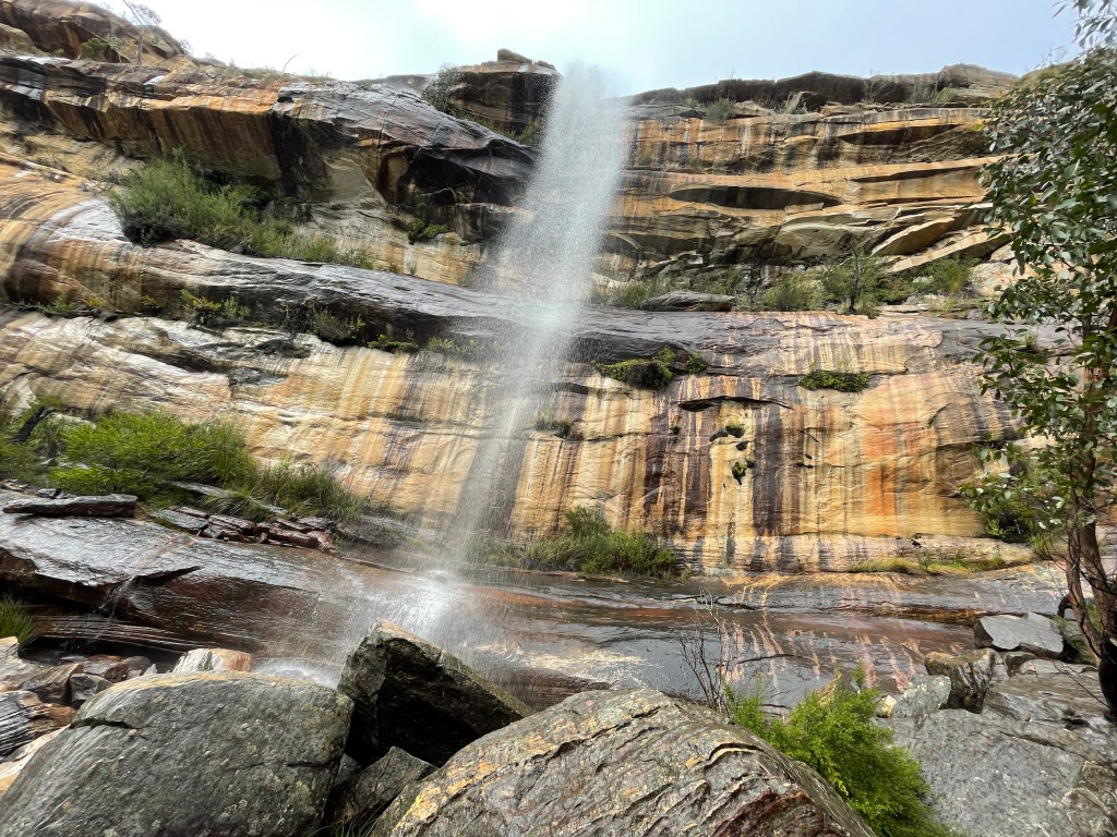
We are walking along Troopers Creek in Grampians –Gariwerd and rain has given new voice to this little stream.
It is like being in another place and time entirely. Wet, hilly and with flowing water. Troopers Creek truly is a wonder to behold.
We have all heard the buzz about Bee Hive falls – a few km further along Roses Gap Road. But while Beehive is overflowing with cars and people today, Troopers Creek is just full of water.
We hear it first, soon after leaving the camping grounds – then we movement through the bush.
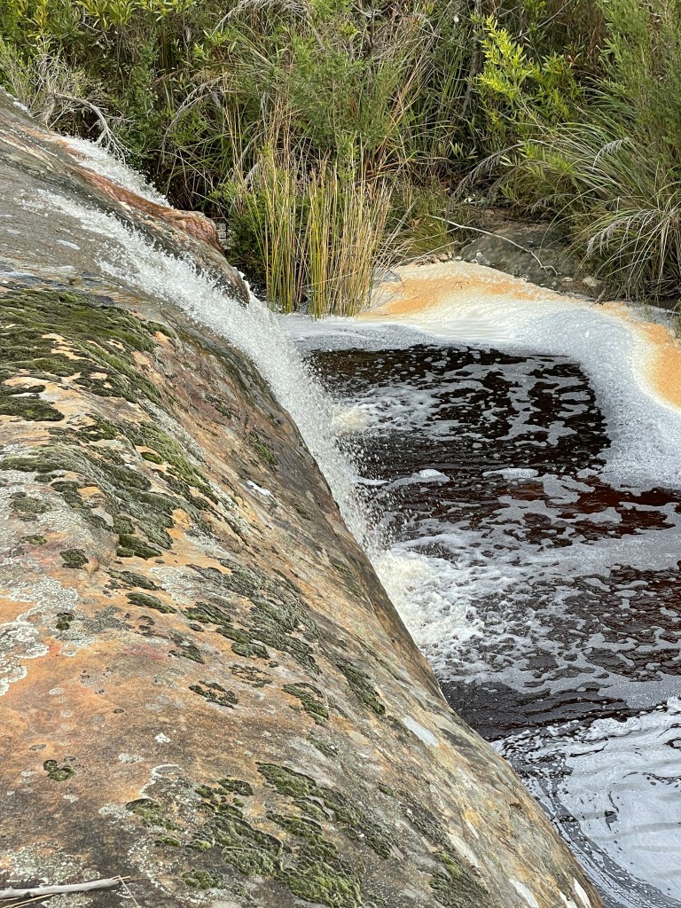
Clear water somersaults down the slope forming beds of foam, which sometimes gets grabbed by the breeze and swirls around like snow.
Countless tiny waterfalls form as the creek rolls over rocks big and small.
The moving water combines with sunshine and the ochre creek bed to create natural marbling. This light and water have also helped dusky pink sundew flowers break free from the dirt.
Other plants are loving the moisture too and tiny buds appear on many of them while lush ferns perch contently under or near rocks along the creek.
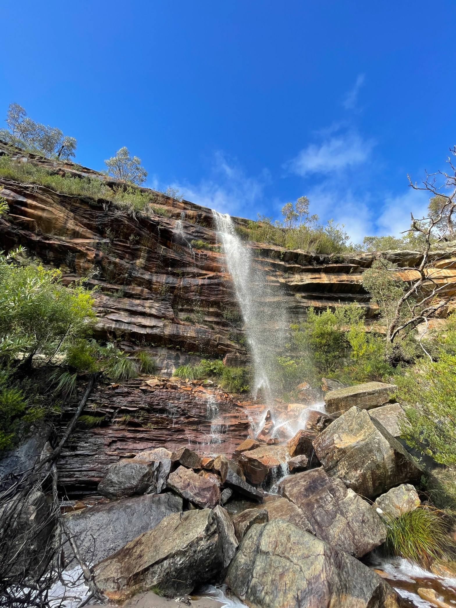
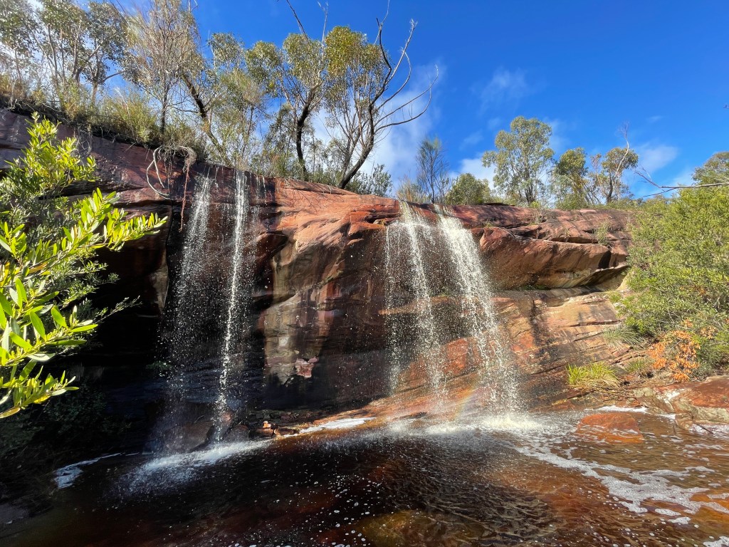
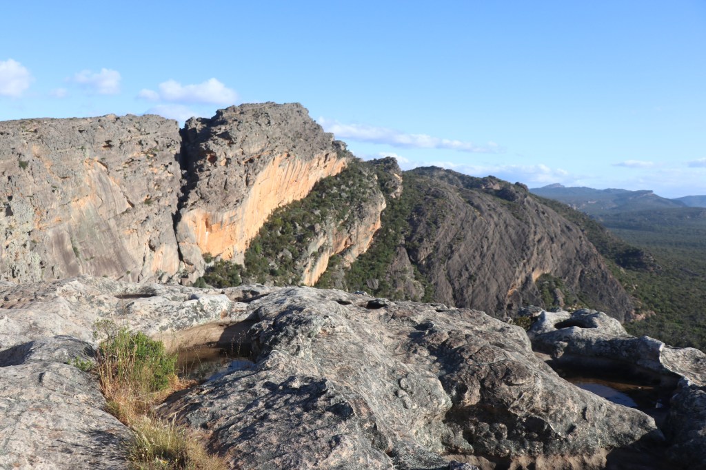
Things just get better as I reach Gar’s first official water fall. The sky is blue, sun is out and the orange rock and white water combine magically for a postcard shot. Am I really in Gariwerd?
It does not end here –two more big waterfalls to explore – so on onward and upward.
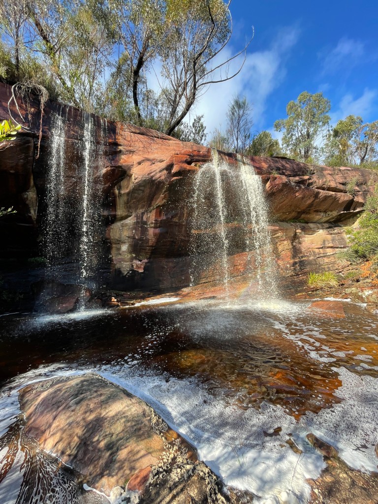
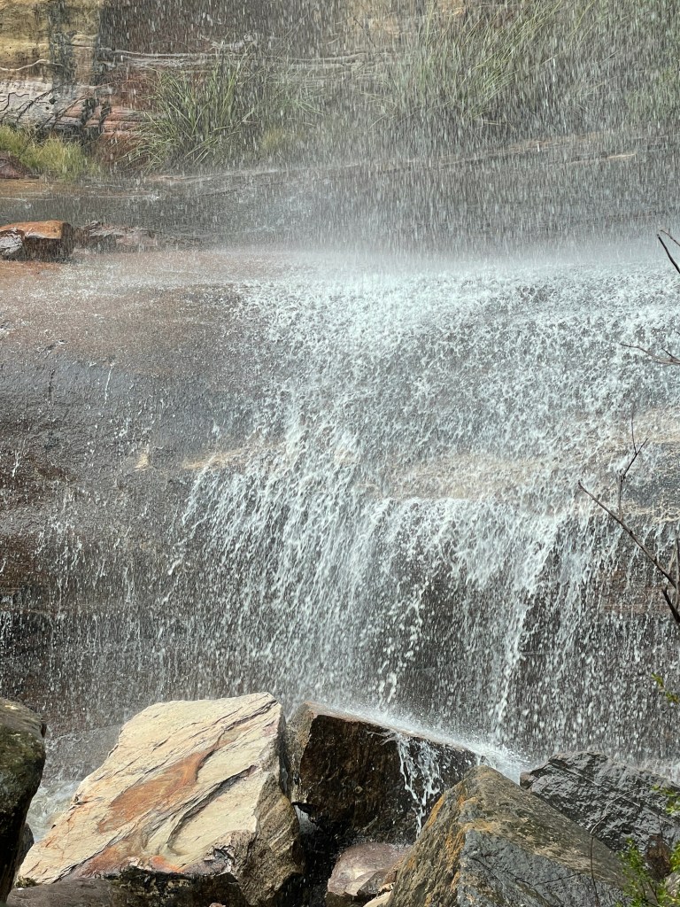
We follow the creek to waterfall number two – a bit higher and thinner but equally impressive.
The darker rocks here seem to have been carefully stacked and host delicate ferns half way up the face.
There are also some big boulders getting a good shower at the base.
The track climbs higher as we head to the third waterfall about 1km away. For the first time we get a classic mountain view.
Looking down on the bush there are a few trees that seem to have very bad hair – I find one along the way and it is like some hitch hiker vine that has taken up residence.
There are more views from a rocky ridge and the bush starts to change.
Trees are smaller and understorey thins but the extra light might be beneficial, as even more flowers are starting to emerge despite the cold weather.
I see my first blooming wattles and banksias and also grass trees. I am impressed at how the track builders placed large flat rocks in the creek as a stepping stone crossing.
Trooper’s volume has not dulled and we pass more mini waterfalls and foam. A tall, charred trunk tells us this place has seen fire in recent years.
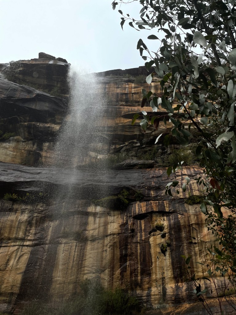
Then we see it – Gar water fall number three.
This one tumbles over a tall, black and muddy yellow cliff with its thin shower often blown about by the wind.
The water also brings out all the colours of the rocks at the base and provides plenty of moisture for the small plants in the rocks.
I sit by the base and watch and feel the gentle shower.
Then it is time to return and gain some new perspectives on the 2km route.
Different mountain views, lichen on the south side of trees and plants now seen because my view is down not up.
A burst of sun beautifully illuminates gum leaves at one point our new friend Trooper constantly runs beside me, happily humming as it makes its way to the valley below.
The waterfalls change from different viewing positions and when grey clouds drop in and change the light.
This really is one of the great walks of Gariwerd – next time it rains make your way to Roses Gap Road and check it out.
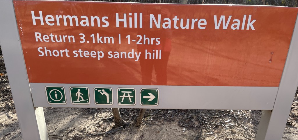
You would imagine Herman Strauss was a content bloke.
Well unless there was a drought, mouse plague, dust storm or any other sort of the disaster hits farmers on the edge of the Big Desert.
At the end of whatever day he had, Herman had the chance to climb a nearby sand hill and regally cast his eye over a vast sandy kingdom.
Today we will follow in his footsteps up this hill named in his honour.
I could not find out much about Herman, he apparently lived in a ‘homestead’ that could be seen from the top of what is now called ‘Herman’s Hill”.
I know the Strauss name goes back to early white settlement around Rainbow district. The family ran a shop but I assume Herman was a farmer and that he must have spent time on the hill.
Heman’s house and farm sat on an important line – the 36th parallel – where in 1885 under siege from rabbits from the south and wild dogs from the north – the government decided to build a netting fence to keep the ‘vermin’ out.
This fence was six feet – about 183cm – high and stretched 328km from the Murray River to the SA border. I still wonder how the border stopped the rabbits and the dogs – but that is probably another story.
Anyway, Herman’s Hill overlooks this fence and Netting Fence Road – and is north east of Netherby, and west of Lake Hindmarsh, in the northern Wimmera.
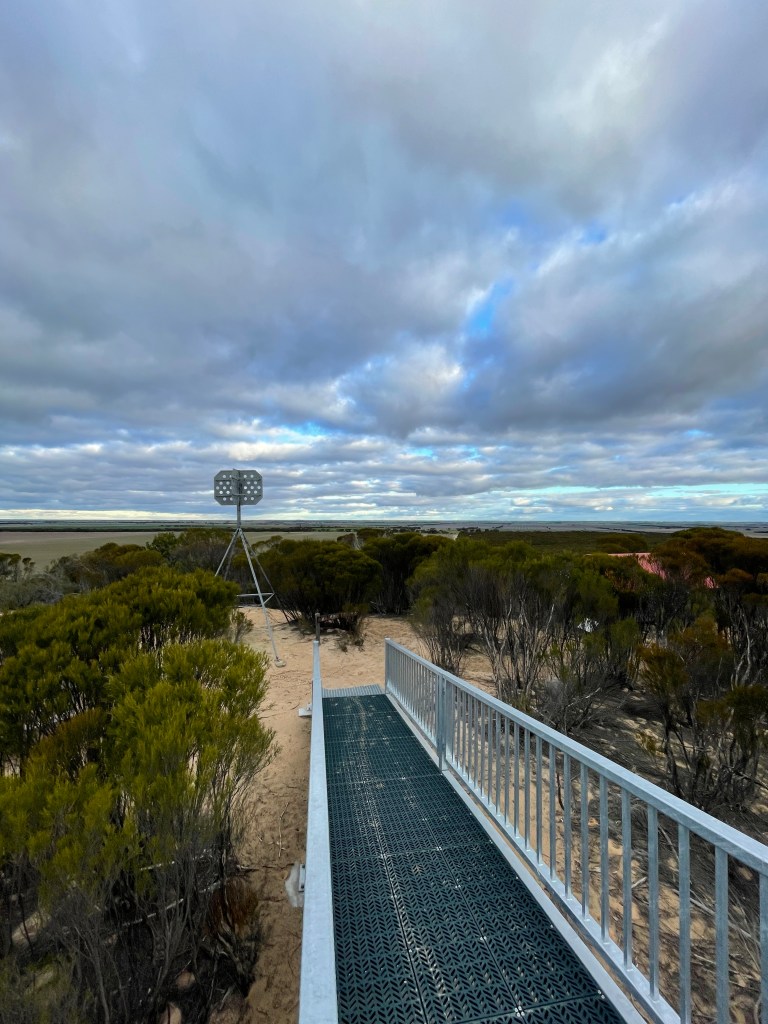
About 20 years ago locals lobbied for some funds to build a proper lookout which was completed with the help of students from Nhill.
A four-wheel drive will take you up the hill to this lookout, but today we’ll walk a longer track carved out of the scrub.
I approach the Hill from the Nhill Netherby Road, turning into Perenna Road and then right onto the Netting Fence Road for a few 100m to the car park – which is just a bit of cleared space on the roadside.
Once on the walk make sure you take the right sandy track – it is the one with a ‘2.0’ post at the start. The other track follows a cable and runs parallel with Netting Fence Road.
From a few km away the hill looks pretty small and you can’t imagine that this little incline marks that start of sandy desert up to 100km wide.
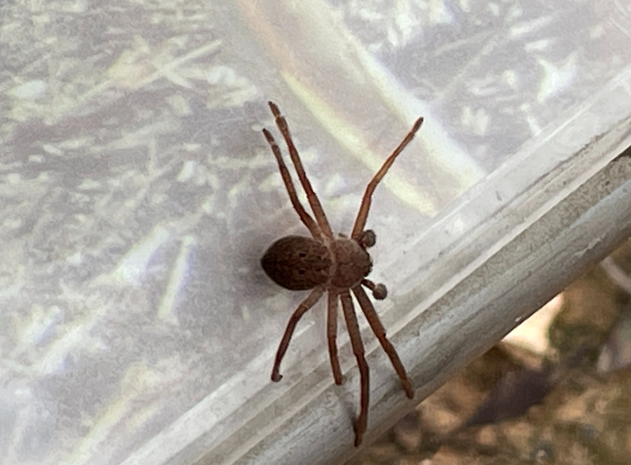
All along the trail are metal lids with handles that host information boards– and big spiders. Open them carefully!
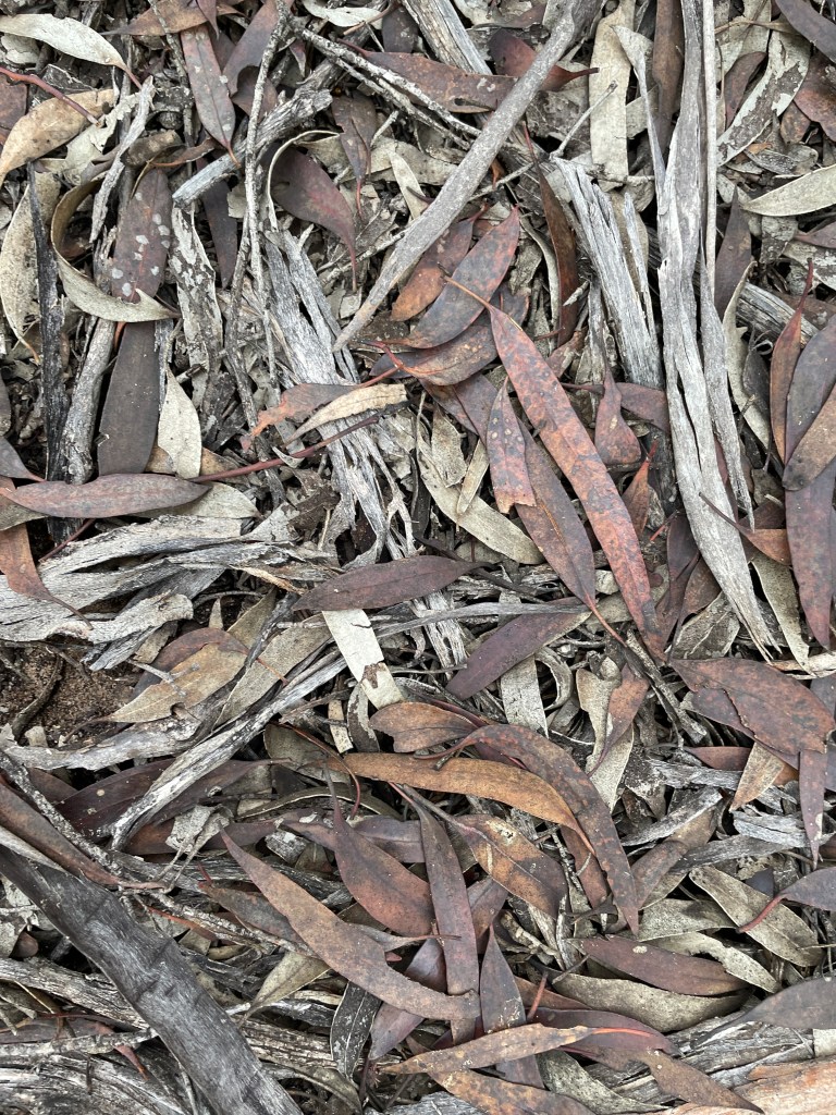
From these boards we find out about the many Acacia wattles – indigenous name Wallowa. The resident species Acacia Calamifolia can grow on sand or clay and provides shelter and food for native animals and birds.
We get lessons about understory plants which for many months seem non-existent but burst into life every spring. This includes an array of orchids -gnat, greenhoods, spiders, mosquito and sun.
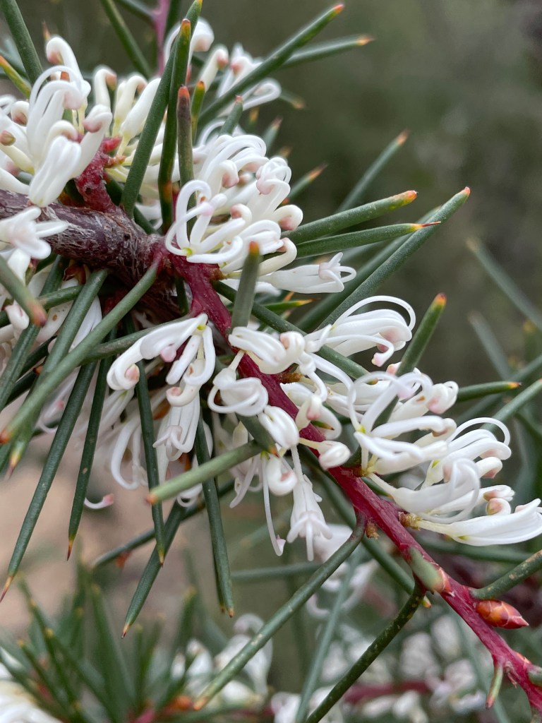
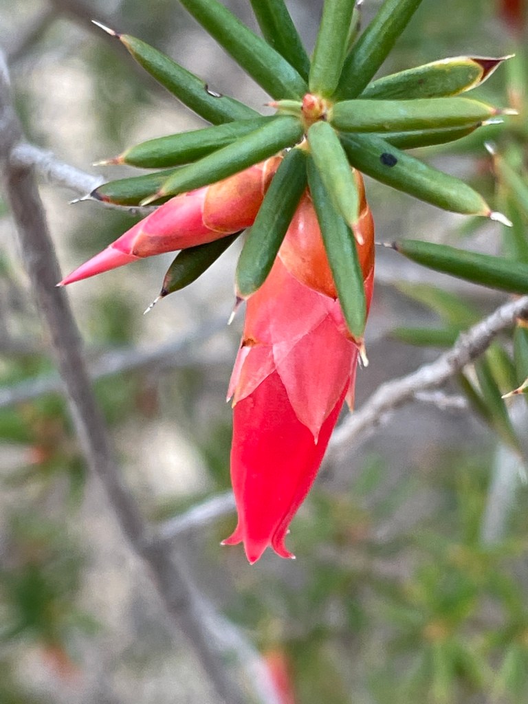
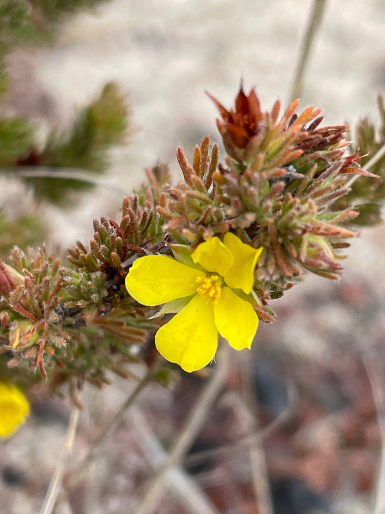
Herman’s little hill is also home to two banksias – desert and silver. But on this winter’s day the main flowering plant is flame heath.
We discover that Mallee eucalypts grow differently – several stems come out of a bulb at or below ground level. The roots store water and sometimes travel horizontally in search of every bit of moisture. The tree canopies are likened to umbrellas. I look up and – wow – they are.
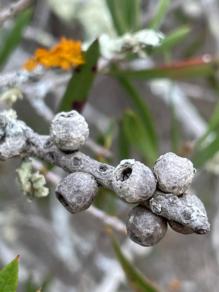
We also read how the quandongs that grow here are bitter and inedible – and being parasitic rely on host plants including Acacias (wattles) and desert she-oaks (casuarinas).
This place is also home to industrious Mallee fowl who spend ten months each year building their nest – a temperature-controlled compost heap. Their clever chicks can fly a day after birth – but with parents working 10 months a year on the house – independence is probably a bonus.
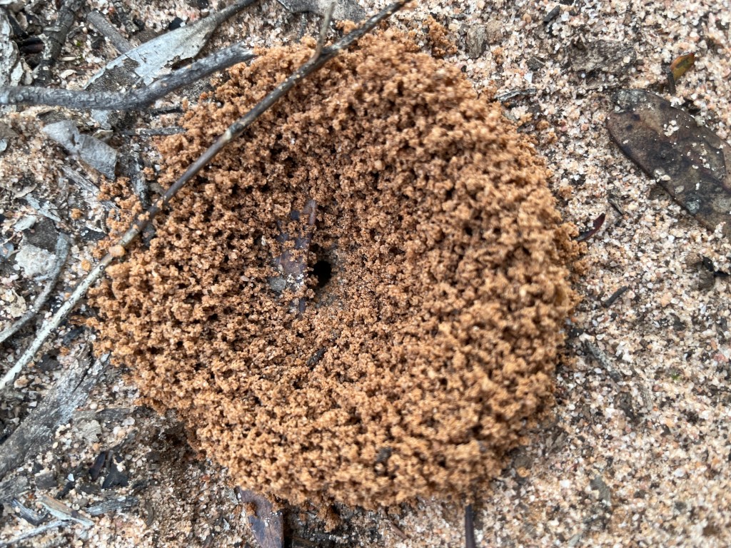
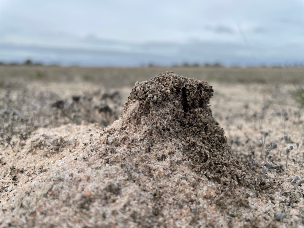
The local ant holes are huge and I wonder whether the ants are big or they are expecting a LOT of rain.
I come across a ‘swamp’ where the ground is clay – which seems a big weird in a desert – but probably a great source of water for the local wildlife.
Speaking of which I see kangaroo tracks but no Mallee fowl. I see banksias but no quandongs – much to my disappointment.
There are also quite a few spiders under the lids.
The first ridge provides a nice view – something you don’t get much around thee parts.
This about 150m and a small climb to the lookout. While the walk is a 2km to the top, the lookout is only 25m higher than the car park starting point.
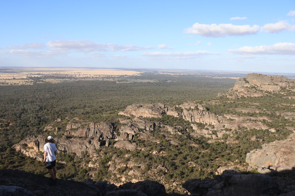
Once at the lookout – you get a bit more height going up the ramp and an awesome view – in all directions.
Herman had to just love this – and you can understand why the locals wanted to share it.
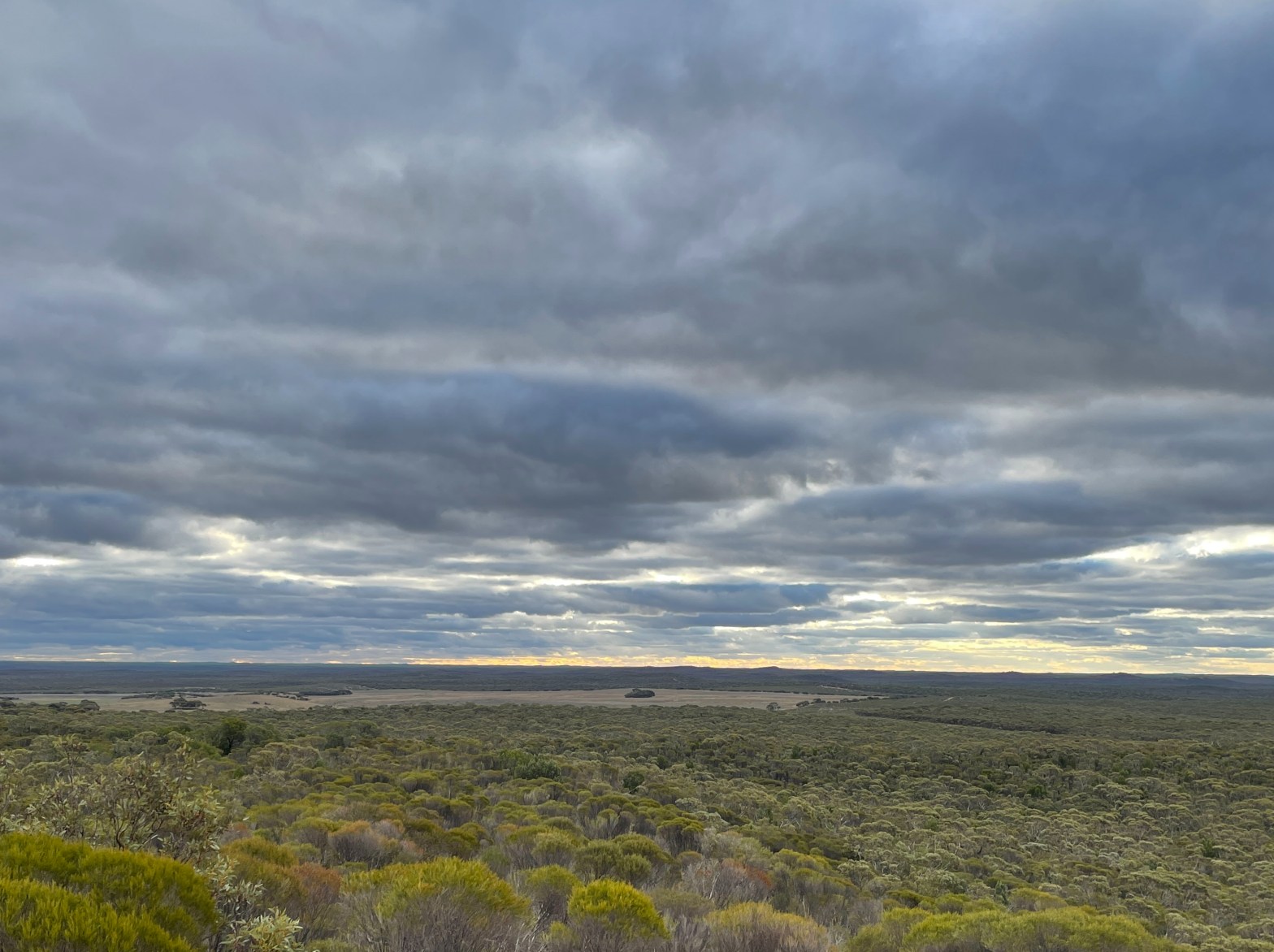
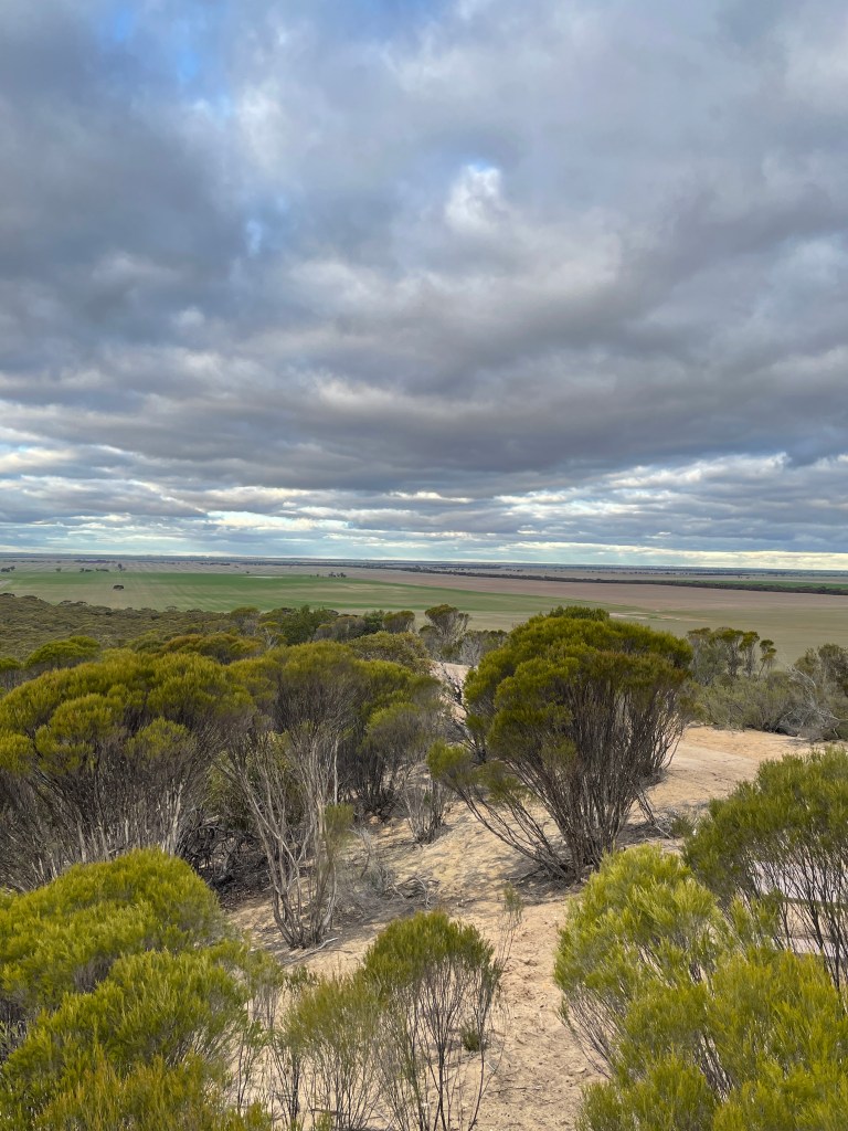
To the north is a mass of desert – rolling sand hills covered in denim scrub. At one point big burst of late afternoon sun light smashes out of the grey clouds.
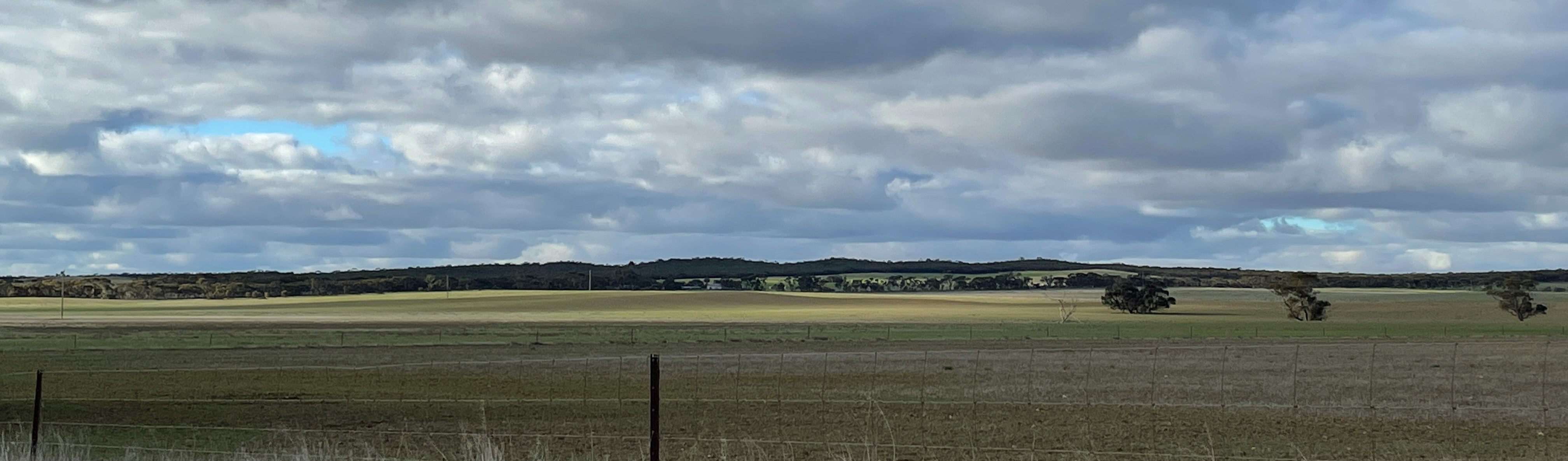
To the south is the farmland and the place where Herman lived. It has finally rained recently and the paddocks are greening up. Imagine in spring when the canola is in full bloom – it must be magic.
To the west is Lake Hindmarsh – dry now but Herman probably saw the water from here in good years.
And to the west more sand and more big sky.
We are so the king/queen of this giant sand castle.
But all things must end and it is time to head down the sandy track back to the car.
It is an easy descent with paddocks on one side and scrub on the other.
Near the bottom I see what looks like the twisted remains of an old outdoor dunny. Maybe this was King Heman’s throne.
Back at the car and I decide to look for some netting fence on the way out. Heading east towards Lake Hindmarsh is a stretch of oversized chicken wire – or should we call it dog and rabbit wire.
The posts look very old and while it is not 183cm high, I nostalgically hope it might be connected to the original fence – and maybe Herman or his relatives had a hand in putting it up.
This has been a great little adventure, with old stories, news ways of seeing the landscape and a chance to get immersed in nature.
It has been a right royal adventure climbing Herman’ Hill.
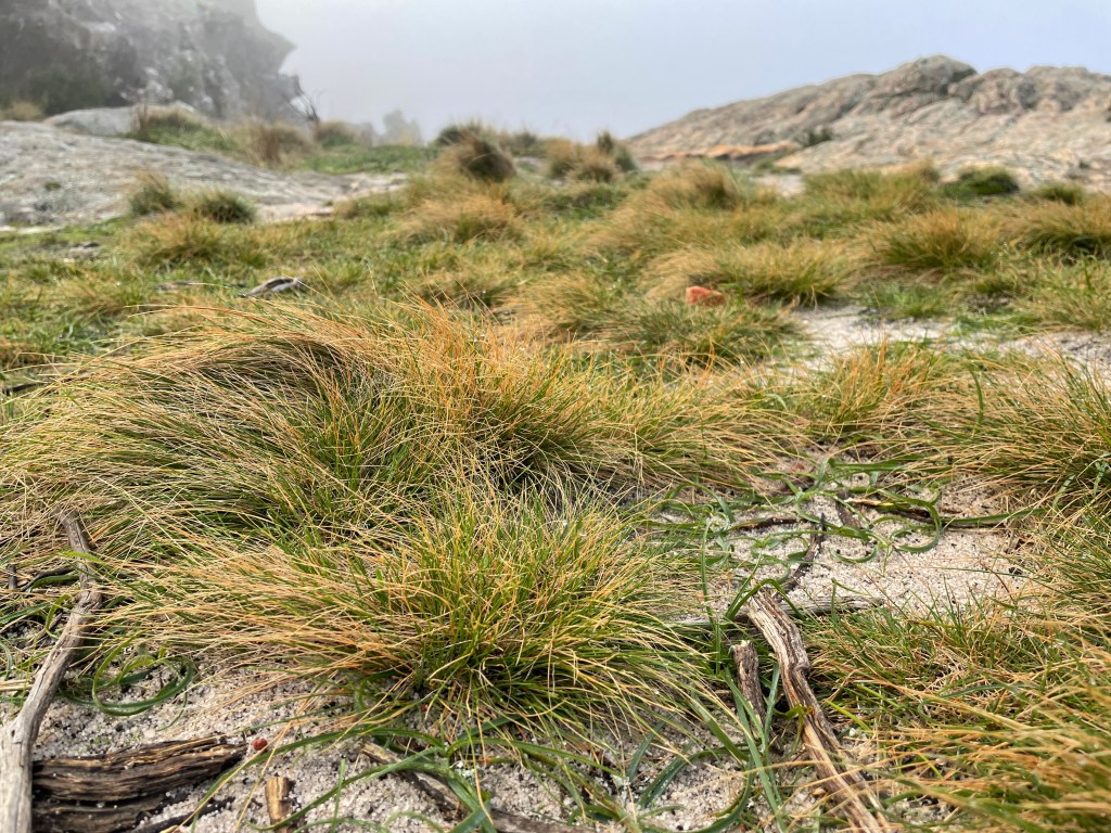
Where – Northern end of Gariwerd Grampians How long – 2.2km return
10 words – Great walk, climb, rocks and cave. Limited views when foggy
It is Week 26 and we are nearing the hump of our 52 walks and it is time to return to the mountains – our old friend Gariwerd.
Perched to the east of Horsham Gariwerd -or the Grampians- is often taken for granted by locals as just part of the landscape.
Not by me. I never tire of watching its changing moods and colours.
I love how this big mass of rocks sits on such a flat landscape and I hope that my body can sustain me to explore as much of it as possible in the coming years.
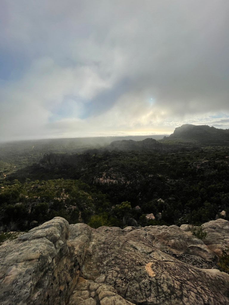
Today, however, Gariwerd is lost in a big fog and 360 degree mountain and landscape views are not looking promising.
I am walking with visiting student Emilie and we are climbing Hollow Mountain or Wudjub-guyan – a 2.4km round trip.
It is a well-defined track from the Hollow Mountain car park towards the rock. Don’t turn left down alternate paths, just keep heading straight to the mountain ahead.
We pass quite a few flowering plants but most of our focus is straight ahead – on the shifting mist.
At times the sun breaks through, spotlighting a rock – before disappearing just as fast.
We leave the formed track and follow yellow arrows up a rocky path to the cliff face where we veer right for a bit of scrambling and climbing.
The cloud seems determined to hang around. Distant hills appear and disappear and but we are getting the odd glimpse of blue sky.
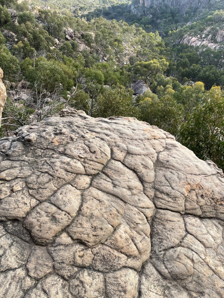
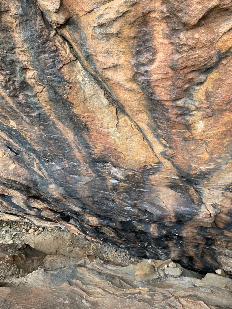
The rock wall is pretty amazing. Some parts of the wall is black, as if singed by fire, other parts are rich ochre or muddy yellow.
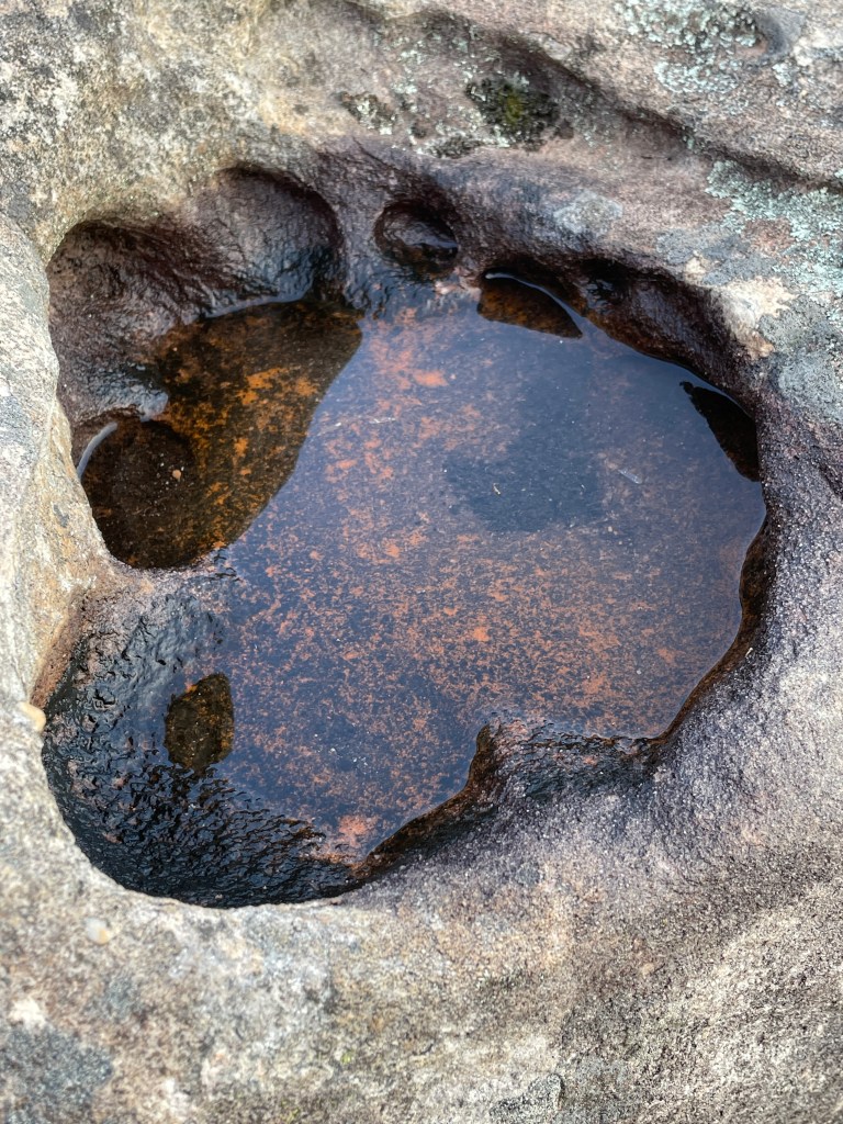
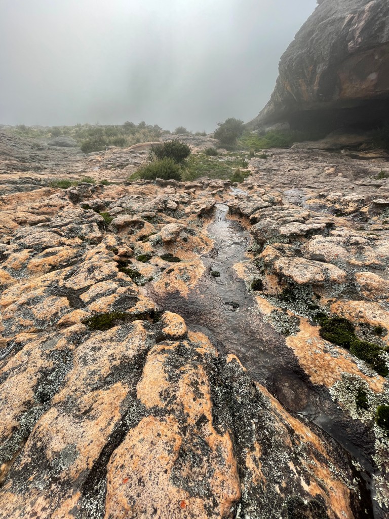
A bit more climbing and we turn a corner to be struck by a breeze and rapid temperature drop. It has got to be snowing somewhere as we pass a series of rock pools filled with water from recent rain.
One pool resembles a big fat foot.
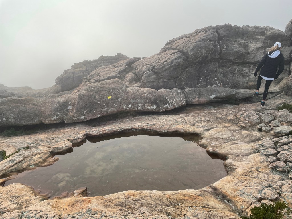
On a good day the views are amazing and you see how big the drop is over the edge. Today we sense the danger but just can’t see it.
What is obvious is the tree, lichen, mosses and lush patch of grasses that somehow thrive on this blustery peak.
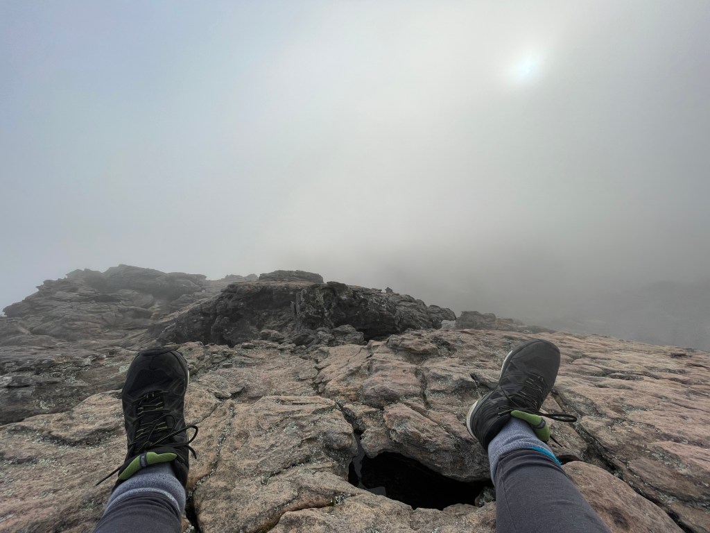
More climbing takes us to the very top. No view but there is a tiny shrub of pink flowers growing in a crevice.
With the promise of fire-cooked bacon and eggs waiting down the road, we begin heading down.
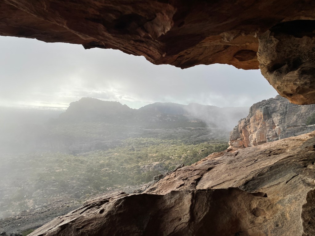
It’s a different perspective descending. We notice how running water has carved mini river beds in the rocks and we climb into the Hollow Mountain cave.
How many people have watched the world from here over the years and what did they make of the eery fog that seems to descend from both directions and hang around the entrance?
At times we get hints of how wonderful the view would be on a clear day but mostly the clouds are just too persistent.
Towards the end of our descent we take time to look at the good mix of plants which seem to be flowering early this year.
It might not have been a clear day but clearly a great adventure no less.
Thanks Emilie, for a lovely walk – hope you enjoyed your first trip to the Grampians.
PS – And just in case you are wondering I have added some images taken on my last birthday when I climbed at dusk – so you can see what the view from the top should look like.
10 words – Relaxing, diverse, great banksias, angry bees, amazing history, resilient landscape
Farming defines much of what many Wimmera people produce, earn and do every day – but it has changed the landscape forever.
What was once a wild tangle of bush, is often now neat lines of cereal and pulse crops.
Many trees are gone or stand as grey skeletons, chopped down, ring barked or drowned in the occasional swamps that became more permanent when the disappearing bush allowed more water to flow.
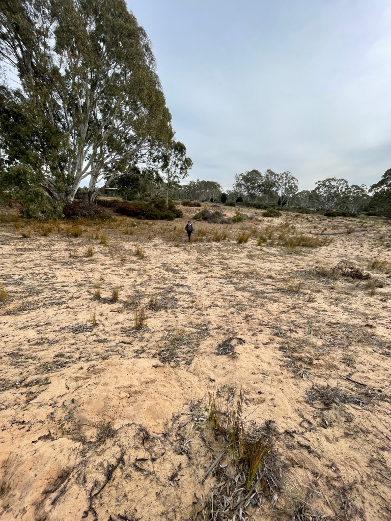
But all is not lost and today we will visit a survivor. An oddly shaped chunk of bush that was probably too sandy and deemed too marginal, to fully clear and crop.
We are down near Clear Lake on Wotjobaluk Country at the block of my friends Deb and Tom. For almost a decade and a half they have cared for this land. Removed the sheep, fought battles against rabbits and weeds and triumphantly watched the land slowly recover.
We are exploring the North Western end of this block, starting at a highlight, two grass trees happily growing on the block, one tiny remnant.
It is hard to imagine such sandy ground not being a home to a host of these hairy plants but for some reason this is a rare site.
It sits in a veritable garden of lemon and gold banksias and daphne heath and under the watchful gaze of a resident black wallaby who hardly moves as we pass.
The ground rises slightly and we pass a few more yellow gums, stringy barks and banksias before descending to a seasonal swamp flanked by old thickets of Callistemon (Scarlet Bottle brush).
Like the swamp, they are looking pretty thirsty. A pack of thin grey brown trunks huddled together with their ‘bad hair’ branches of sparsely covered foliage rising sticking up all over the place.
It has been a long time between deep drinks. This swamp was filled to overflowing in the 2010-11 downpours but normally only gets gumboot wet after spring rains.
A small dam dug in the middle of the swamp for long gone stock holds the last bit of local water. You can see a community of wildlife footprints at one end and the turtles which normally bob around in the muddy water are still today. Not a good sign.
Then in all this winter grey and beige we find an explosion of tiny golden mushrooms, that somehow found enough moisture to break out from sandy soil.
There is quite a bit of limestone around the edge that must have surfaced when the hole was dug. One bit looks like a big ram.
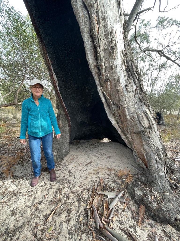
At the Eastern swamp bank is a big tree with a hollow trunk that would provide fantastic shelter against a nasty Southwester. We wonder who may have sought refuge there over the years.
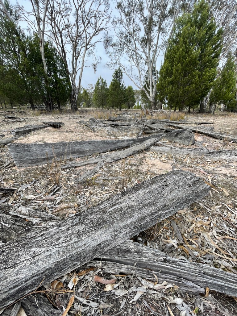
Other trees are not so lucky and sit cut up and abandoned on the ground – cast offs of fencing or sleeper projects in the distant past.
Heading South we come across beautiful mosses, lichens, seed pods and several feathers caught on plants.
And despite it being a cold but dry start to winter, there is an amazing array of flowers underfoot.
There are also some freshly dug holes around in the sand, courtesy of the resident echidna, whose distinctive nose hole tells us he been hunting ants.
Tom and I head over to a big old gum that looks like it has been ring barked and then he starts running, an angry bee in pursuit. I laugh until the bee’s mates take a liking to my rainbow hat.
I am running, the hat is flung off and we hope the rest will stay put. They do, but Tom gets stung on the face.
We head to a stand of bracken and put some sap from the stem on his face.
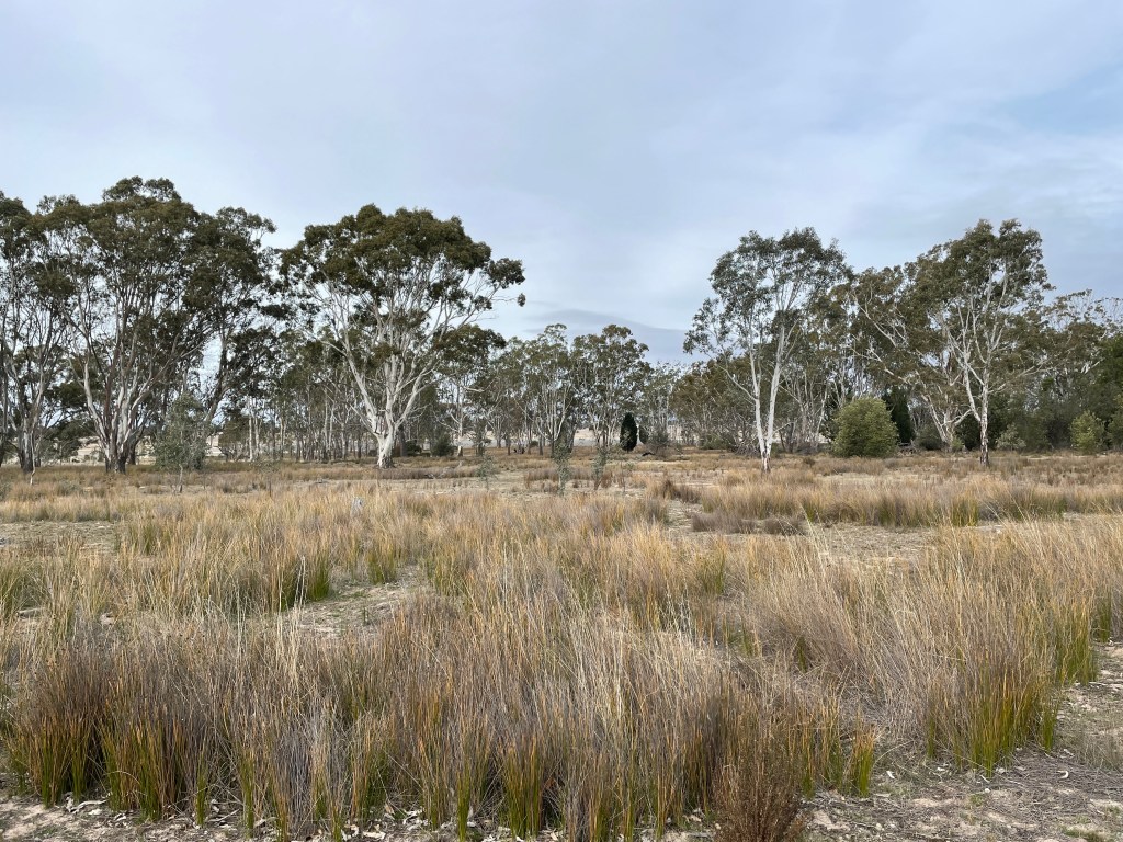
After another swampy area the scrubby heath gives way to taller gum trees and a cleared patch home to a several kangaroos.
Near the South Eastern boundary we reach a lunette looking North over Hectors Swamp, a spring fed ephemeral lake also awaiting its spring fill.
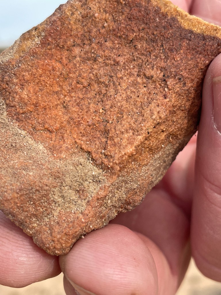
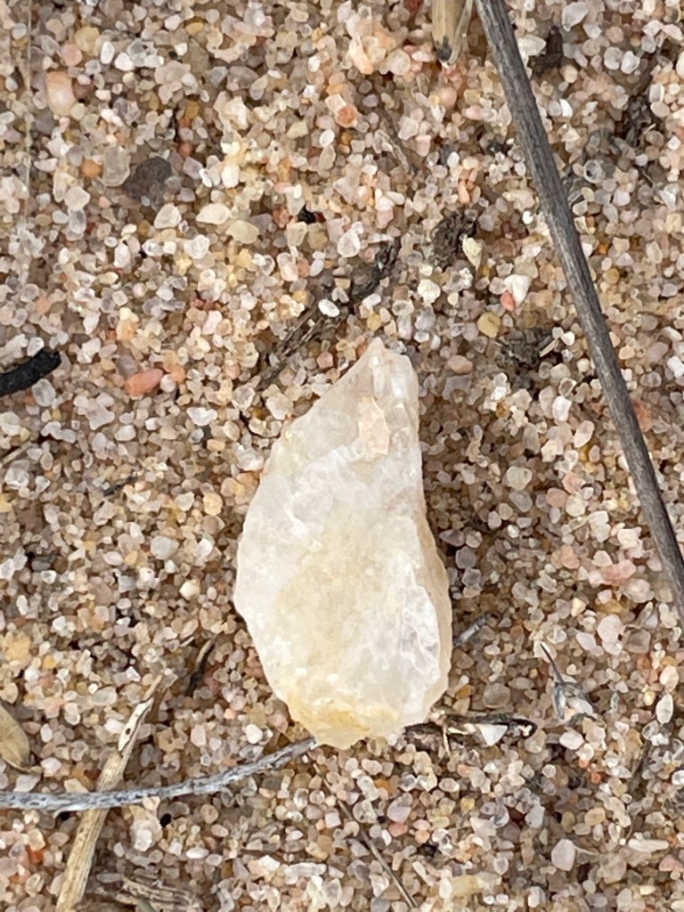
Among the sand Tom points out lumps of ochre, a sharpened stone tool and some quartz pieces probably used by this the block’s original residents.
It is pretty amazing seeing all these bits of history which we leave exactly where they were found.
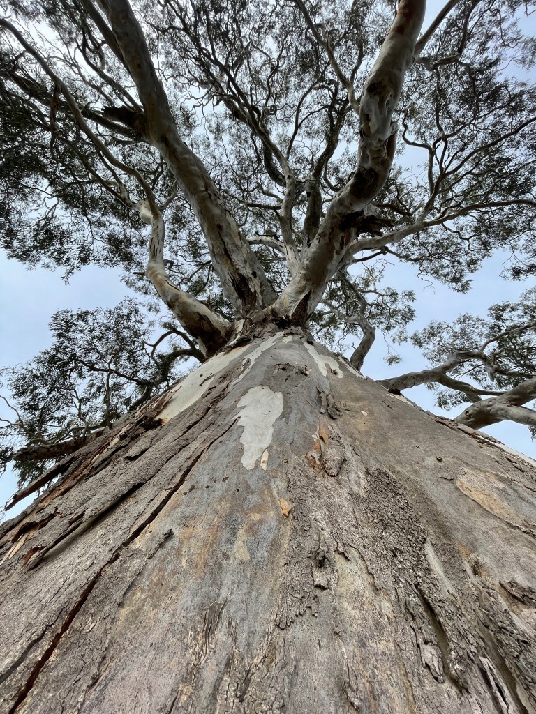
Watching over us during our search is the biggest tree on the block. A mighty red gum that would have some stories to tell and also enjoys a magical view of Hectors Swamp and Mt Arapiles – Dyurrite.
We move from this tree down to the lake. Deb reckons it has filled every year since they bought the place but not last year.
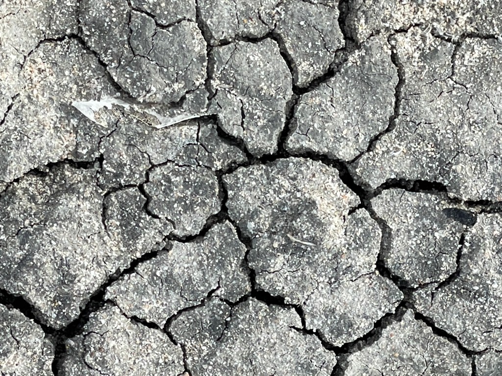
The cracks are plenty and there is no risk of sinking when we walk over the surface.
From here it is back to the scrubby heath and through some more trees and sand and until we reach the another interesting tree.
It seriously looks like the trunk has grown around a fence post. A hollow reveals a post with wire right inside the tree. So we will end with a mystery.
Thanks Deb and Tom for our Clear Lake – uncleared block adventure – it might have had a bit of a sting but also showed what wonderful non-cropped things do grow in the Wimmera.
Reserve between farming properties for close to Wimmera River
40 minute walk flat and pretty much on rough vehicle track
Today’s walk (which did in early March) takes place in two locations. One is a popular and well formed 30 minute track through a sand hill just outside Dimboola and the other was a random ramble through one of the many reserves on the edge of the desert between Dimboola and Horsham.
The first stop was Pomponderoo Hill walk, just half an hour, and reached from Dimboola via Horseshoe bend road and then Pomponderoo Hill Road.
Sandy hill with formed track and plenty of desert plants
It is a sandy rise that provides pretty amazing views across the Little Desert.
There are not many hills in the Wimmera so getting a view like this is a treat.
Many will think it is just another sandy track. And yes it is but look around and there are quite a few plants miraculously thriving in the sandy landscape.
I see some really beautiful banksias and am surprised to see them flowering so well in mid autumn.
The gum trees also have some really lush green leaves and even the tiny buds on some of shrubs make for nice pics.
It’s like trudging through a sand dune at the beach, with bathers replaced by trees. Some of them are very gnarly too, hardened by too many days and years under unrelenting sun.
It is all worth it when I get to the viewing platform. Some awesome panoramas and little white clouds floating like cotton wool on a bright blue sky.
You get to see a big view of the desert to the south and it makes for interesting looking.
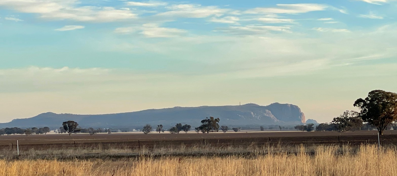
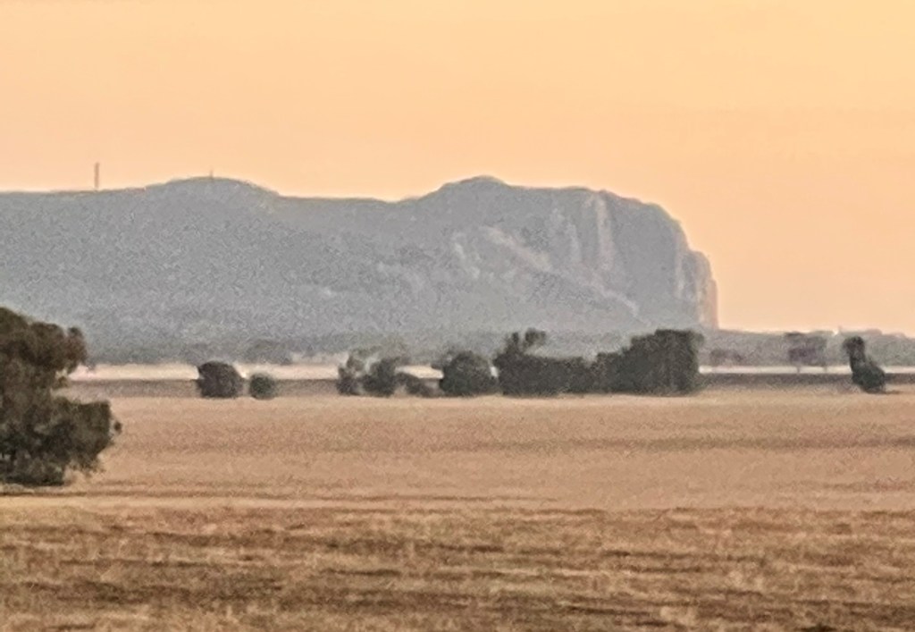
In one direction there is a forest of pines just plonked in the middle of the scrub and then in another we see Mt Arapiles Duyritte.
The tracks winds down the hill and around and passes more banksia and chunky buloke seed pods and some beautiful grasses.
A short stroll oaf about 1km but well worth the trip to Dimboola
I need to do some more walking and am not game to drive along the sandy rack past horseshoe bend back to Horsham so opt for a return route on the western side of the river and settle for the West Wail Conservation Reserve on the Wail Polkhemmet Road..
It is big reserve but I decide to do one corner which covers about 3km
The first quarter of the square track looks out onto an adjoining farm. It is pretty sandy – probably the reason the trees were not cleared in the first place – and there is a bit of salt bush and red pig face growing along the edge.
It has been pretty hot and the eucalypts are shedding their bark, bit like skin peeling off after sunburn.
Loss of bark has revealed smooth pale limbs in an appaloosa-like mix of white, pale yellow and tan,
Out in the paddock is an ancient thatch shed stands abandoned under a few big gums. It seems to have a lot of ‘bark off too’ and it won’t get grow back next year.
I look down on the track and see some horse hoof prints. I also hear a few random shots in the distance. Is West Wail a little bit wild?
I find a lichen covered log that looks like big hairy lizard and another branch that just screams elephant trunk. But no cowboys.
It is getting late so I search for the track to take me back to the road and along the way find the remains of an old channel that probably once fed a dam over the fence.
There are few native pines growing in the reserve and other flowering shrubs and I pass a couple of trees that have scars.
It is a not walk of many discoveries but nice bit of bush no less and in the cleared farming landscape that is Wimmera – any remnant bush is something to cherish.
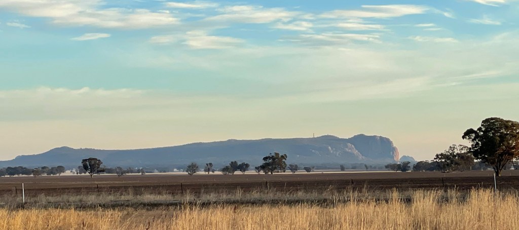
Where – 35km from Horsham off the Noradjuha Tooan East Road
How long 6.6km
Do you ever drive past a somewhere and think it might be worth inspecting on foot one day?
Today I am going to do the block.
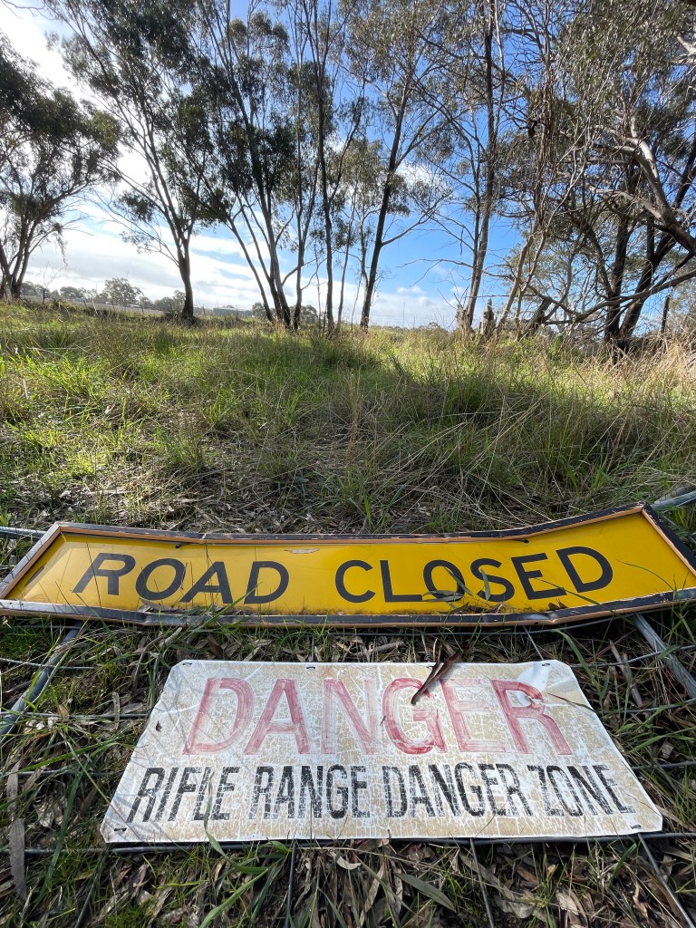
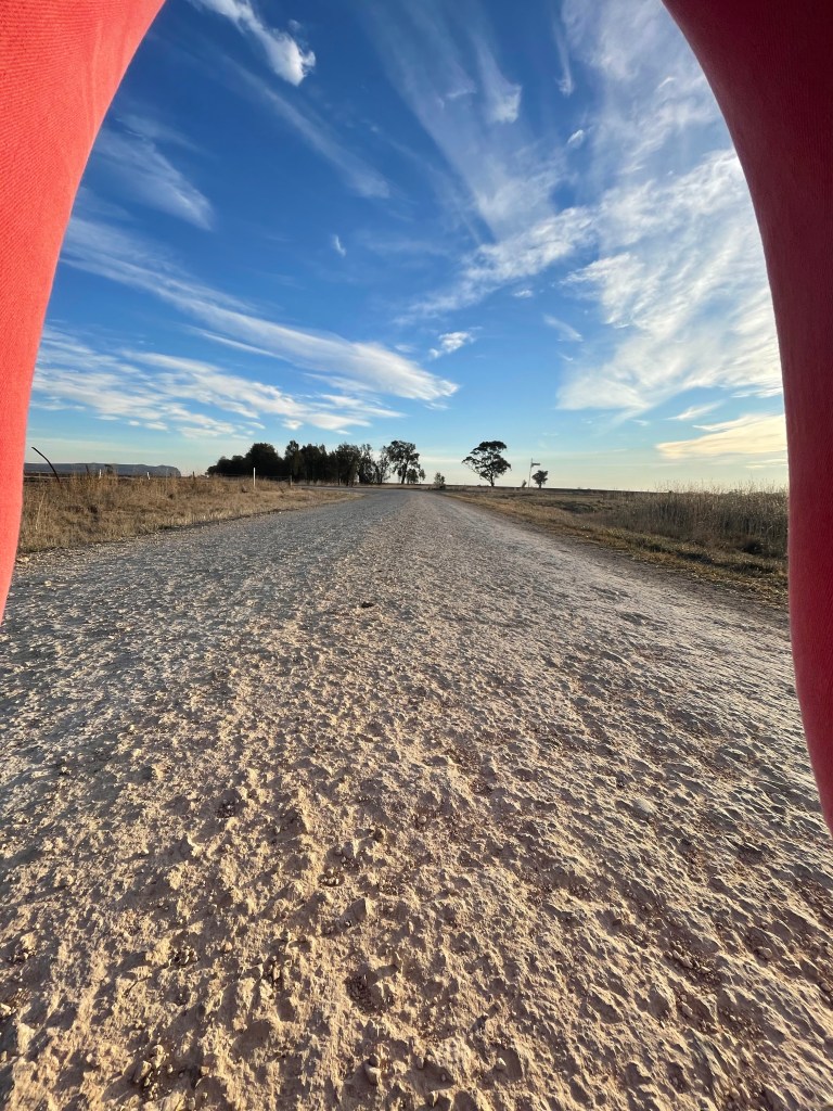
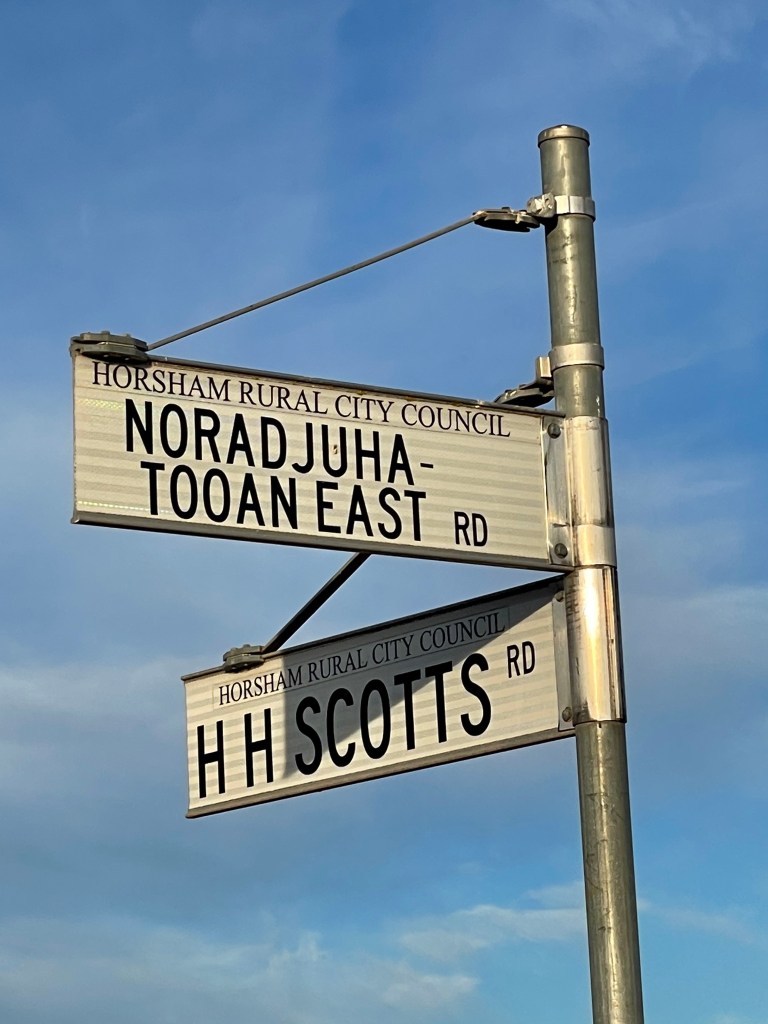
A walk through agriculture, through history and along much-driven roads – Rifle Butts Road, the extension of Fergusons Sandhill Road, Noradjuha Tooan East Road and HH Scotts Road.
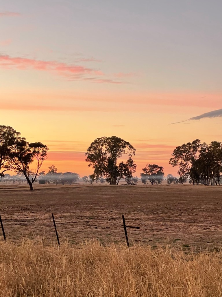
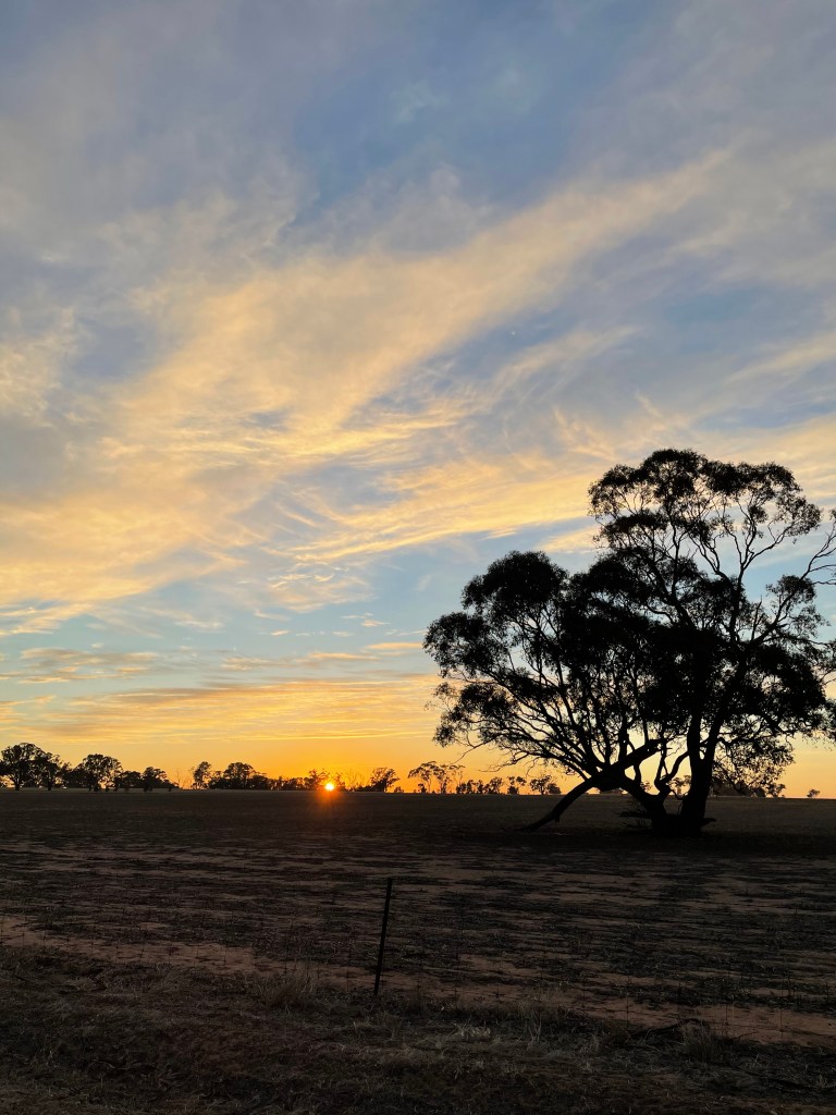
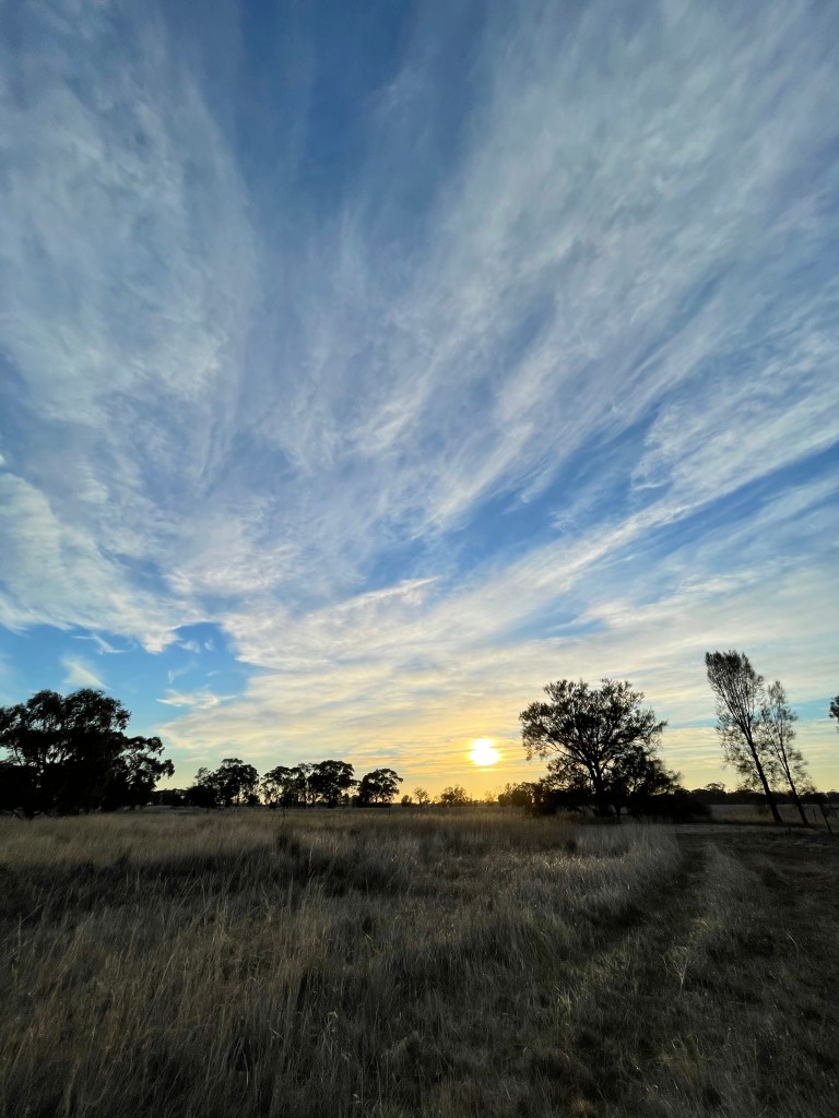
I hit Rifle Butts Road just before dawn, hoping to get to the peak on Ferguson Sandhill Road track right when the sun is ready to shine.
It is cold with just a mango glow in the east and now sound or movement from the sheep or the birds.
A misty layer hangs over the lowest point in the paddocks with a fair bit of stubbles burning yesterday it is hard to tell if it’s smoke or fog. It looks awesome.
The sky is filled with wispy pale pink lines and in the dim light Arapiles or Dyuritte looks like its covered in frost.
It painfully dry for May and a water trough sits absurdly on bubbles of sand in an empty paddock.
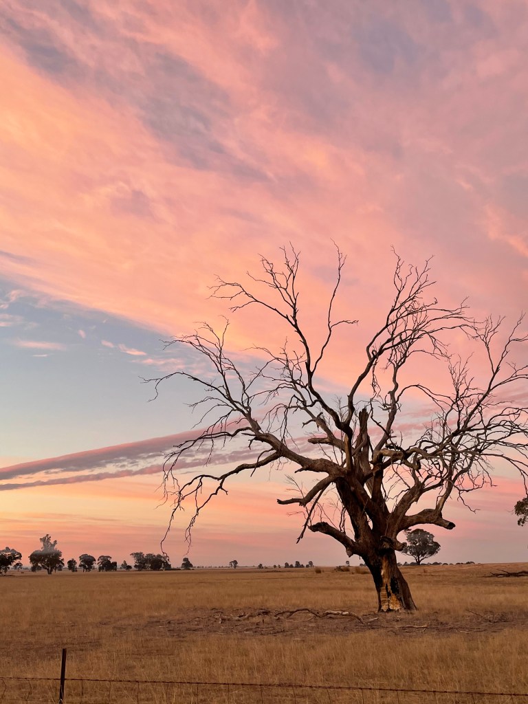
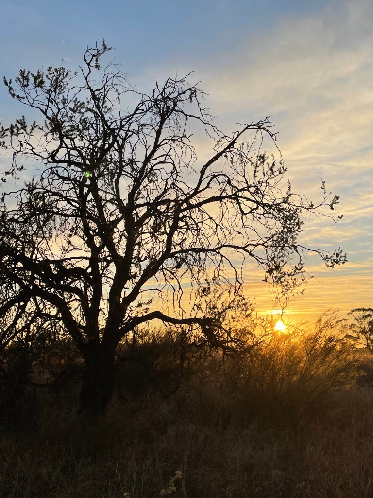
A dead tree provides an eery silhouette against the growing mess pink cloud which starts to look like a giant hand waving from on high.
I reach a small creek and start to head up Ferguson’s sandhill road.
Out in the paddock is a large gum with a big scar. Perhaps this little creek was a handy water supply back in the day.
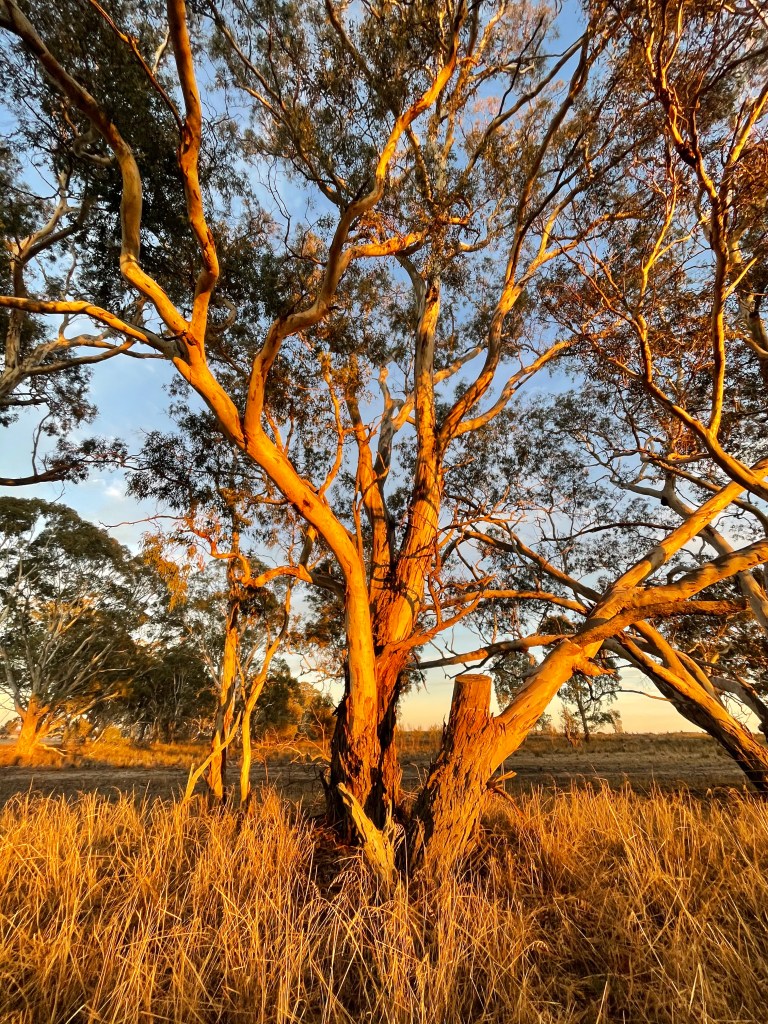
The trees thin out as I leave creek and things get sandy as the I move up the hill where there seems to be a mini forest of gums.
The sky changes by the minute, with vast differences of colours and light in every direction
Then, on cue, at the top it is sun rise. Banksias and lichen glow, a dead tree comes to life with natural back lighting, stubbles look amazing and bulokes sing – with sunshine.
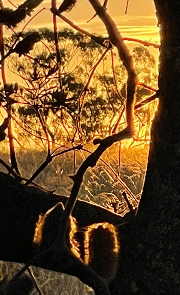
It is a focus on Arapiles- Dyuritte once I hit Noradjuha Tooan East Road and the frosty look has thawed.
There is also the exploding cotton ball look happening in the east and the wide angle lens just loves it.
Down HH Scotts Road I invent the bend and shoot style which I won’t explain and re-discover roadside vegetation I have flash passed dozens of times in the car.
Golden moss grows in front of the bulokes and combines magically with the sun. Even the limestone road ruts contrast dramatically in morning light.
Back at the block, I know the day has started as the sheep run away as soon as they see me.