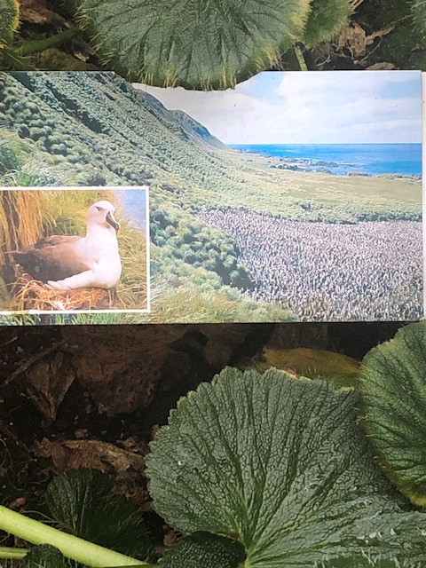
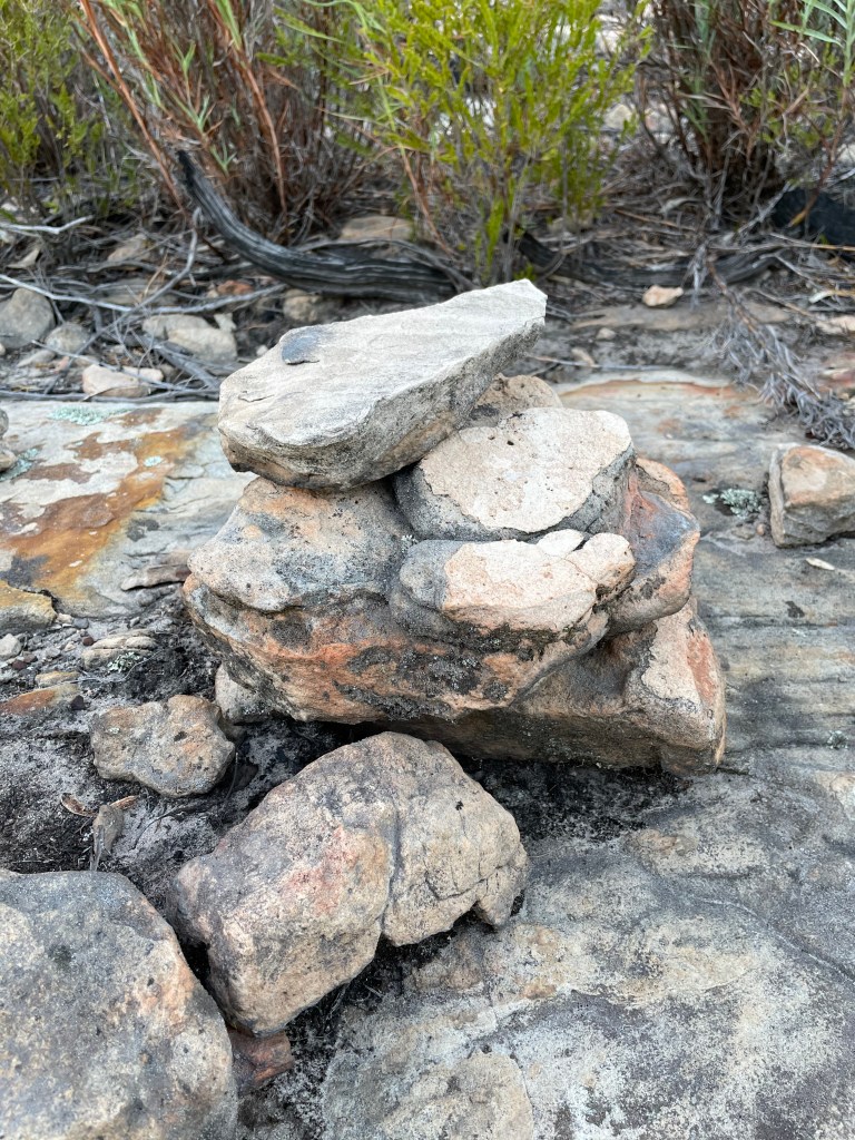
Where Pink Lakes, 22km from Linga in the Mallee Sunset National Park
What – series of salt lakes which were once a major salt producing operation and now are a reserve.
10 word – salty wasteland rich in colour, texture, history, beauty and wonder
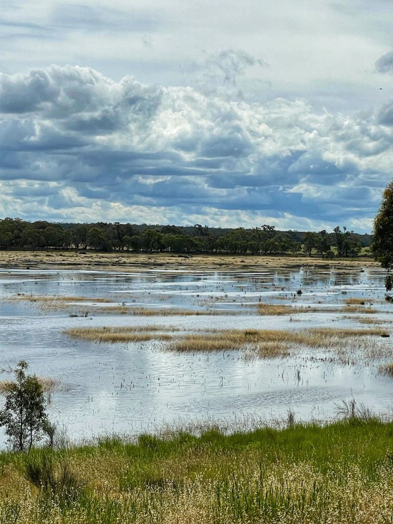
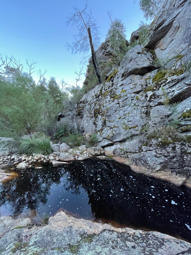
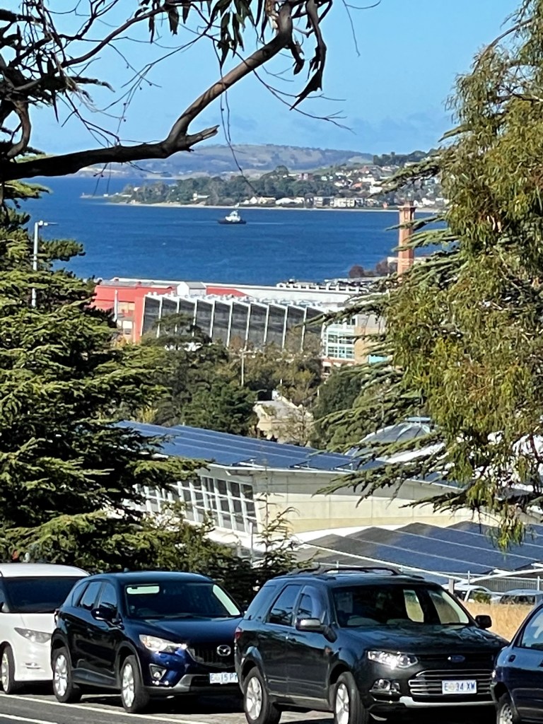
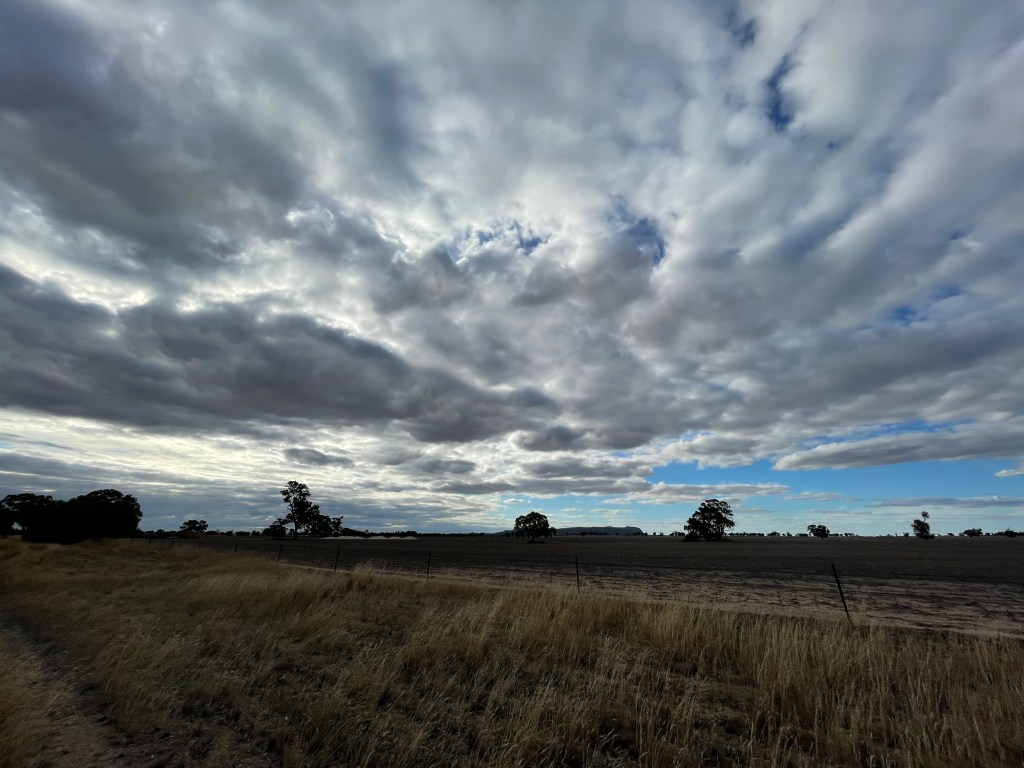
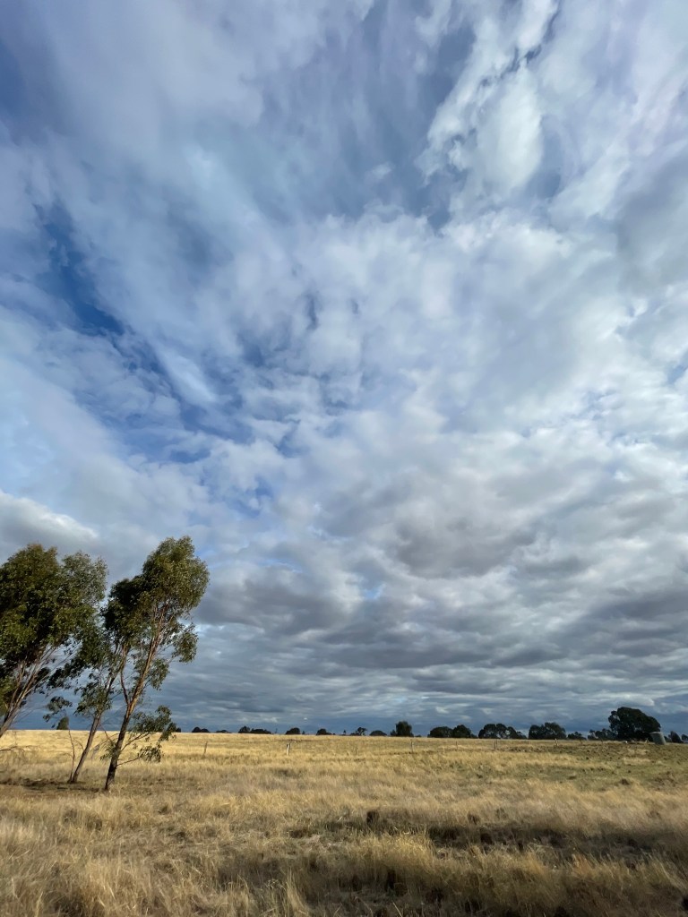
This week we’re off to another Mallee Lake, well several of them, but the water is pretty thin on the ground.
I popped in here on the way home from another walk during March and with lockdown keeping me home – I thought it a good time to tell you all about it.
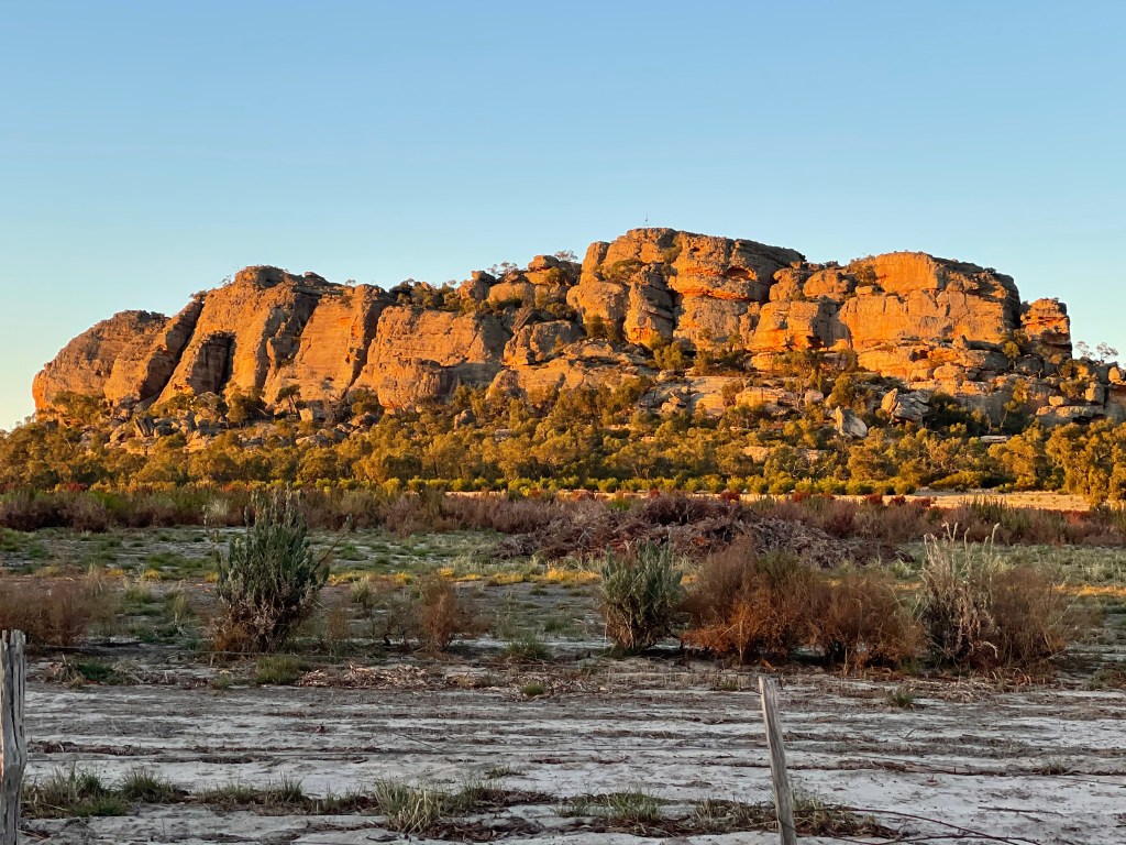
They are the pink lakes of Murray Sunset National Park, north west of Ouyen on the traditional lands of the Latji, Ngintait and Nyeri Peoples.
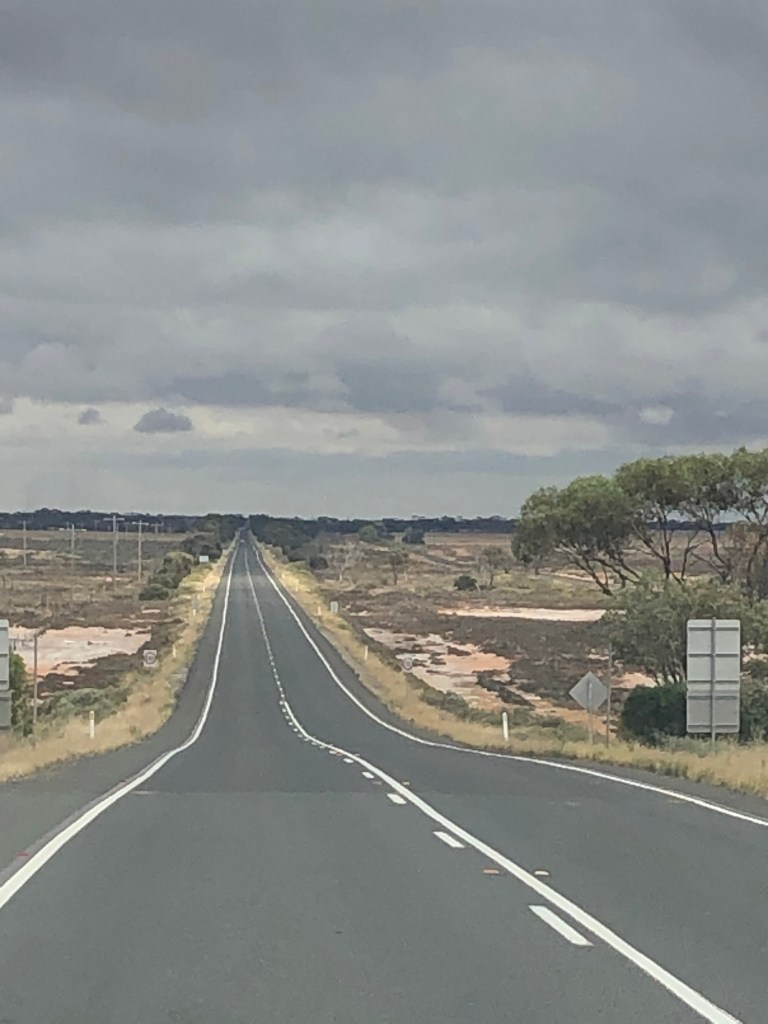
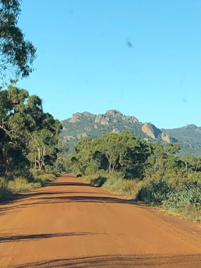
Way harder to find than Wimmera’s Pink Lake on the Western Highway between Horsham and the SA border, these ones require turning off a Ouyen, heading to Linga and then another 22km north.
It does provide a great chance to see the real Mallee.
You see how time and population decline has hit these remote communities but also their absolute resolve to forge on regardless.
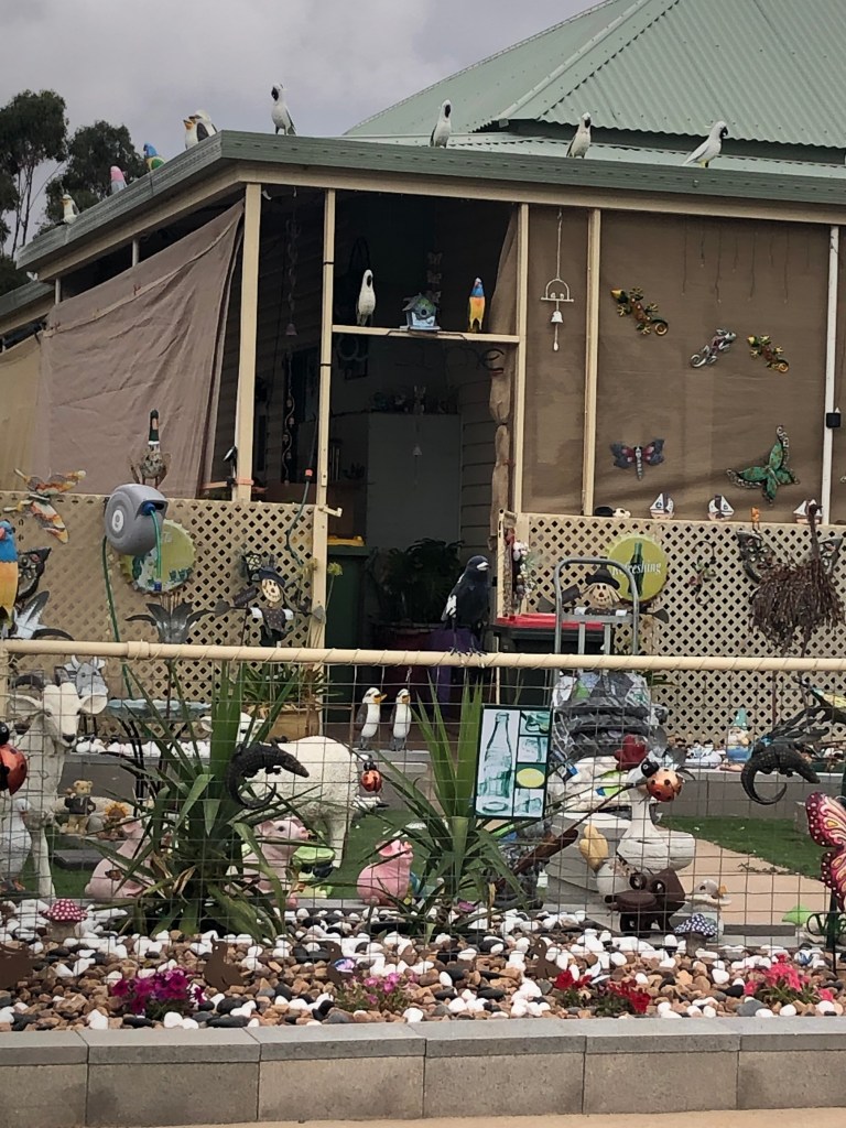
A salt lake outside Ouyen features a fake man being chased by a shark and at Underbool there’s a house with more garden decorations than a $2 shop.
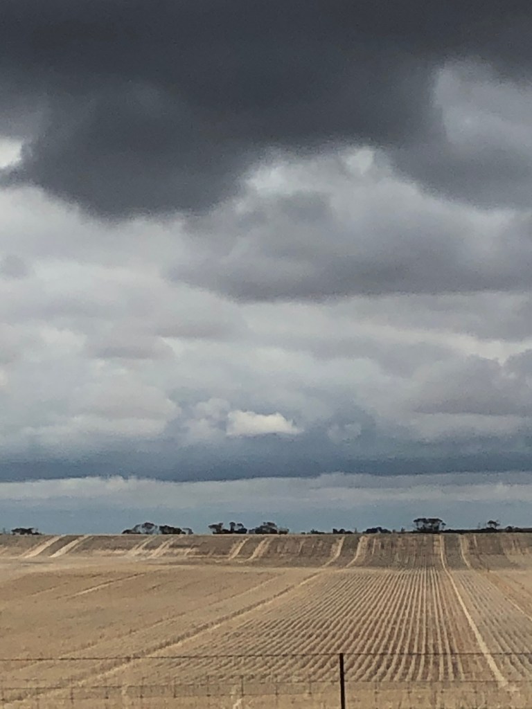
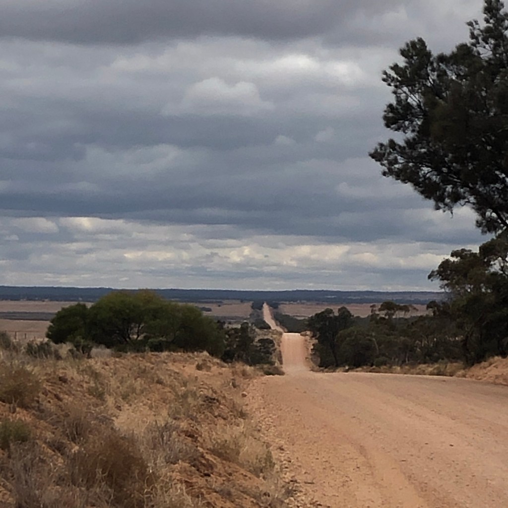
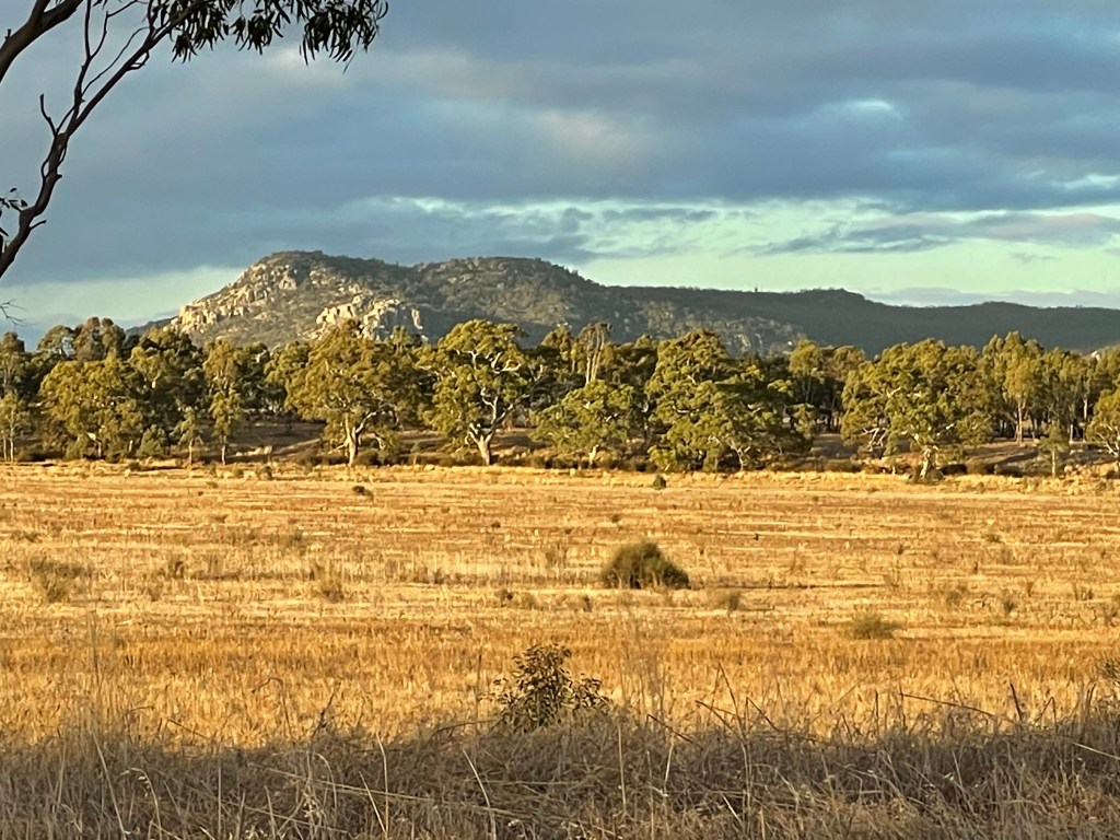
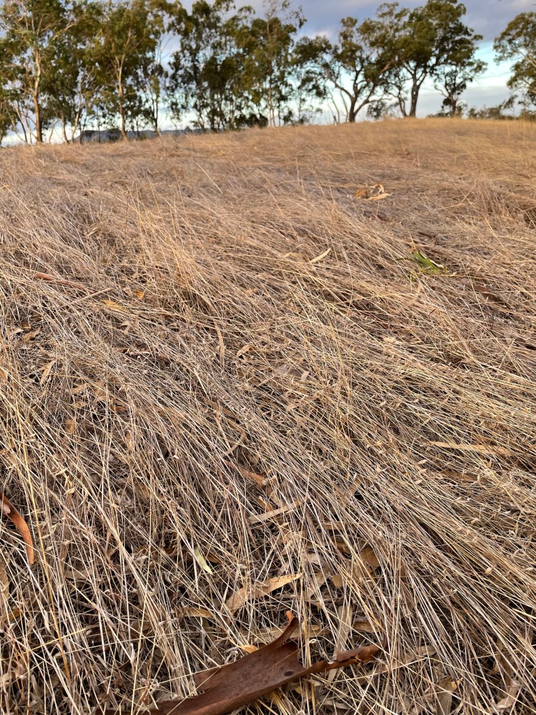
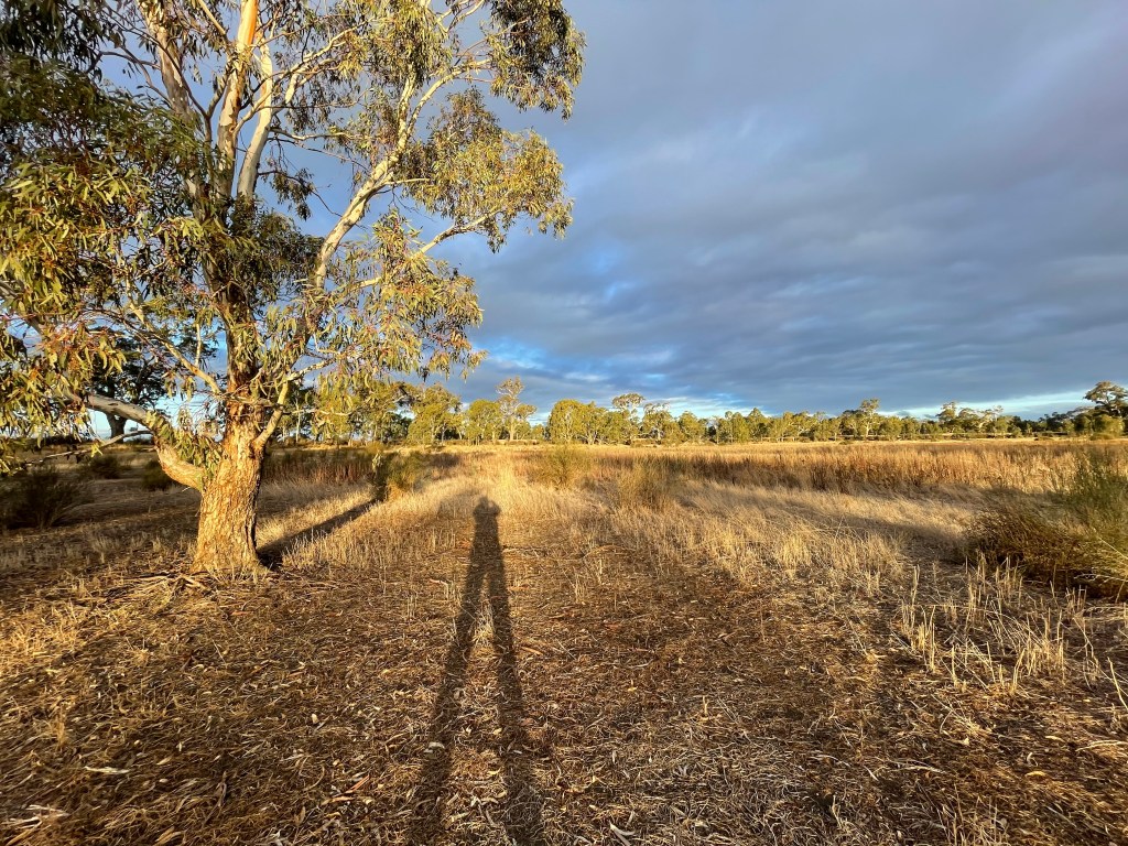
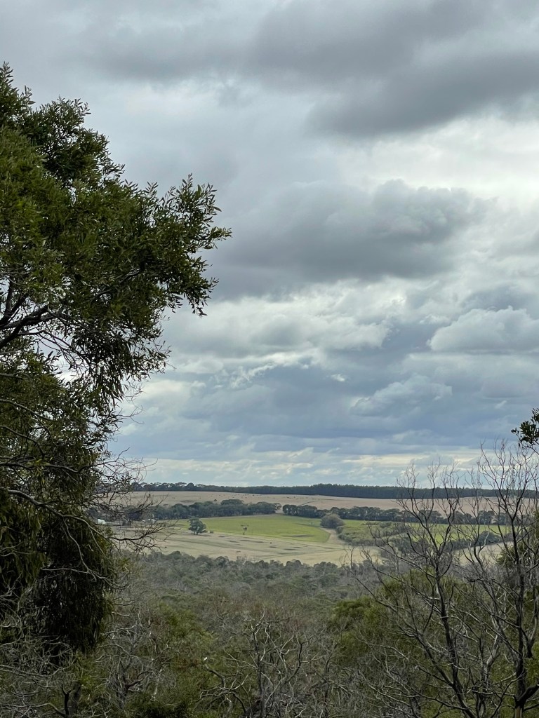
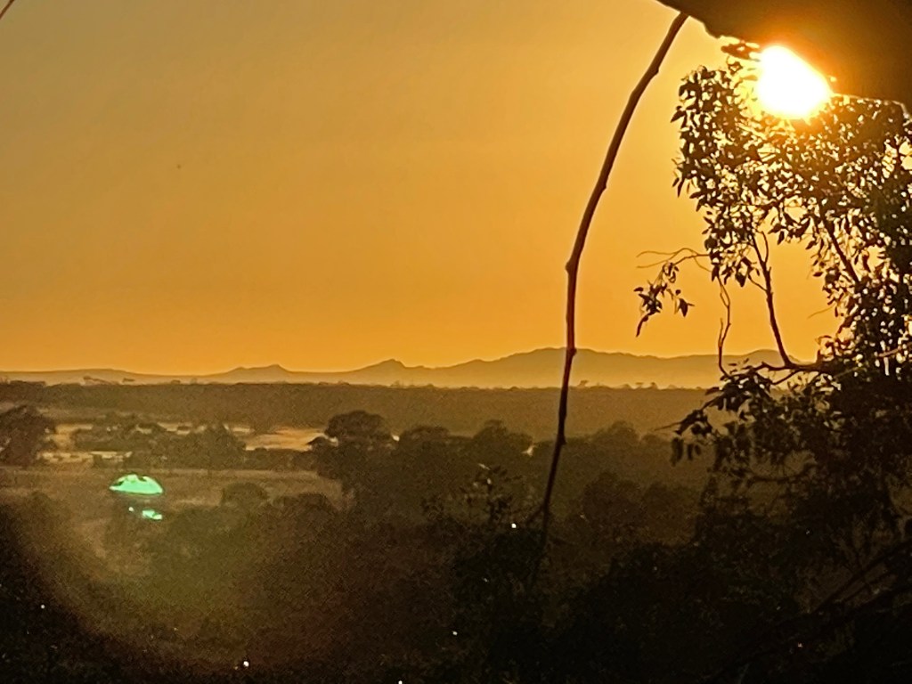
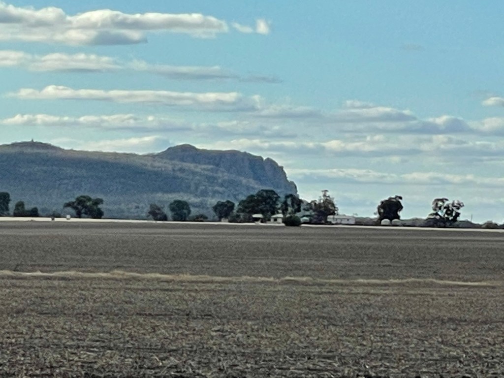
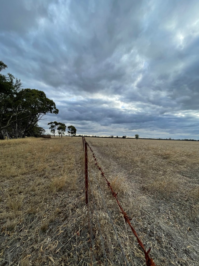
Along the Pink Lake Road, you come to a hill that really shows how far you are from anywhere. Some would find it soul destroying to look so far and see only paddocks but for others this provokes a feeling of ultimate freedom.
I choose the latter every time.
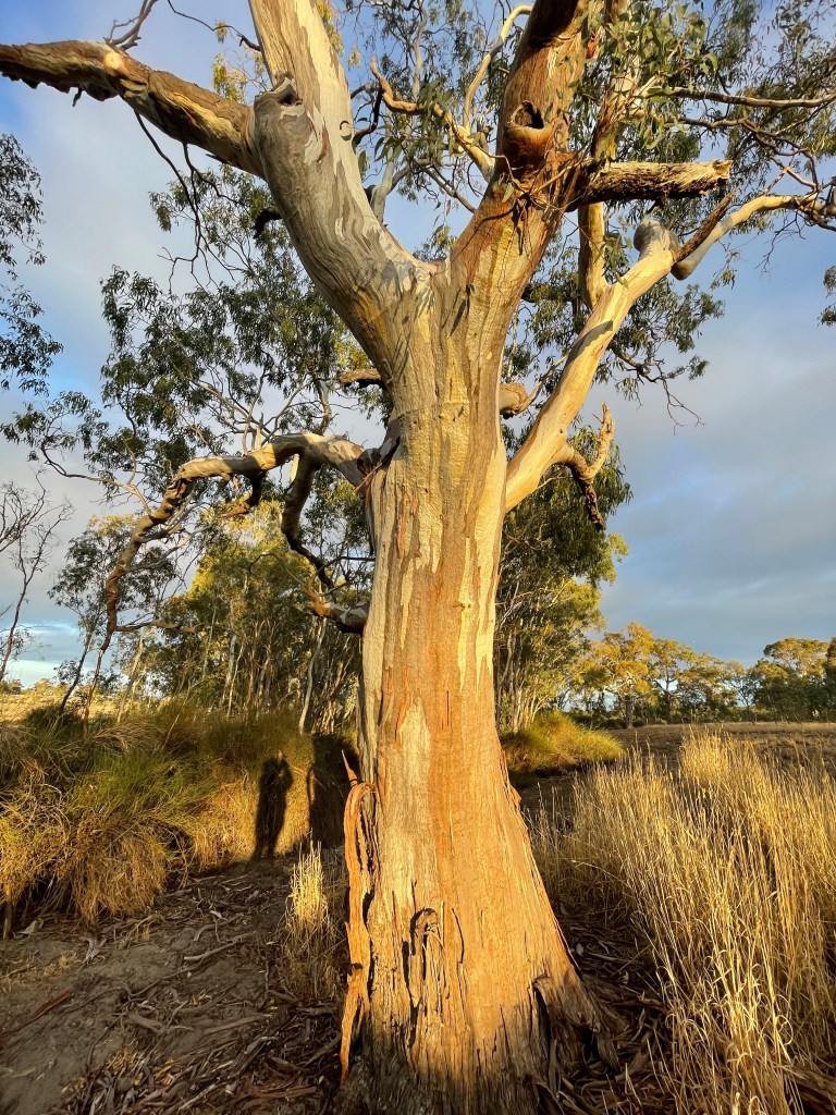
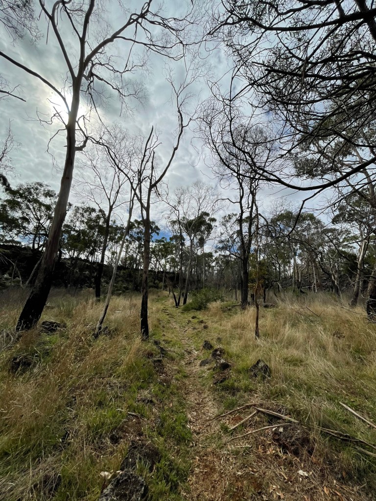
On arrival it seems a miracle that anyone could have found, let alone profitably exploited these remote salt lakes but that is exactly what happened – for more than 60 years.
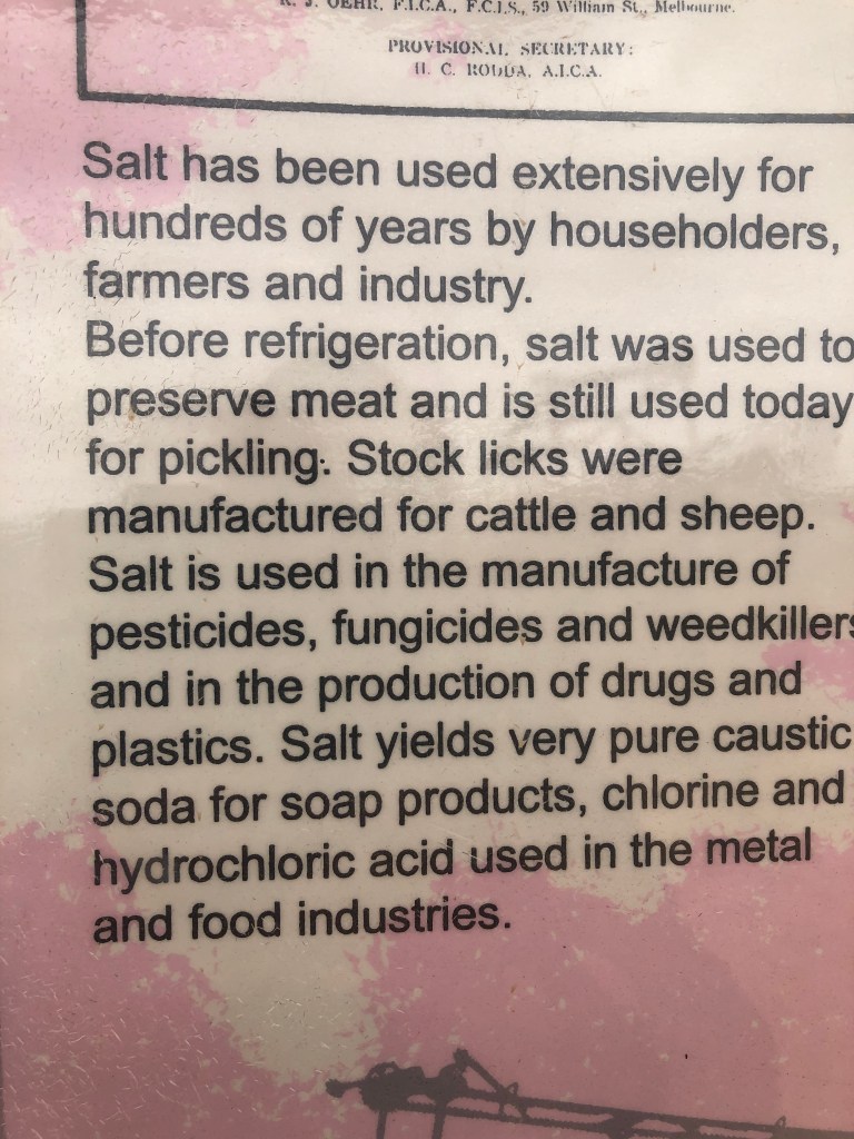
You have to remember salt was big business back in the day. It was vital for preserving meat, which was even more important in soaring Mallee temperatures.
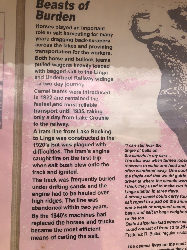
Pink Lake salt production started here during World War 1. Underbool store owner Ebenezer Jones was the man of the moment and he used a pick and shovel to harvest the salt.
In 1922 Afghan camel drivers began taking the salt to the railway at Linga and Underbool and in the depression the area provided work for the many blokes who took to the roads in search of employment.
World War two provided more lucrative markets for Ebenezer and during this time his workforce included Italian Internees.
The lease changed hands after the war, things became more mechanised and production continued till 1979 when the area became a national park.
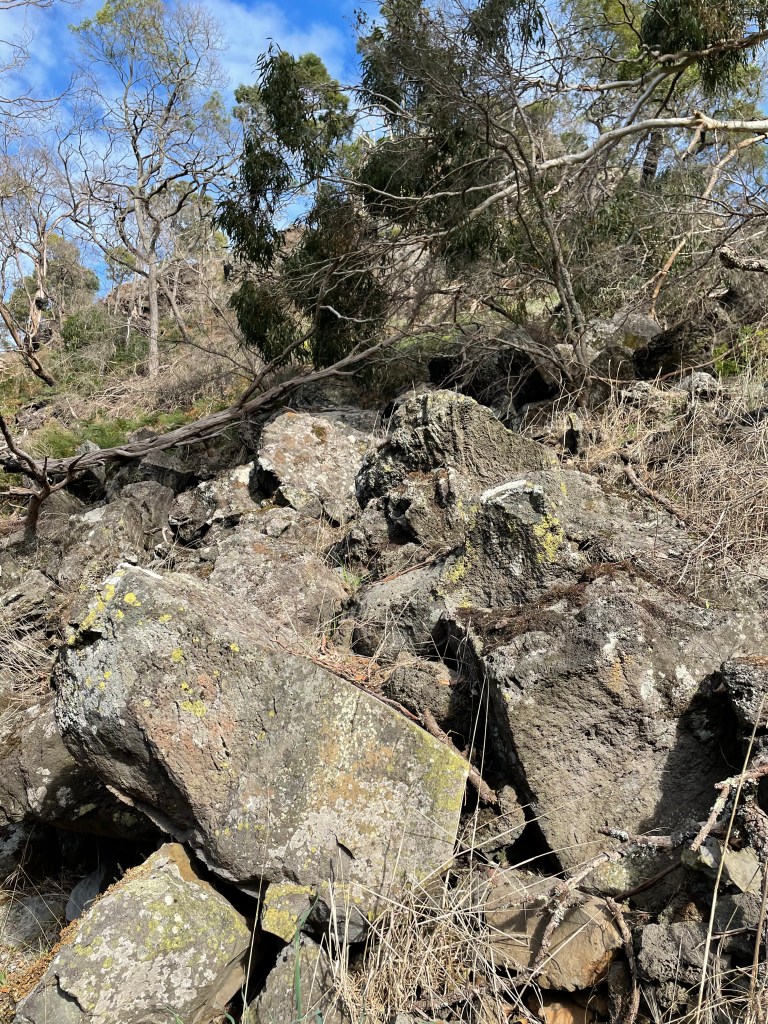
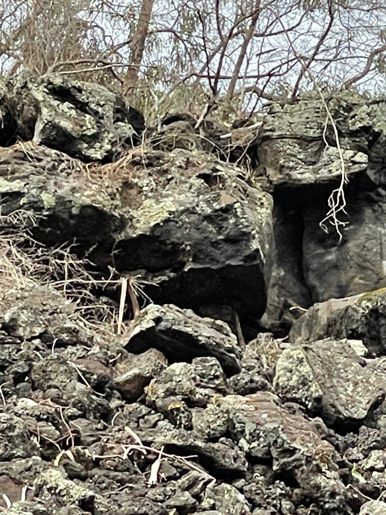
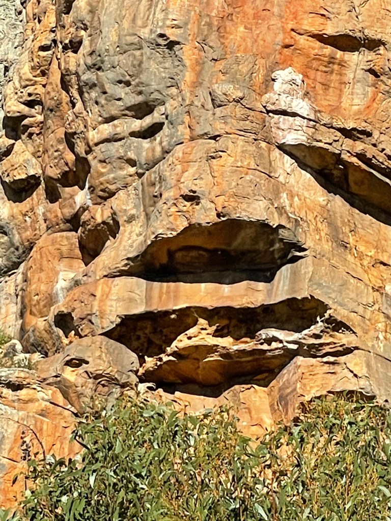
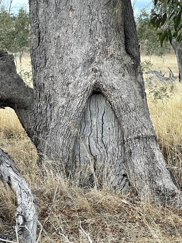
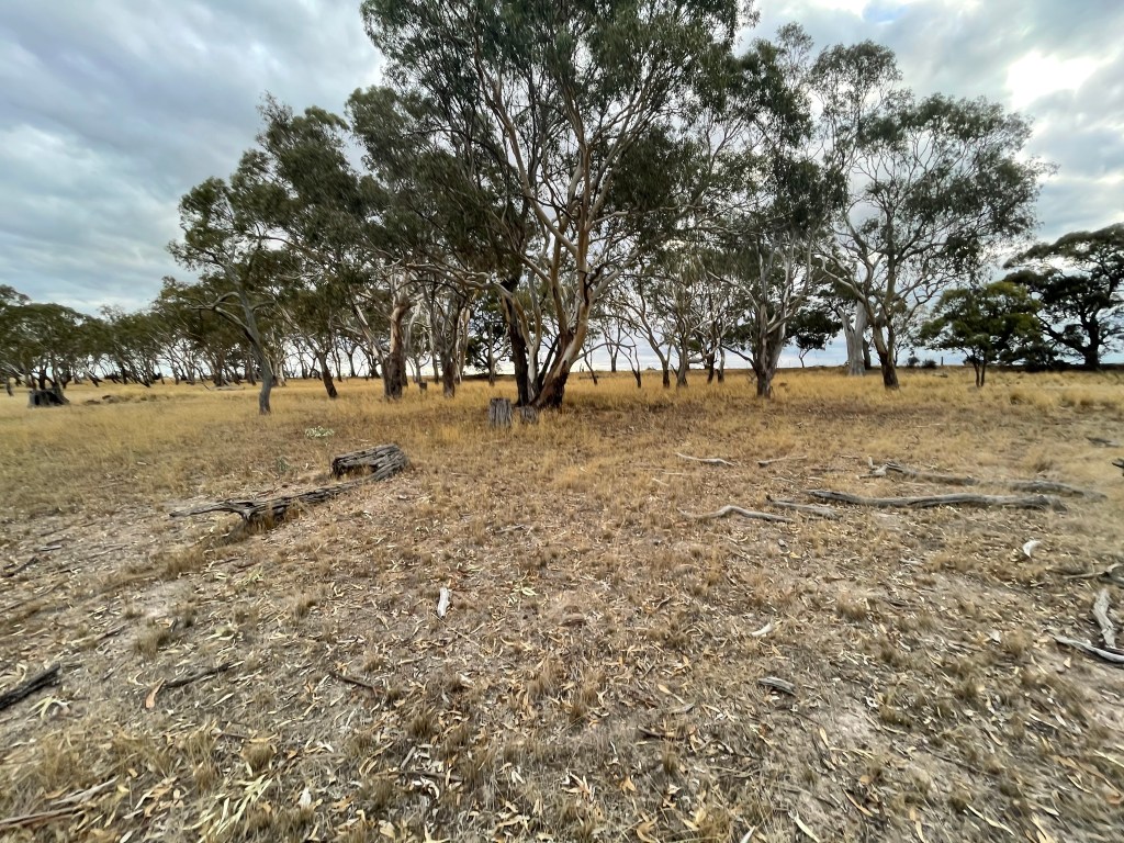
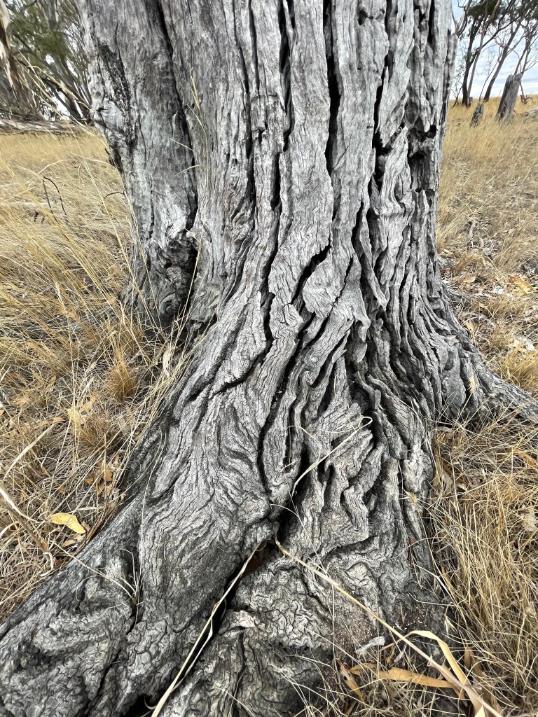
Today mechanical relics and mounds of salt stand abandoned on the edges of the Lakes, as they have done for the past 40 years.
It is a fascinating place but just make sure you have some insect repellent in the car as the march flies are as determined and relentless as old Ebenezer must have been back in the day.
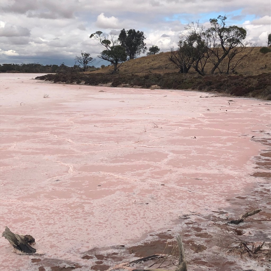
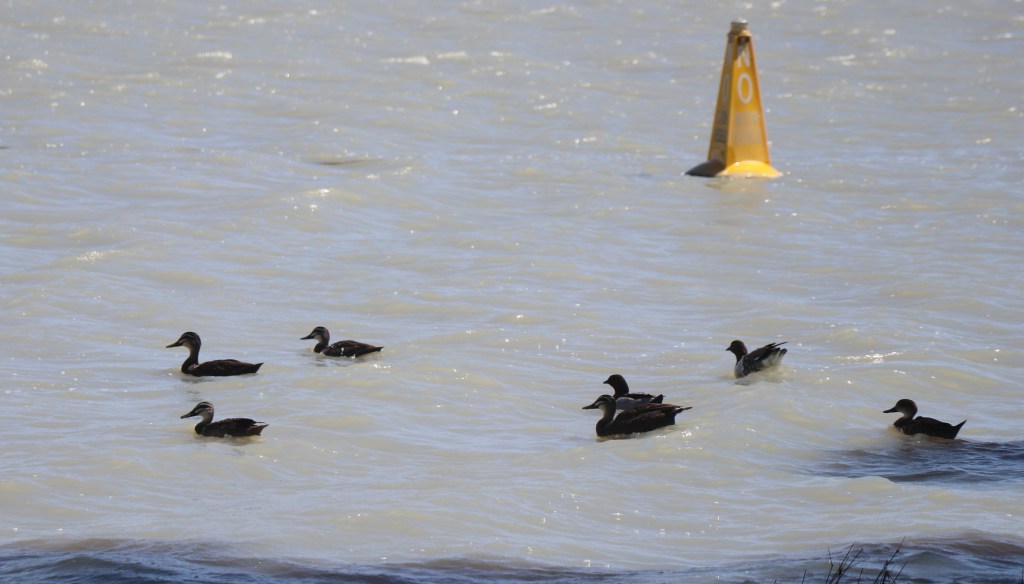
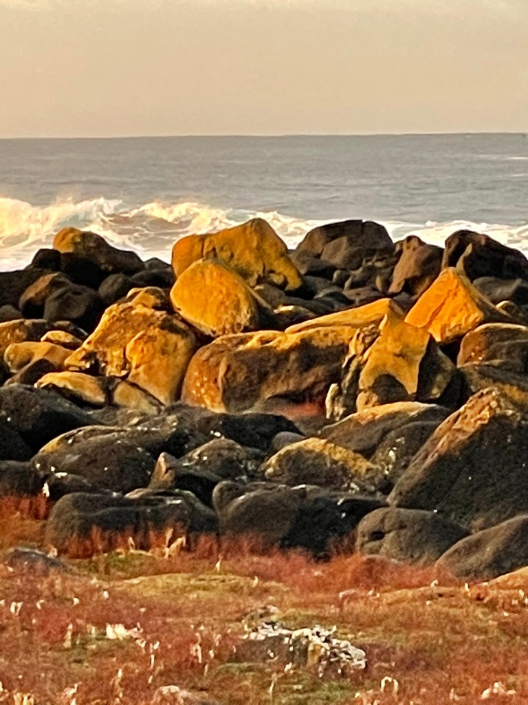
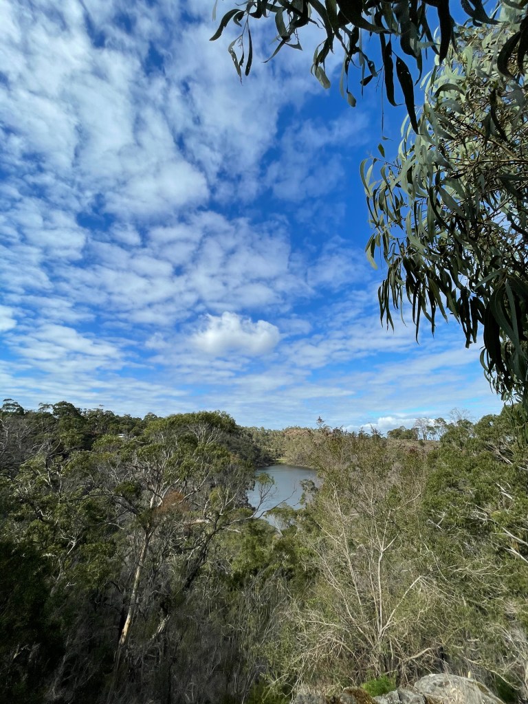
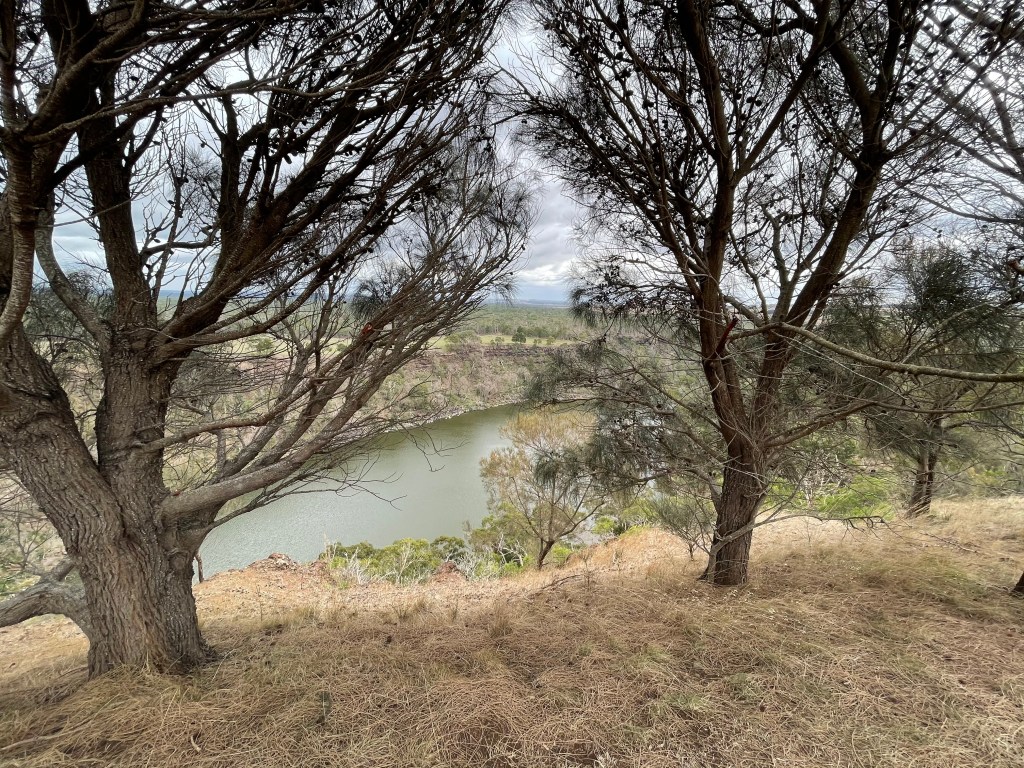
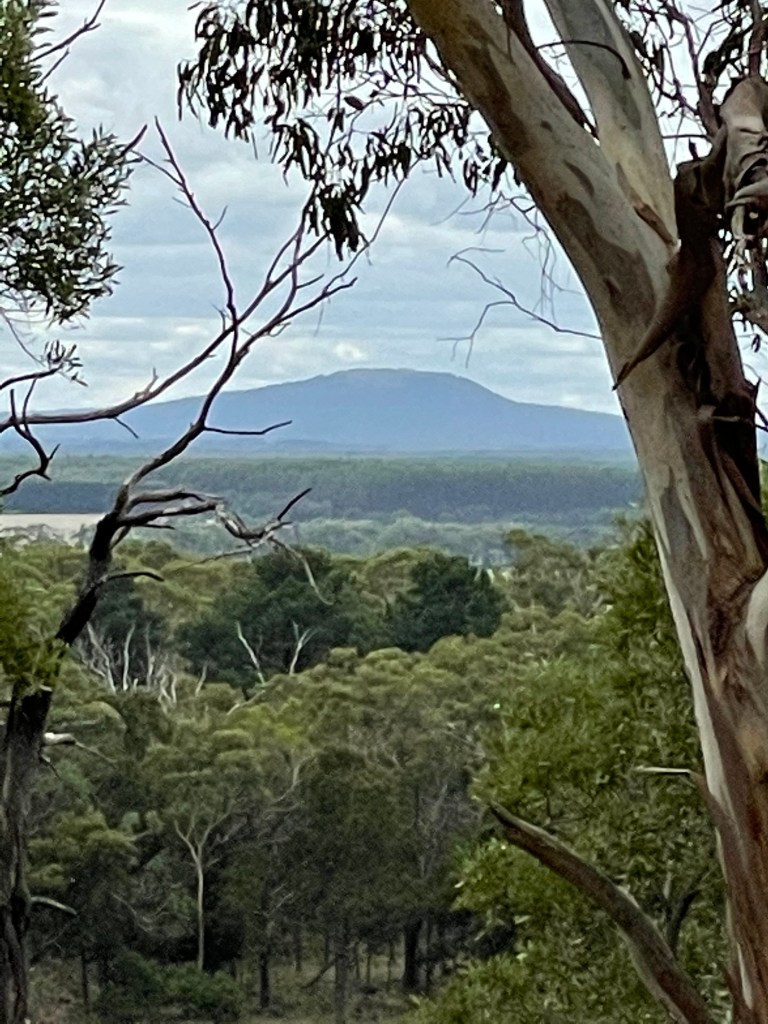
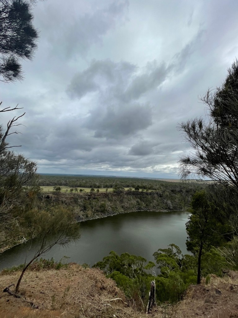
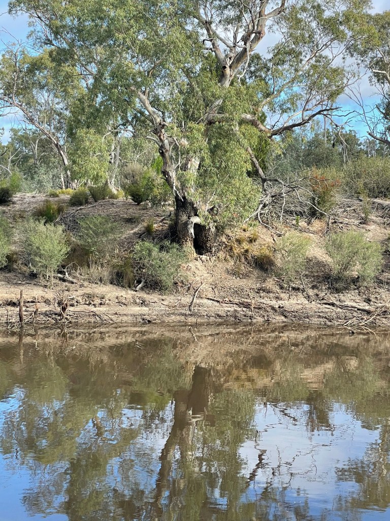
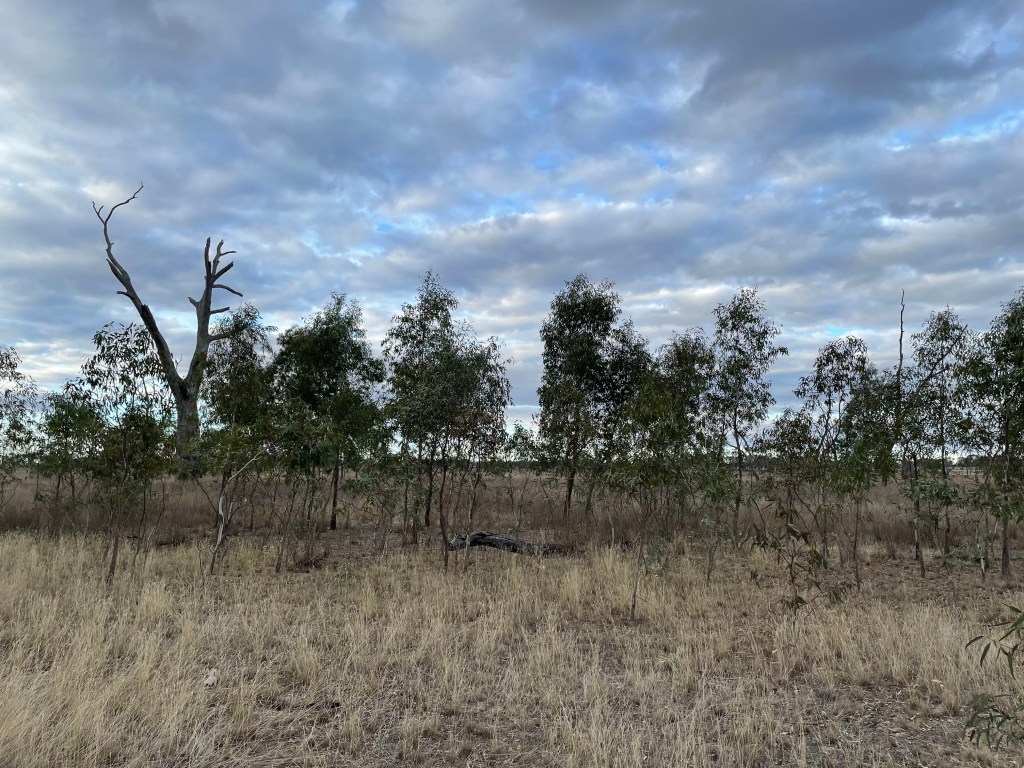
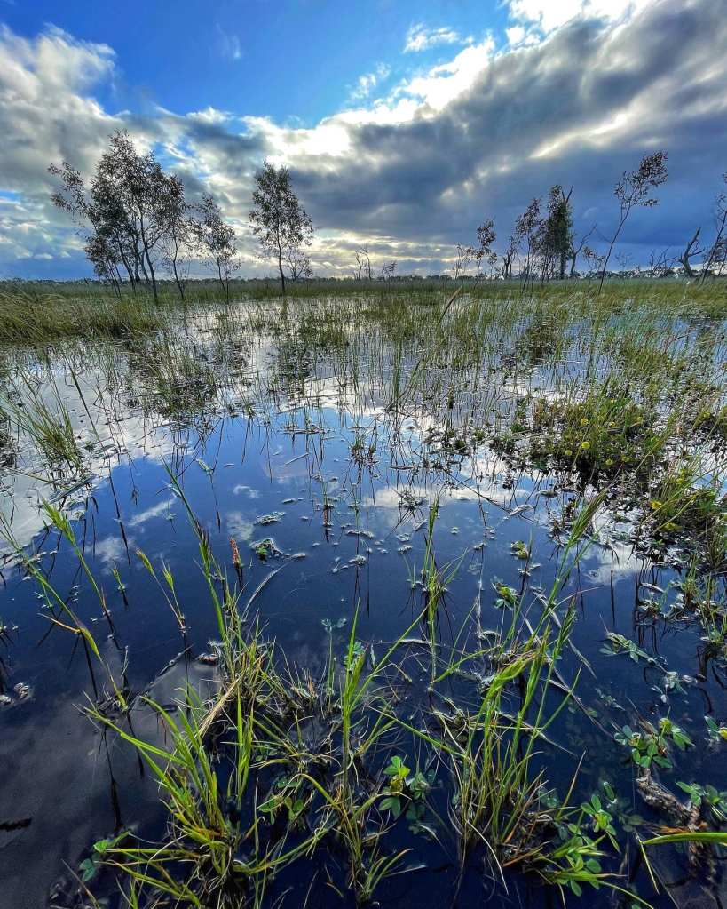
There are three lakes in all – Crosbie, Kenyon and Becking.
There is a track that would make a great walk around the site but time did not allow me to do much walking during my visit.There are quite a few interpretive signs that explain salt harvesting and industry and on the right days at the right time of the year the sunsets are amazing.
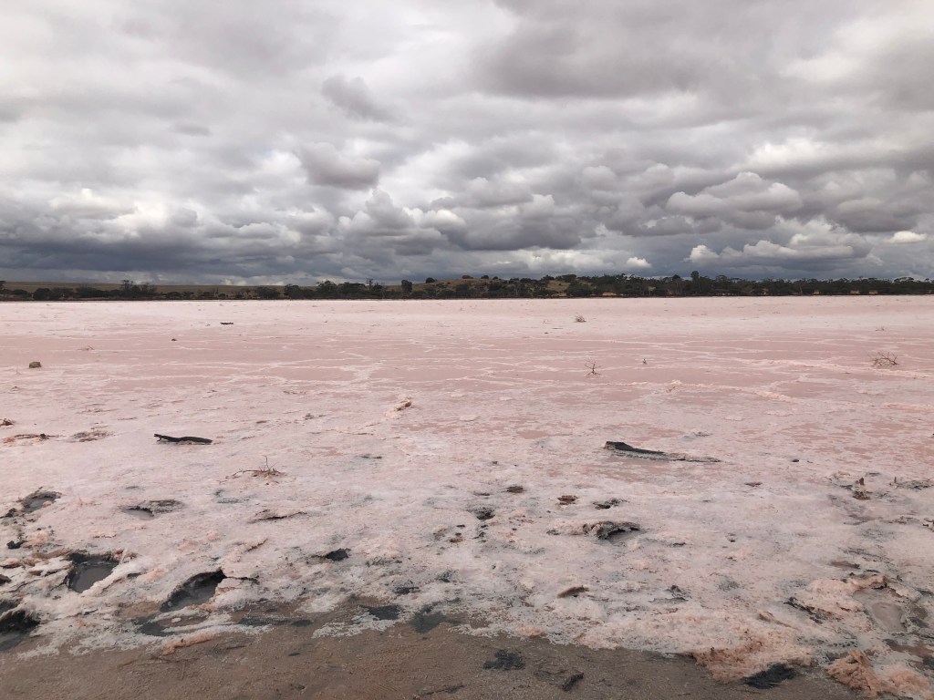
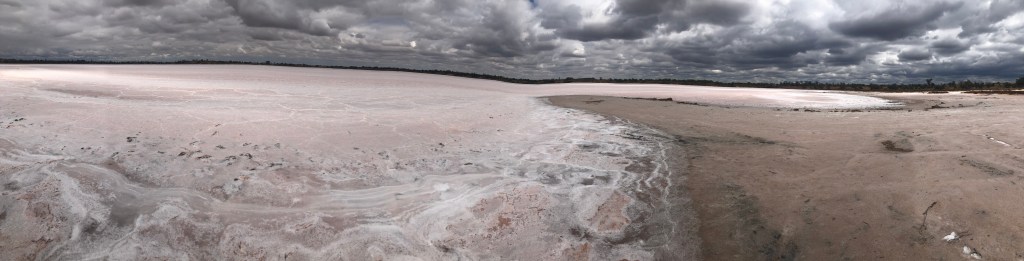
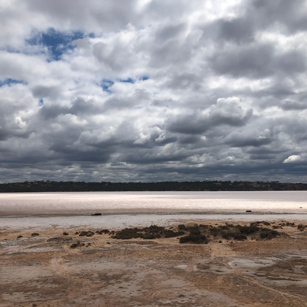
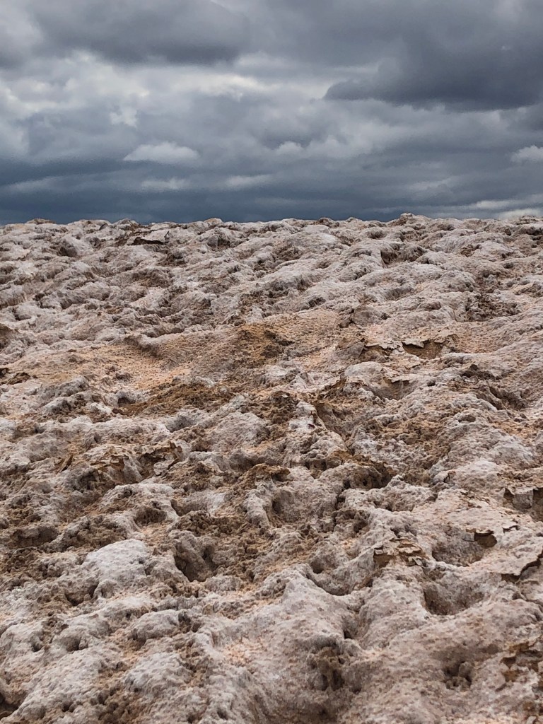
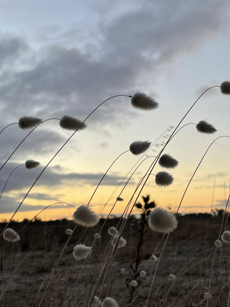
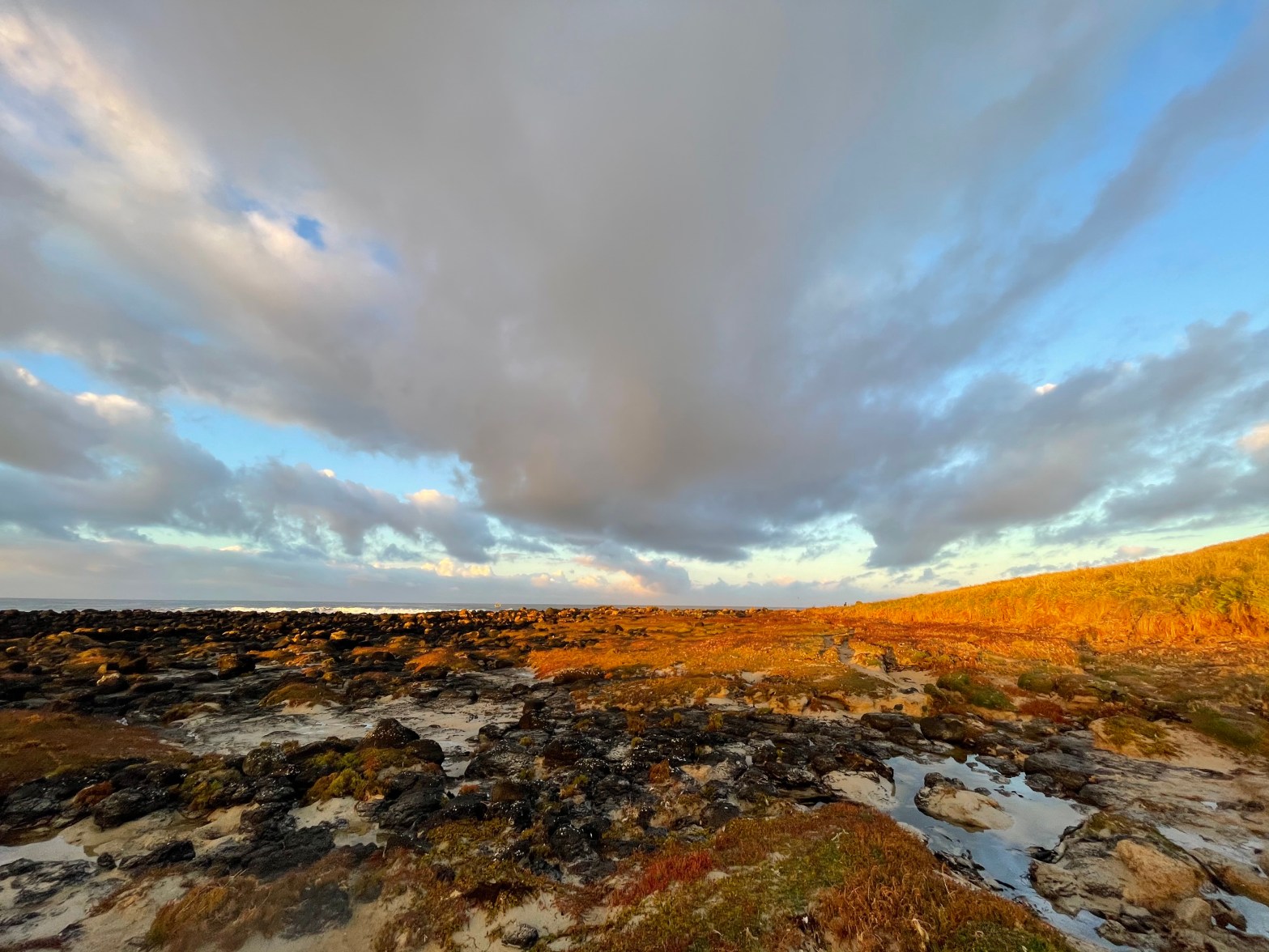
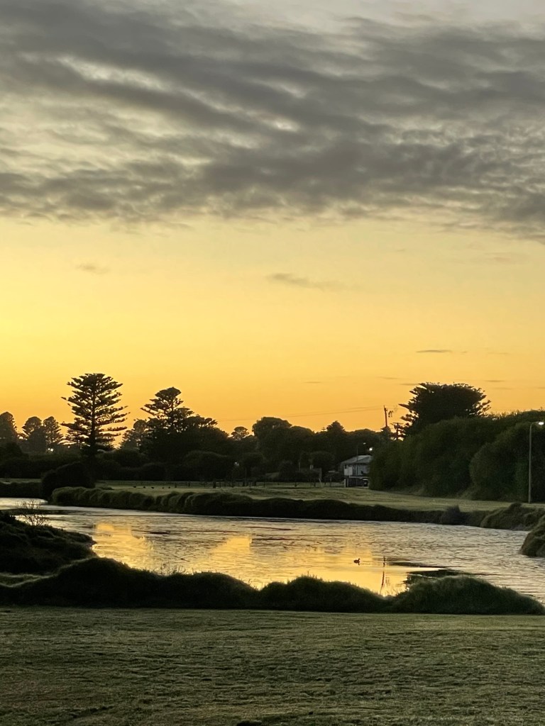
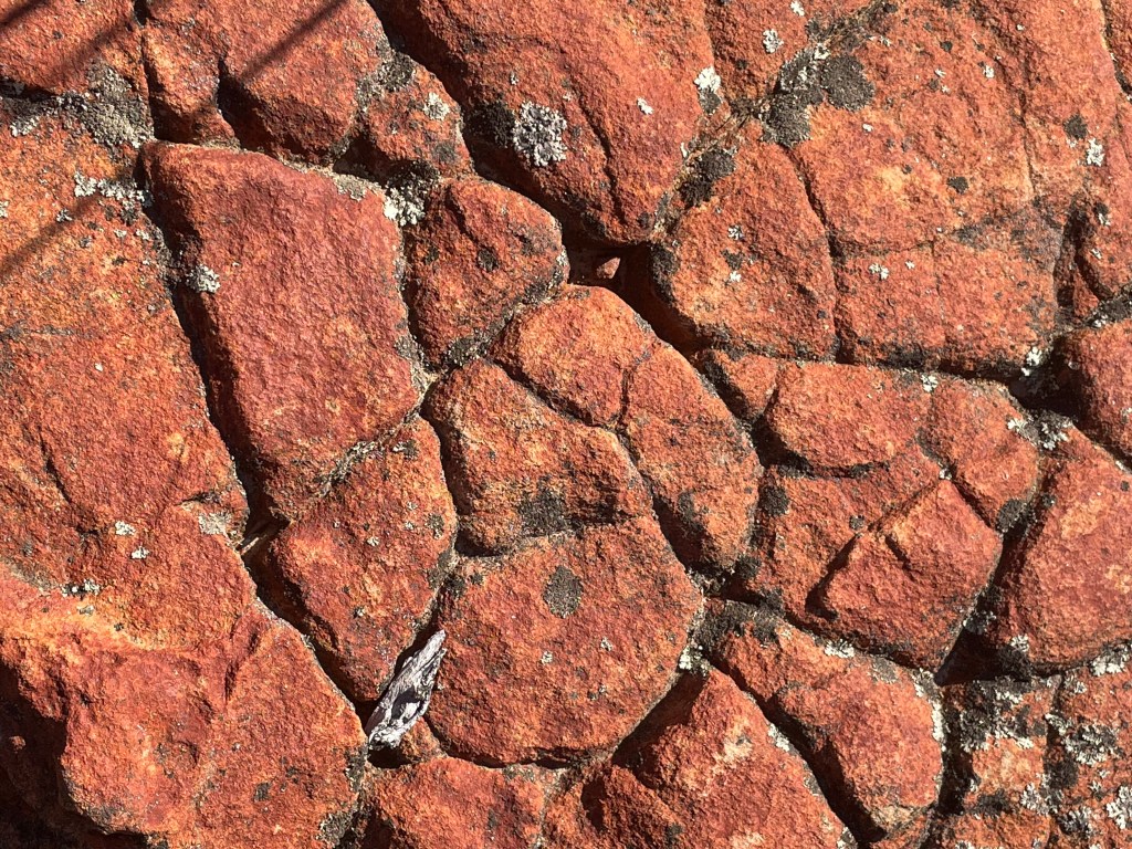
We are a few weeks too late to see water, but the big denim sky makes a great contrast with the pastel pink.
We don’t spot any wildlife but one long abandoned salt pile reminds me of a rough lizard hide another another looks like the sleeping goanna.
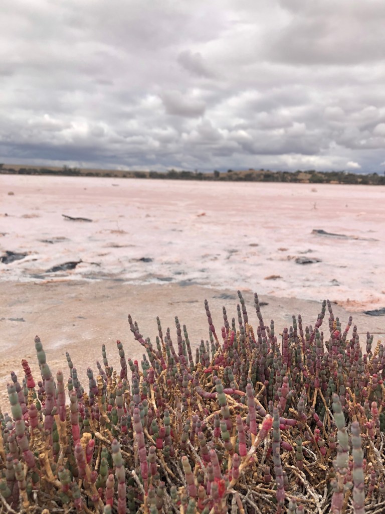
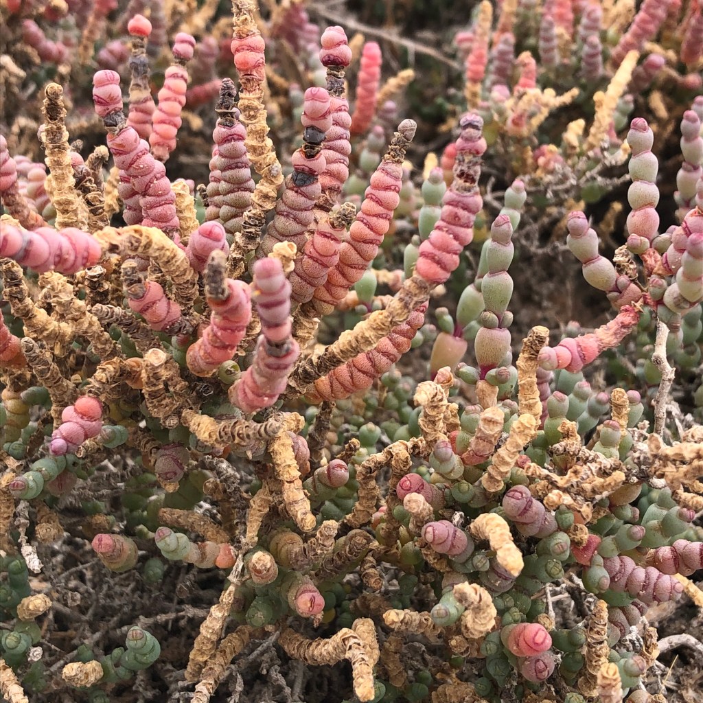
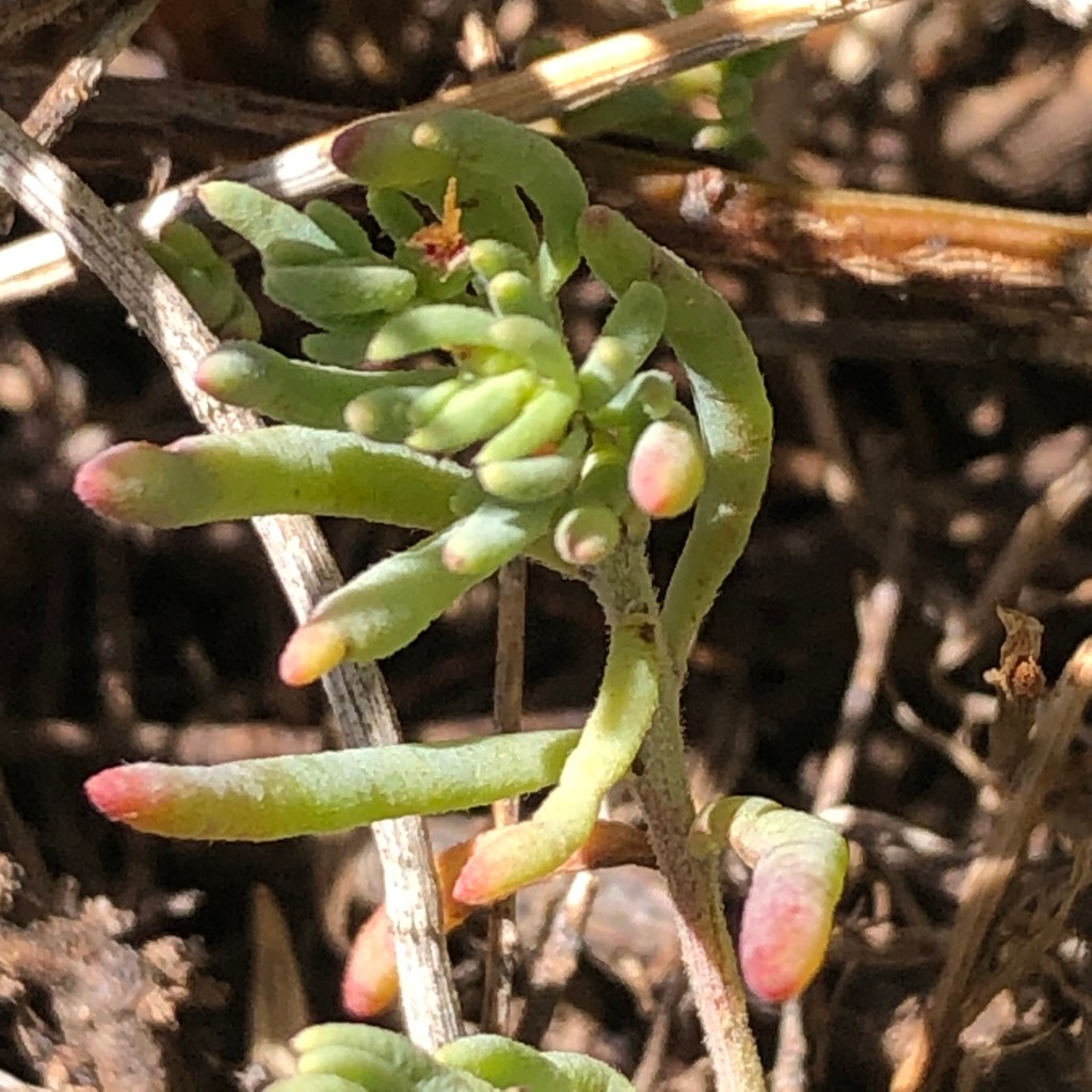
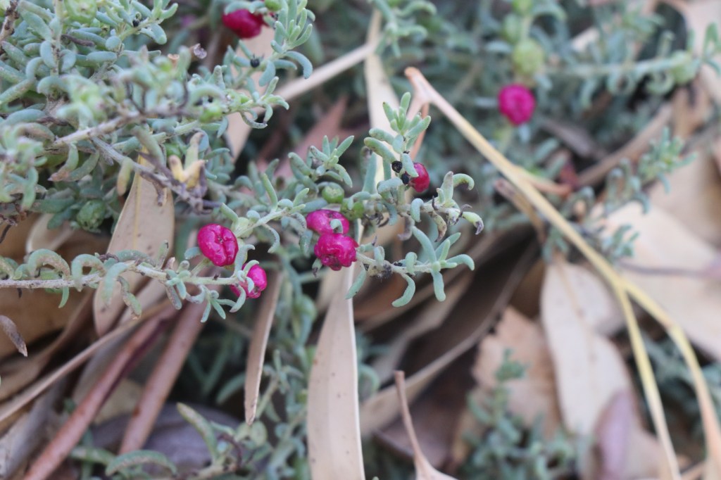
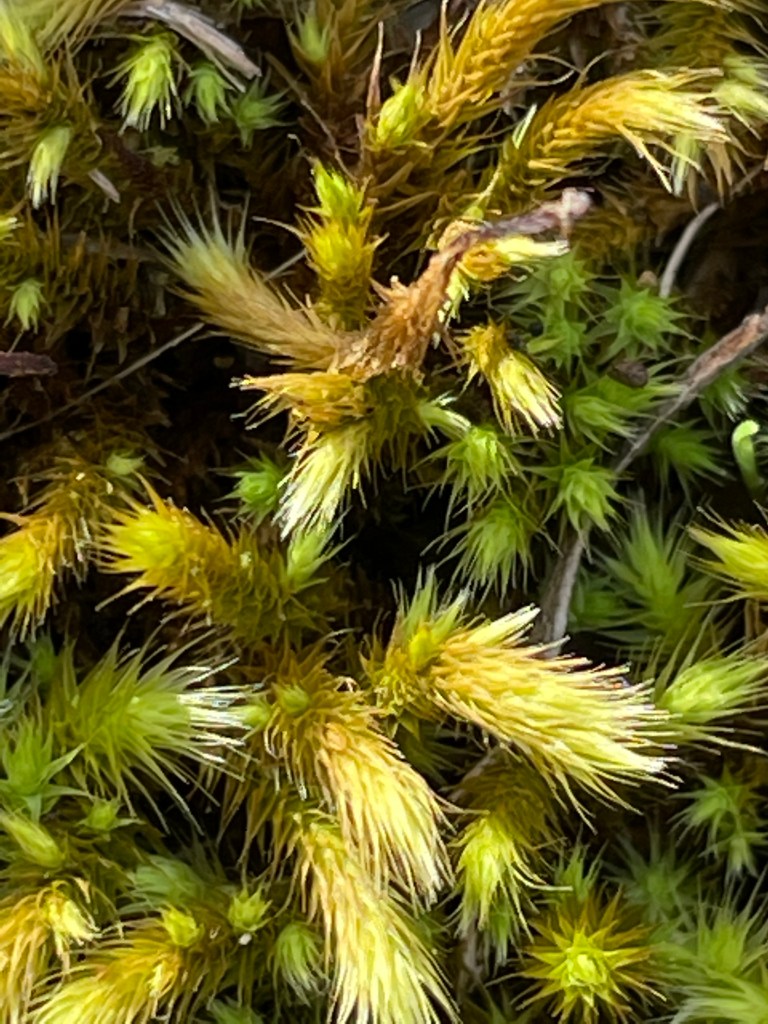
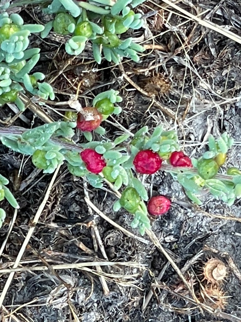
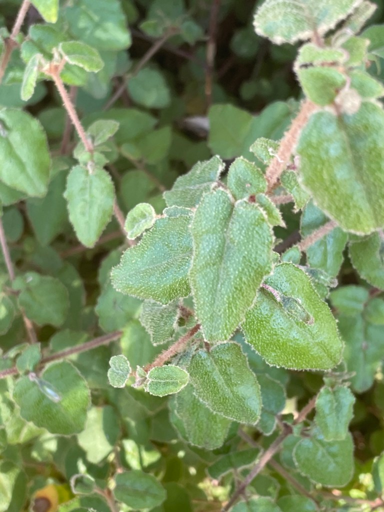
The salt seems to sit in waves and, just like pink lake at Dimboola, the lakes are home to salt tolerant succulents that mirror the shades of the salt.
It’s a beautiful but harsh, remote but much-visited, untouched but developed and well worth a trip to the Mallee.
What – Tchum Lake – lake, camping ground and reserve, about 4km walk in total.
Where – 10km from Birchip on Birchip Wycheproof Road
In 10 words – Oasis in a sea of crops – awesome box trees, running water
It sits is in one of the driest parts of Victoria.
Off the beaten track, tucked between open cropping country, sporting a fairly unknown name and probably the last thing you might expect to find
But Tchum lake – Birchip’s very own oasis – is well worth a visit.
On the northern tip of the Wotjobaluk Nations, it is about 10km east of Birchip and one of many lakes created during with Wimmera Mallee channel supplies in the 20th century.
Families in remote Victorian farming communities needed water for connection, sport and escape from the hot and the dry. Tchum provided that escape and – unlike some of its counterparts – it still does.
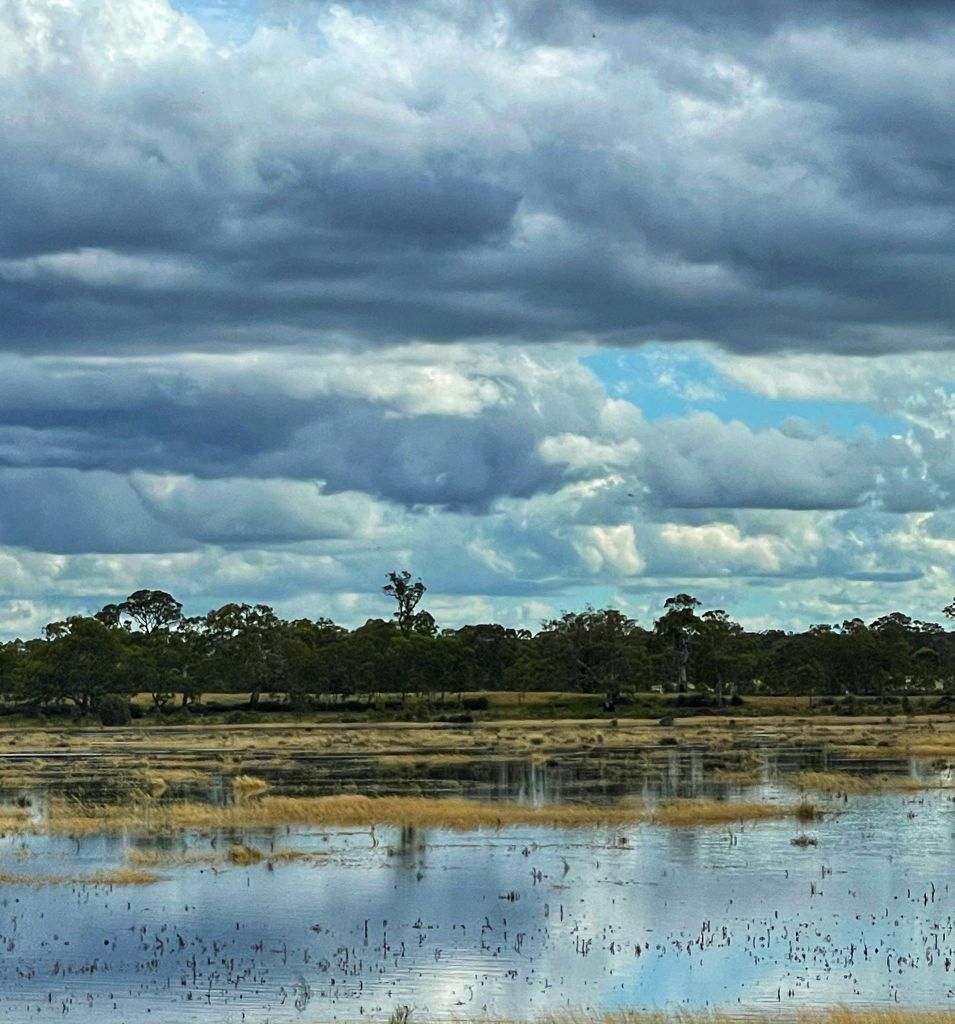
During the 1980s local farmers worked to transform a swamp into this lake which has become a haven for wildlife, swimming, watersking and fishing.
Dry seasons in the 1990s hit the water supply but, with the advent of the Wimmera Mallee pipeline, the community was able to buy an allocation to fill the lake each year.
Locals manage the lake and its campgrounds, with fees offsetting the water cost.
But the lake has not only been good for the mental and physical health of locals people.
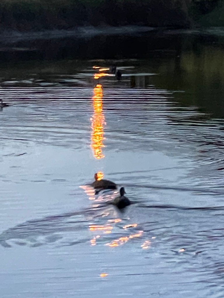
Wild life, including birds, frogs and turtles have also flocked the area including coots, egrets, darters, pelicans, swans and ducks.
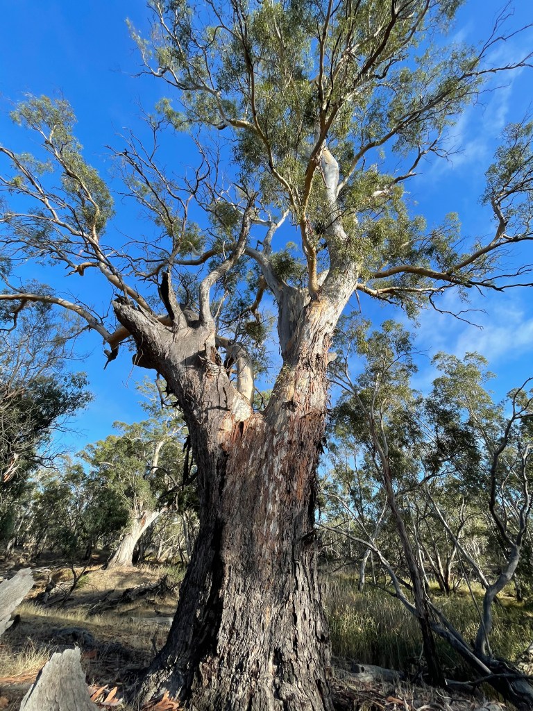
I start my walk on a track through a paddock of black box next to the lake which is part of a bike path linking the lake to Birchip.
Several sign explaining the site stand between clumps of gnarly old trees which possibly formed the fringe of the swamp and got their feet dampened in wetter years.
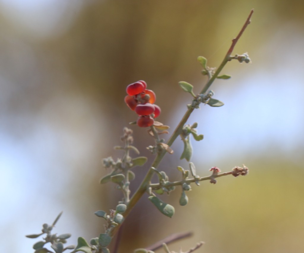
It is hot and dry and the southern Mallee does not appear to have any wet feet in a while. The ruby salt bush berries are burgundy and shrinking like sultanas and other the succulents seem very thirsty.
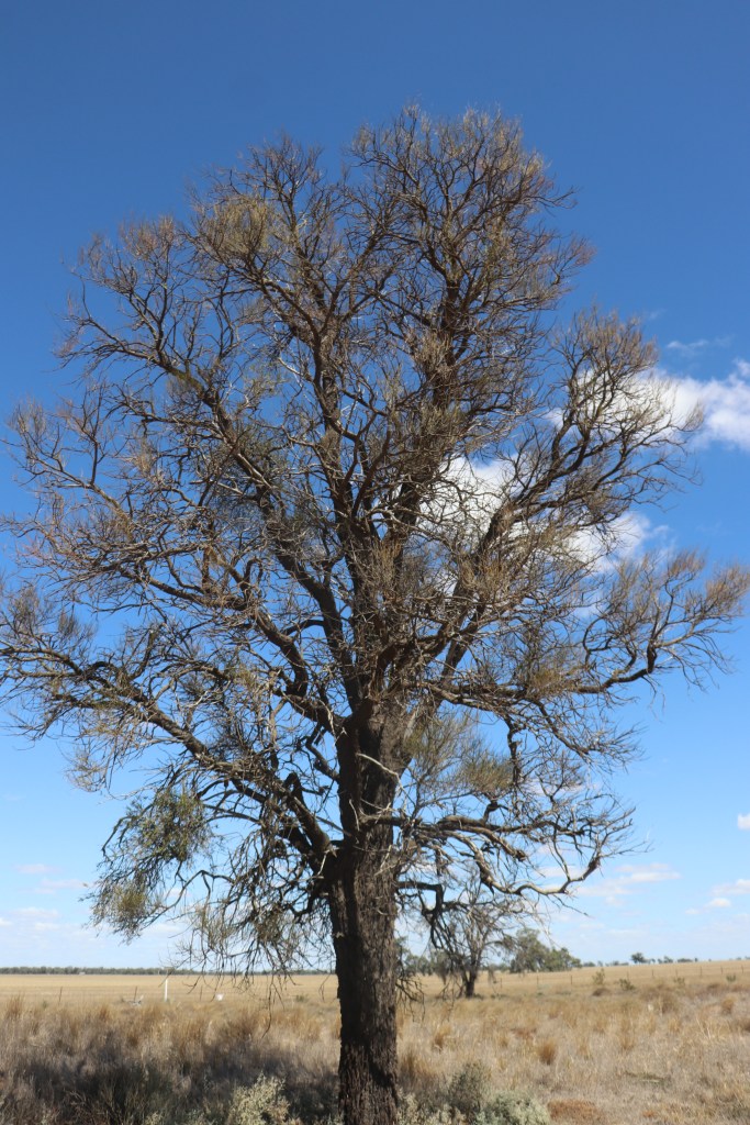
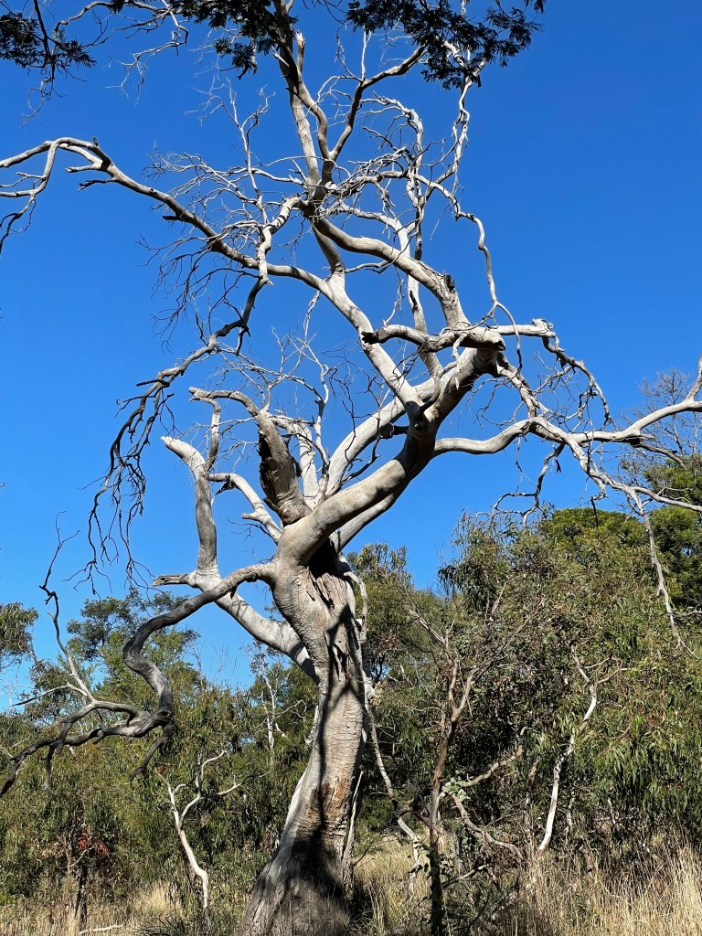
My wander along the gravel paths is a vivid illustration of the guts and determination it takes to live and endure in the Mallee.
The trees are grey and tough, the ground has visible cracks and many of the hand planted trees seemed to have simply said’ no’ and keeled over before get much higher than the tree guard.
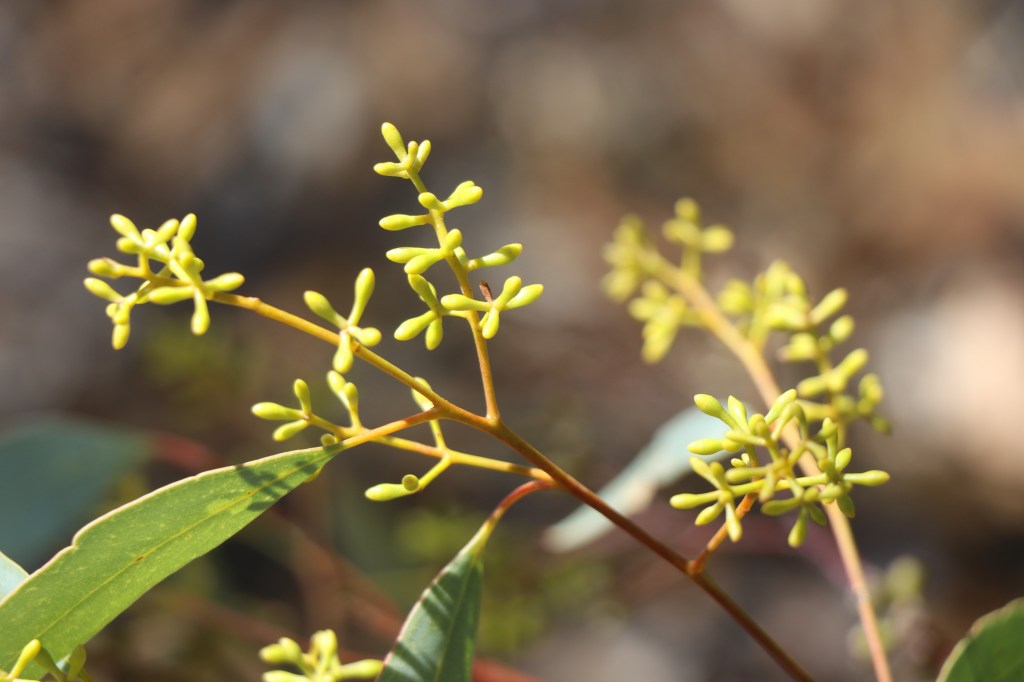
But then – just to prove you wrong – there appears bright red fruit on a salt bush, lime green buds on a tree and other hand planted trees bursting forth.
They never say never around here.
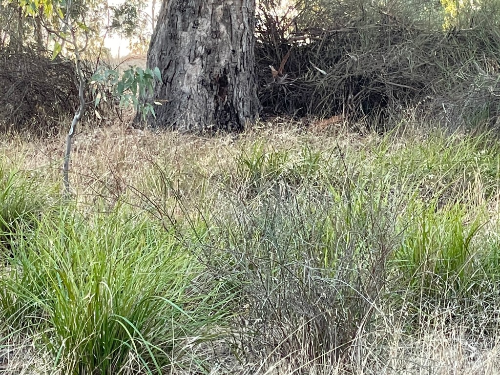
I return back to the lake and start walking around its edge – initially on the old swamp area beyond the bank.
Here there are plenty of long-time arboreal residents enduring in the sand, their horizonal roots growing on top of the ground.
Several others stand in a line – branches invisibly folded – defying the doubters.
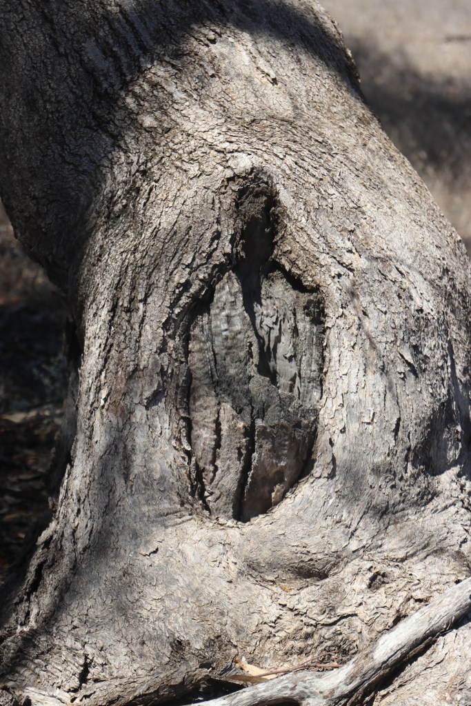
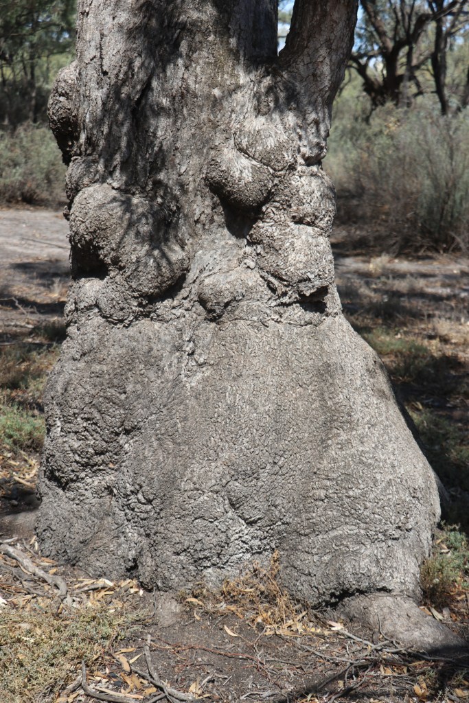
A camping area down the back features some shady trees, one with a trunk like an elephant foot and another with a small round scar. They probably did not need a lot of canoes up here very often.
Then, when I climb up the bank to the lake the world changes. There is green grass, big red fruit on the little salt bush, robust introduced trees and the sound of water lapping.
Several campers laze by tents and a boat bobs gently at the water’s edge. There are even a few rabbit burrows so there must be plenty to eat around here.
Around near the main facilities I see swimming area with both a floating pontoon and a mob of ducks both rising and falling with the waves.
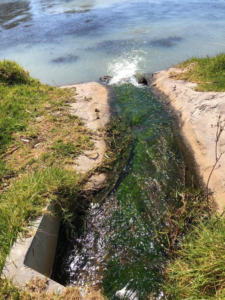
Planted shrubs form a buffer between the lake and the road and towards the western side I hear the sweet sound of water flowing into the lake.
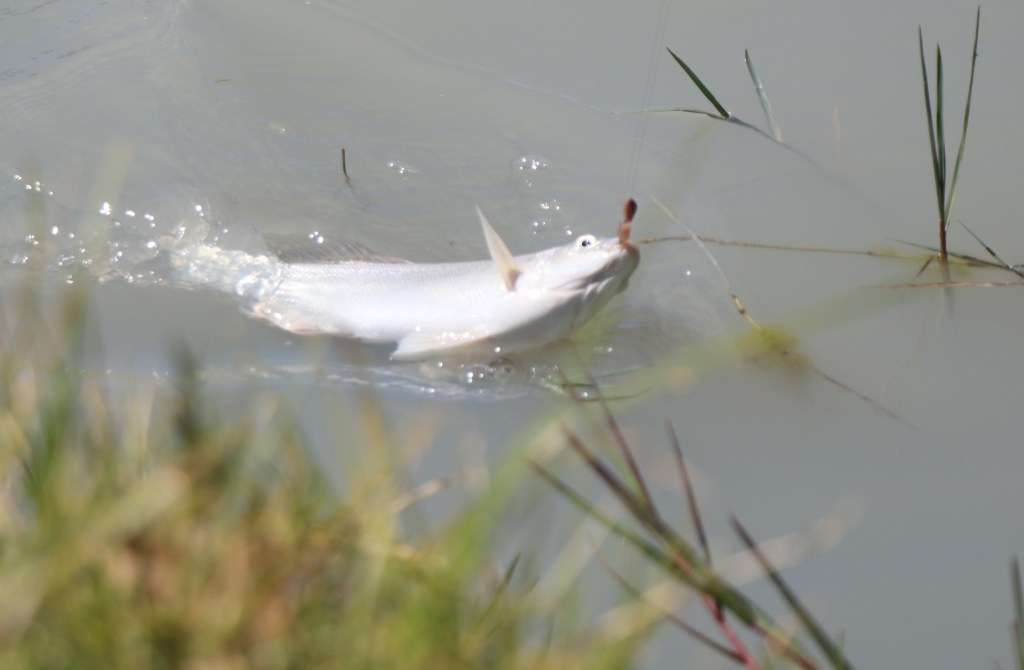
I see fish caught and watch insects gently cruise along the shore.
It is an oasis and like the tough old box trees, it defies our view of the thirsty Mallee.
It is not the easiest of environments, but the trick is finding out the best way to work with it and the people of Birchip have done that. – and very successfully.
What St Mary’s Lake – dry lake and reserve. 5km walk
Where – Tooan Mitre Road, Tooan
In 10 words – Beautiful beach, great trees, quite kangaroos – there’s something about Mary
It has been a busy few weeks with a sick mother and one-legged one-armed son so walking has been a bit of a challenge.
Not to be beaten and I steal away late on Sunday to explore St Mary’s Lake, Tooan.
I was first here in the 1990s, camping and catching yabbies – something that probably has gone on for 1000s of years.
Today the yabbies are sleeping way below the sand and dry St Mary seems slightly, dishevelled and abandoned. But like most things in the Wimmera she’s a survivor and it does not take long to get the feeling this place had plenty of character.
She sits just across the paddocks form Mount Arapiles – Dyuritte – where traditional owners have for thousands of years, maintained deep spiritual and cultural connections.
Recent cultural discoveries at Dyuritte have included rock art sites, artefact scatters and quarry sites.
Googling did not find any sites at St Mary’s, but standing on the rise overlooking the big lake area – you imagine it has been a good place to prop and to find a feed for 1000s of years.
That is probably what white fellas Messrs Glendenning and Urquhart also thought in 1845 when they decided to create a St Mary’s station in the area.
In 1884 the Shire of Arapiles formed at a farming village by lake and 10 years later an Arapiles village settlement was formed in the same area.
On New Year’s Day in 1909 the Tooan Sports events were held here, complete with foot and horse events and a ball.
Today it is hard to imagine a bustling settlement anywhere near here. There is no cheering or horses or music – only the gentle wind, distant tractors sowing into dust and resident birds.
I start at the top of the grand tree-covered lunette on the eastern end and follow the track around the northern bank. The shore has an impressive beach and must have been a great place to sit and watch the day go by when there was water in lake.
While the lake is ringed by giant eucalypts, the lignum that grows in the sand beneath them is perfect for rabbits. And lots of them.
It does feel a bit bleak along this stretch of the shore. An old sign rusts on a tree trunk, a stretched-out dead fox grins hideously at me and, over the fence in paddocks it’s just stubble and dirt where emerging green crops should be.
But don’t panic, there is still life and beauty in this old lake.
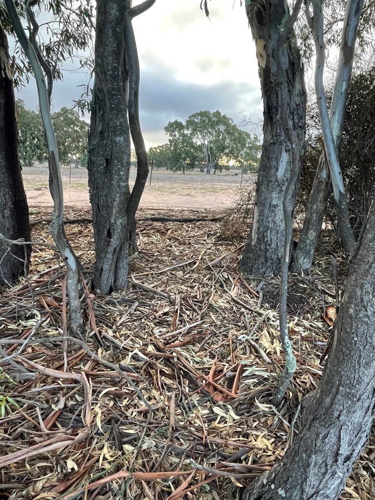
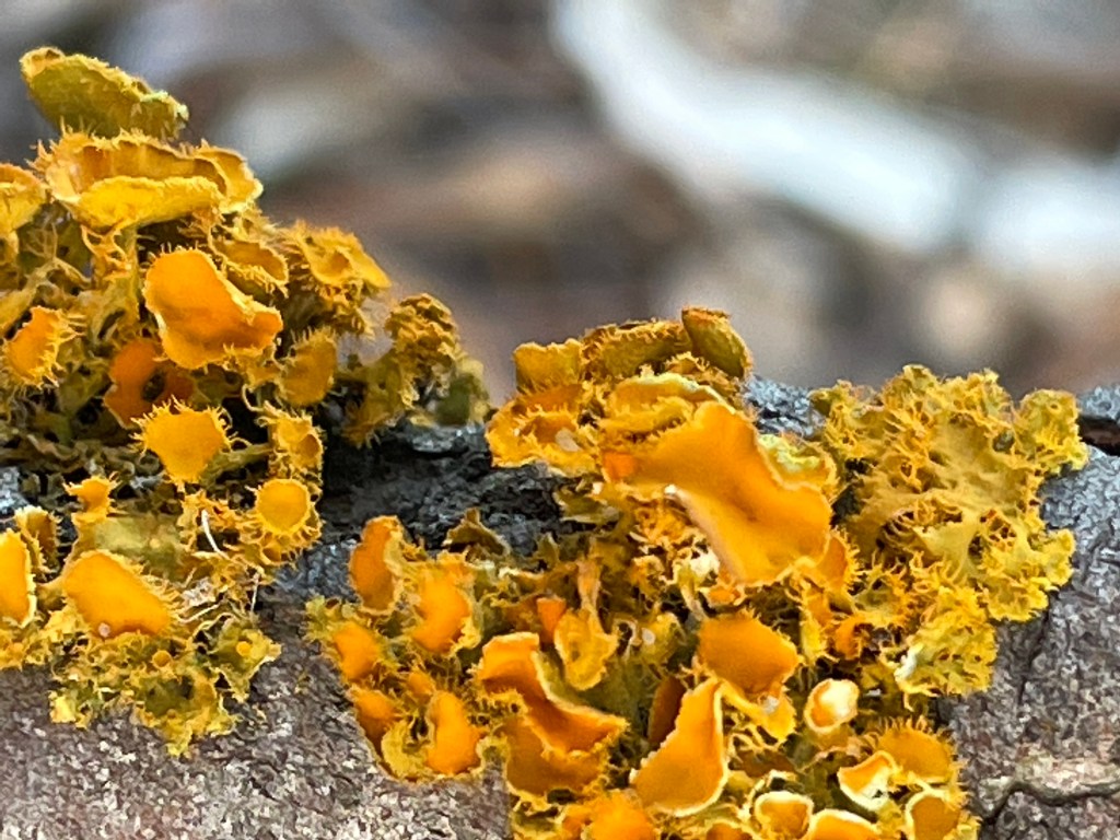
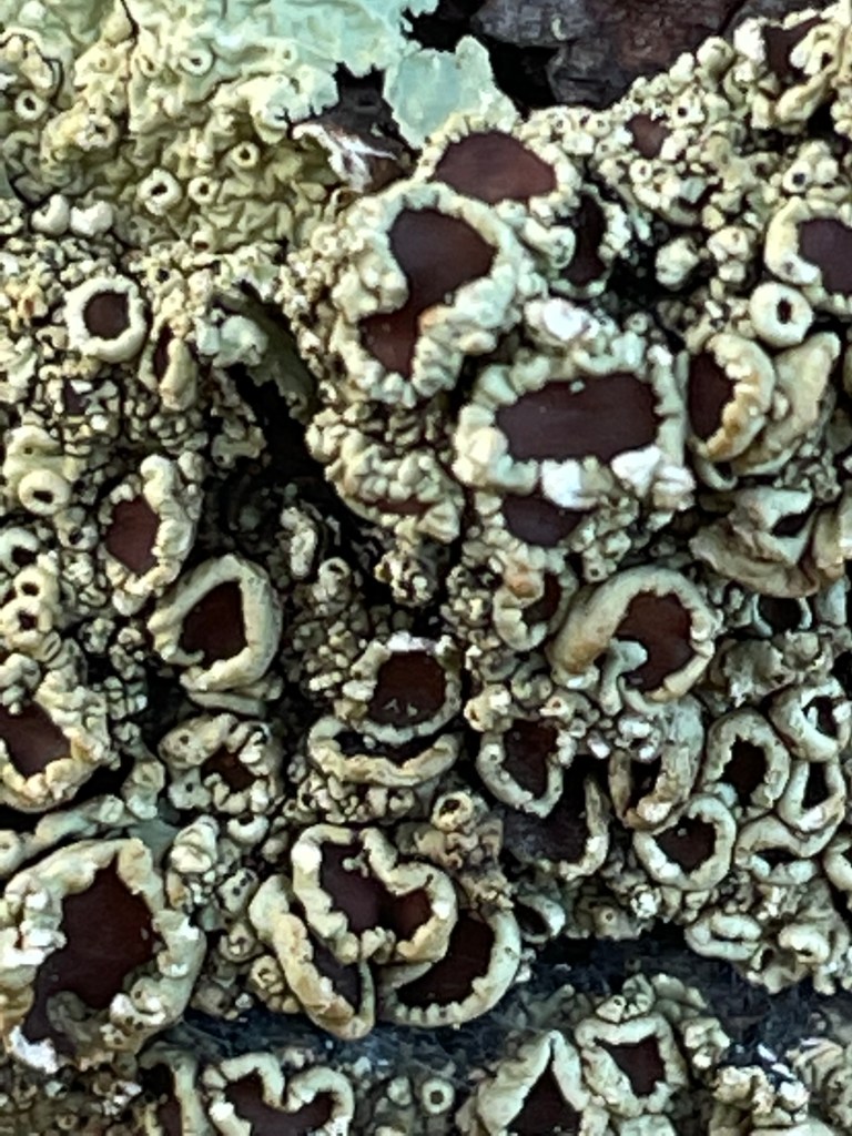
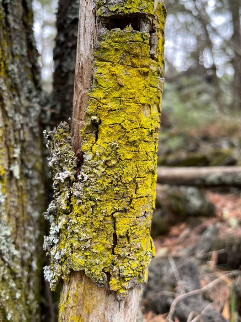
Just take the dionellas growing like weeds along the shore line. And the stunning and colourful lichens – bursts of curly golden-orange ‘flowers’ and chocolate ones with a bubbly white borders.
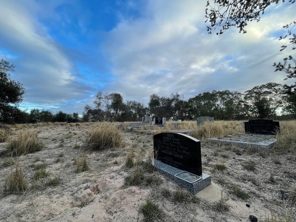
I come across a row of pines, veering away from the sandy track. It all seems a bit ordered for this wild place and a bit further along I see why. It was a track to a cemetery – although I reckon they might need a hearse with 4WD. I double back and take a look.
What a place to ‘rest’. The cemetery ‘garden’ features lemon-coloured banksias growing randomly right across the site. Resident caretakers are a community of noisy, happy birds which only add to the charm.
For a cemetery it is a happy place and as I wander around I see it residents include our past favourite veggie grower Reg O’Connor. I reckon he would love those flowers.
It seems odd it being way out here, but when you think of all that settlement action in the 1800s, it makes sense.
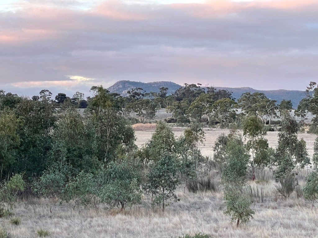
I head back to the track and get an awesome view of Arapiles or -Dyuritte – the late afternoon sky is ominously grey and matches perfectly with her rocky curves.
To the west I discover a second smaller lake with steep a bank covered in flattened long grass resembling long blonde hair. Would not want to get the knots out of that lot.
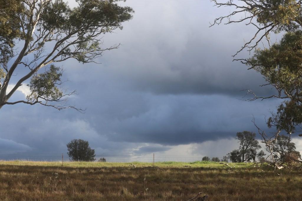
It’s a nice little wetland and I wander in to explore just as the sun emits some last gasp evening light. It makes for great contrast against an increasingly angry grey sky.
The sun gives me a shadow of someone on stilts and birds don’t like it – or probably don’t like me really. Would not get a lot of visitors I expect.
I am glad I have a coat and hat as the sky gets even darker.
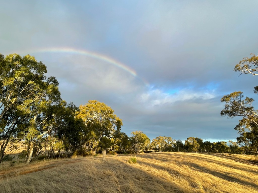
I get moving and head back to the track, passing what looks like scar tree at the lake edge. All of the sudden sun shines right on that tree. Is someone telling me there is plenty of history right here? I think I already knew that but thanks for the heads up.
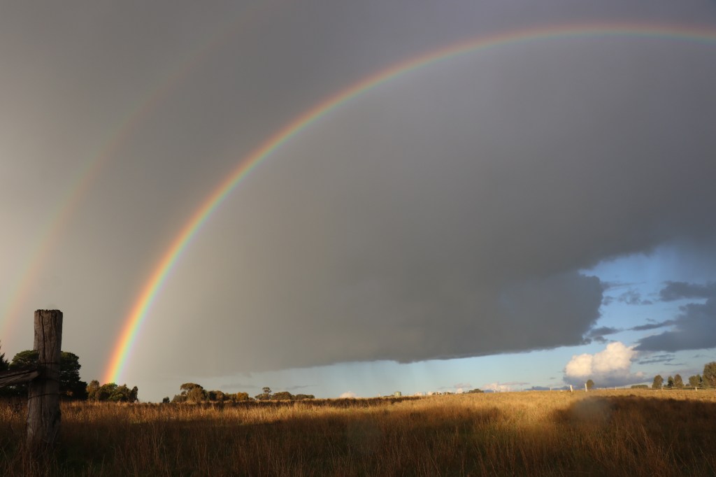
Then, to top it off, I get a rainbow.. Lucky day.
The lake’s western shore looks like it might have been a popular camping place in the 20th century. There are tracks in and you can see some ‘people rubbish’ lying around.
The lake bed and Dyuritte both take on a glow and the sun chooses various trees to spotlight. The sky is now blue. Bonus, I really did not want to get wet.’
Round a little corner I find a few healthy ruby salt bush growing, lots for dionellas and come across a stand of bulokes looking beautiful in the evening glow.
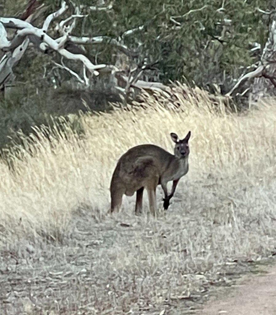
I also get pretty close to a couple of kangaroos too busy feasting by the track to notice my ridiculously loud rainbow hat.
I can’t stand here like a statue forever and finally they see me and do the bolt.
On the southern side of the lake I find the inlet creek and see a lot of young eucalypts – probably a result from the last flood.
There are piles of shells and some delicate pussy tail weeds and the sky takes on shades of lemon, dusky pink and grey at different shades and intervals.
It is getting pretty dark when I get to the car but it has been an awesome walk.
It might be more like a desert than a lake but St Mary’s is not dead – There is still plenty of life in this old girl.
Update spring 2022
There is life in the old girl and in November 2022 the waters began flowing back in. See some images of below taken on November 13, 2022
How – From Horsham – 50km south on Henty Highway and turn off at Bilywing Road and head to Buandik Camping ground.
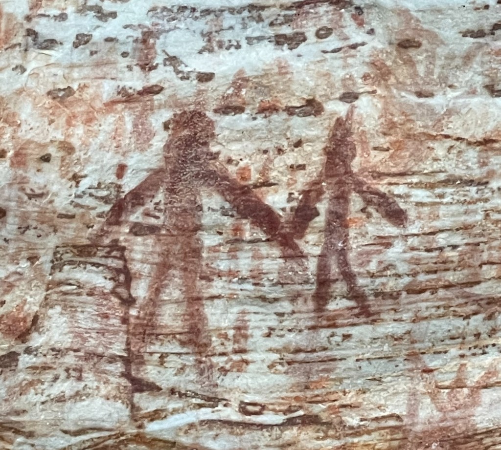
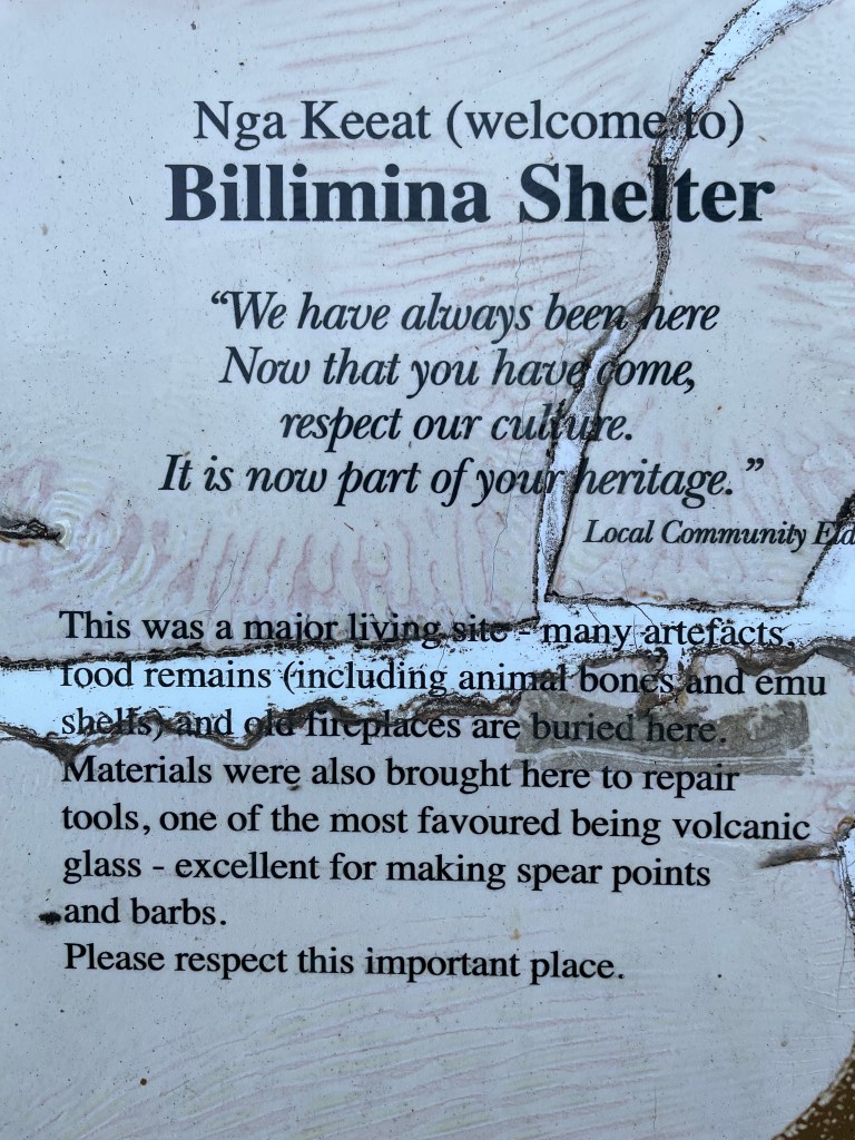
What – Aboriginal rock shelter and artworks. Walk is only 2.2km
10 words – Amazing place, living museum, witnessing history going back 100s of years.
We know it is beautiful, peaceful and magical but there is more to Gariwerd, Grampians than trees and kangaroos.
It is a living museum with 90 per cent of Victoria’s known rock art sites, some dating back more than 20,000 years.
So what better way to spend a spare hour on the way home from a workshop in Hamilton than to check out some of this art.
And it is not just art that graces this living museum – there are also shelters, ancient quarries and other important cultural heritage sites developed and cherished by our first nations people.
Today we veer off the Henty Highway at Billywing Road, Glenilsa to head 9.5km to Buandik camping ground for a quick 2.2km walk to Billimina Shelter.
It is late afternoon so we carefully dodge the many kangaroos busy grazing and bounding along the edge of the ochre gravel road.
Ochre is the colour of the hour as the late afternoon sun makes an impressive encore before leaving the stage for the night.
We twist and turn along Billywing and few other gravel roads before hitting the aptly named Goat Track and the turning into Buandik camping ground.
We are in a valley and pass over a stream with some water, which is surprising considering how dry the autumn has been so far.
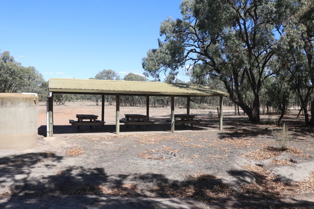
At the camping area we make a bee-line for most distance picnic spot – where our walk up the side of the mountain begins.
It is really pretty country and the camping ground looks worth returning to but this evening we are on a mission.
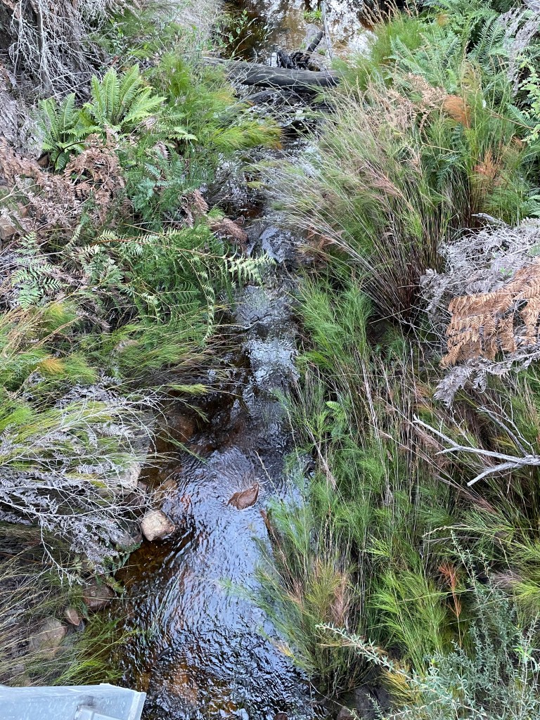
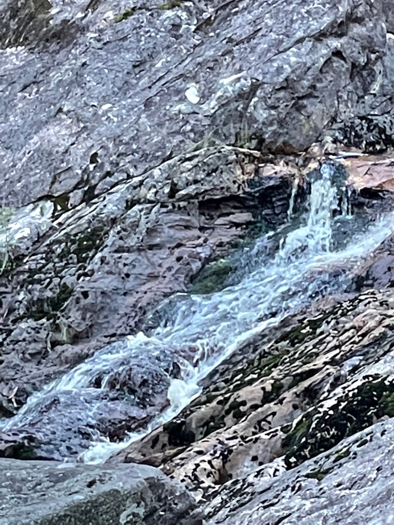
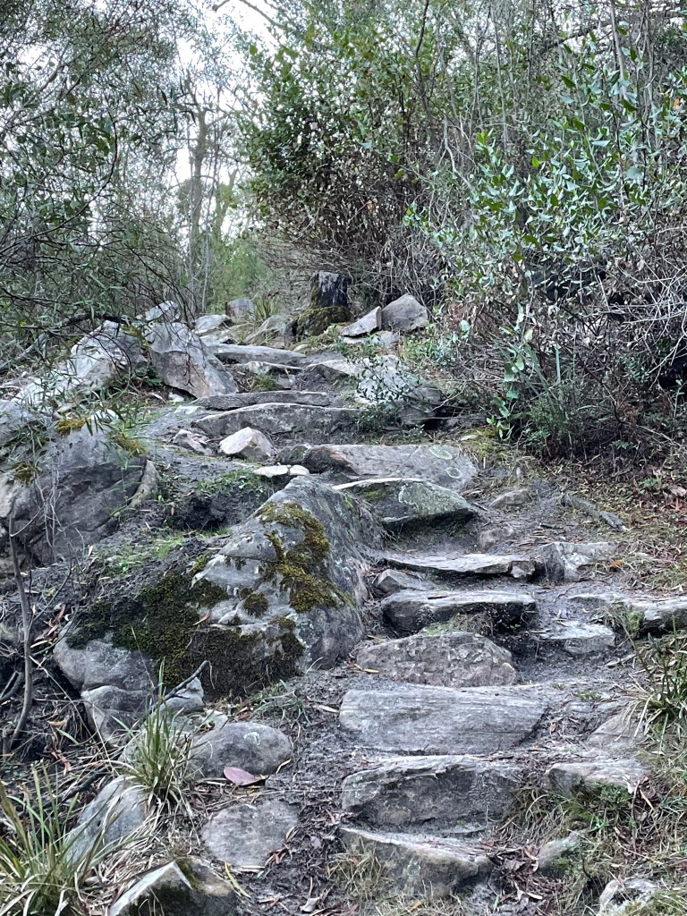
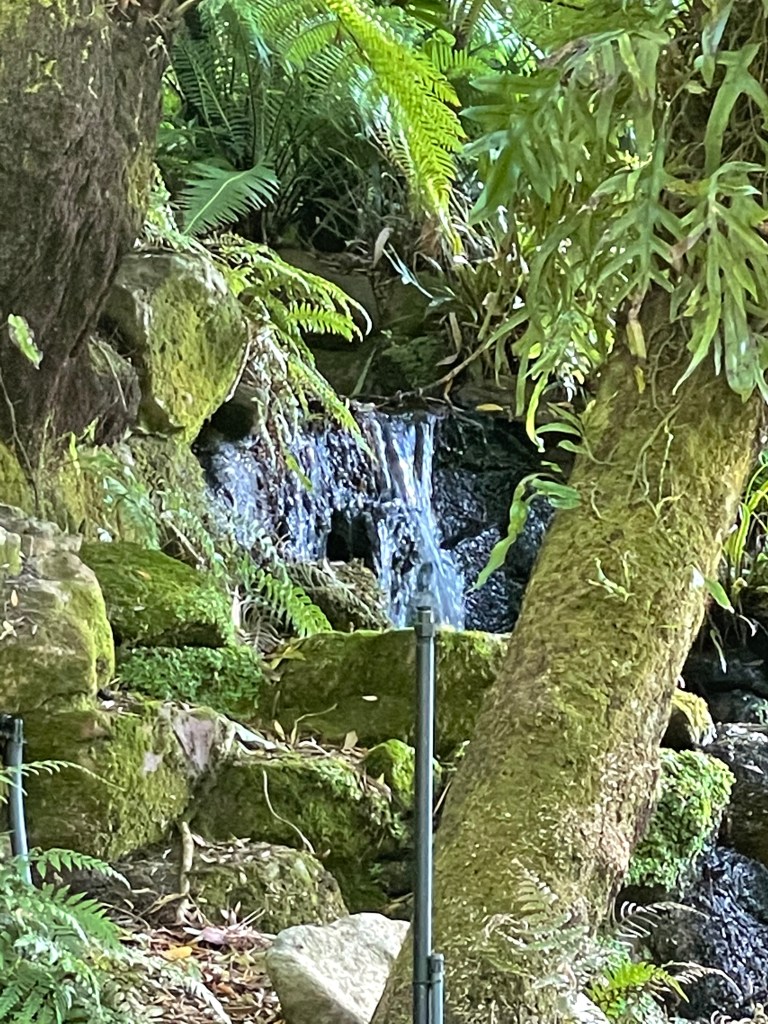
It is 1km to the shelter and we will also do a little detour to the Buandik falls. The track follows Billimina creek which you can actually hear flowing.
You can tell this area does not get heaps of light as everything seems so lush. We disturb a roo resting in the bracken and also see some magical tiny plants growing in the damp.
The stream which gets even more noisy and impressive when the veer off the main track to view the Buandik water falls.
It is more of a dribble than a fall, but that means I can get pretty close without the risk of falling flat on my face. I am not wearing walking boots and Maureen has made it clear she is not carrying me out.
I do a bit of scrambling but with my heavily plastered son in mind, am very very careful.
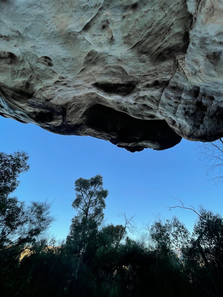
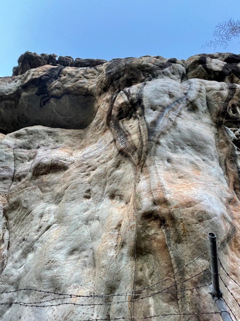
We return to the track and start going up hill to the shelter. It is cold and dark on this southern facing track but we can see the sun just bathing the mountains to the south in light.
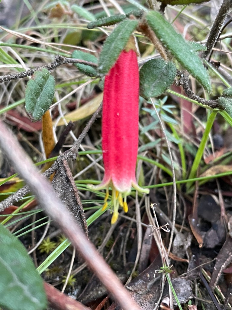
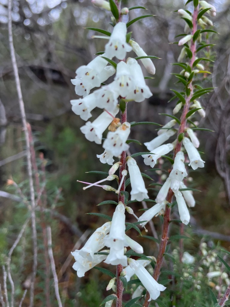
We pass some pink and white heath in flower and a Correa..
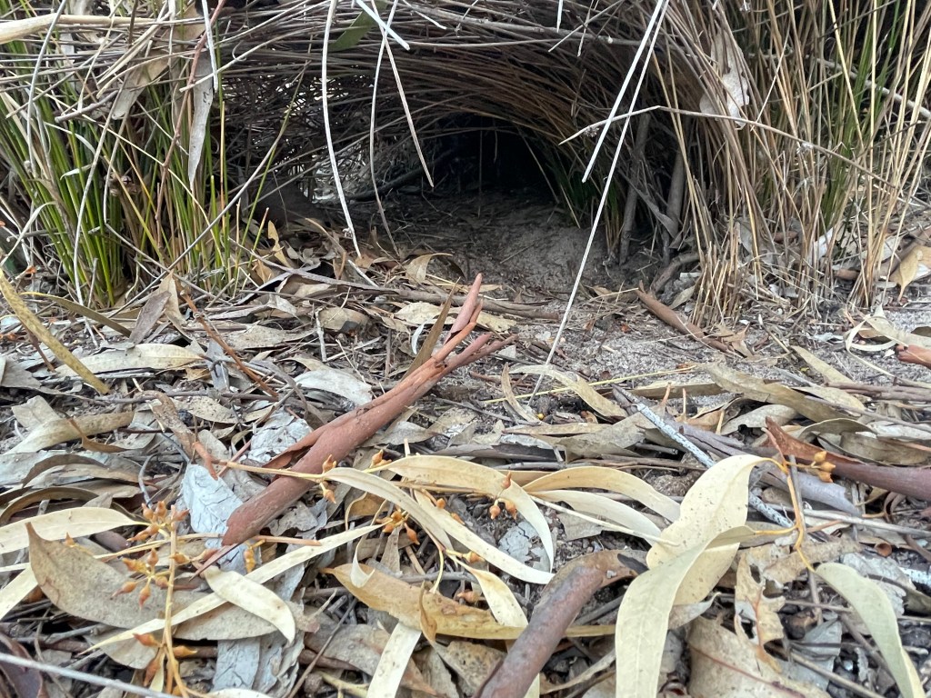
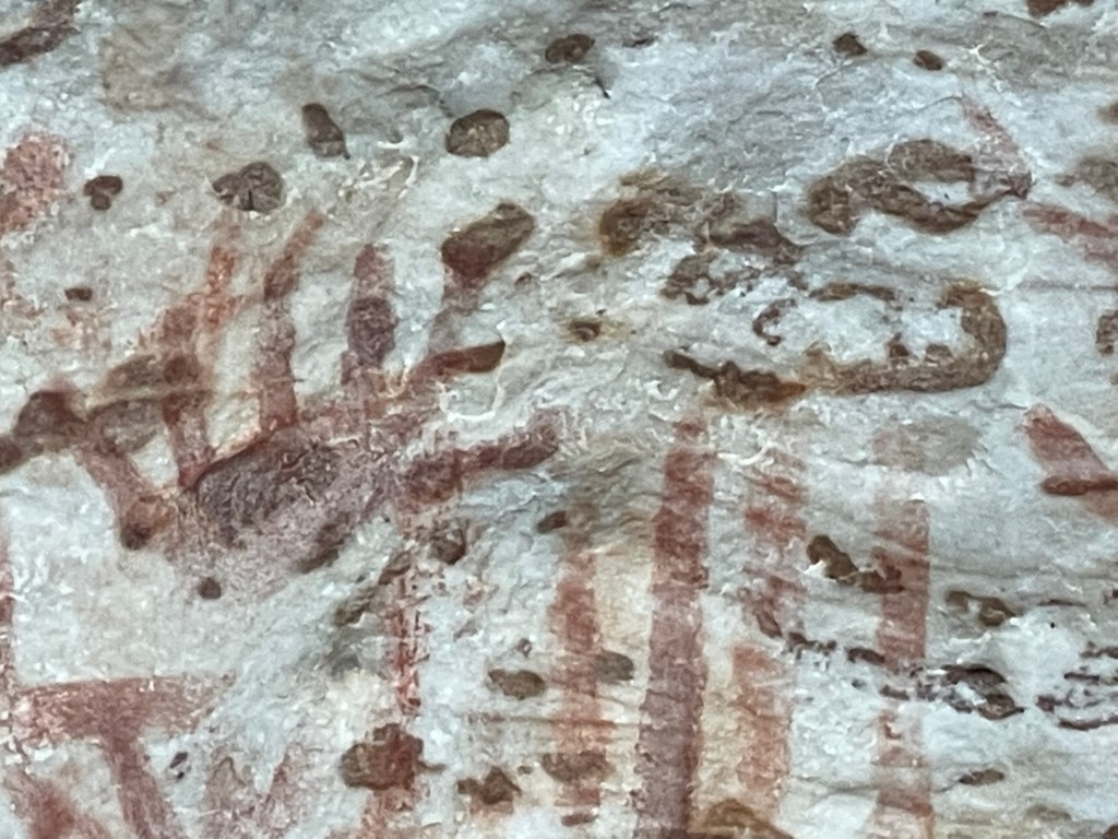
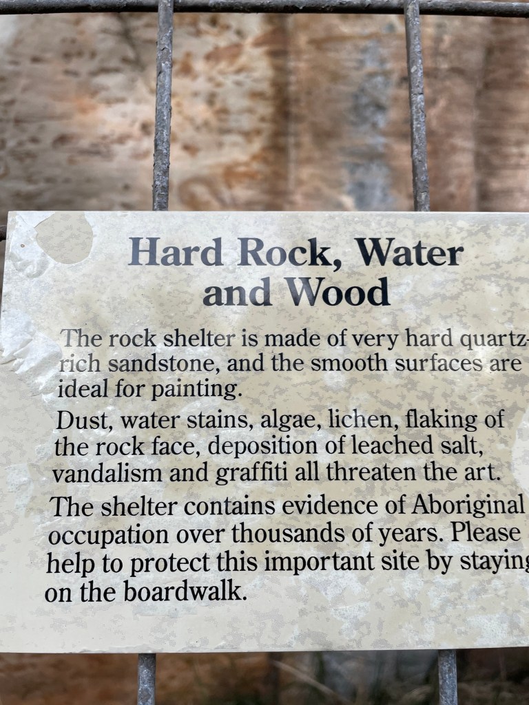
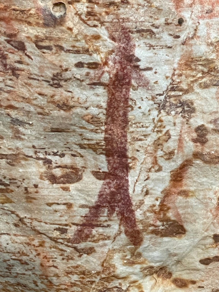
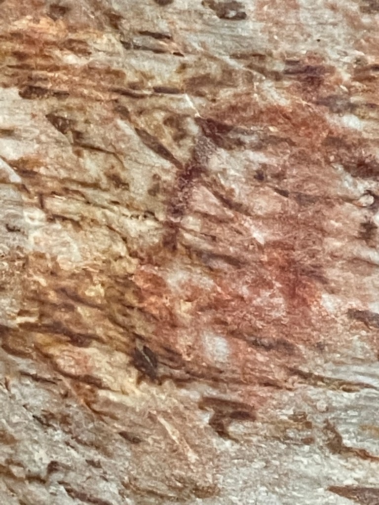
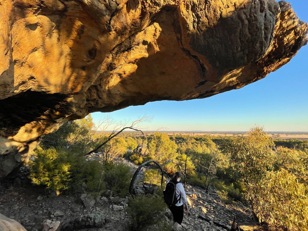
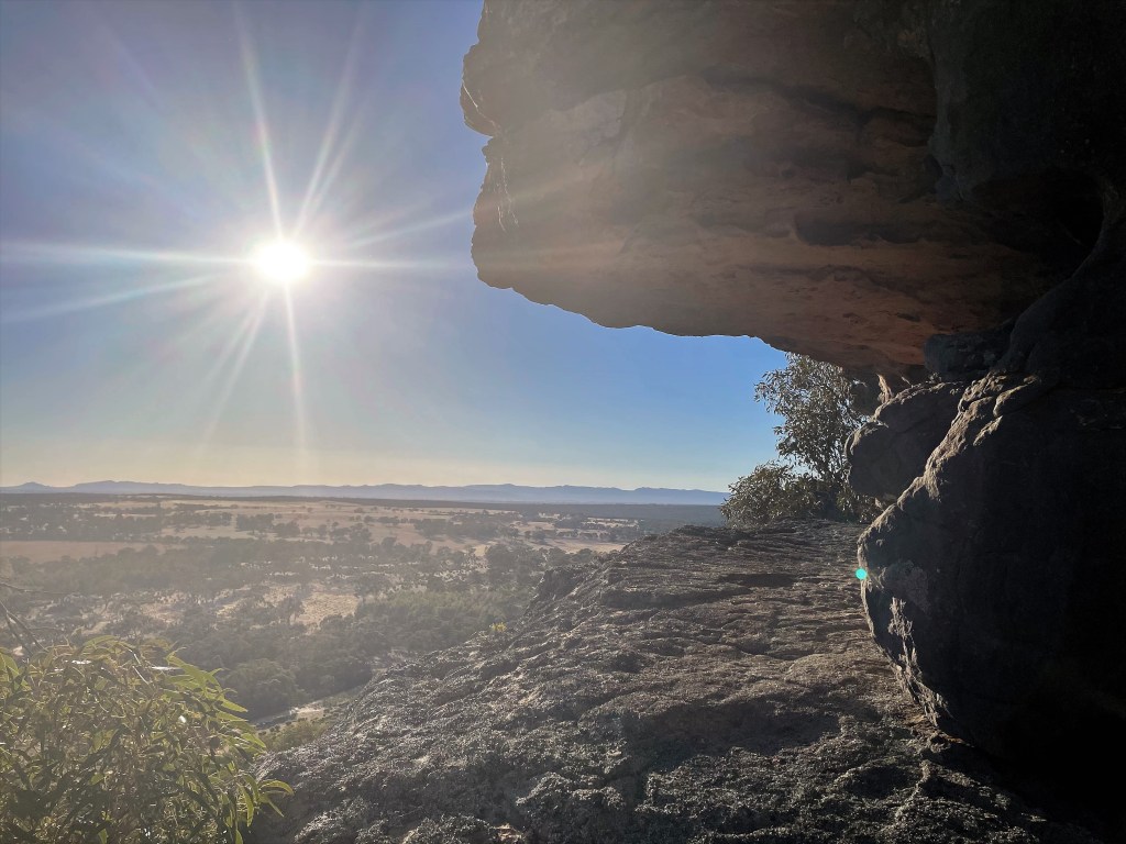
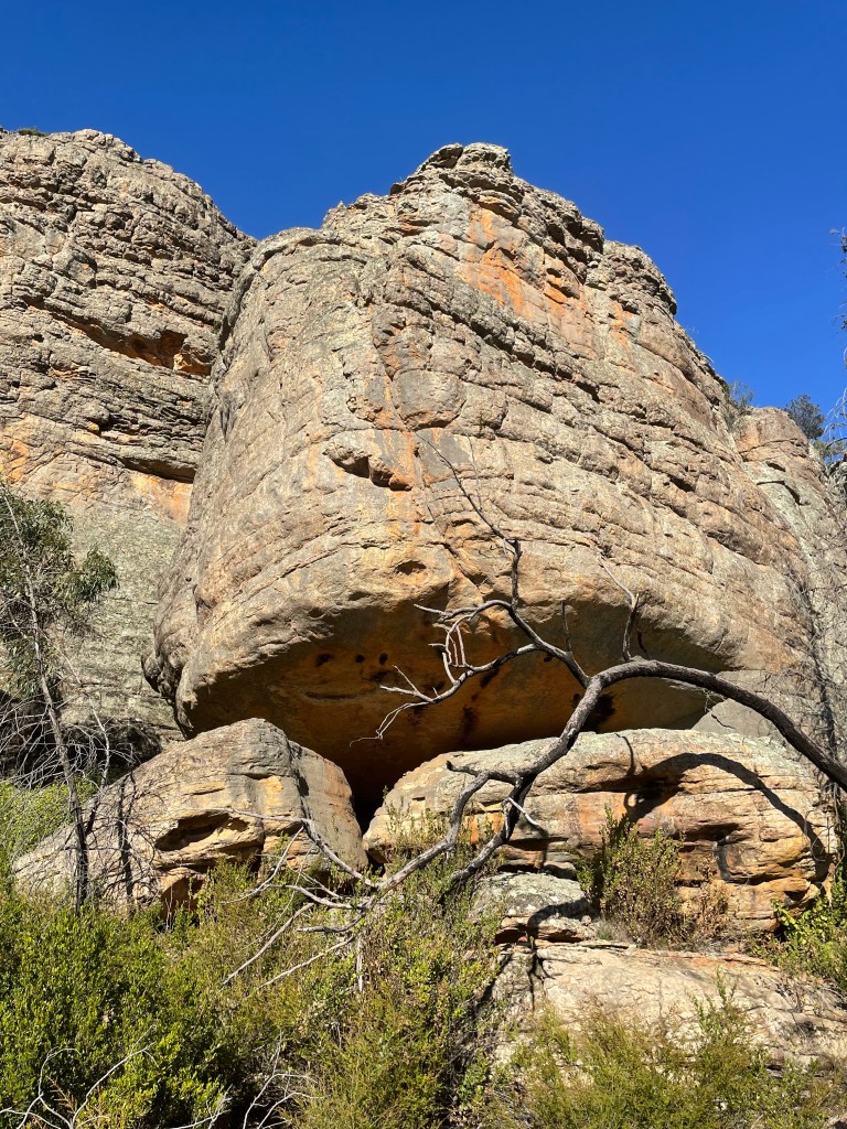
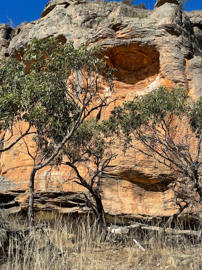
A bit more climbing and around a bund and we are confronted with a giant fenced off rock overhang.
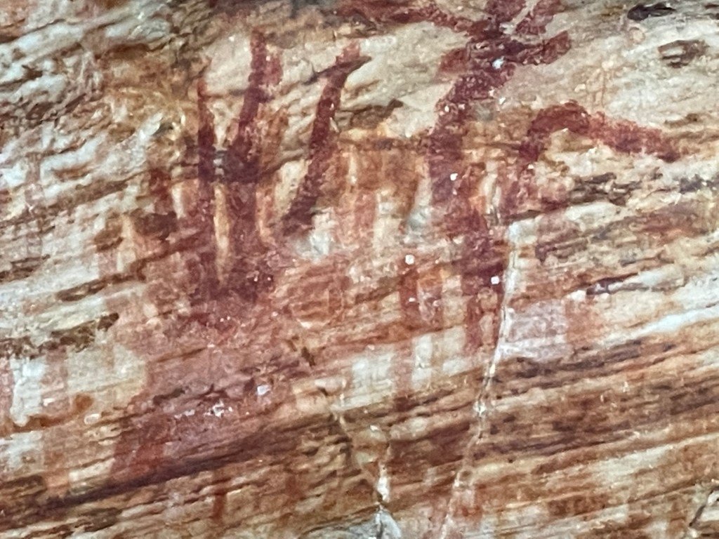
It is covered in more than 2000 red ochre paintings and would have been a great vantage point across the valley below for the Jardwadjali people who lived here from time to time.
In the 1970s archaeologists found stone tools and the remains of plant and animal foods which suggested groups camped here from late winter to early summer.
The Jardwadjali did tool repairs and caught kangaroos and small mammals such as bandicoots, possums and bettongs. They also collected emu eggs and freshwater mussels.
The rows of bars in the paintings are believed to be marks used to count events in retelling stories or to record the number of days spent at a place.
While they are not easy to find there are pictures of emus, kangaroo and emu tracks, and 55 human stick figures on these rocks
It is an amazing thing to behold and you can only imagine how many stories were told and retold under this mighty rock, possibly over 1000s of years.
But with the temperature getting lower and the sun giving one last burst on the range to the south, we hightail back down the track to the car to get out of the bush before it is dark.
There are plenty of roos on the way home and we take it very easy but we all get home in one piece happy we took the detour into our region’s rich and long indigenous history.
Where – Port Fairy include Russell Clarke Reserve, Pea Soup, the Passage and the Wharf
10 words – familiar, quiet, windy and wild, rejuvinating, salty, beautiful at dawn
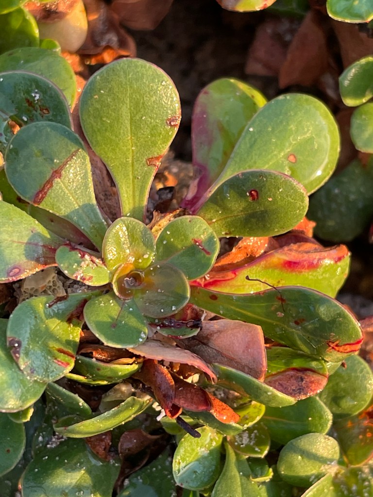
The very lush inlet between Pea Soup and the Passage which was teaming with succulents.
I love Port Fairy. But maybe not the same way many tourists do.
It is part of my childhood and really my whole life. Half the town would relocate to camp every summer and while we were not one of them. Daltons were often in the mix. Later my nanna and mum both lived there.
I love the river and sea – although I did catastrophise about tidal waves when sleeping in Snow Sharrock’s borrowed caravan the one time our family did camp. I love going to the slide at Yambuk which was just a fun-filled sand dune in our youth.
I am walking on Gunditjmara country today as I wander through Port Fairy’s streets, along the beach and beside the river. It was a quick sprint down to see my child Lily for the Mother’s Day weekend so I got there Friday night, will have a dawn walk Saturday before heading up the road 3 hours to visit mum in the nursing home.
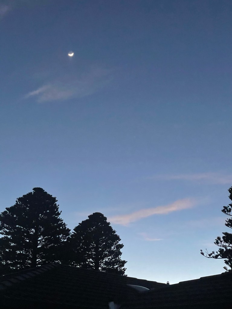
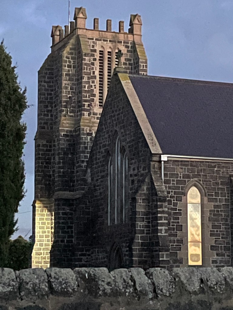
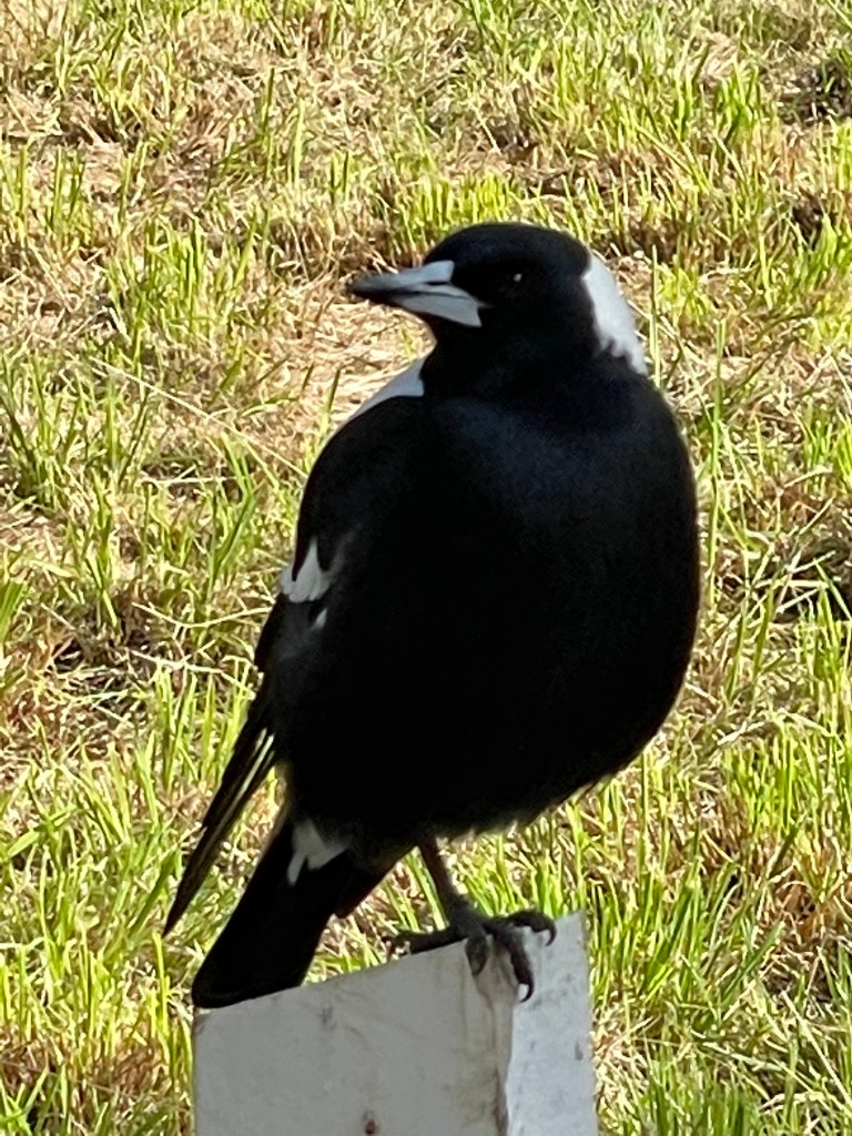
It is still dark when I roll out of bed. Outside the moon grins smugly as the austere stone church is serenaded by a choir of insomniac magpies backed up by the humming sea.
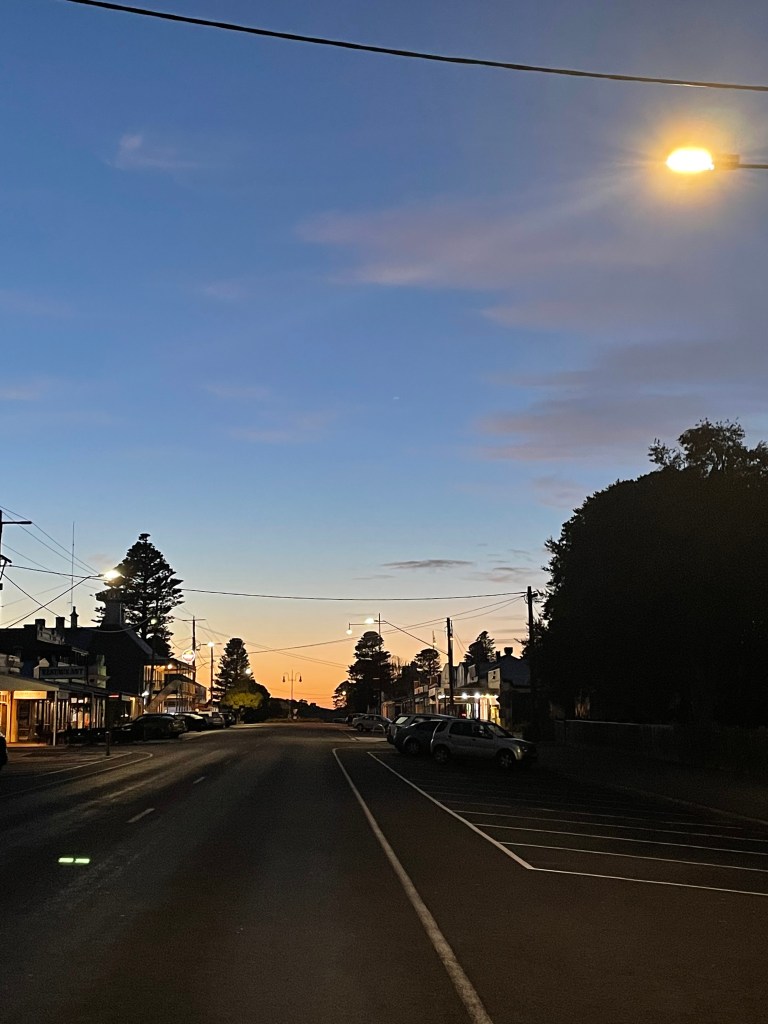
Approaching Bank street, I get some mother’s days wishes from flowers perched outside the bank and the early morning symphony is joined by clanging pots through the café window.
Lights in Banks street seemed to approve of the morning song and swing rhythmically over the inky black road.
I head west through waking streets where magpies are now discussing issues of the day overhead on a power pole.
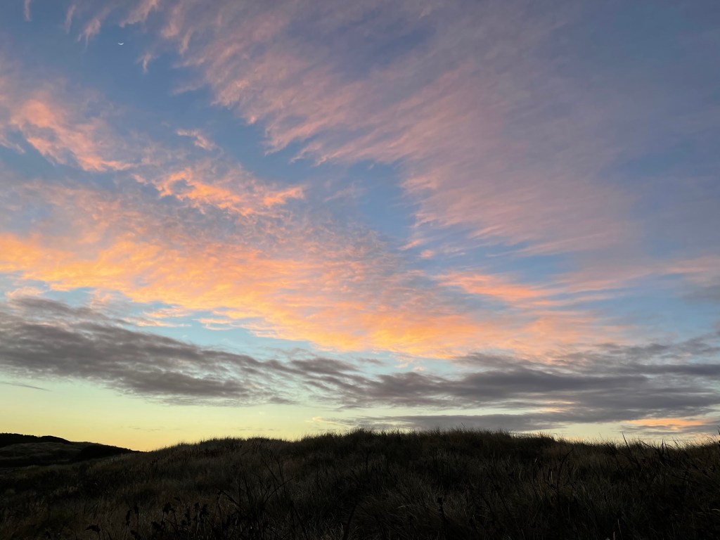
Houses give way to trees at Russell Clarke Memorial Park where the sky beings to transform. The denim fades to pale lemon near the horizon as Russel’s park takes me through shrubs and wetlands.
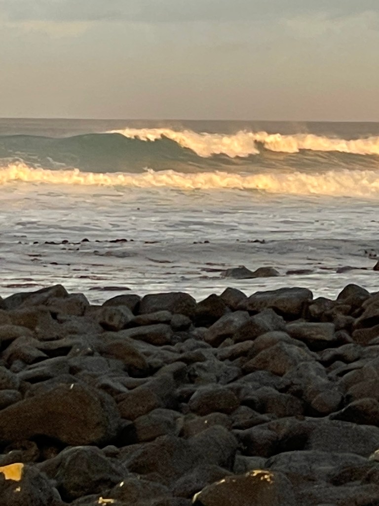
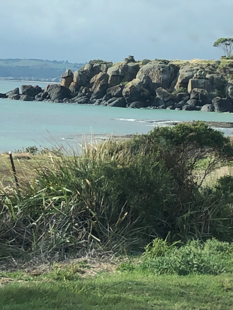
There were some big seas a few weeks ago so I scout for signs of the storm as I arrive at the beach.
Named Pea Soup it is a giant pool sheltered by off shore rocks.
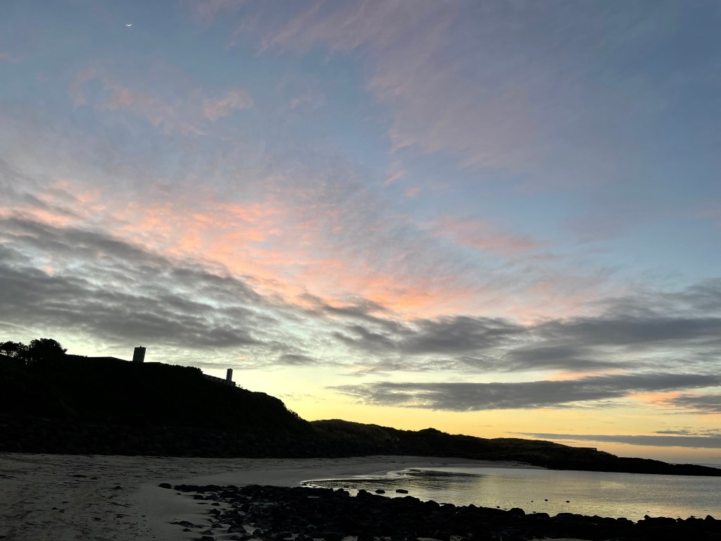
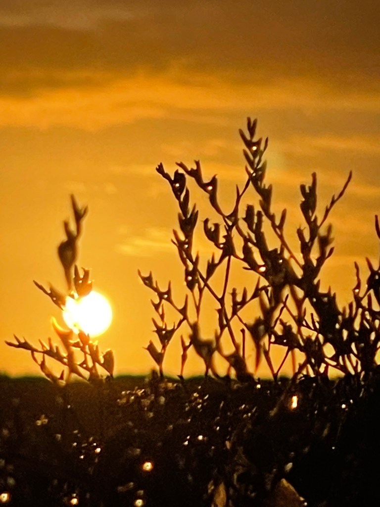
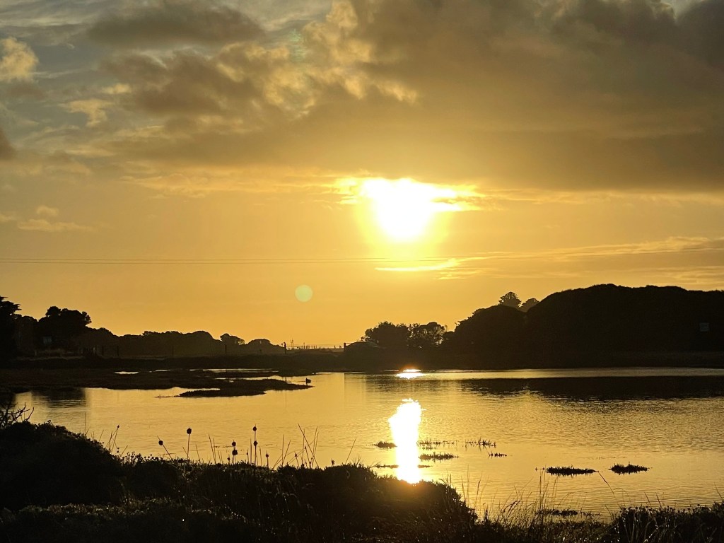
Clouds are taking on shades of pink and blue and I am looking forward a pretty awesome sunrise when the she pops over the dunes to the east.
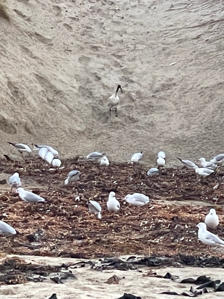
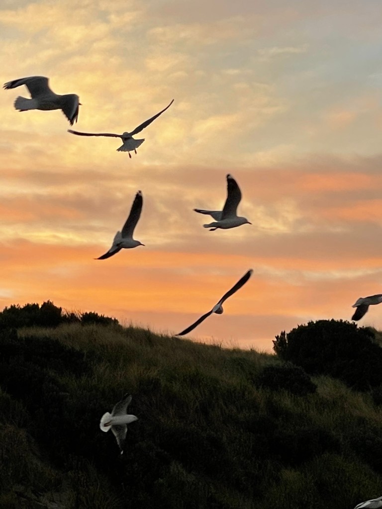
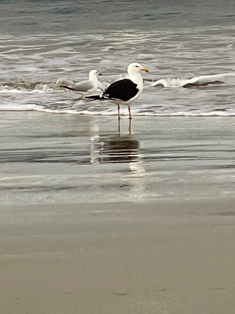
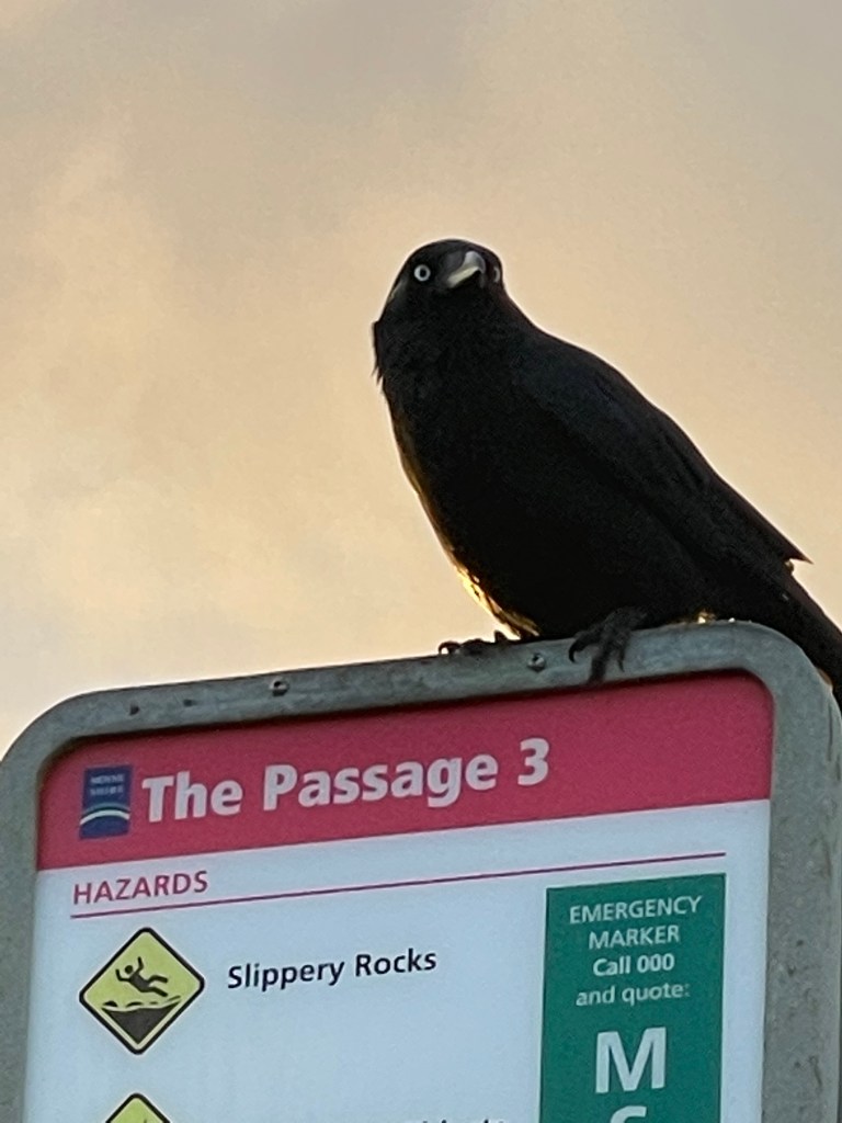
At one point I see a crowd of noisy birds busy foraging in sea weed where the dune has been attacked by waves. There is no discrimination at this feast with birds of all shapes and sizes engrossed in their sandy breakfast.
Many fly back and forth enmasse in a chaos of feathers and squarks, while others prefer chatting – like the magpies – along the shore.
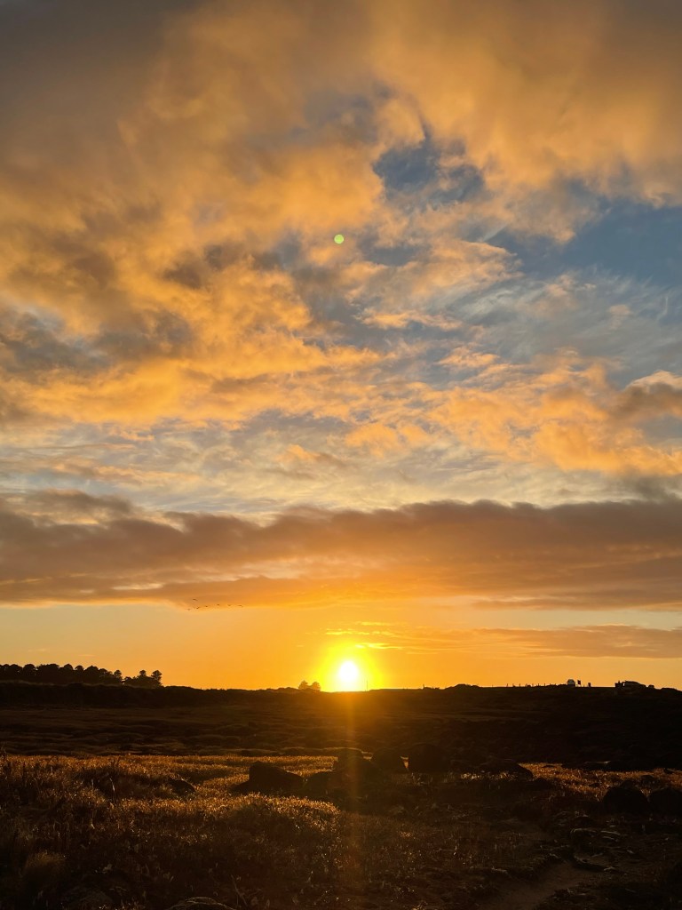
I take one last look at the pastel sky as the bold sun prepares for a very grand entrance.
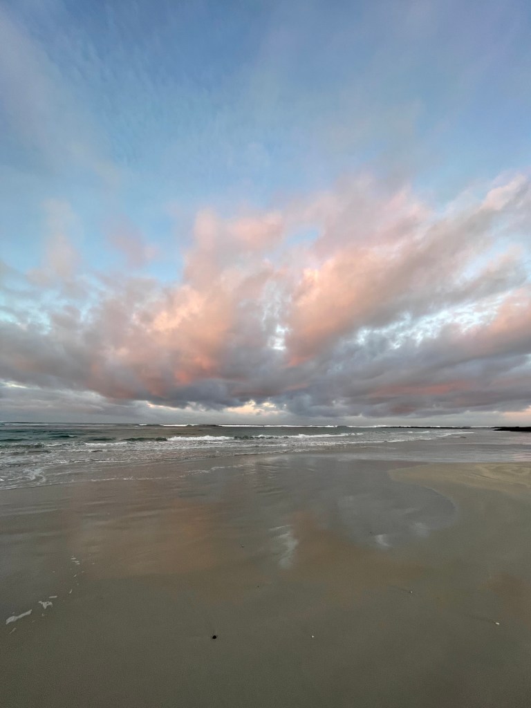
Charcoal rocks turn gold, waves and even a boat glow and a big ray smashes over the horizon.
I round a corner to a little bay and it’s like someone turned on a spotlight. Tiny weeds make an amazing silhouette and the grey sky in the west contrasts dramatically with floodlit dune grasses.
Looking down I also wonder if the big seas have boosted growth of the many succulents and plants growing at the water’s edge. These lush plants are just glowing.
Then the light goes out and as I reach the The Passage, the sun has also disappeared.
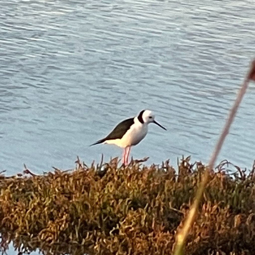
I cross the road and head through another wetland where big rocks sit absurdly on the cut grass thanks to recent storms. There is a quick detour into a bird hide and then it is off to the wharf.
The Norfolk Island pines effortlessly look impressive, a plover has a big of a whinge and the disciplined boats obediently line the river’s edge.
It’s been a great way to start the day in this familiar, friendly and unique coastal town.
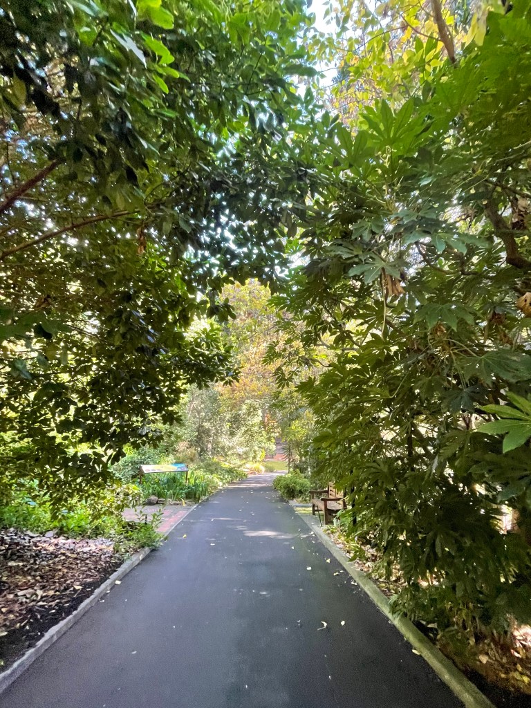
Where – Queens Domain Hobart including Royal Tasmania Botanical Gardens
What – 5.36km round trip from Royal Hobart Hospital
In 10 words – Bulokes, birds, bright leaves, city bush, buildings, big trees
Okay, so I am breaking the rules this week.
But it has been a week of breaking things – including one ankle and one wrist – which finds me in Hobart and spending much of the day in hospital or organising things around a patient.
Great place to end up on a mercy mission but still not a holiday.
A few days ago Noah fell off Doctor’s Rocks (see pictures) and I have come to get all his car (at the northwest end of the state), then travel to Hobart (south-east end) and support him while in hospital and then get us all home.
I had planned to come in May for a holiday so this is like a preview visit which has been made much more enjoyable by the kindness of Noah’s workmates, my old friend Max, cousin Kane and the wonderful staff at Royal Hobart Hospital.
Today I find myself with a short window – the operation is over and Noah is feeling a bit better, the car is booked on the ferry tomorrow night and I can’t visit the hospital till 2pm – so I have a few hours for a walk.
At the suggestion of veteran bush walker and conservationist Franz – a patient in the next bed who has been entertaining Noah with his amazing stories – I am heading to see the Royal Tasmania Botanical Gardens.
From Ward 9 East we got a view of roughly where they sit a couple of km away on a hilly spot Queens Domain.
I head towards the river and find myself in what I later discover is the University Rose Garden in front of Domain House a former school built about 150 years ago. From house steps I can see the Royal Hobart Hospital so I call Noah and start waving. He actually spots me from more than half a km away which is pretty cool.
I have a backpack for my water and a bum bag for the phones/cameras. Later that day my nephew explains the sad equation – bum bag + two phones = drug dealer – Today’s customers will be very disappointed.
Indeed no customers or even other walkers here today on this still, sunny autumn day. That sun has a real kick – something to do with Tassie being closer to the hole in the ozone layer. Good reminder about correct disposal of old fridges I say.
I have no clue where I am going but there are little bush tracks all over the place and subtle but detailed signs pointing me to several landmarks including the gardens.
I am loving walking through natural, peaceful bush within yelling distance of the main road into Hobart.
At one point something moves in the grass. Not a hop or a slither – something else. I am wondering if it might be a quoll or bandicoot, which are said to live in Hobart bush. It seems pretty amazing when we think how both species have been devastated by foxes, cats and people in Victoria.
The path is quite hilly and at times you get some excellent views to the river and the hairy denim mountains rolling down to its banks.
I have not come across any ancient eucalypts or trees with scars but this place was settled more than 200 years and with all these hills, farmland would have likely been cleared to grow food and run livestock.
Town and river names are also very British and I am not noticing as many indigenous names as we have in northwest Victoria.
(A bit of research post walk did uncover some dual Aboriginal names including Nipaluna – Hobart; Trowunna – Tasmania and – timtumili minanya – Derwent River)
I also found out that before Europeans arrived the Mouheneener people camped along the Derwent to access food including shellfish and in all there 21 Aboriginal sites recorded across the Queen’s Domain area.
I am pleased to see some bulokes and a healthy stand of kangaroo grass as I wander through the bush.
I head through a war memorial drive and then past a patch of bush that was planted to commemorate the visit of a US war ship in the 1970s.
Things get greener and leafier and more ordered as I approach the great iron gates of historic Royal Tasmania Botanical gardens.
Formerly a farm. the gardens began in 1818 and have been a popular recreational site since the late 1820s. They were also important for botanical research and providing trees and shrubs for many parks.
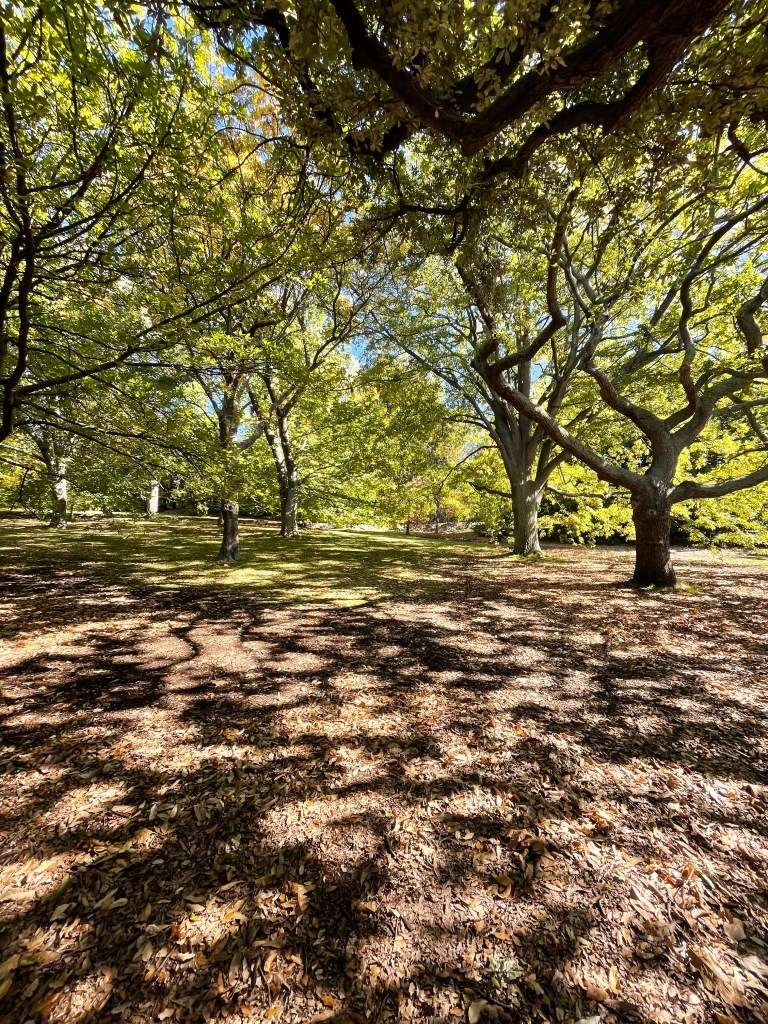
The first thing I am struck by are the monster trees.
Our Morton Bay figs dwarf the aptly named Wellingtonia – Big Tree which soars more than 30m skyward. (And it still has growing to do.) Next door it equally tall Agathis Robustus or the Queensland Kauri.
I wander past some infant Huon pines – tough, long living and useful for all sorts of things and then around another corner I am catapulted into full blown autumn.
Big-leafed oaks light up the whole section of garden. Earlier this week the conservationist in me felt uncomfortable with how often deciduous trees popped up during my cross Tassie sprint – but today I am in awe of the bold colours, giant leaves and grandeur of these trees.
The Iphone gets a workout and I even hug one of the giant trunks. (This is because a water diviner once told me it is a great way to get energised and, after days of walking up and down hills I need some energy).
I head back across the sloping lawns and paths and eat lunch beside the big artificially heated wall that was built in 1829 to protect plants from the frost. Truth is they did fine without the heat and it was turned off a few years later but wall is still here nearly 200 years later.
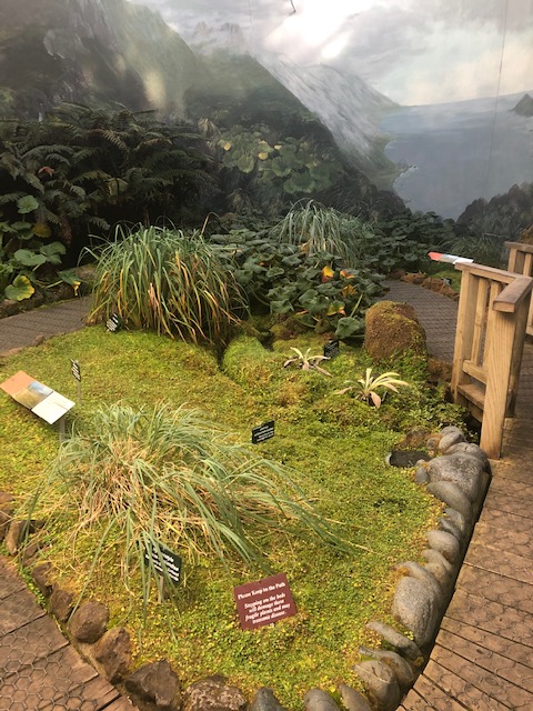
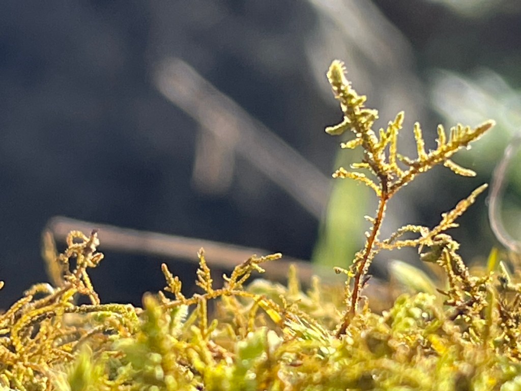
I then head to world’s only Subantarctic Plant House which has island plants displayed in a freezing cold building. These mosses and other plants were all collected during trips to Macquarie Island.
Finally it is a quick look at the stone Conservatory which is a mass of colour and wonderful smells.
Time is ticking so I head back to the gate and return to the CBD. Somehow I manage to find a whole new bush track but link up with the trail back towards the hospital. I see quite a few birds on the way back including a one legged magpie and some parrots.
Later that day we are watching from the ninth floor and see four policemen searching near a tree where I was walking only hours earlier. Hope no one called in a report of that middle-aged woman with two phones and a bum bag.
Nothing to see here – except the pictures that go with this story.
In five short km I have heaps but not even remotely scratched the surface on this amazing, incredibly friendly, welcoming and beautiful state and I can’t wait to come back for some real adventure.
How long – 9km walk around part of the lake and the Lava Canal Walk
In 10 words – Place of adventures, memories, tranquility, beauty and (sadly) burnt trees
Budj Bim National Park, formerly Mt Eccles, is my favourite place.
It is 10km from the house of my childhood and has been a much-visited destination of inspiration, adventure, celebration and mountains of marvellous memories.
As a 6-year-old I stood at the crater searching for koalas who had been released to the bush – their arrival coinciding with the impending loss of resident tiger quolls – who progressively fell victim to predators including unhappy chook owners and foxes.
We regularly picnicked, barbecued and walked at Budj Bim. I also painted landscapes, explored caves and got married there.
Obviously we are not the only one to be captivated by this magical place. Gunditjmara have walked its rocky landscape for years – 1000s of them.
Among their Budj Bim stories is a very old one – possibly dating back 37,000 years.
It tells how Budj Bim was one of three giants who roamed the southern part of Australia. One day he crouched down and was transformed into a volcano and his teeth became the lava the volcano spat out.
Budj Bim’s eruption formed a spectactular stony landscape that stretches from the mountain previously known as Eccles, through the National Park, along a couple of creeks and swamps and down to Tyrendarra and the sea.
This has been a long week and today I feel rather tired – so what better way to cheer up than by heading ‘home’ and reconnecting with Budj Bim’s and his ancient handiwork.
We start at the lookout area and picnic shelter which dates back to the 1930s So many photographs taken here, sausages burned on the barbecue and tentative steps taken down a very steep path that once led from here straight down to the lake.
Safety issues probably saw the demise of this path but stories about it live on.
When wells went dry in drought times early settler Mary Anne Broadwood would head down the steep path – a load of washing in hand – and washing clothes in the lake, drying them on the rocks at its edge. Decades later one overdue pregnant apparently walked up and down the steep path try to bring on labour.
With no hint of the steps remaining, I head down a more gentle grassy path to the northern end of the lake.
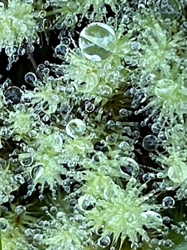
The birds are in fine song, wallaby eyes stares silently at me from behind thick braken and the morning sun spotlights tiny spiders webs.
This bit of the park is vintage Budj Bim – lush, peaceful and with a familiar damp, earthy smell . I am transported back to my childhood.
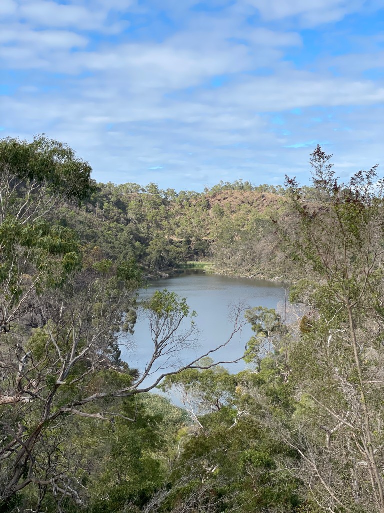
The lake looks low today, something that’s happened over the past few decades as well as more bouts of blue green algae.
After many years visiting, photographing and painting this lake I notice the reeds have exploded at the end of the lake.
Look how few reeds there were in the 1960s painting by Port Fairy’s Irene Bartlett.
It was during one of my own painting sessions that I came face to face with snake walking up the path from here to the cave. No snakes today but no path either – this one too has been lost to the bush.
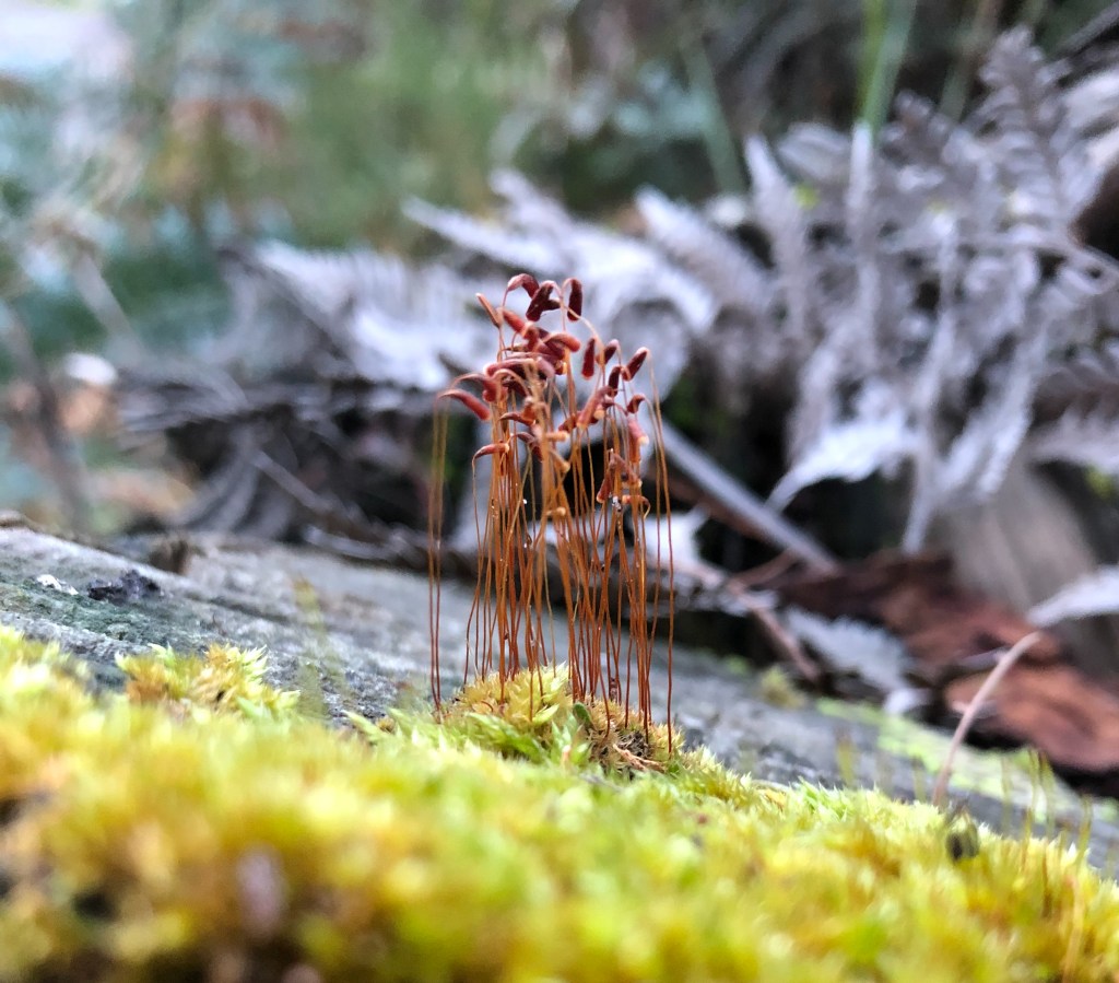
I retrace my steps, checking out some pretty awesome mosses on the way up, and then head towards the cave, stopping at the lookout along the way.
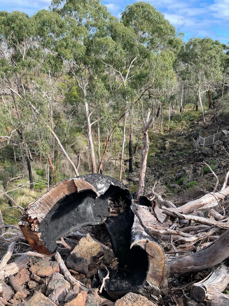
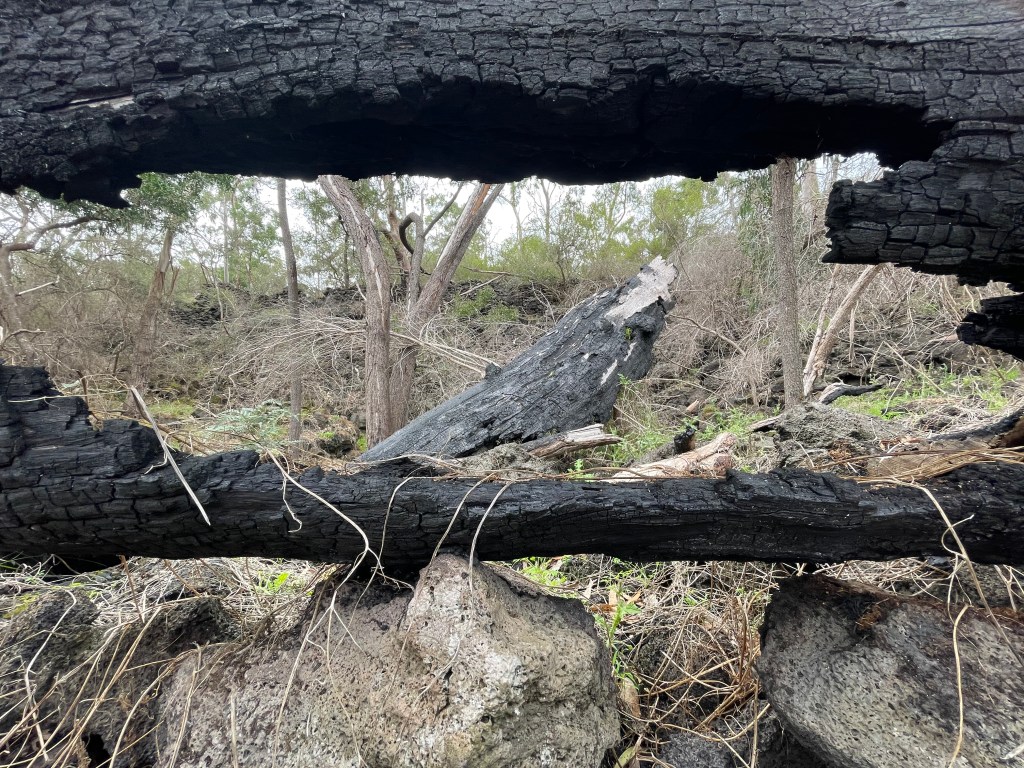
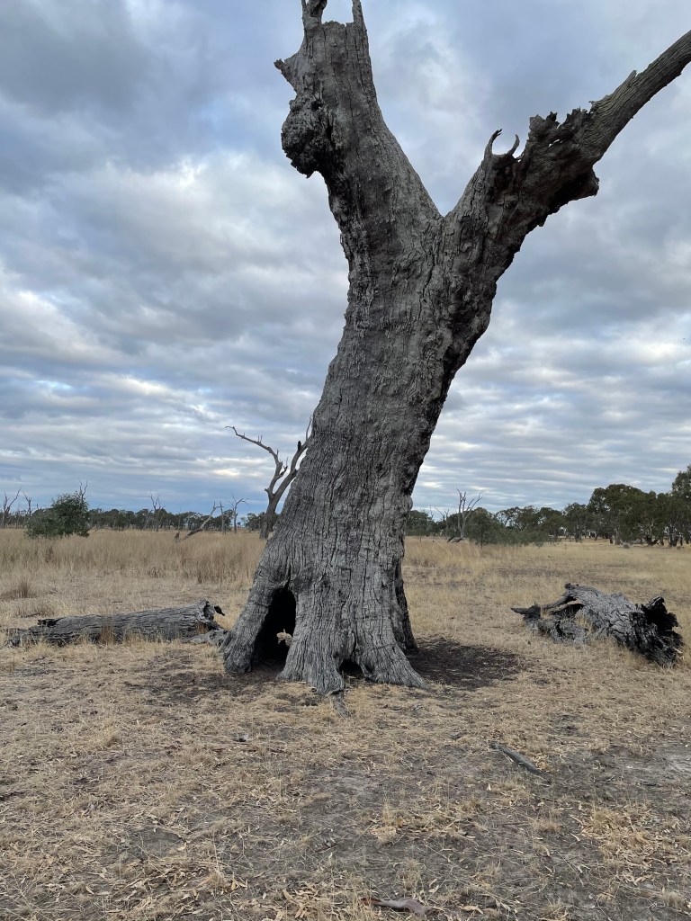
Much of the view is now blocked by trees and the 2019 fires have burned access steps to the caves so it is off limits too.
Two years on and poor Budj Bim is still licking his wounds.
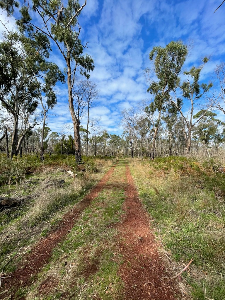
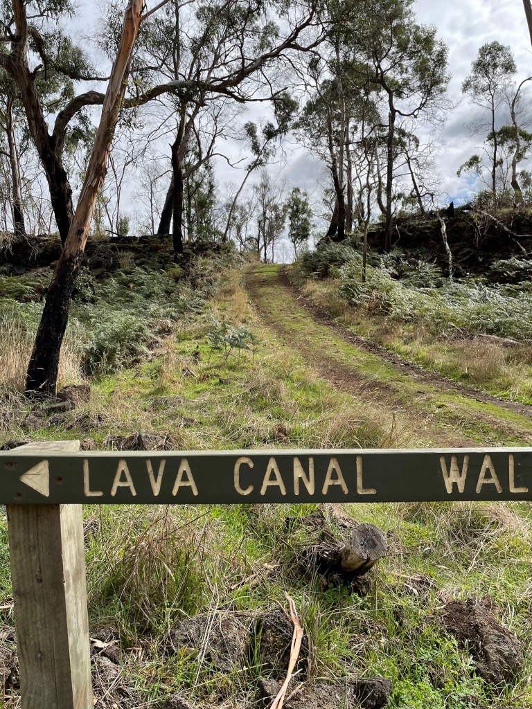
I double back again and follow paths beside the camping ground and along the park boundary towards the Lava Canal walk.
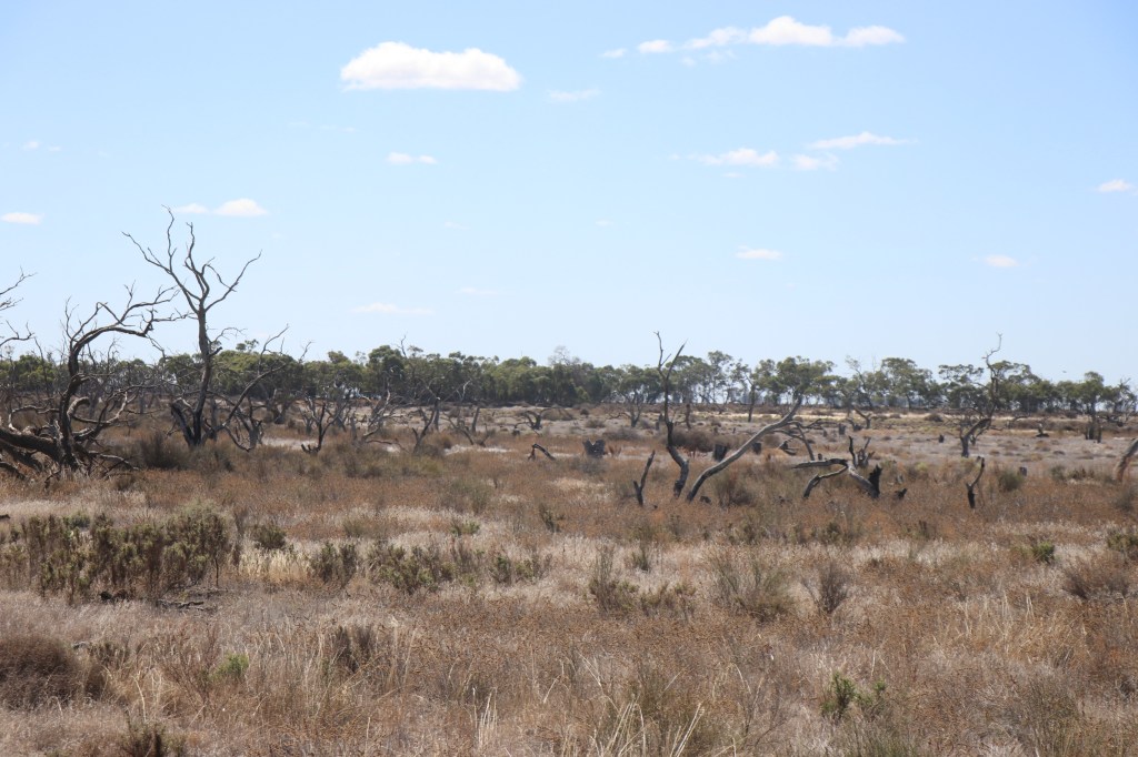
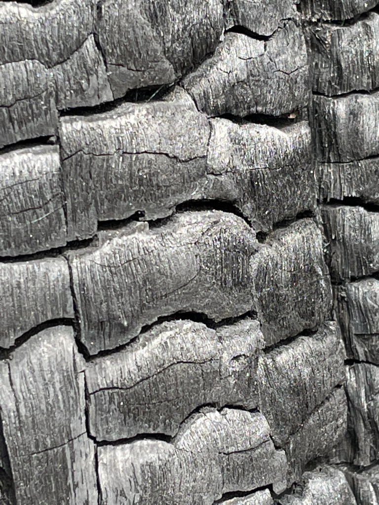
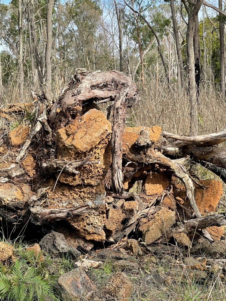
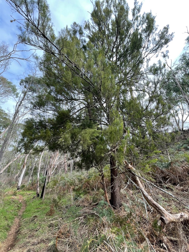
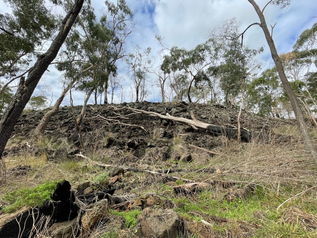
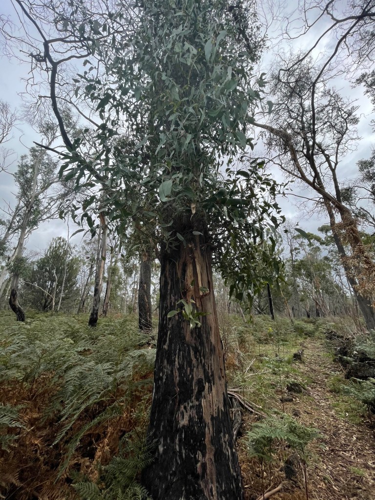
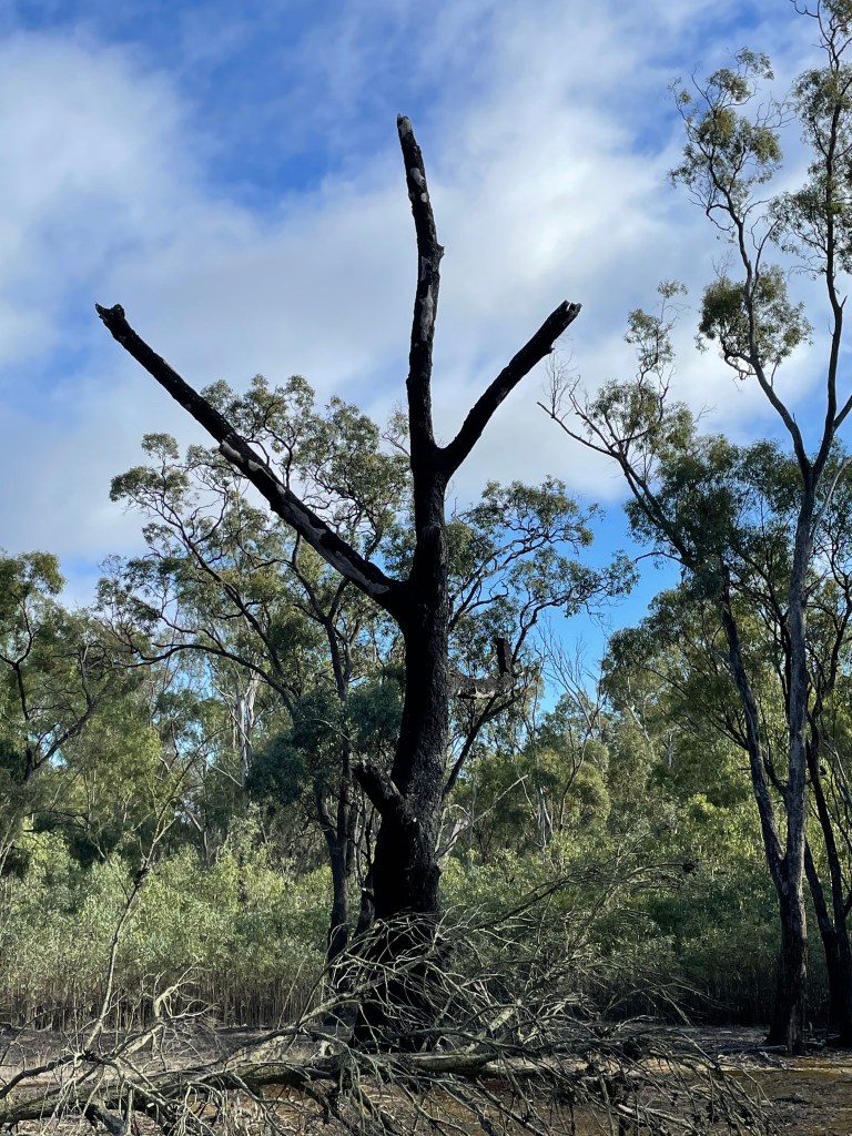
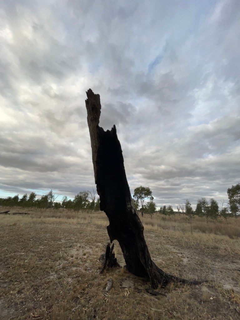
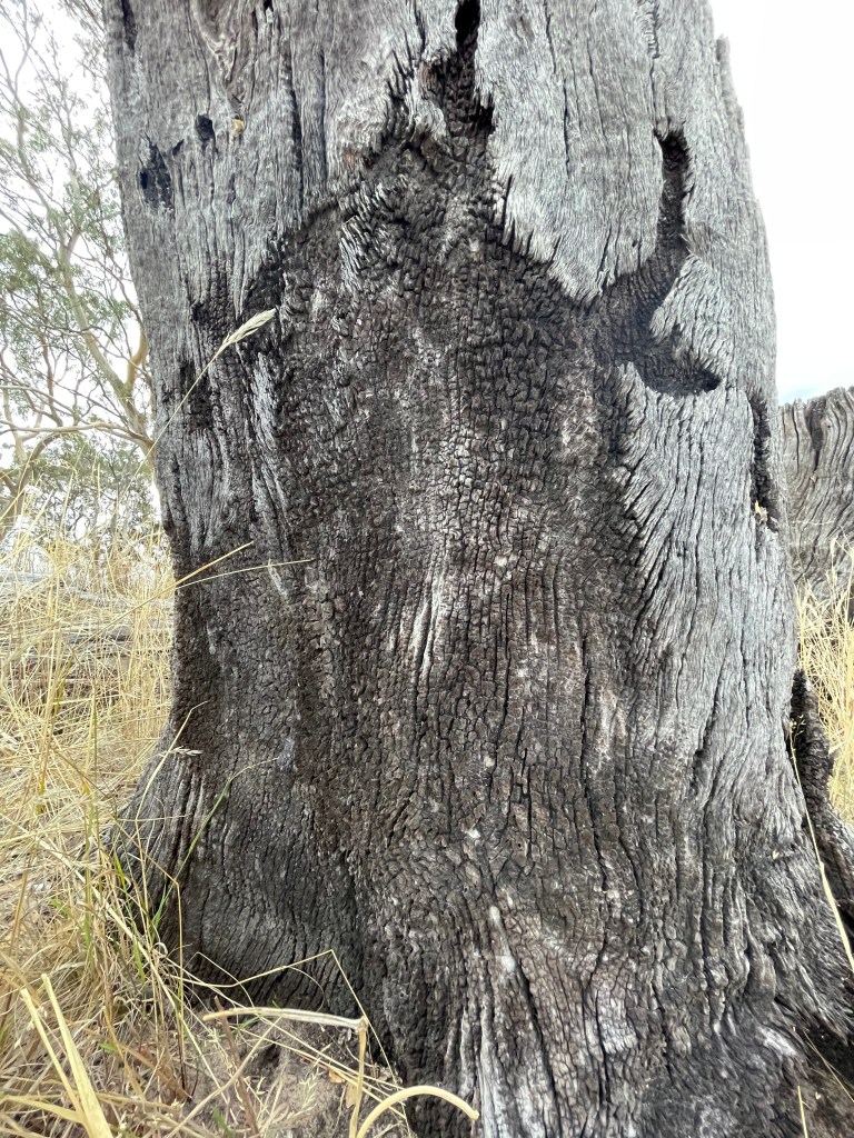
You start to get a real sense of the fire’s impact. Lush bush is replaced by a mess of grey and blackened limbs which stretch as far as the eye can see. Sooty tree trunks resemble tyre tread while others are caste on the ground, with roots defiantly clutching rocks and soil.
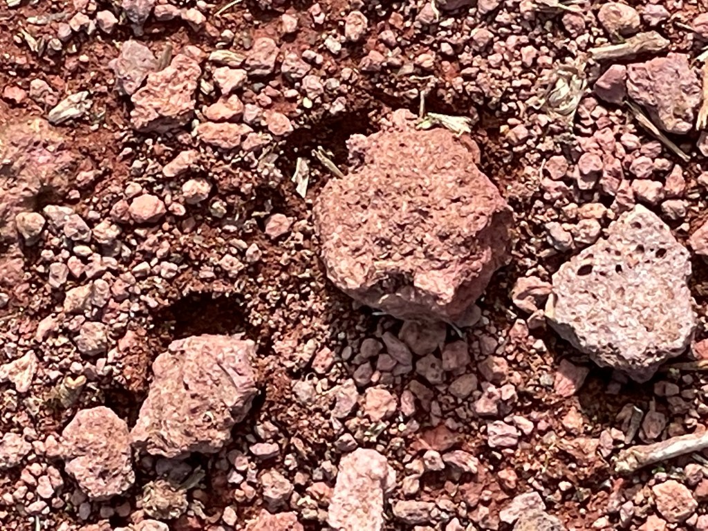
Wimmera farmers talk of red dirt, but this track holds the red dirt of my childhood made 37,000 years ago with compliments of Budj Bim’s teeth.
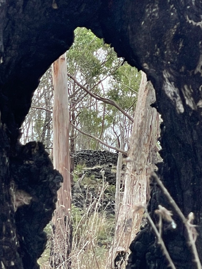
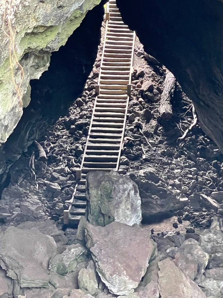
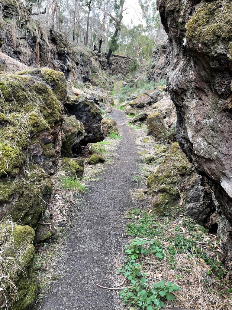
I soon reach the Lava Canal which is up to 100m wide and bordered by high walls.
I am suddenly a human boat sailing – or bouncing – along the sea of stone that stretches pretty much from here to the sea.
It is a sheltered and almost eery place with very little wind, a warmer temperature and dead quiet.
Of big walls can’t stop the fire which has torched the trees and undergrowth, exposing the full extent of this rocky this landscape including some wierd “faces” watching from the wall.
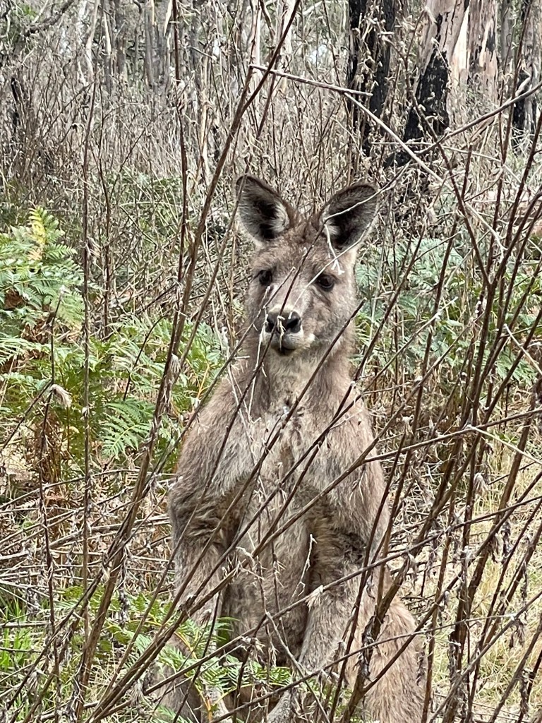
Little lizards flash across the rocks and a crack in the bracken reveals big kangaroo, virtually beside me. We say hello, he poses for a few photos and then he is off.
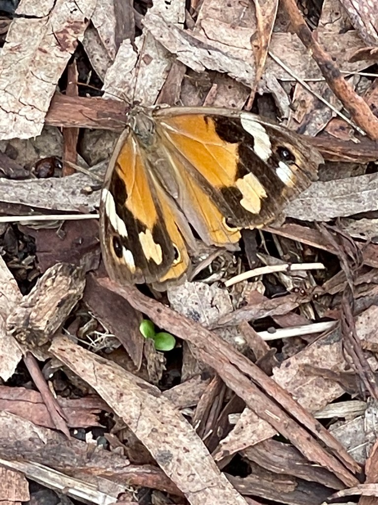
I am also sharing the path with two ochre-coloured butterflies that periodically stop and pose on the ground in front of me. Throughout the whole 9km pairs of these butterflies are a constant – well probably not these two but them and their friends.
I also find a survivor – possibly the cherry ballart tree – which appears to have miraculously withstood the flames. One green plant in a forest of grey and black.
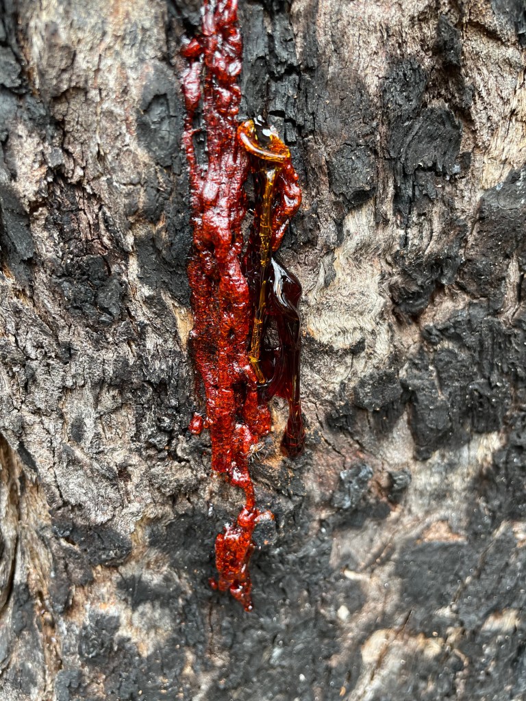
Then everything changes as I reach an unburnt patch. Amazing mosses, fluoro lichen, blood red sap and thick bracken that almost hides the path.
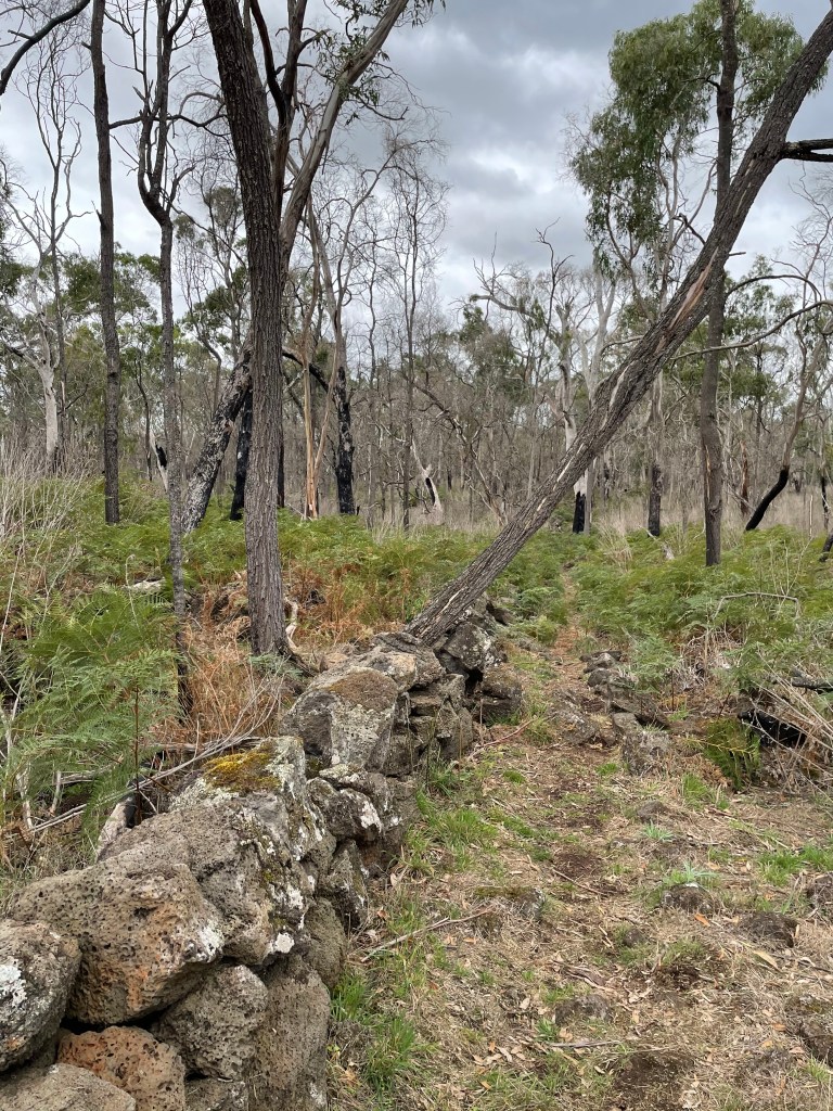
This feels like wild and remote country – then we come across old drystone walls stretching across the canal and probably built by early settlers to hold their stock at bay.
At the last of these walls that we leave the canal and follow red arrows up the rocks to follow a low stoney path towards the lake via the Natural Bridge.
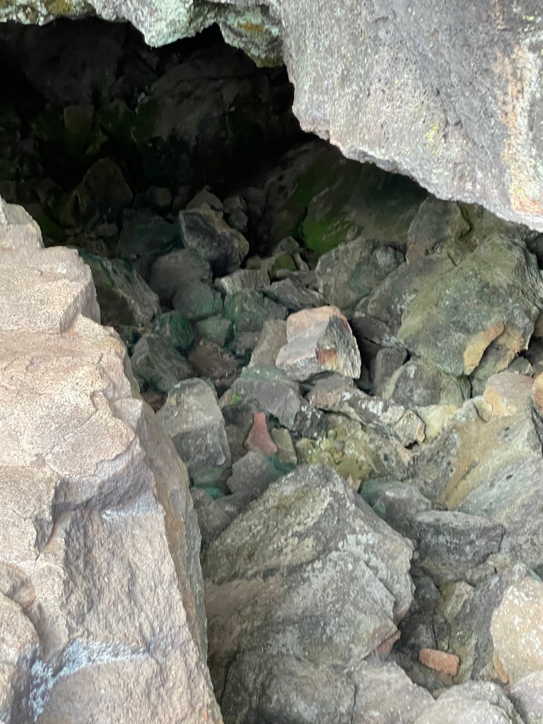
In my 20s I spent many hours out in this country searching for and exploring caves – often with mixed success.
Today without even trying I find one on the path up the canal wall and then pass another along our trail to the Natural Bridge.
This bush has also been smashed by the fires.
I think of the painting I did here in the early 1980s when the bush was so alive – lush and green. Today it looks dis-shevelled – stripped, shivering and waiting for its blanket of leaves to return.
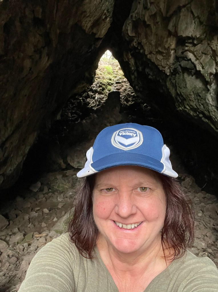
The Natural Bridge has not changed, except that it is way easier to access. We used to clamber over stinging nettle-infested rocks to get in and now there are steeps all the way.
The ‘bridge’ is actually the ground covering a long skinny cave with two entries and a big pile of stones in the middle.
Beyond the bridge we pass another crater filled with trees instead of water and then begin climbing up the hill which I assume is the crouching Budj Bim.
In my childhood the mountain was still being quarried and was a treeless bump. Today there is a veritable forest on top which cover some of the views we used to get.
On a good day we’d look for the silos of Portland or Lady Julie Percy Island (Deen Maar) and Mount Napier (Tapoc) but it is not that easy any more.
On the way down I am greeted by a line of bulokes – singing beautifully in the wind – and some wattles and blackwoods.
I also get to see Tapoc too – through the trees.
Back at the car park and I am exhausted but happy. I have had my Budj Bim fix and the world is definitely a better place. Thank you Budj Bim and may your burns continue to heal too.
This week’s walk is dedicated to Mountains.to.climb – a fundraiser on Instagram started by my son Noah Talbot to cover 2502 km of hiking and climbing over a year – one kilometre for each man who lost his battle with mental illness in 2019
Noah wanted to highlight the benefits – mentally and physically from getting out in the bush – exercising and reaching new peaks.
“The mountains we face differ from person to person. For some, a mountain might be dealing with a breakup. Others might just be getting out of bed. No matter how big or small, your mountain is still a mountain. Give yourself credit for overcoming these, because the view is always better at the top.”
A few days before this walk Noah had a climbing accident and was in hospital waiting for surgery when I went to Budj Bim. He broke his ankle and wrist and it will be a long recovery. He obviously can’t complete the required average of 48.11km each week so here is my 9km contribution to help his tally. Others are also welcome to contribute their own walking tallies.
What – Barengi Djul (Wimmera River) from Big Bend to Barbours Lake and back
Where – Wimmera Track west of Wail in Wail State Forest
How long – 9km
10 words or less – River, dry lake, sand, scars, pines, camping, wallaby, kangaroo, questions….
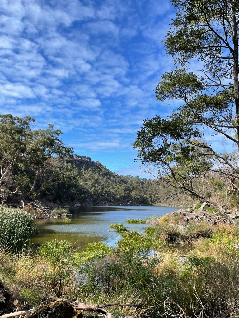
Today we will see parts of the Heritage Wimmera River, a dry lake bed and plenty of enduring trees.
We all know the Wimmera River – Barengi Djul or Barringgi Gadyin – it stretches from the mountains of the Pyrenees, north to the Southern Mallee sands.
Today we are going to visit a little snippet of this Heritage River between Horsham and Dimboola in the Wail State Forest.
It’s a place of cultural heritage with plenty of scar trees, signs of middens and reports of stone scatters.
And just up the River on the other side at Ackle Bend or Wutiyeti, ( which means Camping Place on the river) there are even stories of a local Bunyip.
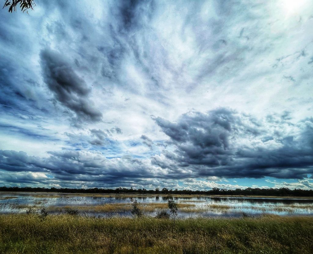
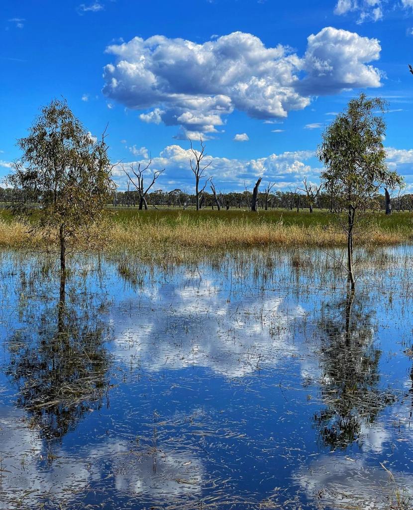
Our walk starts at Big Bend picnic ground and winds along sand tracks, across Reedy Swamp or Barbour’s Lake – depending on which map you read – and back along the river bank.
Today we will see plenty of water, sand hills or lunettes, a mix of different plants and the odd kangaroo and wallaby.
I struggled to find a lot of documented history about this sandy landscape which does feel less altered by white settlement than other parts of the region.
In 1902 Wail residents were lobbying for a stock and domestic water supplies so maybe a lack of water and the sandy soil saved it from clearing.
That year locals attended the Polkemmet bridge opening with activities including a ladies’ nail driving competition and a women versus men tug of war. The Wail school meeting also agreed ‘in a most liberal manner’ to subscribe money for a library and science apparatus.
Later in the 20th century science was applied several kilometres east at the Wail nursery where the Government established an arboretum, researched, and propagated 1000s of trees and helped farmers get them in the ground.
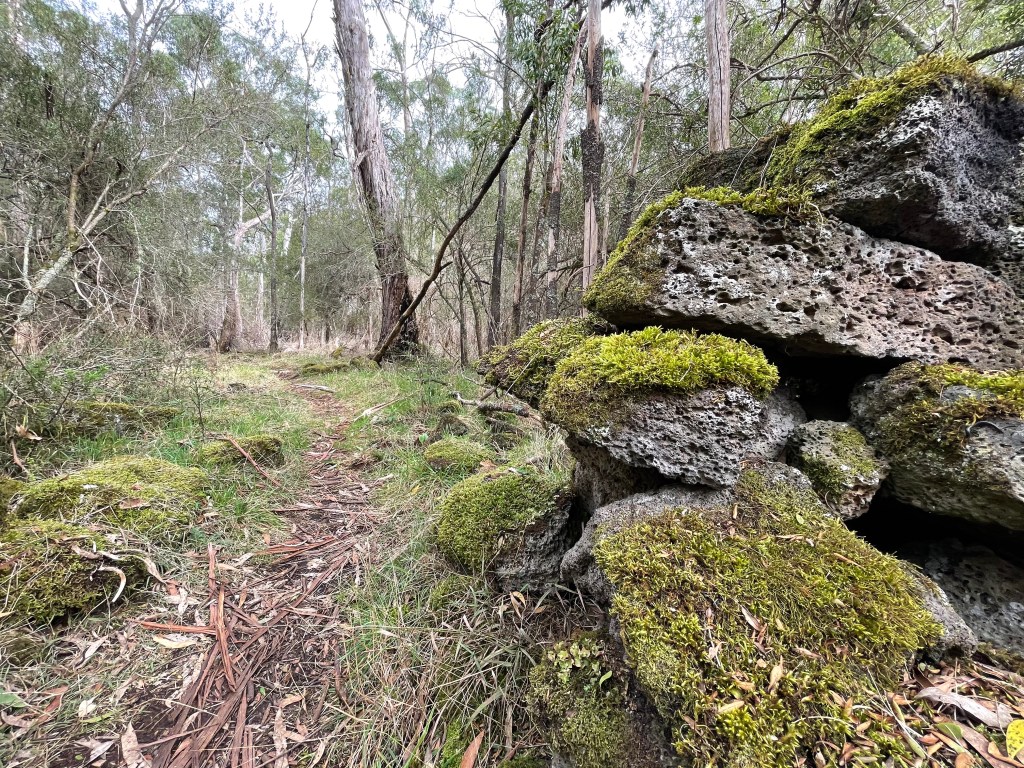
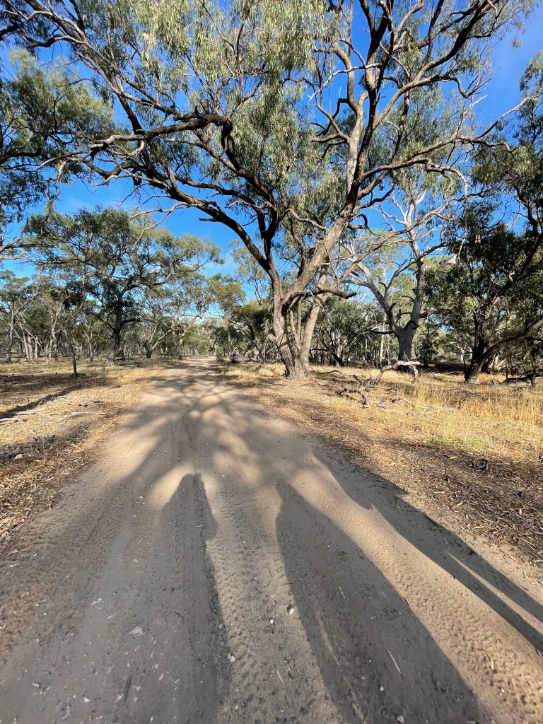
Our walk takes us along a sandy track that would not be brilliant in two-wheel drive. On the right is a forest of native pines which makes a welcome change from eucalypts.
It is cool and windy so we don’t hear a lot of birds, but we do disturb a couple of kangaroos. You get the feeling there are more motorcyclists, drivers, and anglers than bushwalkers out in Wail State Forest.
We follow Wimmera Track for a few kilometres looking for a turn off to Reedy Swamp or Barbour’s Lake.
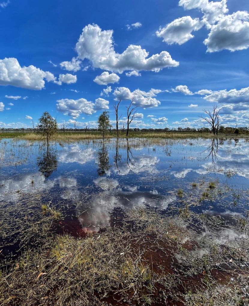
I found a bit of information in a 2011 CMA report citing a Reedy Swamp being a permanent saline wetland that could reach up to 2 metres in depth and typically held water all year round.
A lot has changed since 2011 and it appears this includes the permanent water and name of this swamp that now has the sign Barbours Lake at the northern entrance.
I found no information about Barbours Lake or even who Barbour was although there were and still are plenty of Barbers in the district.
The lake’s depth is another interesting question. One large tree is sporting a watermark well up the trunk so it must have been wet here sometimes in the past.
Today things are dry with ruby saltbush growing on the lakebed and plenty of recent vehicle tracks heading from one side the other.
It feels more like a dry paddock, than a reedy swamp.
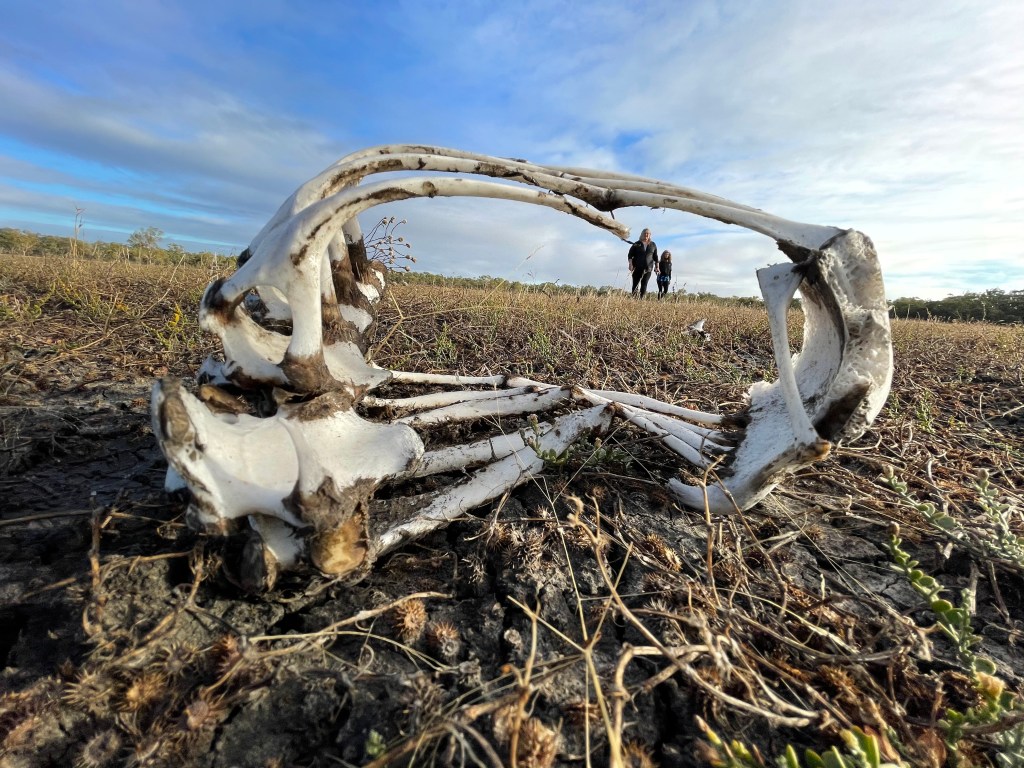
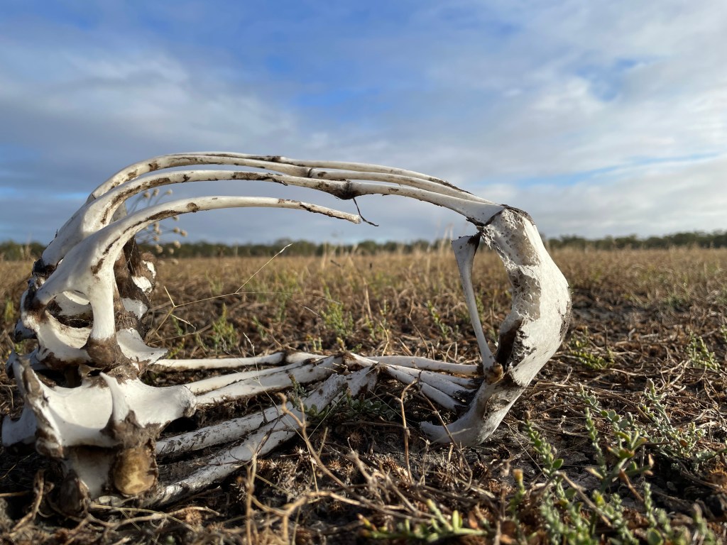
One other find out in the middle is a kangaroo carcase, spread across several metre, with a small skull suggesting there was also a joey’s in the mix.
Things get interesting on the other side with a noticeable hill beyond the bank -possibly a lunette formed from the soil blowing over many years in times when the lake was dry.
Large gums form a boundary ‘fence’ of this wetland arena and beyond them is a big crowd of spindly pines all cheering silently from sandy hill.
We are also seeing a few scars on the trees and the view and atmosphere suggests it is a great place to be a spectator of life, especially when the arena had water.
Further on the boundary line is also home to some paperbarks, an odd buloke and some other shrubs. After several hundred metres we reach Wail Camp 2 and the official entrance to Barbours Lake.
A feature of this basic camps site is an unusual dead tree. Lounging on its side it looks like it fell over many years ago and several new branches grew vertically from the trunk. Not a bunyip but a possibly a multi-armed trunk monster.
We leave the lake and re-join Wimmera Track, now heading south to our starting point. But instead of sticking to the road we veer into campsites along the Wimmera River.
In some parts we are walking along a billabong which is dry and separate from the river, but we also enjoy plenty of tree-lined stream.
The red gums are old and impressive, and the tall banks suggest that this area can host some big flows in wet years.
Lush clumps of eucalypt saplings are the progeny of recent floods and bare black trucks show this area has also been hit by fire.
There are quite a few scarred trees along this stretch, the odd buloke and one tree with bright yellow berries which I could not identify. Any ideas anyone?
Wail State Forest is quiet, peaceful and a great place to walk and apart from one ute – where the driver asked if need help – and a cluster tents at one camp – we are the only other humans here.
Barengi Djul’s still water plays host to many ducks and a few mysterious bubbles but we can’t report any bunyips.
Our calves get a work out in the sand but our souls are pretty well soothed by the time we return to Big Bend. A great way to start the weekend and an excellent 9km walk.
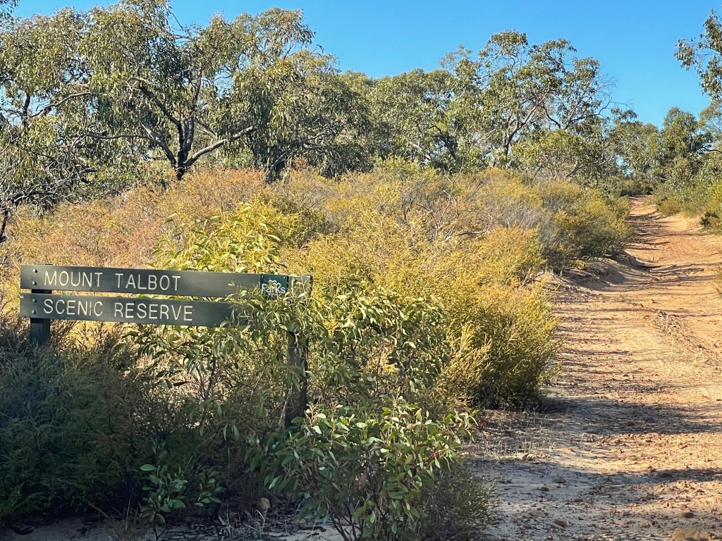
Where – 60km south from Horsham via Toolondo, Norton, Miss Williams, Holmes, Camerons, Mt Talbot Road
What – Culturally significant small mountain on the northern tip of Burrnj (The Black Ranges)
We were walking in the traditional lands of Wotjobaluk Nation and pay our respects to elders past, present and emerging and thank them for allowing us to enjoy their country.
10 word – Golden morning, amazing rocks, unique perspectives, wallabies, enduring landscape, shelters
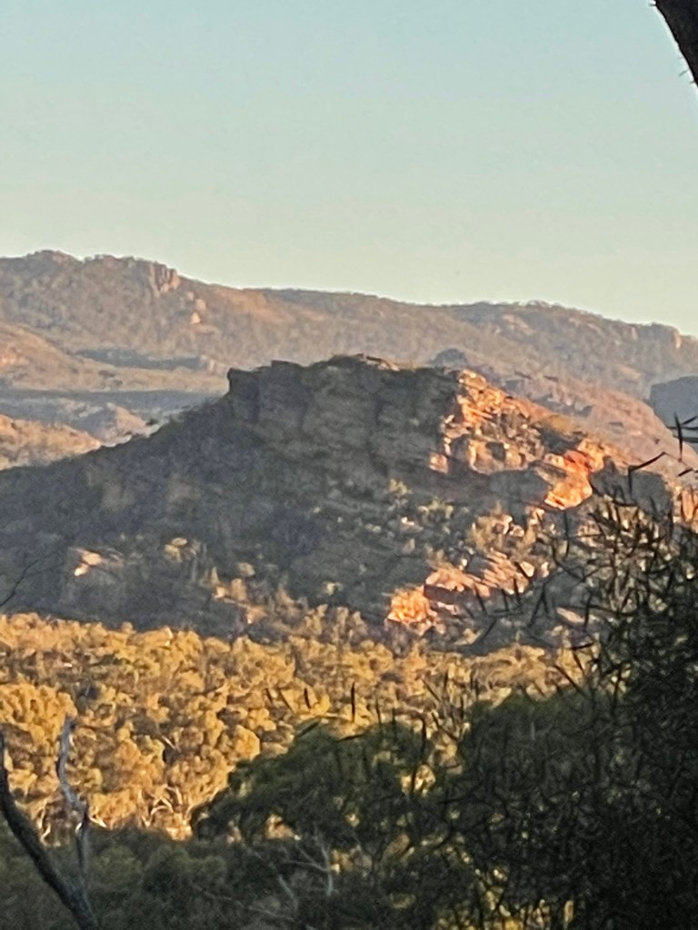
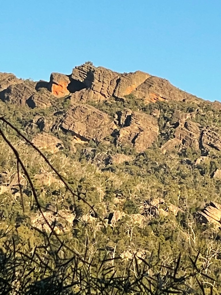
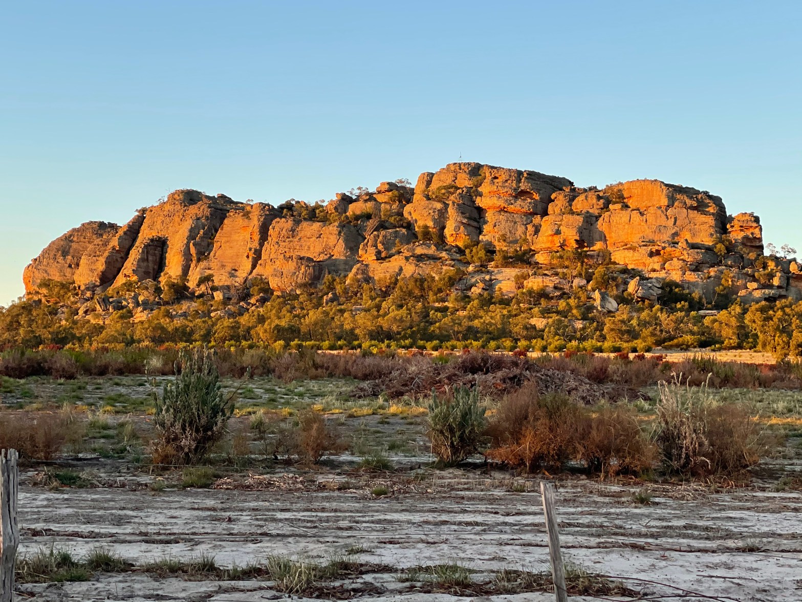
Today we climbed a little-known gem of the Southern Wimmera.
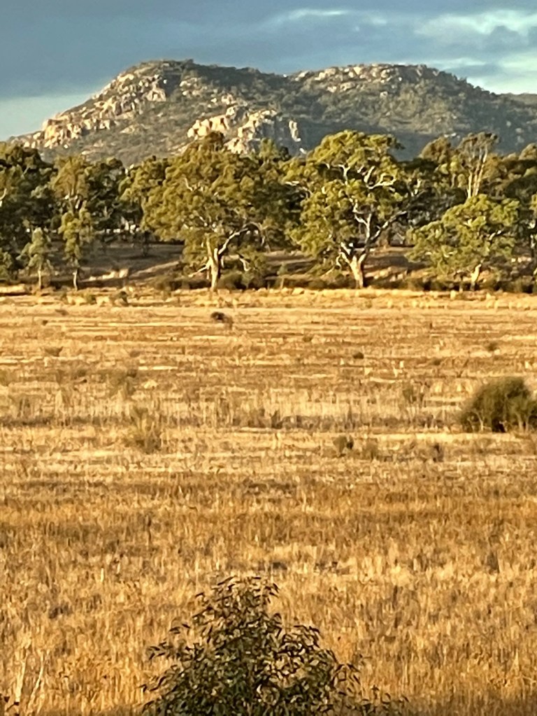
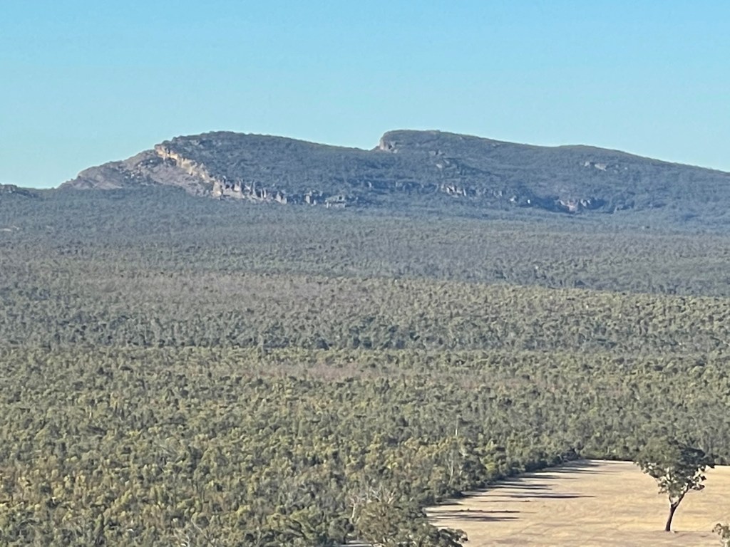
Perched between Red Rock – Lil Lil and the Black Ranges – Burrunj, Mount Talbot is a tiny peak with plenty of colour, character and history.
The 2020 Greater Gariwerd Landscape Draft Management Plan lists both artefact sites and rock art at this reserve and rock climbing is currently banned but we found no restrictions on following the walking path to the top.
Carbon dating of a Mt Talbot rock shelter and the nearby Mugadgadjin shelter at Burrunj (Black Ranges) shows evidence of occupation from more than 5,000 years ago.
We are definitely treading carefully and respectfully on this important landscape.
There are plenty of twist and turns as we navigate our way to our destination via Toolondo and roads including Miss Williams, Holmes, Camerons and Mt Talbot.
You will pass a plantation of trees just before the entrance but I would suggest you don’t head up the rutted hill track unless you have a four-wheel drive car.
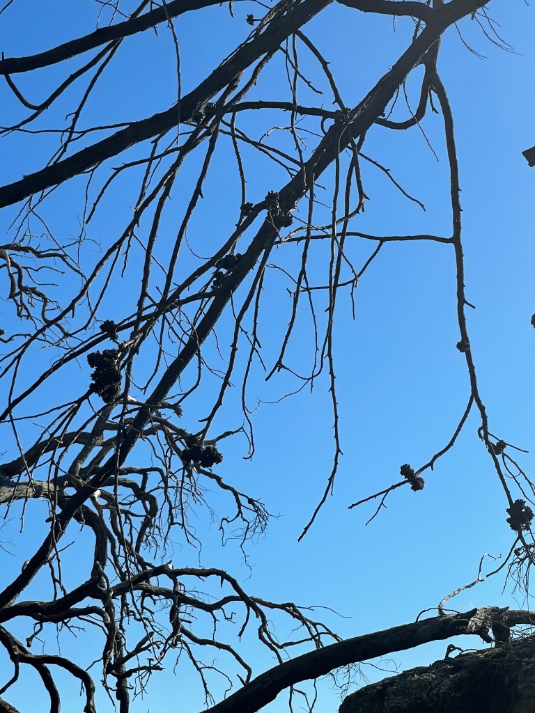
Mt Talbot Scenic Reserve was established in 1983 and it looks like little more has been done to update it since. Fires swept through here several years ago and brittle, blackened trees still dominate the areas.
Mount Talbot was the name of a large station that covered this area from the mid 1800s. The original family is still in the district, as is the homestead which stands on the western side of Toolondo.
One descendant Charles Myles Officer learned the language of first nations people living on the land he farmed and he documented some of their stories.
According to Charles’ account lore stated ‘trees formerly had the power of locomotion’ and plants were as likely as animals to be ‘powered’ .This was reflected in placenames that illustrated them.
He also wrote of a conflict between Eagle and Cockatoo – who alone held fire. Cockatoo was struck on the head, which released the fire – which ‘raged across the land’ .
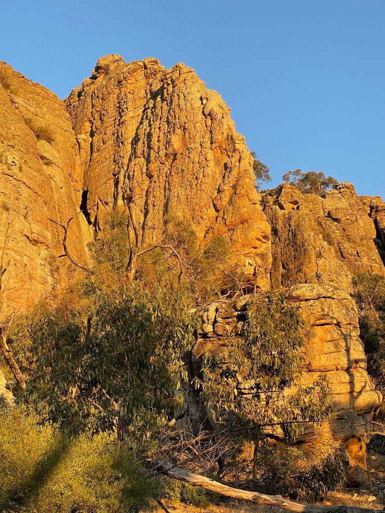
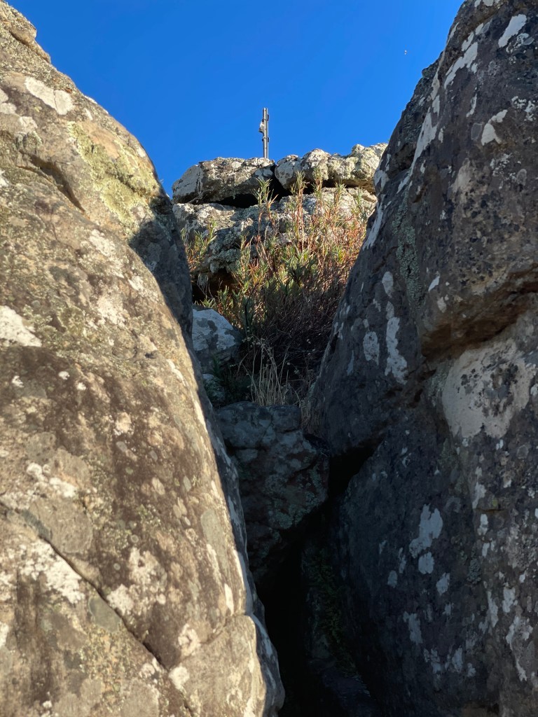
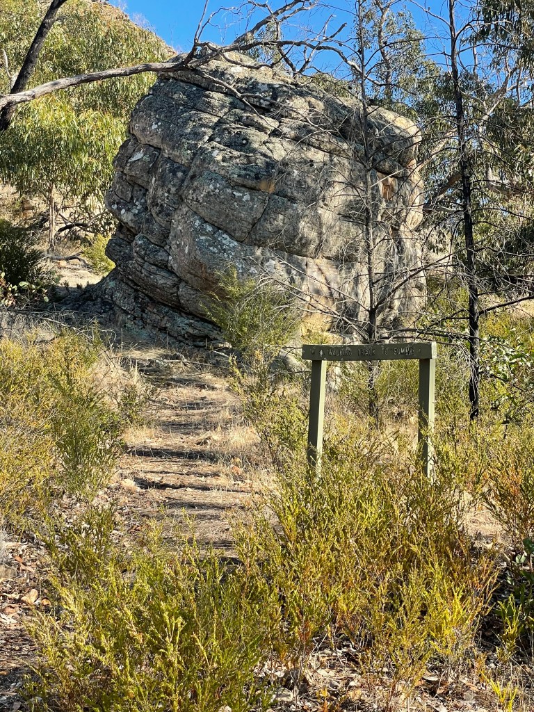
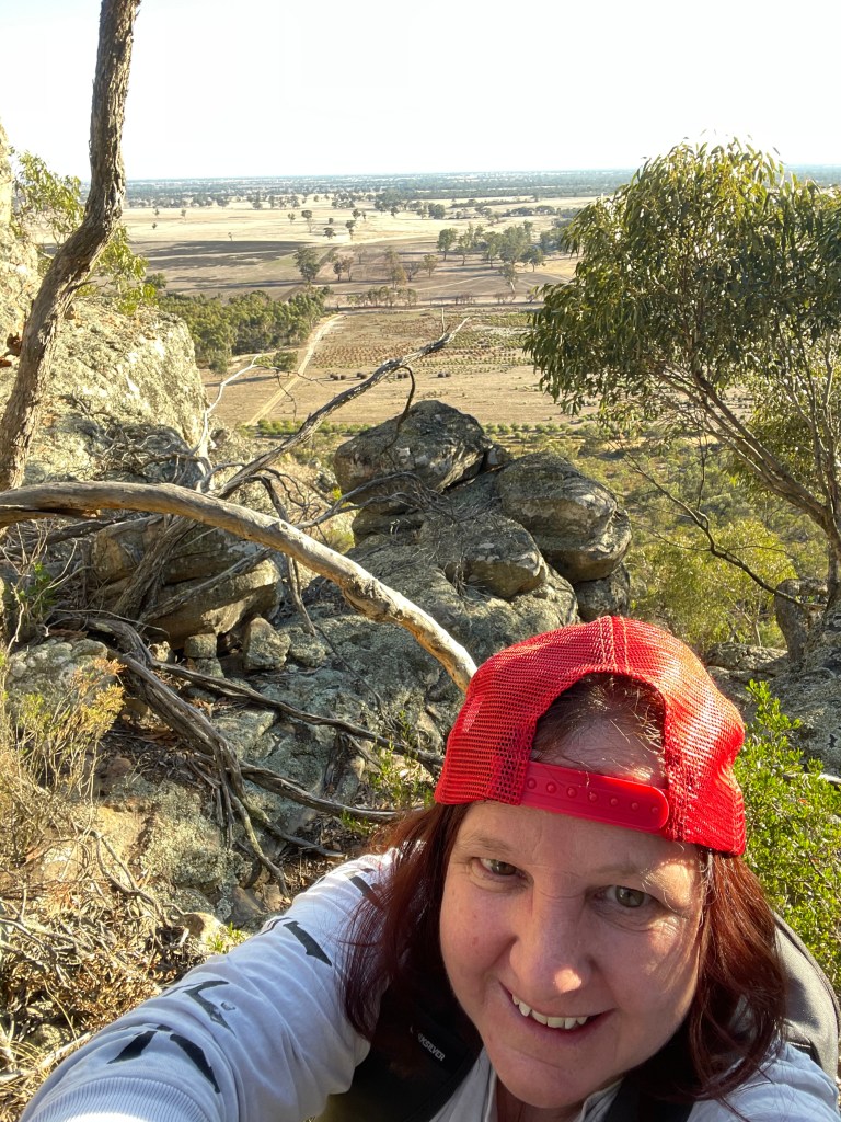
It is a fiery site that greets us when we arrive at this little mountain – bathed in shimmering golden sunshine.
The sun keeps its brilliant spotlight on the red-coloured rock face as we park the car and head for the start of the walk.
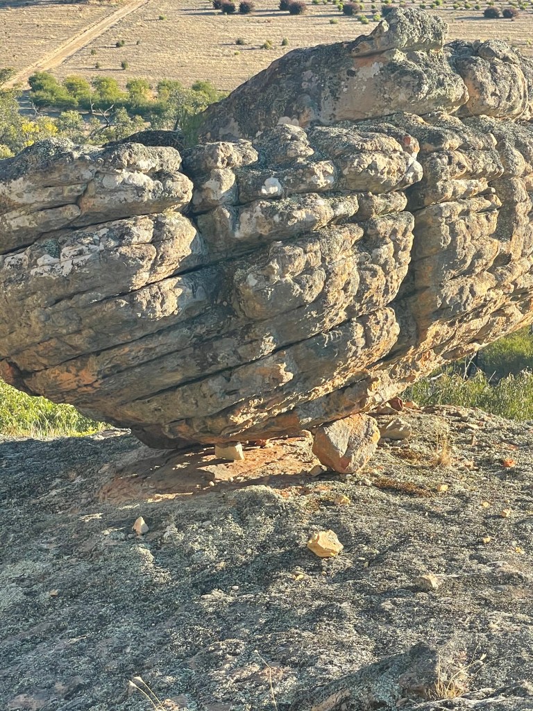
We are immediately struck by the number of big rocks scattered on and around the mountain as we skirt around the base.
The sun is blinding but also lights up the neighbouring native plant farm and the sweeping plains beyond.
A wallaby moves in the bush ahead and slowly bounces away. It is one of several we will see today.
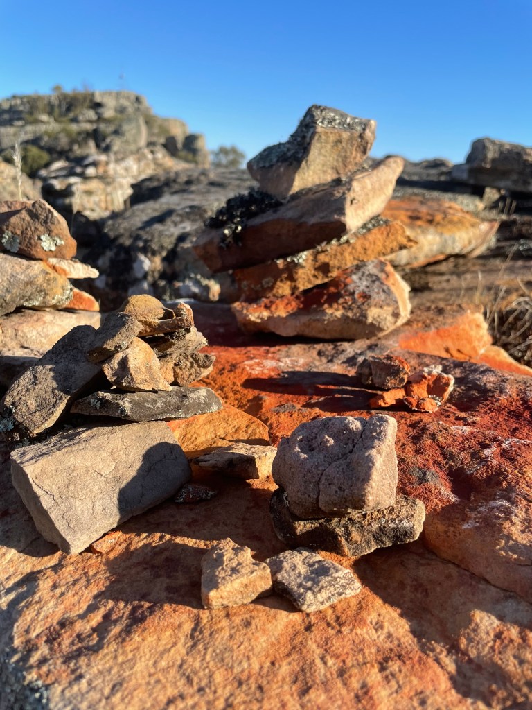
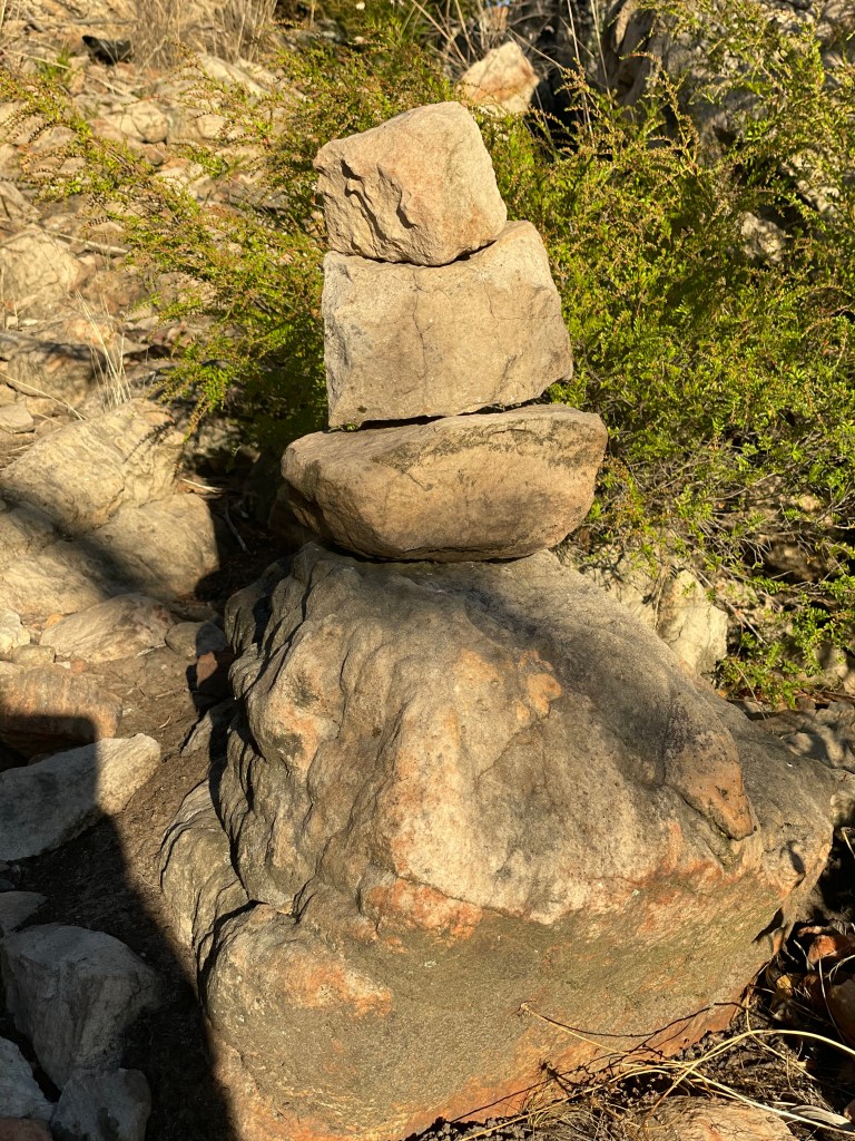
On the northern side we come across the first small cairn, one of may that will guide us today.
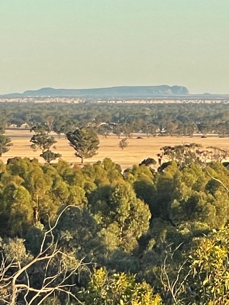
We also spot a natural rock verandah, which would provide great protection from westerly winds and excellent views north and east. There is also a whole new perspective on Mt Arapiles.
Forgetting the cairn, and captivated by this view, we head northwest and waste way too much time around the other side of the mountain on a path to nowhere.
This may well be an unused climbers’ track which is not being accessed any more.
So – note to self – ‘when you can see Mt Arapiles from under a rocky shelf, turn around, look for a Cairn and head up the path beyond it’.
Back on track, we head upwards following a path along the flat rocks that are now taking us back in an easterly direction.
At one point we see a giant rock which seems to be perched precariously on the edge of the rocky cliff, seemingly held in place by a tiny stone balancing it at one end.
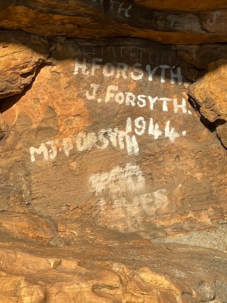
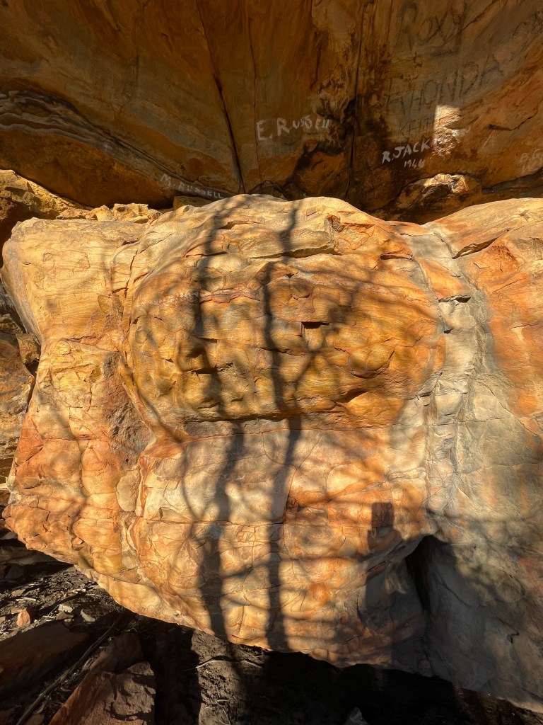
Around a corner and we see another shelter which sadly has been graffitied, with some names dating back to 1944.
I see one red coloured stone on the ground that looks like it has veins – similar to the bed of the salty pink lake near Dimboola.
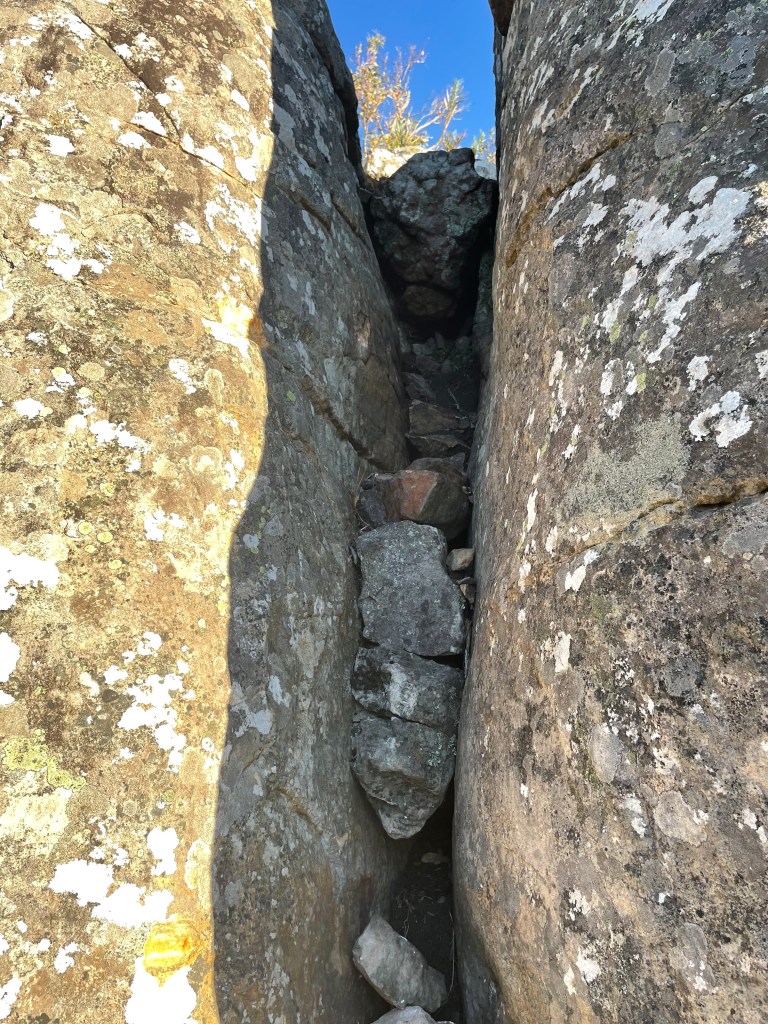
We head around a rock and then up again and find ourselves between two peaks.
The highest point alludes us because we’d need to climb rocks to get to the top. There are remnants of former hand holds that may have been installed back in the 1980s and have since decayed.
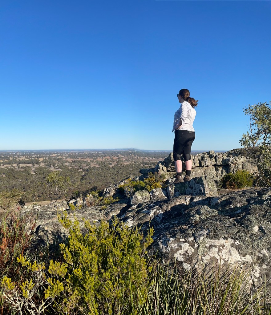
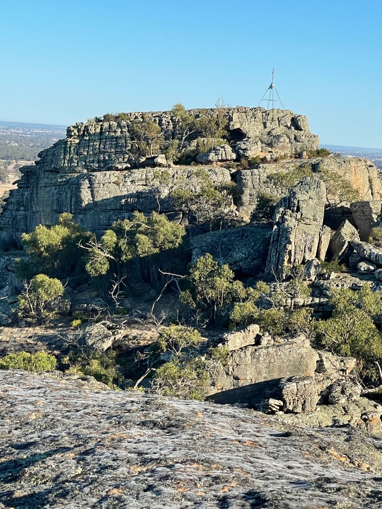
So we head to the other side, led by cairns to the top.
We are rewarded by a magical view – atypical to the Wimmera.
Instead of a sea of cropping paddocks we see Gariwerd to the distant east, denim-coloured peaks of Burrunj (Black Range) spreading across the southern landscape and to the north – the smaller mounds of Lil Lil (Red Rock).
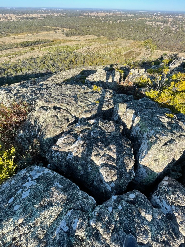
And below the mountain itself, neat lines of human planted-natives are etched into the sand.
My legs make ridiculously long shadows in the morning sun but standing before this breathtaking landscape makes me feel pretty small.
These rocks have seen so much over the past 5000 years. How many other pairs of legs walked this way and what did their owners do and see while they were here?
We enjoy an easy walk back down, taking time to look at the plants living in the rocks, stone shadows that make faces and the boulders that dominate this unique place.
More wallabies pop up and scarper but apart from that it is a quiet, uneventful and peaceful walk.
On the way home we call into Lil Lil to see just how red those rocks are.
Signs clearly tell us we can’t move past the fence so we take a photo from outside the barrier and leave.
Lil Lil’s rocks are incredibly red and I am reminded of the cockatoo’s fire story.
Could it be connected to this colourful place?
Thanks Mt Talbot, for great walk. So many wonderful things to see but so many questions unanswered.
# After our visit I discover in the Gariwerd management plan that removal of rocks is illegal so please – if you visit Mt Talbot – don’t make any more of these cairns and don’t disturb the rocks.
## Every care is taken to make this as factual as possible. Please let us know if this is not the case . We welcome your feedback and suggestions.
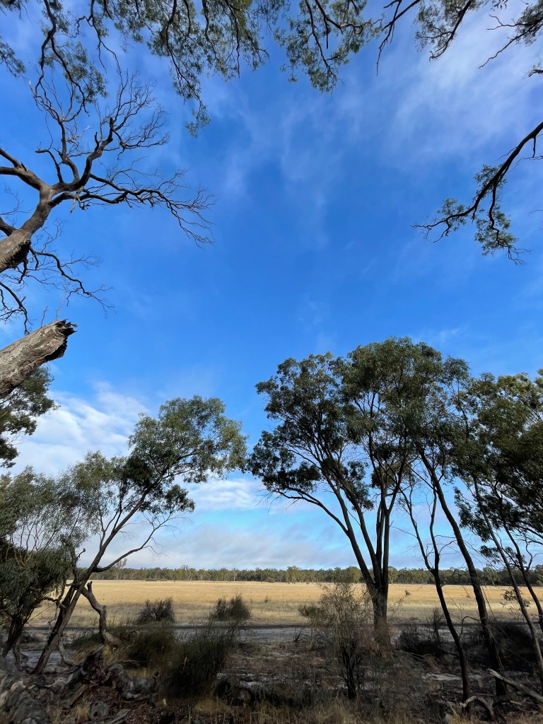
Where – Boundary Swamp Wildlife Reserve, 35km west south west of Horsham
What – 154ha wetland which is part of Douglas Depression
How Long – 5.4km to walk around its edge
10 words – Big skies, good memories, birds, trees, kangaroos, history, art, endurance
Today we visit an old friend.
We’ve caught up dozens of times over the past 14 years.
I have seen her struggle in the heat, get cold and wet in the winter and be knocked around by big winds.
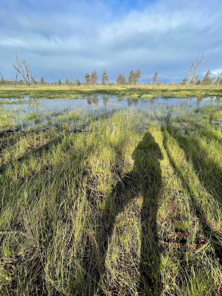
And once – just once – I saw her shine with metre deep-water which quietly sprinted from surrounding hills within hours of rain.
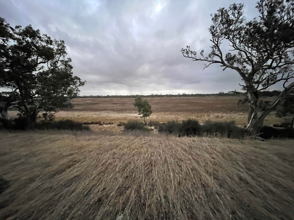
She is the 154ha Boundary Swamp, 35km WSW from Horsham and 10km south of Mount Arapiles.
Officially a Wildlife Reserve, Boundary lies on the Douglas Depression a long line of curved lakes and wetlands that may have helped link the Murray River to the sea.
This ancient drain starts at White’s Lake near Harrow and north east to Oliver’s Lake then, according to some, continues up through Lake Hindmarsh and Lake Albacutya to the top end of Wyperfeld.
On paper Boundary Swamp has few claims to fame. It’s dry, flat, remote and one of many local wetlands. There’s no town nearby but there might have once been a school at its eastern end,
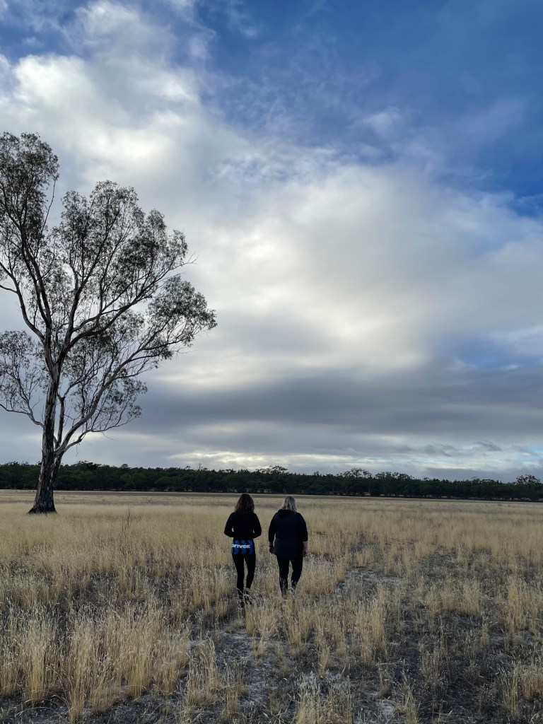
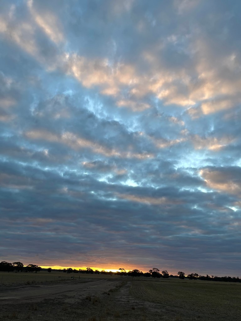
Our walk starts on the end of Rifle Butts Road under a big blue sky awash with wispy clouds. That’s probably its real claim to fame – boundary swamp does great sky.
It’s autumn but we’ve had some summer rains and there are flowers on quite a few of the shrubs growing by the track.
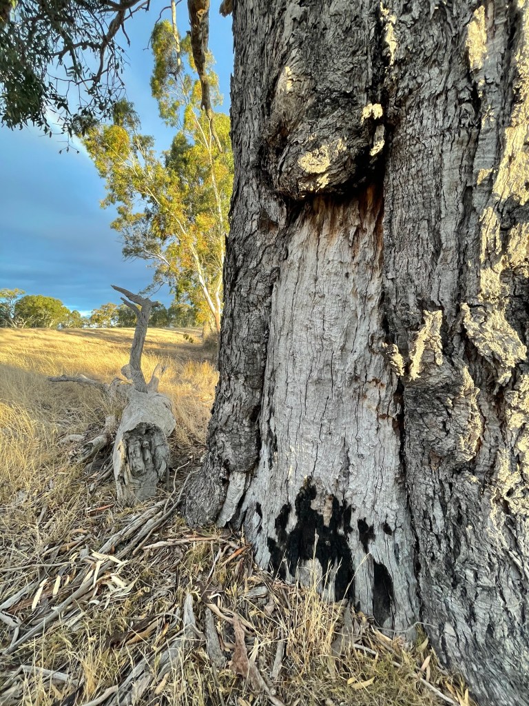
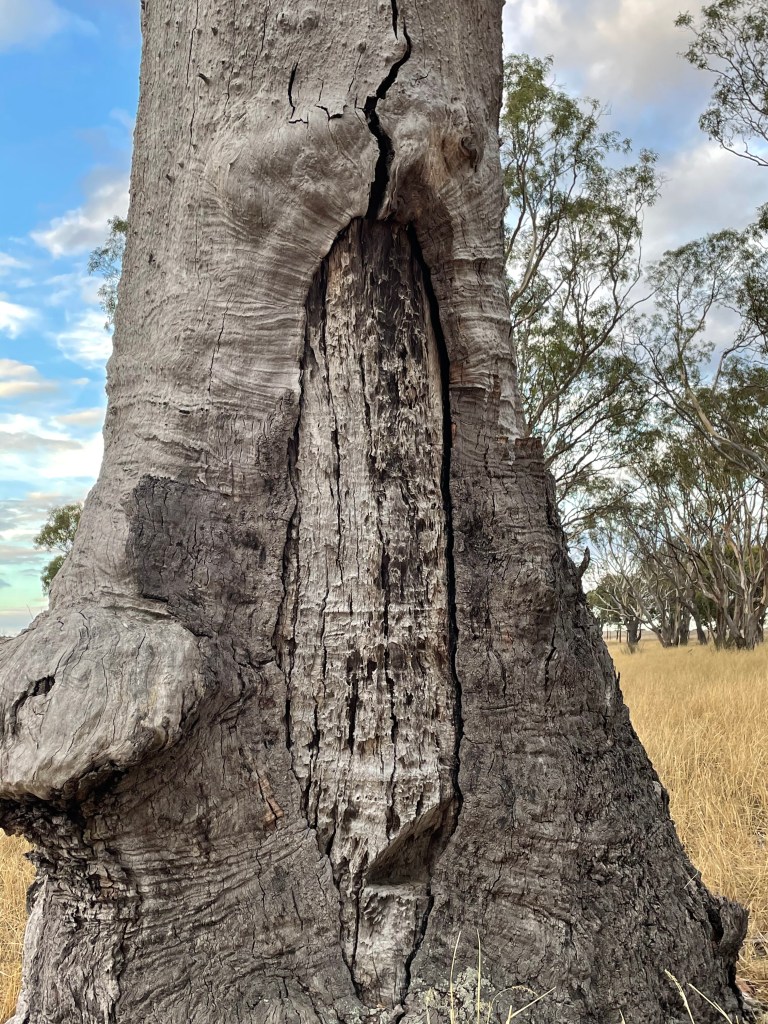
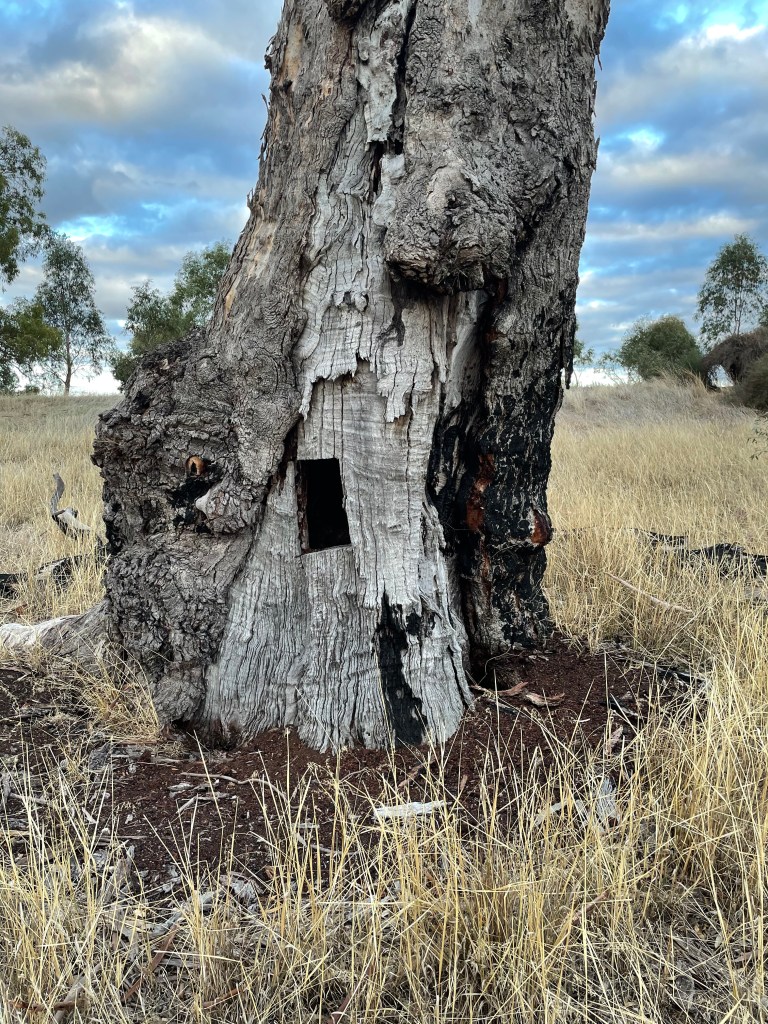
I pass some veteran red gums including a burned hollow trunk which may have also been scarred by a human hand in a long distant past. It is right near a dry creek that feeds the swamp after a downpour.
You never forget big Wimmera rains. Frogs started singing overnight and are soon joined by birds, dragon flies and mosquitoes.
Boundary is a popular spot of galahs, sulphur crested cockatoos, magpies, blue wrens, mudlarks, swallows and fairy martins.
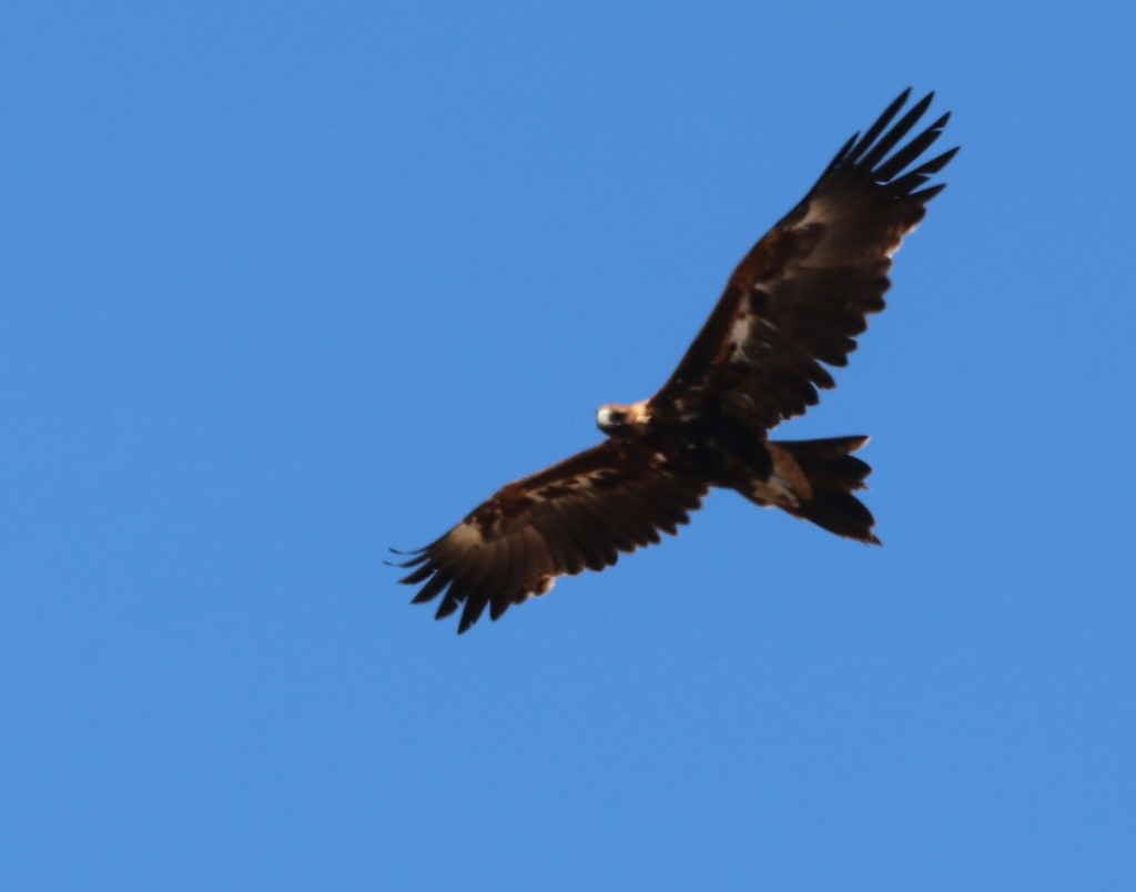
We’ve seen brolgas, yellow-tailed black cockatoo and, pairs of wedgetailed eagles, It made the 2018 Australian Good Birding Guide which also mentions spoonbills, Ibises, ducks and water hens.
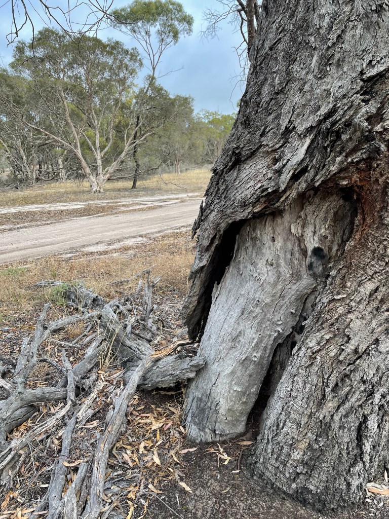
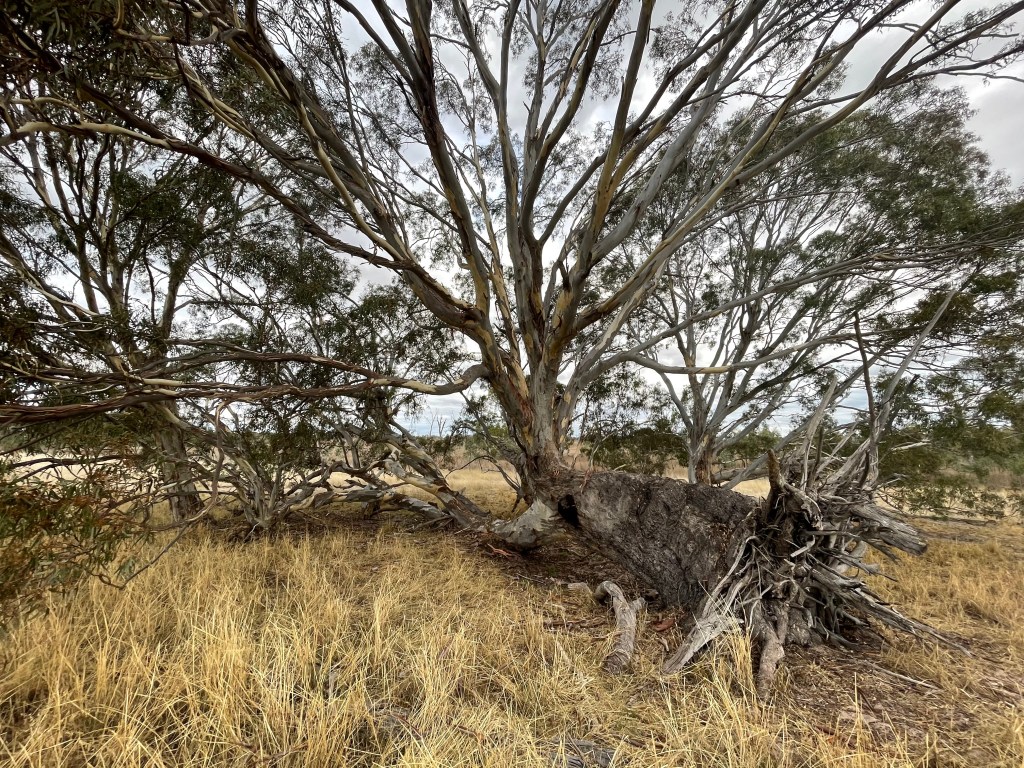
I leave the road to explore the northern bank and visit one of my favourite trees. It fell over years ago and while the exposed black roots are redundant, one side of the trunk now grows into the ground.
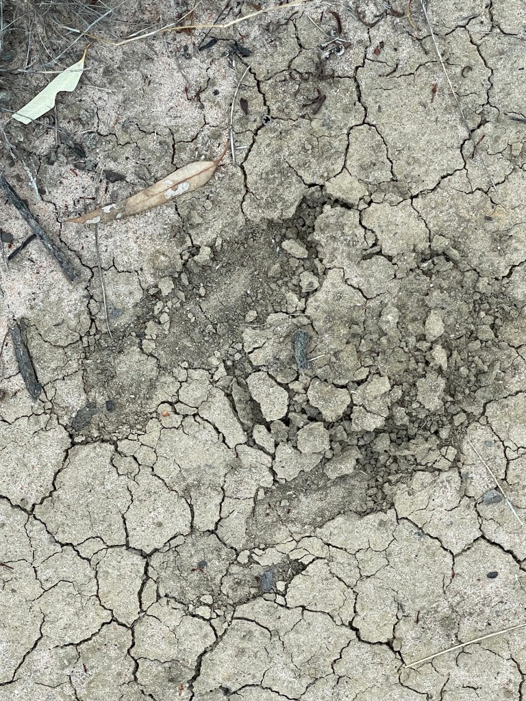
My presence sends a lone kangaroo to a cluster of saplings that emerged after the 2011 flood and grumpy cockatoos hurl abuse at me from on high. They don’t like visitors.
A patch of the northwest corner looks like an abandoned tennis court. Nothing grows on this high ground but you get a handy view in many directions. I pass one tree with a small scar as we head east, moving from tennis court to art gallery.
Lines on dead grey trees resemble lino cut designs, vertical tree trunks create dramatic sculptures and a stump sports natural black carvings.
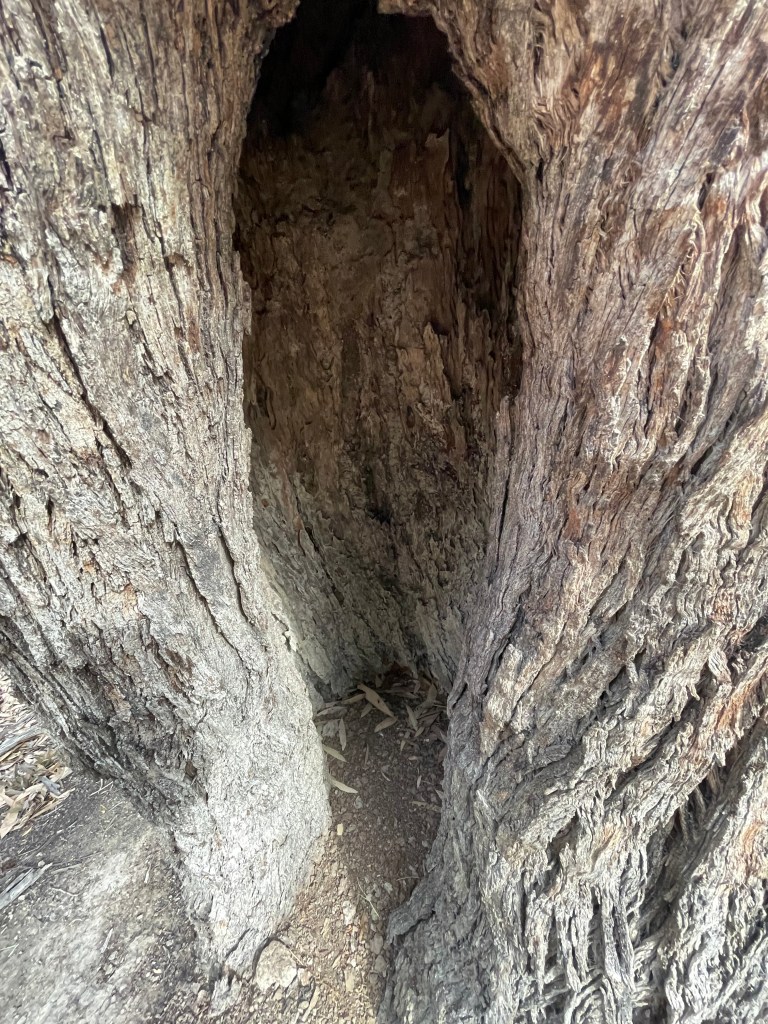
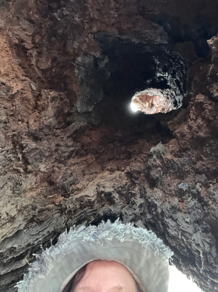
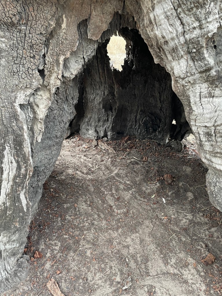
There’s a huge opening into one tall hollow tree that is almost big enough to stand in. Who might have sheltered here over the years?
This hollow tree has a huge opening and is almost big enough to stand in.
There are plenty of live trees too, with graceful curved white branches that seem to be shedding their bark.
Evening is fast approaching; a kookaburra starts laughing at me and then I set the cockatoos off again.
I find another inlet creek at the southern end and more red gums, including some with scars.
The swamp’s access track is on the eastern side. In wet years this place attracts duck shooters and when it’s dry the targets are foxes.
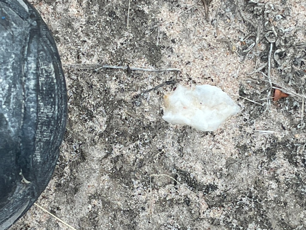
I find a few pieces of quartz in the track and some kangaroo tracks and pass a tree that burned a few years back when it was struck by lightning.
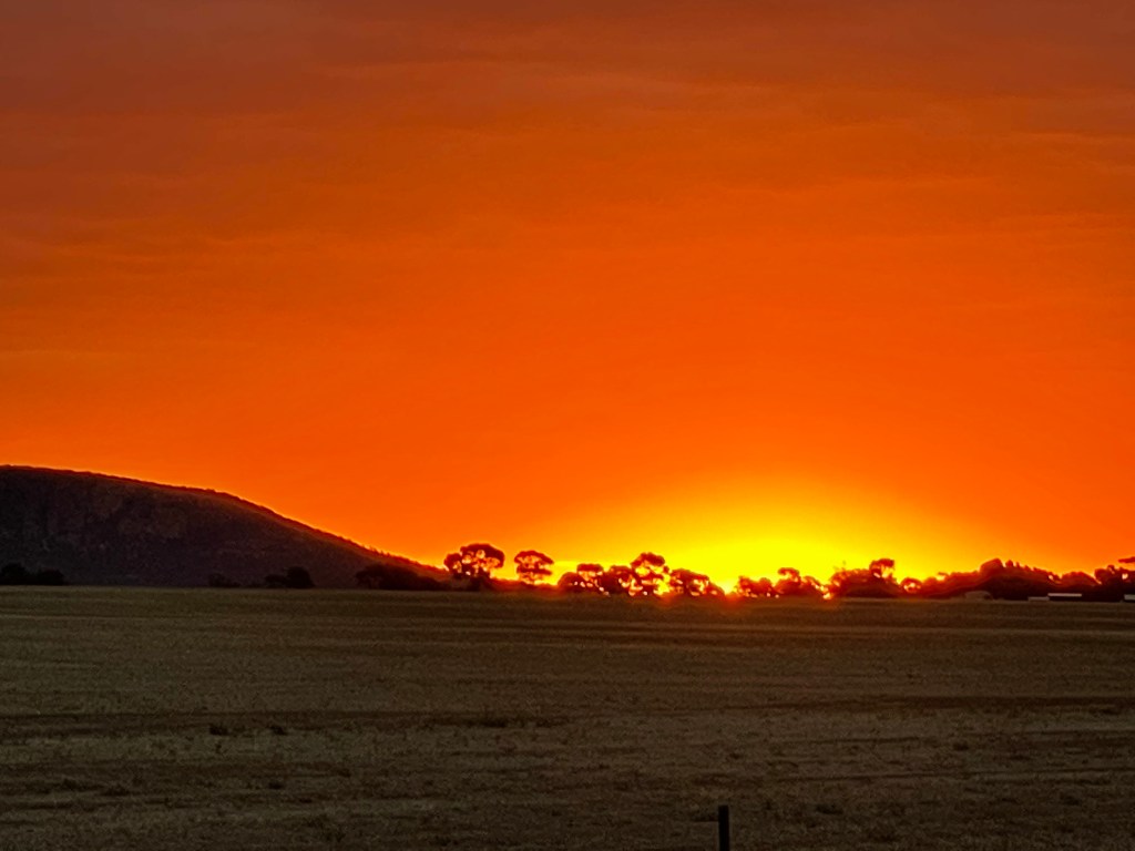
The big, grey cloudy sky gets a yellow glow on the western horizon as I reach the end of the walk, climbing through the fence to follow a lunette to Rifle Butts Road.
This sandy slope often gets willy willies that start with the rustling leaves in the red gums before swirling north as they grab unsuspecting objects in their path.
Tonight, it’s still and calm.
The sky puts on a brilliant orange sunset at Arapiles on drive back to Horsham and the moon smiles down over Quantong
Thanks Boundary Swamp – another great catch up, always something to see, appreciate and discover.